Search results
Jump to navigation
Jump to search
Page title matches
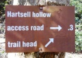
File:White Rock Trail - Hartsell Hollow trail sign.JPG |File name=White Rock Trail - Hartsell Hollow trail sign.JPG |Trail=White Rock Trail(448 × 317 (109 KB)) - 22:52, 23 December 2018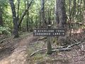
File:PCSP Point Lookout Trail - spur trail sign.JPG |File name=PCSP Point Lookout Trail - spur trail sign.JPG |Trail=Point Lookout Trail(4,032 × 3,024 (7.89 MB)) - 21:04, 11 September 2020
File:PCSP Norris Blackburn Trail - hiking trail marker.JPG |File name=PCSP Norris Blackburn Trail - hiking trail marker.JPG |Trail=Norris Blackburn Trail(3,024 × 4,032 (5.37 MB)) - 21:24, 11 September 2020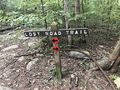
File:PCSP Lost Road Trail - trail junction sign.JPG |File name=PCSP Lost Road Trail - trail junction sign.JPG |Trail=Lost Road Trail(4,032 × 3,024 (5.83 MB)) - 07:50, 14 September 2020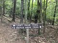
File:PCSP Lost Road Trail - another trail junction sign.JPG |File name=PCSP Lost Road Trail - another trail junction sign.JPG |Trail=Lost Road Trail(4,032 × 3,024 (5.76 MB)) - 08:02, 14 September 2020
File:Phipps Bend Trail - near trail end.jpg |File name=Phipps Bend Trail - near trail end.jpg |Trail=Phipps Bend Trail(600 × 450 (80 KB)) - 12:39, 28 July 2020- ...il' template. It is expected to be typically used by the [[Form:Trail|Form Trail]]. This template creates the 'sidebar' with info about each trail like the state, nearest city, coordinates of the tail head. If not used, en9 KB (1,166 words) - 19:07, 15 April 2023
- ...rsion to the current Trail Template (or Park) format. This would place the trail in the category [[:Category:Trails|Trails]]. {{#ask: [[Category:Trail]]52 members (0 subcategories, 0 files) - 00:14, 30 December 2019
- 119 bytes (22 words) - 23:47, 9 October 2015
- This is the "Trail" form. {{#forminput:form=Trail}}8 KB (1,248 words) - 22:29, 11 September 2020
- ...OLETE" are not to be used and should be deleted in the usage if updating a trail page. They are left here for backward compatibility and will be removed onc {{Infobox Trail6 KB (844 words) - 11:01, 20 November 2018
- {{Trail |Banner Image=File:Lakeside Trail - Bays Mountain Dam.jpg4 KB (663 words) - 17:12, 19 March 2023
- Below are the images seen on the trail infoboxes, what they mean, and how to use them if you edit trails. !Name in trail editing lists2 KB (295 words) - 15:22, 6 October 2019
- -->{{Infobox Trail | Trail Use = {{Hike}} {{Skiing}}4 KB (508 words) - 11:21, 21 November 2015
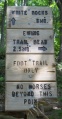
- {{Trail |Trail Highlight=Access to the Sand Cave and White Rocks (the colloquially known n7 KB (1,173 words) - 23:19, 27 November 2019
- <noinclude>This returns a map of the trails associated with the trail page it is called on. {{Trail Map|Main Trail={{PAGENAME}}|Other Trails= |Zoom Cancel=[any entry will trigger cancel]}}8 KB (992 words) - 13:30, 23 March 2023
- {{Trail |Trail Marking=Signs2 KB (265 words) - 23:30, 15 December 2019
- {{Trail |Trail Highlight=Connects Lakeside Trail with Lake Road2 KB (281 words) - 15:51, 15 December 2019
- {{Trail |Banner Image=File:BMP Azalea Trail.JPG3 KB (372 words) - 20:34, 12 April 2023
- {{Trail |Trail Marking=Signs2 KB (262 words) - 17:03, 15 December 2019
- {{Trail |Trail Marking=Signs2 KB (295 words) - 20:07, 15 December 2019
- {{Trail |Banner Image=File:BMP Orchid Trail sign.JPG2 KB (294 words) - 19:17, 15 December 2019
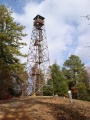
- {{Trail |Banner Image=File:BMP Cliffside Trail view from obs tower towards firetower.JPG4 KB (520 words) - 22:48, 14 December 2019
- ...ieces will provide background information to allow more folks to enjoy the trail.6 members (0 subcategories, 0 files) - 05:48, 16 April 2012
- ...on of a trail (including park page defined stubs). Its expected use is for trail tables and map balloons.193 bytes (34 words) - 15:36, 24 November 2019
- {{Trail |Banner Image=File:BMP Chinquapin Trail.JPG3 KB (448 words) - 20:49, 14 December 2019
- #REDIRECT [[Barred Owl Trail]]30 bytes (4 words) - 20:34, 12 April 2023
- This trail name is used by more than one park. * [[Lake Trail (Big Ridge State Park)]]181 bytes (29 words) - 23:36, 30 November 2019
- {{Trail |Trail Highlight=5,560' summit with view of northern highlands6 KB (930 words) - 22:36, 2 December 2019
- {{Trail |Trail Marking=Signs3 KB (468 words) - 14:50, 14 December 2019
- -->{{Infobox Trail | Trail Number =5 KB (776 words) - 12:12, 7 January 2023
- -->{{Infobox Trail | Trail Use = {{Hike}} {{Biking}} {{Dogs}}4 KB (565 words) - 09:42, 31 October 2015
- {{Trail |Trail Highlight=Nice views of the viaduct and Grandfather Mountain3 KB (469 words) - 08:20, 7 December 2019
- -->{{Infobox Trail | Trail Use = {{Hike}} {{Dogs}}5 KB (666 words) - 12:12, 7 January 2023
- {{Trail |Trail Marking=White3 KB (493 words) - 14:01, 19 September 2021
- |Trail Condition=Problems147 bytes (21 words) - 18:04, 2 May 2024
- ...of the hike is in the shade. It is a great opportunity to get out on the trail even if you or your family don’t have a lot of experience hiking. <br>'''F/B: Bays Mountain Park - Lakeside Trail, Saturday, May 24''', 2:00 pm – 3:30 pm2 KB (267 words) - 15:32, 30 May 2019
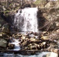
- ...d back down towards the parking lot. We picked up the 2.1-mile Cabin Creek Trail to see the waterfall and ate lunch along the rocks in front of it.2 KB (295 words) - 13:38, 15 June 2014
- -->{{Infobox Trail | Trail Use = {{Hike}} {{Biking}} {{Dogs}}3 KB (501 words) - 15:53, 20 May 2019
- {{Trail |Trail Highlight=A Rails-to-Trail between Bristol and Mendota, VA5 KB (792 words) - 20:01, 16 June 2023
- ...s. This is different than a Park. Most distinct example is the Appalachian Trail System which is made up of trails in many parks, regions, states, etc.254 bytes (46 words) - 14:01, 6 December 2018
- ...the type [[Has type::Page|Page]]. It was created to be the used to log the trail hiked for a hike event.115 bytes (25 words) - 20:35, 29 September 2015
- 37 bytes (4 words) - 21:57, 10 September 2015
- These pages are trail stubs typically expected to be created on Park pages using the form. {{#ask: [[Category:Trail Stubs]]0 members (0 subcategories, 0 files) - 09:09, 26 November 2019
- ..., would be 2.5 mi, where as the field [[Property:Trail distance round trip|Trail distance round trip]] would be 3.0 mi.589 bytes (91 words) - 21:15, 18 September 2015
- ...d to hold the choice of Loop / Segment / In-and-Out to signify roughly the trail type. ...'' hikes are those hikes where a significant portion, at least half of the trail, can be completed without repeating large sections in the reverse. Addition841 bytes (146 words) - 10:08, 4 October 2015
- ...is a property of type [[Has type::Text|Text]]. It is used to describe the trail blaze, unless otherwise unique, simply the color name should suffice.154 bytes (27 words) - 12:25, 26 April 2018
- ...he 'Trail Search' template. It should be called via the [[Special:RunQuery/Trail Search]] form. {{#if: {{{trail uses|}}}|[[Allowed activities::{{{trail uses|}}}]]}}873 bytes (90 words) - 14:25, 24 June 2023
- This is the "Trail Search" form. {{#forminput:form=Trail Search}}844 bytes (114 words) - 14:27, 24 June 2023
- ...ype [[Has type::Text|Text]]. It is used to list the updates needed for the trail page. Intent is to make it easier to find trails that need various updates. ...description;Photos;Winter photos;Stub;Remove trail in name;Update infobox;Trail pins;Update mileage|+sep=;918 bytes (146 words) - 18:47, 16 October 2015
- ...specific trail number (if applicable). Typically this is a Forest Service Trail Number.192 bytes (33 words) - 00:05, 4 October 2015
- ...ed in [[Property:Page needs reviewed on]]. See [[Property:Trail page needs|Trail page needs]] for the current and previous designations. {{Trail page needs3 KB (465 words) - 22:06, 21 October 2015
- Here's the list of trail page needs. {{#ask: [[Category:Trail]]196 bytes (25 words) - 22:41, 2 January 2016
- -->{{Infobox Trail | Trail Use = {{Hike}}5 KB (598 words) - 12:12, 7 January 2023
- ...Please scroll down to edit the main content of the article. -->{{Infobox Trail | Trail Number = USFS Trail #6035 KB (730 words) - 18:24, 16 April 2023
- {{Trail |Trail Marking=Pink2 KB (315 words) - 21:57, 19 September 2021
- {{Trail |Trail Highlight=A hike up the west side of Holston Mountain past an overlook4 KB (621 words) - 10:17, 4 January 2023
- This is the "Trail Stub" template. Its use is for the [[Form:Park|Park Form]] to list trails t {{Trail Stub778 bytes (102 words) - 15:34, 24 November 2019
- Not too surprising there are multiple uses of Summit Trail. The following are known. *[[Summit Trail (Elk Knob)|Summit Trail in Elk Knob State Park]] North Carolina256 bytes (40 words) - 22:39, 2 December 2019
- ...is a property of type [[Has type::Text|Text]]. It is used to describe the trail blaze, unless otherwise unique, simply the color name should suffice.154 bytes (27 words) - 13:43, 15 November 2018
- '''Trail Lows and Highs''' are as simple as it sounds. If using a GPS points or trac '''Trail elevations and elevation changes''' is trickier than one would initially be2 KB (313 words) - 08:19, 7 December 2019
- 46 bytes (9 words) - 11:22, 18 November 2018
- ...holds comments from a trail trip report focusing on the conditions of the trail. Not to be confused with [[Property:Hike Comment]] which holds general comm227 bytes (39 words) - 14:17, 18 November 2018
- {{Trail |Trail Highlight=Although your likely goal, not the typical access6 KB (865 words) - 10:56, 7 January 2023
File:Trail Markers.JPG |File name=Trail Markers.JPG |Trail=Phipps Bend Trail(3,024 × 4,032 (5.68 MB)) - 08:55, 9 August 2020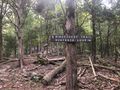
File:Trail intersection.jpg |File name=Trail intersection.jpg |Trail=Ridge Crest Trail(640 × 480 (165 KB)) - 17:24, 6 September 2020- {{Trail |Trail Highlight=Good for beginners2 KB (343 words) - 19:04, 11 September 2020
- {{Trail |Trail Highlight=Wander around more than seven sinkholes1 KB (205 words) - 21:28, 11 September 2020
- {{Trail |Trail Highlight=One mile extension to Raider's Run1 KB (162 words) - 10:09, 21 September 2020
- {{Trail |Trail Highlight=A steep climb to a 180° stunning view of the countryside1 KB (181 words) - 10:34, 21 September 2020
- {{Trail |Trail Highlight=Additional hike option to Molly's Knob and Vista Trail2 KB (235 words) - 09:17, 22 September 2020
- 244 bytes (33 words) - 11:59, 2 December 2018
- ...distance, thus reported for annual data book update. This page, like the trail itself, is a work in progress to figure out how to best use the available t <br>- Backbone Rock Trail (blue blaze)7 KB (1,010 words) - 12:12, 7 January 2023
- {{Trail |Trail Highlight=Your likely trail if you want to "go to The Channels"6 KB (906 words) - 10:47, 8 January 2023
- |Trails=Ewing Trail |Trail Condition=Clear1 KB (224 words) - 18:13, 14 July 2023
- {{Trail |Trail Highlight=Starting waterfall, view of the Powell River Valley5 KB (783 words) - 22:37, 27 July 2020
File:Trail Wiki Layout.png (1,006 × 541 (28 KB)) - 00:27, 12 December 2019- {{Trail |Trail Marking=White6 KB (1,004 words) - 13:20, 11 July 2021
- {{Trail |Trail Marking=Signs2 KB (310 words) - 15:29, 10 November 2019
- This category was created to flag trail pages without a KML on their map3 members (0 subcategories, 0 files) - 21:26, 29 August 2015
- {{Infobox Trail | Trail Use = {{Hike}}{{Dogs}}{{Camping}}6 KB (880 words) - 12:12, 7 January 2023
- {{Trail |Trail Highlight=Loop with a waterfall and a rhododendron tunnel2 KB (251 words) - 07:58, 29 August 2020
- {{Trail |Trail Highlight=Look out over Cherokee Lake or also walk down to the water4 KB (566 words) - 21:12, 11 September 2020
- Hike Report: Roaring Branch Trail up to High Butte, March 19th, 2011 ...en, except for several species of birds and a small snake on a rock in the trail.1 KB (209 words) - 16:25, 22 March 2011
- -->{{Infobox Trail | Trail Use = {{Hike}}4 KB (580 words) - 12:12, 7 January 2023
- hike report for the Elk Park Trail written by Bill Stowell in Oct 1998 Elk Park Trail to Houston Ridge, December 8, 2007, Vic Hasler reporting219 bytes (33 words) - 21:56, 5 April 2011
- 23 bytes (2 words) - 11:42, 27 September 2015
- {{Trail |Banner Image=File:BMP Dolan Branch Trail waterfall.JPG5 KB (746 words) - 07:45, 15 December 2019
- {{Trail |Banner Image=File:BMP Firetower Trail tower.jpg3 KB (416 words) - 16:10, 10 November 2019

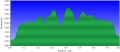
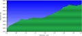
File:Towhee trail profile.png |File name=Towhee trail profile.png |Trail=Towhee Trail(1,160 × 660 (23 KB)) - 23:27, 15 December 2019
File:Hemlock trail profile.png |File name=Hemlock trail profile.png |Trail=Hemlock Trail(1,160 × 660 (23 KB)) - 15:40, 15 December 2019- {{Trail |Trail Marking=Signs2 KB (260 words) - 23:22, 15 December 2019

File:Holly trail profile.png |File name=Holly trail profile.png |Trail=Holly Trail(1,160 × 660 (22 KB)) - 17:00, 15 December 2019- {{Trail |Trail Marking=Signs5 KB (675 words) - 23:11, 14 December 2019

File:Pine trail profile.png |File name=Pine trail profile.png |Trail=Pine Trail(1,160 × 660 (22 KB)) - 20:05, 15 December 2019
File:Cliffside trail profile.png |File name=Cliffside trail profile.png |Trail=Cliffside Trail(1,160 × 660 (22 KB)) - 22:40, 14 December 2019- ...r trails. Park/Trail aware. Probably will make different ones for Park vs. Trail instead of one monolithic beast. * Trail name1 KB (177 words) - 13:41, 6 January 2021
- {{Trail |Banner Image=File:BMP Bays Ridge Trail sign.JPG4 KB (595 words) - 23:09, 23 November 2019
- {{Trail |Trail Marking=Blue6 KB (988 words) - 16:33, 19 September 2021
- Holston Mn Trail Hike May 27-28,2011 ...howed us where the blue blaze trail was that is the end of the Holston Mn. Trail. It's at the top of the hill on the left going SOBO from the shelter. After2 KB (494 words) - 14:30, 6 June 2011
- {{Trail |Banner Image=File:BMP Big Oak Trail.JPG3 KB (460 words) - 00:12, 11 December 2019

File:Chinquapin Trail Profile.png |File name=Chinquapin Trail Profile.png |Trail=Chinquapin Trail(1,160 × 660 (27 KB)) - 20:46, 14 December 2019- {{Trail |Trail Marking=None5 KB (719 words) - 16:06, 8 December 2019
- {{Trail |Banner Image=File:BMP Pretty Ridge Trail sty.JPG3 KB (537 words) - 15:22, 10 November 2019
- {{Trail |Banner Image=File:BMP Bear Run Trail.JPG3 KB (482 words) - 18:15, 24 November 2019
- {{Trail |Trail Marking=Signs2 KB (340 words) - 15:51, 10 November 2019
- -->{{Infobox Trail | Trail Use = {{Hike}}{{Dogs}}4 KB (641 words) - 12:12, 7 January 2023
- |Trails=John Tomko Trail -->{{Infobox Trail4 KB (645 words) - 14:18, 8 May 2024
- -->{{Infobox Trail | Trail Use = {{Hike}}{{Dogs}}4 KB (632 words) - 12:12, 7 January 2023

File:Trail edit with form.png Editing a trail page with the form(1,646 × 373 (446 KB)) - 23:11, 12 December 2019
File:Three trail editing tabs.png trail editing tabs(620 × 329 (50 KB)) - 23:20, 12 December 2019- {{Trail |Trail System=Mountains-to-Sea Trail, SB6k4 KB (625 words) - 20:46, 3 December 2019

File:Chestnut trail profile.png |File name=Chestnut trail profile.png |Trail=Chestnut Trail(1,160 × 660 (28 KB)) - 14:45, 14 December 2019- -->{{Infobox Trail | Trail Number = FS# 534 KB (664 words) - 12:12, 7 January 2023
- -->{{Infobox Trail | Trail Use = {{Hike}} {{Dogs}}5 KB (718 words) - 12:12, 7 January 2023
- -->{{Infobox Trail | Trail Number = 1544 KB (646 words) - 23:38, 27 November 2016
- {{Trail |Trail Highlight=Connector trail between AT and Iron Mountain Trail - North4 KB (512 words) - 16:01, 19 January 2020
- |Trails=Lakeside Trail,Lake Road (Bays Mountain Park),Hemlock Trail,Holly Trail |Trail Condition=Clear473 bytes (71 words) - 11:32, 15 March 2020
- {{Trail |Trail Highlight=High ridge line hike with a great name for hike discussions6 KB (976 words) - 14:26, 5 January 2020
- -->{{Infobox Trail | Trail Use = {{Hike}} {{Biking}} {{Dogs}} {{Horses}}5 KB (742 words) - 10:28, 31 October 2015
- {{Trail |Banner Image=File:Daniel Boone Trail Banner.jpg5 KB (829 words) - 08:26, 27 July 2020
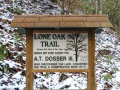
- {{Trail |Banner Image=File:Lone Oak Trail Dosser sign.JPG4 KB (686 words) - 13:40, 19 September 2021
- {{Trail |Banner Image=File:Tower Ridge Trail.JPG3 KB (419 words) - 22:52, 19 September 2021
- {{Trail |Banner Image=File:White Rock Trail overlook.JPG5 KB (711 words) - 22:33, 19 September 2021
- {{Trail |Trail Marking=Blue2 KB (371 words) - 13:52, 19 September 2021
- {{Trail |Trail Marking=White2 KB (298 words) - 16:26, 19 September 2021
- {{Trail |Trail Marking=Blue3 KB (411 words) - 16:16, 19 September 2021
- {{Trail |Trail Marking=Blue2 KB (291 words) - 21:23, 19 September 2021
- 592 bytes (100 words) - 00:52, 14 May 2012
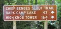
File:CBST Trail Sign.JPG |File name=CBST Trail Sign.JPG |Trail=Chief Benge Scout Trail(448 × 212 (94 KB)) - 00:04, 2 March 2020- {{Trail |Banner Image=File:Phipps Bend Trail - near trail end.jpg3 KB (518 words) - 14:28, 9 August 2020
- ...haven’t been exercising in 2014. Early wildflowers are expected along the trail. We’ll leave Colonial Heights at 1:00 pm or Johnson City at 1:20 pm to ar A possible hike plan for this trail could be:2 KB (283 words) - 13:27, 6 September 2014
- 822 bytes (139 words) - 23:27, 6 October 2015
- -->{{Infobox Trail | Trail Use = {{Hike}} {{Biking}} {{Dogs}}4 KB (632 words) - 12:12, 7 January 2023
- F/B Hike: Erwin Linear Trail, Sunday – August 19, 2012619 bytes (105 words) - 15:30, 6 September 2014
- 84 bytes (12 words) - 09:47, 23 August 2015

File:Cloudland trail profile.png |File name=Cloudland trail profile.png |Trail=Cloudland (Roan Mountain State Park)(1,160 × 660 (24 KB)) - 17:41, 20 December 2019- {{Park trail count|Park={{PAGENAME}}}} {{#ask: [[Category:Trail||Trails||Trail Stubs]] [[Park::Warriors' Path State Park]]817 bytes (119 words) - 11:50, 12 December 2018
- ...to the page name, it sums the values in property [[Property:Trail Distance|Trail Distance]] in miles and returns that value. {{Park trail miles|Park={{PAGENAME}}}}1 KB (149 words) - 11:50, 12 December 2018
- {{Park trail list|Park={{PAGENAME}}}} {{#ask: [[Category:Trail||Trails]] [[Park::Warriors' Path State Park]]737 bytes (106 words) - 11:25, 20 November 2018
- ...st the trails that are accessible from this trail (not just at or near the trail head).152 bytes (30 words) - 22:14, 18 September 2015
- 23 bytes (2 words) - 10:49, 27 September 2015
- 23 bytes (2 words) - 11:29, 27 September 2015
- 20 bytes (2 words) - 09:38, 4 October 2015
- 25 bytes (3 words) - 09:38, 4 October 2015
- #REDIRECT [[Chestnut Trail]]28 bytes (3 words) - 11:59, 4 October 2015
- #REDIRECT [[Chinquapin Trail]]30 bytes (3 words) - 12:08, 4 October 2015
- #REDIRECT [[Cliffside Trail]]29 bytes (3 words) - 12:17, 4 October 2015
- #REDIRECT [[Fern Trail]]24 bytes (3 words) - 12:55, 4 October 2015
- #REDIRECT [[Fire Tower Trail]]30 bytes (4 words) - 14:21, 4 October 2015
- #REDIRECT [[Hemlock Trail]]27 bytes (3 words) - 22:29, 5 October 2015
- #REDIRECT [[Holly Trail]]25 bytes (3 words) - 22:38, 5 October 2015
- #REDIRECT [[Lakeside Trail]]28 bytes (3 words) - 19:34, 6 October 2015
- #REDIRECT [[Talk:Lakeside Trail]]33 bytes (4 words) - 19:34, 6 October 2015
- #REDIRECT [[Orchid Trail]]26 bytes (3 words) - 21:53, 6 October 2015
- #REDIRECT [[Pine Trail]]24 bytes (3 words) - 22:01, 6 October 2015
- #REDIRECT [[Towhee Trail]]26 bytes (3 words) - 23:21, 6 October 2015
- {{Park trail map|Park={{PAGENAME}}|Zoom=<nothing will kmlrezoom, number will zoom to tha ;?Trail Distance #-n-p28 KB (946 words) - 09:24, 9 May 2020
- -->{{Infobox Trail | Trail Use = {{Hike}}4 KB (440 words) - 12:12, 7 January 2023
- 173 bytes (24 words) - 15:37, 15 November 2018
- 237 bytes (32 words) - 11:58, 2 December 2018
- #REDIRECT [[Lake Trail]]24 bytes (3 words) - 09:23, 27 November 2016
- -->{{Infobox Trail | Trail Use = {{Hike}} {{Biking}} {{Dogs}} {{Fishing}}5 KB (777 words) - 12:12, 7 January 2023
- |Trails=Ridge Ranger Trail {{Trail245 bytes (31 words) - 04:00, 3 May 2024
- ...Please scroll down to edit the main content of the article. -->{{Infobox Trail | Trail Number =3 KB (505 words) - 12:12, 7 January 2023
- {{Trail |Trail Marking=Yellow4 KB (638 words) - 11:08, 25 April 2024
- ...ails associated with the park page it is called on along with any assigned Trail Stubs. ...er) the queries use the Template [[Template:Park trail table template|Park trail table template]].3 KB (409 words) - 12:15, 28 December 2019
- ...returns a gallery of photos that have been tagged with the defined park or trail. ...expected for the current page. It is expected to only use the Park or the Trail parameter1 KB (147 words) - 08:03, 25 November 2018
- -->{{Infobox Trail | Trail Number =5 KB (711 words) - 12:12, 7 January 2023
- ...ld the external link to the official trail map for a park or an individual trail.143 bytes (29 words) - 15:16, 11 November 2018
- 177 bytes (32 words) - 22:42, 11 November 2018
- ...]. It is the sum of all the unique miles of trails (no double counting for trail access or in-and-out). It will be populated either manually or automaticall489 bytes (73 words) - 14:36, 30 November 2019
- ...the [[Template:Trail|Trail Template]] that the form fills and places onto Trail pages. Pages created by this system should all be in the [[:Category:Trails5 members (0 subcategories, 0 files) - 15:44, 20 November 2018
- |Trails=Chestnut Trail |Trail Condition=Clear248 bytes (34 words) - 19:10, 31 March 2020
- |Trails=Channels Trail |Trail Condition=Clear1 KB (221 words) - 08:19, 3 August 2020
File:Channels Trail Banner.jpg (3,024 × 4,032 (4.74 MB)) - 06:34, 3 August 2020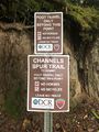
File:Spur trail sign.JPG |File name=Spur trail sign.JPG |Trail=Channels Trail(3,024 × 4,032 (4.09 MB)) - 06:58, 3 August 2020
File:Channels trail profile.png |File name=channels trail profile.png |Trail=Channels Trail(1,160 × 660 (20 KB)) - 18:09, 3 August 2020- {{Trail |Trail Highlight=Steep descent to Cherokee Lake3 KB (414 words) - 20:47, 11 September 2020
File:Hiking Trail Marker.jpg |File name=Hiking Trail Marker.jpg |Trail=Ridge Crest Trail(480 × 640 (143 KB)) - 17:18, 6 September 2020- |Trails=Old Wagon Trail |Trail Condition=Clear695 bytes (114 words) - 14:36, 11 September 2020
- {{Trail |Trail Highlight=Thru maple forest to a wildlife observatory2 KB (302 words) - 19:54, 11 September 2020
- {{Trail |Banner Image=File:PCSP Maple Arch Trail - sign at loop split.JPG3 KB (421 words) - 08:17, 14 September 2020
- {{Trail |Trail Highlight=Loop around Ore Mine Hill2 KB (279 words) - 08:20, 14 September 2020
- |Trails=Seven Sinkholes Trail |Trail Condition=Clear728 bytes (117 words) - 15:10, 11 September 2020
- {{Trail |Trail Highlight=Rightly named trail is hard to follow for its full distance2 KB (325 words) - 07:57, 14 September 2020
File:Old Wagon Trail Banner.jpg (4,032 × 3,024 (5.71 MB)) - 21:14, 11 September 2020
File:Seven Sinkholes Trail Banner.jpg (4,032 × 3,024 (6.46 MB)) - 21:27, 11 September 2020
File:Vista trail profile.png |File name=vista trail profile.png |Trail=Vista Trail(1,160 × 660 (21 KB)) - 10:35, 21 September 2020- {{Trail |Trail Highlight=A loop hike around the lake and access to most of the park's amen2 KB (330 words) - 08:35, 22 September 2020

File:Lake Trail Loop.kml (25 KB) - 08:18, 22 September 2020- |Trails=CCC Trail, Lake Trail Loop, Molly's Knob Trail, Vista Trail |Trail Condition=Clear621 bytes (100 words) - 09:21, 22 September 2020
File:Vista Trail-20200922131830.kml (46 KB) - 09:21, 22 September 2020- {{Trail |Trail Highlight=Kitchen Rock is a large sandstone outcropping with an eroded smal2 KB (268 words) - 07:21, 11 July 2021
- |Trails=Channels Trail |Trail Condition=Clear964 bytes (163 words) - 15:31, 21 August 2021
- |Trails=Lakeside Trail |Trail Condition=Clear590 bytes (95 words) - 11:06, 27 August 2021
- ...ip distance one would take to get to this trail, hike the entirety of this trail and return to the starting area.486 bytes (75 words) - 10:32, 23 December 2019
- {{Trail |Trail Marking=Blue7 KB (1,046 words) - 15:35, 10 January 2023
- == Getting started adding a trail page == Steps to creating a new trail (or filling out a referenced one that has no page)10 KB (1,857 words) - 17:31, 8 March 2020

File:Roaring branch trail profile.png |File name=roaring branch trail profile.png |Trail=Roaring Branch Trail(1,160 × 660 (22 KB)) - 22:30, 27 July 2020
File:Lakeside trail - evergreen grove.jpg |File name=Lakeside trail - evergreen grove.jpg |Trail=Lakeside Trail(500 × 375 (83 KB)) - 20:11, 10 November 2019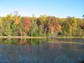
File:Lakeside Trail - former aviary area.jpg |File name=Lakeside Trail - former aviary area.jpg |Trail=Lakeside Trail(600 × 450 (69 KB)) - 20:13, 10 November 2019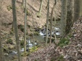
File:Laurel Run Trail creek.jpg |Trail=Laurel Run Trail |Caption=Cascading creek below the Laurel Run Trail - photo by Vic Hasler(768 × 576 (175 KB)) - 15:36, 10 November 2019- 28 bytes (4 words) - 14:17, 4 October 2015
File:WPSP Overlook Trail profile.JPG (736 × 321 (32 KB)) - 08:07, 23 March 2011- {{Trail |Trail Highlight=Secluded hike to balds with expansive views11 KB (1,595 words) - 22:13, 18 September 2021
- {{Trail |Trail Highlight=Steep trail to top of spectacular cliffs overlooking Linville Gorge4 KB (621 words) - 13:20, 23 July 2020
File:Roaring Branch Trail profile.JPG (754 × 331 (32 KB)) - 06:01, 21 March 2011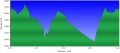
File:Holston Bluffs Trail profile.JPG |File name=Holston Bluffs Trail profile.JPG |Trail=Holston Bluffs(701 × 308 (28 KB)) - 08:09, 15 December 2018
File:Mendota Trail Elevation Profile.jpg Snipped from May 2023 trail newsletter(855 × 247 (35 KB)) - 18:54, 16 June 2023
File:Blue 2 Trail Head.jpg |File name=Blue 2 Trail Head.jpg |Trail=Blue 2,Ridge Top (Roan Mountain State Park)(768 × 1,024 (194 KB)) - 10:35, 28 December 2019
File:WPSP Overlook Trail sign.jpg |File name=WPSP Overlook Trail sign.jpg |Trail=Overlook(265 × 351 (25 KB)) - 13:58, 17 December 2018
File:WPSP Overlook Trail path.jpg |File name=WPSP Overlook Trail path.jpg |Trail=Overlook(351 × 265 (23 KB)) - 14:00, 17 December 2018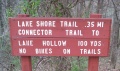
File:WPSP Lakeshore Trail sign.JPG |File name=WPSP Lakeshore Trail sign.JPG |Trail=Lakeshore(1,024 × 608 (198 KB)) - 11:31, 16 December 2018
File:WPSP Riverbank Trail sign.JPG |File name=WPSP Riverbank Trail sign.JPG |Trail=Riverbank(1,024 × 497 (166 KB)) - 08:29, 21 December 2018
File:WPSP Lakeshore Trail sign2.JPG |File name=WPSP Lakeshore Trail sign2.JPG |Trail=Lakeshore(448 × 336 (61 KB)) - 11:33, 16 December 2018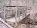
File:WPSP Lakeshore Trail bridge.JPG |File name=WPSP Lakeshore Trail bridge.JPG |Trail=Lakeshore(448 × 336 (64 KB)) - 11:32, 16 December 2018- 28 bytes (3 words) - 11:40, 26 November 2019
- 33 bytes (4 words) - 11:40, 26 November 2019
- The Mountains-to-Sea Trail (MST) is one of the newest and most scenic long-distance trails in the regi Maintained by the Friends of the Mountains-to-Sea Trail and its affiliated groups & agencies, it travels from8 KB (1,087 words) - 23:19, 1 March 2020
- 28 bytes (3 words) - 11:50, 27 September 2015

File:Rocky Fork Trail Map.pdf Rocky Fork Trail Map (Provided by Dave Ramsey)(715 KB) - 13:22, 7 August 2014- |Trails=Laurel Run Trail,Back Hollow Road,Pretty Ridge Trail,Kiner Hollow Trail |Trail Condition=Clear518 bytes (79 words) - 17:08, 10 November 2019
File:BMP Firetower Trail tower.jpg |File name=BMP Firetower Trail tower.jpg |Trail=River Mountain Road, Fire Tower Trail(300 × 401 (34 KB)) - 15:59, 10 November 2019
File:Whitetail loop trail profile.png |File name=Whitetail loop trail profile.png |Trail=Whitetail Loop(1,160 × 660 (24 KB)) - 15:39, 29 December 2019
File:Sweet gum trail profile.png |File name=Sweet gum trail profile.png |Trail=Sweet Gum Trail(1,160 × 660 (23 KB)) - 23:19, 15 December 2019
File:Cross ridges trail profile.png |File name=Cross ridges trail profile.png |Trail=Cross Ridges Trail(1,160 × 660 (24 KB)) - 23:07, 14 December 2019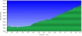
File:BMP Azalea Trail profile.JPG |File name=BMP Azalea Trail profile.JPG |Trail=Azalea(733 × 325 (33 KB)) - 23:22, 22 November 2019
File:BMP Orchid Trail sign.JPG |File name=BMP Orchid Trail sign.JPG |Trail=Orchid Trail(252 × 448 (97 KB)) - 19:10, 15 December 2019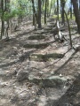
File:BMP Cliffside Trail steps.JPG |File name=BMP Cliffside Trail steps.JPG |Trail=Cliffside Trail(768 × 1,024 (251 KB)) - 22:29, 14 December 2019
File:BMP Cliffside Trail sun.jpg (600 × 800 (112 KB)) - 07:00, 24 April 2011
File:BMP Cliffside Trail lookout.JPG (768 × 1,024 (280 KB)) - 07:09, 24 April 2011
File:Cherry Knobs Trail Profile.png |File name=Cherry Knobs Trail Profile.png |Trail=Cherry Knobs(1,160 × 660 (28 KB)) - 13:03, 14 December 2019
File:BMP Cliffside Trail profile.JPG (783 × 343 (34 KB)) - 10:54, 26 April 2011
File:BMP Orchid Trail sign2.JPG (206 × 448 (97 KB)) - 05:46, 2 May 2011File:Iron Mountain Trail - South.kml KML for [[Iron Mountain Trail - South]](26 KB) - 00:24, 22 December 2018
File:BMP Azalea Trail sign.JPG |File name=BMP Azalea Trail sign.JPG |Trail=Azalea(140 × 448 (86 KB)) - 23:21, 22 November 2019
File:BMP Chinquapin Trail bridge1.JPG |File name=BMP Chinquapin Trail bridge1.JPG |Trail=Chinquapin Trail(448 × 301 (105 KB)) - 20:35, 14 December 2019
File:BMP Chinquapin Trail bridge2.JPG |File name=BMP Chinquapin Trail bridge2.JPG |Trail=Chinquapin Trail(336 × 430 (95 KB)) - 20:35, 14 December 2019- Friday Hikers, Iron Mountain Trail, August 13, 2010<br> ...ance covered was 9.6 miles. There was a moderate amount of trash along the trail, and even more evidence of bear traffic -- we kept wondering if we would ha2 KB (295 words) - 21:48, 6 August 2011
- -->{{Infobox Trail | Trail Use = {{Hike}} {{Biking}} {{Dogs}} {{Camping}} {{Horses}} {{Shelter}}4 KB (599 words) - 12:12, 7 January 2023
- {{Trail |Banner Image=File:CBST Trail Sign.JPG7 KB (1,125 words) - 07:42, 2 March 2020
- |Trail= * Remove the Trail page needs template2 KB (270 words) - 13:35, 14 December 2019
- #REDIRECT [[John Tomko Trail]]30 bytes (4 words) - 23:58, 29 December 2019
- #REDIRECT [[Luke Carter Trail]]31 bytes (4 words) - 23:58, 29 December 2019
- #REDIRECT [[Walter Hopkins Trail]]34 bytes (4 words) - 23:59, 29 December 2019
- {{Trail |Trail Marking=White Diamond4 KB (635 words) - 12:36, 19 January 2020
- {{Trail |Trail Number=FS #17917 KB (2,601 words) - 12:12, 7 January 2023
- -->{{Infobox Trail | Trail Use = {{Hike}} {{Dogs}} {{Horses}}6 KB (946 words) - 12:07, 7 January 2023
- -->{{Infobox Trail | Trail Number = FS# 1865 KB (683 words) - 12:12, 7 January 2023

File:Beartree gap trail profile.png |File name=Beartree gap trail profile.png |Trail=Beartree Gap Trail(1,160 × 660 (23 KB)) - 15:58, 19 January 2020
File:Big butt trail profile.png |File name=Big butt trail profile.png |Trail=Big Butt Trail(1,160 × 660 (23 KB)) - 11:11, 5 January 2020- -->{{Infobox Trail | Trail Use = {{Hike}} {{Dogs}} {{Fishing}}5 KB (688 words) - 12:12, 7 January 2023
File:Lone Oak Trail trailhead.JPG |File name=Lone Oak Trail trailhead.JPG |Trail=Lone Oak Trail(480 × 640 (201 KB)) - 09:33, 2 December 2018
File:White Rock Trail overlook.JPG |File name=White Rock Trail overlook.JPG |Trail=White Rock Trail(1,024 × 768 (300 KB)) - 22:50, 23 December 2018- |Trails=White Rock Trail, Cascade Trail, Fork Ridge Trail |Trail Condition=Clear655 bytes (99 words) - 09:14, 16 May 2022

File:Phipps bend trail profile.png |File name=phipps bend trail profile.png |Trail=Phipps Bend Trail(1,160 × 660 (18 KB)) - 12:48, 28 July 2020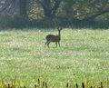
File:Phipps Bend Trail - deer.jpg |File name=Phipps Bend Trail - deer.jpg |Trail=Phipps Bend Trail(456 × 369 (68 KB)) - 12:39, 28 July 2020- ...ier. While an hour and half drive each way, the 3.8 mile Lake Keokee Loop Trail would be a nice family/beginner hike – especially when the spring wildflo ...west of Appalachia, VA – with a side out-and-back on 1.1 mile Olinger Gap Trail. Lake Keokee is a 92 acre secluded lake surrounded by marsh grasses and har1 KB (250 words) - 06:15, 3 April 2014
- ...he hike ended up being an easy three and quarter mile loop by taking Cabin Trail and the roadway back to the trailhead. I would recommend this hike for fami '''Hike Plan - F/B: Natural Tunnel SP - Purchase Ridge Trail, Sunday October 7, 2012'''2 KB (309 words) - 11:40, 26 November 2019
- {{Trail |Trail Highlight=High-point vista from within Rocky Fork SP5 KB (717 words) - 10:45, 25 November 2021
- |Trails=Laurel Run Trail |Trail Condition=Problems641 bytes (110 words) - 09:30, 29 February 2020
- -->{{Infobox Trail | Trail Use = {{Hike}}5 KB (701 words) - 12:12, 7 January 2023

File:Erwin Linear Trail sign1.JPG (448 × 230 (89 KB)) - 21:15, 15 March 2015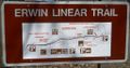
File:Erwin Linear Trail sign2.JPG (1,024 × 536 (176 KB)) - 21:36, 15 March 2015
File:Erwin Linear Trail parking1.JPG (448 × 183 (78 KB)) - 21:49, 15 March 2015
File:Erwin Linear Trail cemetery.JPG (448 × 240 (95 KB)) - 06:08, 16 March 2015
File:Chestnut ridge trail profile.png |File name=Chestnut ridge trail profile.png |Trail=Chestnut Ridge(1,160 × 660 (24 KB)) - 23:44, 18 December 2019
File:Sill Branch Trail Head.jpg |File name=Sill Branch Trail Head.jpg |Trail=Sill Branch(1,280 × 720 (196 KB)) - 22:36, 25 August 2020
File:Squibb Creek trail bridge.jpg A trail bridge along Squibb Creek |File name=Squibb Creek trail bridge.jpg(1,280 × 960 (250 KB)) - 08:50, 9 May 2020- 28 bytes (3 words) - 11:07, 27 September 2015
- 25 bytes (3 words) - 11:22, 27 September 2015
- #REDIRECT [[Bays Ridge Trail]]30 bytes (4 words) - 10:48, 4 October 2015
- #REDIRECT [[Big Oak Trail]]27 bytes (4 words) - 11:50, 4 October 2015
- #REDIRECT [[Cross Ridges Trail]]32 bytes (4 words) - 12:26, 4 October 2015
- #REDIRECT [[Dolan Branch Trail]]32 bytes (4 words) - 12:45, 4 October 2015
- #REDIRECT [[Indian Pipes Trail]]32 bytes (4 words) - 22:45, 5 October 2015
- #REDIRECT [[Pretty Ridge Trail]]32 bytes (4 words) - 22:17, 6 October 2015
- #REDIRECT [[Bear Run Trail]]28 bytes (4 words) - 23:02, 6 October 2015
- #REDIRECT [[Sweet Gum Trail]]29 bytes (4 words) - 23:27, 6 October 2015
- == Featured Trail == ...les were not allowed, signs of their recent presence were along the entire trail.4 KB (675 words) - 22:48, 1 November 2015
File:Rogers Ridge Trail Head.jpg The trail head of Rogers Ridge |File name=Rogers Ridge Trail Head.jpg(1,280 × 960 (323 KB)) - 09:16, 8 December 2019- <noinclude>This is a format template for the [[Template:Park trail table]]. It is expected to be used in conjunction with a semantic query. Th This template was created to handle the combination of trail pages and trail stubs (park page subobjects). As of now, this seems to be the only way to s4 KB (550 words) - 12:47, 28 December 2019
- |Trails=Brumley Mountain Trail |Trail Condition=Clear458 bytes (69 words) - 08:21, 24 March 2020
- |Trails=Fire Tower Trail |Trail Condition=Clear249 bytes (35 words) - 19:30, 31 March 2020
- |Trails=Laurel Run Trail |Trail Condition=Clear373 bytes (57 words) - 22:54, 24 July 2020
- |Trails=Fire Tower Trail |Trail Condition=Clear530 bytes (84 words) - 22:49, 24 July 2020
File:Daniel Boone Trail Banner.jpg |File name=Daniel Boone Trail Banner.jpg |Trail=Daniel Boone Trail(4,032 × 3,024 (4.99 MB)) - 10:18, 26 July 2020- |Trails=Daniel Boone Trail |Trail Condition=Clear2 KB (322 words) - 21:03, 25 July 2020

File:Daniel boone trail profile.png |File name=daniel boone trail profile.png |Trail=Daniel Boone Trail(1,160 × 660 (20 KB)) - 18:55, 26 July 2020- |Trails=Phipps Bend Trail |Trail Condition=Clear1 KB (195 words) - 15:01, 26 August 2020

File:Cabin Creek Trail profile.png |File name=Cabin Creek Trail profile.png |Trail=Cabin Creek Trail(1,160 × 660 (24 KB)) - 07:49, 29 August 2020- |Trails=Cabin Creek Trail |Trail Condition=Clear542 bytes (86 words) - 08:01, 29 August 2020
File:Cabin Creek Trail-20200829115812.kml (22 KB) - 08:01, 29 August 2020- {{Trail |Trail Highlight=Good for trail running2 KB (331 words) - 08:13, 14 September 2020
File:Ridge Crest Trail Banner.jpg (488 × 384 (88 KB)) - 17:15, 6 September 2020- |Trails=Ridge Crest Trail |Trail Condition=Clear1,018 bytes (164 words) - 14:34, 11 September 2020
- |Trails=Point Lookout Trail |Trail Condition=Clear805 bytes (133 words) - 14:35, 11 September 2020
- |Trails=Norris Blackburn Trail |Trail Condition=Clear632 bytes (98 words) - 14:36, 11 September 2020
- |Trails=Maple Arch Trail |Trail Condition=Impassible1 KB (180 words) - 06:29, 11 September 2020
- |Trails=Ore Mine Trail |Trail Condition=Problems942 bytes (154 words) - 14:46, 11 September 2020
- |Trails=Lost Road Trail |Trail Condition=Problems738 bytes (117 words) - 15:35, 11 September 2020
File:Point Lookout Trail Banner.jpg (4,032 × 3,024 (6.12 MB)) - 20:53, 11 September 2020
File:Norris Blackburn Trail Banner.jpg (4,032 × 3,024 (6.64 MB)) - 21:16, 11 September 2020
File:Lost Road Trail Banner.jpg (4,032 × 3,024 (6.46 MB)) - 21:30, 11 September 2020
File:PCSP Seven Sinkholes Trail - Another Sinkhole.JPG |File name=PCSP Seven Sinkholes Trail - Another Sinkhole.JPG |Trail=Seven Sinkholes Trail(3,024 × 4,032 (3.94 MB)) - 21:39, 11 September 2020
File:Ore Mine Trail Banner.jpg (3,853 × 2,721 (2.57 MB)) - 05:24, 14 September 2020- |Location=Mount Mitchell Trail53 bytes (7 words) - 12:39, 21 November 2020
- |Location=Catawba Falls Trail52 bytes (7 words) - 12:58, 21 November 2020
- |Trails=Laurel Run Trail |Trail Condition=Clear571 bytes (94 words) - 08:15, 12 May 2021
- |Trails=Bays Mountain Road, Cherry Knobs, Cliffside Trail, Indian Pipes Trail, River Mountain Road |Trail Condition=Clear318 bytes (46 words) - 18:30, 16 May 2021
File:Indian Pipes Trail-20210516172429.kml (11 KB) - 22:28, 17 May 2021- {{Trail |Trail Highlight=The path encircles the lake with little elevation change to give3 KB (357 words) - 21:09, 10 July 2021
- |Trails=Kitchen Rock Trail |Trail Condition=Clear522 bytes (84 words) - 21:25, 10 July 2021
File:Kitchen Rock Trail Banner.jpg (640 × 480 (133 KB)) - 07:08, 11 July 2021- |Trails=Laurel Run Trail |Trail Condition=Problems898 bytes (159 words) - 12:12, 11 July 2021
File:PRP Luke Carter trail sign.JPG (448 × 336 (94 KB)) - 06:36, 14 August 2011
File:Lakeside Trail - Bays Mountain Dam.jpg |File name=Lakeside Trail - Bays Mountain Dam.jpg |Trail=Lakeside Trail(600 × 450 (84 KB)) - 20:14, 10 November 2019
File:WPSP SW trail sign near stairs.jpg |Trail=Sinking Waters(1,280 × 960 (314 KB)) - 23:51, 18 November 2018
File:Table rock summit trail profile.png |File name=table rock summit trail profile.png |Trail=Table Rock Summit Trail(1,160 × 660 (23 KB)) - 12:40, 23 July 2020
File:Roaring Branch Trail - stone steps.JPG |File name=Roaring Branch Trail - stone steps.JPG |Trail=Roaring Branch Trail(1,154 × 2,086 (507 KB)) - 22:19, 27 July 2020
File:Roaring Branch Trail - first creek crossing.JPG |File name=Roaring Branch Trail - first creek crossing.JPG |Trail=Roaring Branch Trail(1,928 × 2,572 (1.21 MB)) - 22:19, 27 July 2020
File:WPSP Holston Bluffs Trail sign.jpg |File name=WPSP Holston Bluffs Trail sign.jpg |Trail=Holston Bluffs(265 × 351 (24 KB)) - 08:07, 15 December 2018
File:WPSP Holston Bluffs Trail path.jpg |File name=WPSP Holston Bluffs Trail path.jpg |Trail=Holston Bluffs(351 × 265 (25 KB)) - 08:08, 15 December 2018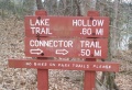
File:WPSP Lake Hollow Trail sign1.JPG |File name=WPSP Lake Hollow Trail sign1.JPG |Trail=Lake Hollow(1,024 × 702 (248 KB)) - 11:04, 16 December 2018
File:WPSP Lakeshore Trail - crumbling path.JPG (336 × 364 (56 KB)) - 05:54, 27 March 2011
File:WPSP Connector Trail - wooden bridges.JPG |File name=WPSP Connector Trail - wooden bridges.JPG |Trail=Connector(336 × 448 (57 KB)) - 22:26, 14 December 2018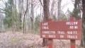
File:WPSP Lake Hollow Trail sign2.JPG |File name=WPSP Lake Hollow Trail sign2.JPG |Trail=Connector,Lake Hollow(448 × 255 (53 KB)) - 11:10, 16 December 2018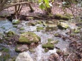
File:Roaring Branch Trail - yet another creek crossing.JPG |File name=Roaring Branch Trail - yet another creek crossing.JPG |Trail=Roaring Branch Trail(448 × 336 (67 KB)) - 22:19, 27 July 2020- 38 bytes (5 words) - 11:31, 27 September 2015
File:BMP Dolan Branch Trail waterfall.JPG |File name=BMP Dolan Branch Trail waterfall.JPG |Trail=Dolan Branch Trail(789 × 768 (205 KB)) - 00:02, 15 December 2019
File:BMP Dolan Branch Trail waterpipe.JPG |File name=BMP Dolan Branch Trail waterpipe.JPG |Trail=Dolan Branch Trail(608 × 1,024 (306 KB)) - 00:01, 15 December 2019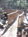
File:BMP Dolan Branch Trail footbridge1.JPG |File name=BMP Dolan Branch Trail footbridge1.JPG |Trail=Dolan Branch Trail(768 × 1,024 (268 KB)) - 00:01, 15 December 2019
File:BMP Dolan Branch Trail footbridge2.JPG |File name=BMP Dolan Branch Trail footbridge2.JPG |Trail=Dolan Branch Trail(768 × 818 (215 KB)) - 00:01, 15 December 2019
File:BMP Big Oak Trail profile.JPG |File name=BMP Big Oak Trail profile.JPG |Trail=Big Oak Trail(720 × 317 (32 KB)) - 00:02, 11 December 2019
File:BMP Fern Trail Lake Road.JPG (695 × 1,024 (187 KB)) - 11:21, 15 April 2011
File:BMP Lakeside Trail floating bridge.JPG |File name=BMP Lakeside Trail floating bridge.JPG |Trail=Lakeside Trail(768 × 1,024 (261 KB)) - 20:22, 10 November 2019
File:BMP Cross Ridges Trail profile.JPG (739 × 326 (33 KB)) - 10:47, 26 April 2011
File:BMP Cliffside Trail lower overlook.JPG |File name=BMP Cliffside Trail lower overlook.JPG |Trail=Cliffside Trail(448 × 336 (95 KB)) - 22:30, 14 December 2019
File:BMP Cliffside Trail higher overlook.JPG |File name=BMP Cliffside Trail higher overlook.JPG |Trail=Cliffside Trail(448 × 270 (82 KB)) - 22:29, 14 December 2019
File:BMP Bays Ridge Trail sign.JPG |File name=BMP Bays Ridge Trail sign.JPG |Trail=Bays Ridge Trail(448 × 295 (111 KB)) - 22:58, 23 November 2019
File:BMP Bays Ridge Trail profile.JPG |File name=BMP Bays Ridge Trail profile.JPG |Trail=Bays Ridge Trail(721 × 317 (33 KB)) - 22:58, 23 November 2019- -->{{Infobox Trail | Trail Use = {{Hike}}8 KB (1,255 words) - 12:12, 7 January 2023
File:Virginia Creeper Trail - Alvarado Station.jpg |File name=Virginia Creeper Trail - Alvarado Station.jpg |Trail=Virginia Creeper Trail(768 × 1,024 (180 KB)) - 00:02, 22 December 2018
File:Virginia Creeper Trail - Abingdon Trailhead.jpg |File name=Virginia Creeper Trail - Abingdon Trailhead.jpg |Trail=Virginia Creeper Trail(768 × 576 (145 KB)) - 00:01, 22 December 2018
File:PRP Luke Carter trail bridge.JPG (336 × 448 (95 KB)) - 06:38, 14 August 2011
File:PRP Walter Hopkins trail sign.JPG (408 × 336 (111 KB)) - 06:48, 14 August 2011
File:PRP Walter Hopkins trail sign2.JPG (387 × 336 (92 KB)) - 06:53, 14 August 2011
File:PRP John Tomko trail sign.JPG (336 × 337 (102 KB)) - 07:01, 14 August 2011
File:White Rocks - Backcountry Trail Register.JPG (448 × 307 (93 KB)) - 21:48, 24 August 2011
File:BMP Pretty Ridge Trail sty.JPG |File name=BMP Pretty Ridge Trail sty.JPG |Trail=Pretty Ridge Trail(336 × 448 (107 KB)) - 15:18, 10 November 2019
File:Green knob tower trail profile.png |File name=Green knob tower trail profile.png |Trail=Green Knob Tower Trail(1,160 × 660 (21 KB)) - 10:50, 19 January 2020
File:White house cliffs trail profile.png |File name=White house cliffs trail profile.png |Trail=White House Cliffs Trail(1,160 × 660 (25 KB)) - 23:15, 21 January 2020- |Trails=Table Rock Summit Trail |Trail Condition=Clear569 bytes (89 words) - 22:48, 24 July 2020
File:Lone Oak Trail Dosser sign.JPG |File name=Lone Oak Trail Dosser sign.JPG |Trail=Lone Oak Trail(1,024 × 768 (334 KB)) - 09:34, 2 December 2018
File:White Rock Trail - creek crossing.JPG |File name=White Rock Trail - creek crossing.JPG |Trail=White Rock Trail(448 × 336 (117 KB)) - 22:51, 23 December 2018
File:AT - High Water Trail intersection.JPG (430 × 336 (91 KB)) - 14:59, 4 July 2012
File:AT - High Water Trail intersection2.JPG (448 × 194 (92 KB)) - 17:10, 4 July 2012
File:Devils Bathtub Trail splash pool.jpg Meeting point of two streams into a splash pool along the Devil's Bathtub Trail |File name=Devils Bathtub Trail splash pool.jpg(2,317 × 2,661 (2.64 MB)) - 22:55, 10 January 2020
File:GSMNP Curry Mountain Trail trees.JPG (336 × 448 (116 KB)) - 21:15, 11 October 2014- |Trails=Long Island of the Holston Trail |Trail Condition=Clear337 bytes (46 words) - 03:50, 3 May 2024
- Here are the steps to create a KML for uploading to a trail page. ** [https://apps.apple.com/us/app/gaia-gps-mobile-trail-maps/id1201979492 Gaia GPS] - Used for logging tracks and taking location r3 KB (571 words) - 13:40, 24 June 2023
File:Roan Chestnut Miller Trail head.jpg Chestnut Ridge trail head sign at Miller Homestead at Roan Mountain State Park |File name=Roan Chestnut Miller Trail head.jpg(2,816 × 2,112 (2.49 MB)) - 23:37, 18 December 2019
File:Roan Ted Gray Trail View.jpg View along the Ted Gray Trail in Roan Mountain State Park |File name=Roan Ted Gray Trail View.jpg(960 × 1,280 (305 KB)) - 22:56, 3 January 2020
File:Roan Mystery Mountain Trail Monster.jpg A mysterious find along the Turkey Trot Trail in Roan Mountain State Park |File name=Roan Mystery Mountain Trail Monster.jpg(576 × 1,024 (146 KB)) - 20:16, 22 December 2019- 29 bytes (4 words) - 11:03, 27 September 2015
File:Rogers Ridge Trail View 1.jpg View along Rogers Ridge Trail |File name=Rogers Ridge Trail View 1.jpg(768 × 1,024 (236 KB)) - 09:16, 8 December 2019
File:Rogers Ridge Trail View 2.jpg View along Rogers Ridge Trail |File name=Rogers Ridge Trail View 2.jpg(768 × 1,024 (291 KB)) - 09:17, 8 December 2019
File:Rogers Ridge Trail view 3.jpg View along Rogers Ridge Trail(768 × 1,024 (238 KB)) - 23:42, 21 October 2015- |Trails=White House Cliffs Trail |Trail Condition=Clear901 bytes (147 words) - 11:07, 25 November 2021
File:Catawba Falls Trail - Former Electrical Station.jpg (640 × 480 (167 KB)) - 16:16, 14 April 2019
File:Daniel Boone Trail locked gate.JPG |File name=Daniel Boone Trail locked gate.JPG |Trail=Daniel Boone Trail(4,032 × 3,024 (6.71 MB)) - 10:17, 26 July 2020- |Trails=Road to Recycling Trail |Trail Condition=Clear743 bytes (117 words) - 14:37, 11 September 2020

File:PCSP Ridge Crest Trail Profile.png |File name=PCSP Ridge Crest Trail Profile.png |Trail=Ridge Crest Trail(1,160 × 660 (22 KB)) - 20:44, 11 September 2020
File:PCSP Point Lookout Trail - overlook.JPG |File name=PCSP Point Lookout Trail - overlook.JPG |Trail=Point Lookout Trail(3,024 × 4,032 (4.49 MB)) - 21:05, 11 September 2020
File:PCSP Point Lookout Trail - bench.JPG |File name=PCSP Point Lookout Trail - bench.JPG |Trail=Point Lookout Trail(3,024 × 4,032 (7.08 MB)) - 21:08, 11 September 2020
File:PCSP Point Lookout Trail Profile.png |File name=PCSP Point Lookout Trail Profile.png |Trail=Point Lookout Trail(1,160 × 660 (20 KB)) - 21:11, 11 September 2020
File:PCSP Seven Sinkholes Trail - Sinkhole 1.JPG |File name=PCSP Seven Sinkholes Trail - Sinkhole 1.JPG |Trail=Seven Sinkholes Trail(3,024 × 4,032 (7.02 MB)) - 21:33, 11 September 2020
File:PCSP Maple Arch Trail - first beach.JPG |File name=PCSP Maple Arch Trail - first beach.JPG |Trail=Maple Arch Trail(4,032 × 3,024 (2.69 MB)) - 21:42, 11 September 2020
File:PCSP Maple Arch Trail - last beach.JPG (4,032 × 3,024 (3.16 MB)) - 21:47, 11 September 2020
File:PCSP Ore Mine Trail - Bench.JPG |File name=PCSP Ore Mine Trail - Bench.JPG |Trail=Ore Mine Trail(3,024 × 4,032 (4.88 MB)) - 07:47, 14 September 2020- |Location=Black Mountain Crest Trail59 bytes (8 words) - 12:42, 21 November 2020
- |Trails=Black Mountain Crest Trail |Trail Condition=Clear327 bytes (47 words) - 12:50, 21 November 2020
File:Bark Camp Lakeshore Trail Banner.jpg (640 × 480 (39 KB)) - 19:42, 10 July 2021
File:Bark Camp Lake trail marker.jpg |Trail=Bark Camp Lakeshore Trail |Caption=Trail marker(480 × 640 (131 KB)) - 20:47, 10 July 2021- |Trails=Bark Camp Lakeshore Trail |Trail Condition=Clear611 bytes (94 words) - 21:20, 10 July 2021
File:Chief Benge Scout Trail sign.jpg |File name=Chief Benge Scout Trail sign.jpg |Trail=Bark Camp Lakeshore Trail(480 × 640 (177 KB)) - 21:30, 10 July 2021
File:Kitchen Rock Trail western stairs.jpg |File name=Kitchen Rock Trail western stairs.jpg |Trail=Kitchen Rock Trail(640 × 480 (180 KB)) - 07:13, 11 July 2021
File:Kitchen Rock Trail eastern stairs.jpg |File name=Kitchen Rock Trail eastern stairs.jpg |Trail=Kitchen Rock Trail(640 × 480 (183 KB)) - 07:14, 11 July 2021- |Trails=White House Cliffs Trail |Trail Condition=Clear612 bytes (100 words) - 08:07, 13 September 2021
File:WPSP Fall Creek Loop Trail profile.JPG (711 × 313 (31 KB)) - 07:46, 23 March 2011
File:Roaring Branch Trail - view from High Butte.JPG |File name=Roaring Branch Trail - view from High Butte.JPG |Trail=Roaring Branch Trail(448 × 336 (47 KB)) - 22:19, 27 July 2020
File:Roaring Branch Trail - wide creek crossing.JPG |File name=Roaring Branch Trail - wide creek crossing.JPG |Trail=Roaring Branch Trail(2,572 × 1,928 (1.01 MB)) - 22:19, 27 July 2020
File:WPSP Holston Bluffs Trail gate sign.jpg |File name=WPSP Holston Bluffs Trail gate sign.jpg |Trail=Holston Bluffs(265 × 351 (22 KB)) - 08:09, 15 December 2018
File:WPSP Connector Trail - Girls Inc bench.JPG |File name=WPSP Connector Trail - Girls Inc bench.JPG |Trail=Connector(448 × 336 (71 KB)) - 22:26, 14 December 2018
File:WPSP Connector Trail fishing spot view.JPG |File name=WPSP Connector Trail fishing spot view.JPG |Trail=Connector(448 × 336 (39 KB)) - 22:24, 14 December 2018
File:Roaring Branch Trail - wading creek crossing.JPG |File name=Roaring Branch Trail - wading creek crossing.JPG |Trail=Roaring Branch Trail(448 × 287 (59 KB)) - 22:19, 27 July 2020
File:GSMNP Grotto Falls - Trail intersection sign.JPG (831 × 768 (141 KB)) - 22:05, 2 April 2011
File:WPSP Fall Creek Loop Trail bridge.JPG (768 × 1,024 (271 KB)) - 12:21, 23 April 2011
File:BMP Cross Ridges Trail Yellow Leafcup.JPG (1,024 × 649 (274 KB)) - 06:05, 25 April 2011
File:BMP Cross Ridges Trail stream crossing.JPG (768 × 1,024 (272 KB)) - 05:24, 25 April 2011
File:BMP Cross Ridges Trail Fire Pink.JPG (448 × 315 (116 KB)) - 05:45, 25 April 2011
File:BMP Cross Ridges Trail star chickweed.JPG (448 × 291 (85 KB)) - 07:12, 29 April 2011
File:BMP Cross Ridges Trail wild geranium.JPG (927 × 768 (276 KB)) - 11:53, 29 April 2011- {{Trail |Trail Highlight=2 KB (238 words) - 22:05, 9 May 2020

File:BMP Big Oak - Chinquapin Trail sign.JPG (128 × 448 (83 KB)) - 02:42, 17 June 2011
File:BMP Azalea Trail sign at BMR.JPG (129 × 448 (80 KB)) - 02:47, 17 June 2011
File:GSMNP Curry Mountain Trail upper end.JPG (425 × 336 (119 KB)) - 21:17, 11 October 2014
File:Roan Fred Behrend Trail Head sign.jpg Trail head sign for the Fred Behrend Trail in Roan Mountain State Park |File name=Roan Fred Behrend Trail Head sign.jpg(2,816 × 2,112 (2.66 MB)) - 22:21, 22 December 2019
File:Black Mountains Photos 06 Trail Relocation.jpg nchighpeaks.org rerouted the trail in 2012 to avoid the notorious Jake's Step rock scramble.(1,200 × 900 (357 KB)) - 16:40, 4 December 2015
File:PRD Cold Mountain Summit Trail Spur.jpg The start of the summit trail is in Deep Gap. 1.5 miles to the top from here.(1,200 × 900 (378 KB)) - 14:51, 13 April 2016
File:AT2016Hike-Laurel Fork Trail to 321.PNG Profile of the Laurel Fork Trail on to Pond Mountain to Shook Branch Rd on US321 section of the A.T.(1,522 × 319 (56 KB)) - 07:36, 29 January 2017
File:Catawba Falls Trail - Chestnut Branch footbridge.jpg (640 × 480 (155 KB)) - 16:12, 14 April 2019
File:PCSP Point Lookout Trail - Cherokee Lake1.JPG |File name=PCSP Point Lookout Trail - Cherokee Lake1.JPG |Trail=Point Lookout Trail(4,032 × 3,024 (5.61 MB)) - 20:58, 11 September 2020
File:PCSP Point Lookout Trail - Cherokee Lake2.JPG |File name=PCSP Point Lookout Trail - Cherokee Lake2.JPG |Trail=Point Lookout Trail(4,032 × 3,024 (2.49 MB)) - 21:00, 11 September 2020
File:PCSP Norris Blackburn Trail - intersection sign.JPG |File name=PCSP Norris Blackburn Trail - intersection sign.JPG |Trail=Norris Blackburn Trail(4,032 × 3,024 (5.94 MB)) - 21:18, 11 September 2020
File:PCSP Norris Blackburn Trail - disc golf.JPG |File name=PCSP Norris Blackburn Trail - disc golf.JPG |Trail=Norris Blackburn Trail(3,024 × 4,032 (5.82 MB)) - 21:19, 11 September 2020
File:PCSP Norris Blackburn Trail - wildlife observatory.JPG |File name=PCSP Norris Blackburn Trail - wildlife observatory.JPG |Trail=Norris Blackburn Trail(4,032 × 3,024 (6.43 MB)) - 21:21, 11 September 2020
File:PCSP Maple Arch Trail - another beach view.JPG |File name=PCSP Maple Arch Trail - another beach view.JPG |Trail=Maple Arch Trail(4,032 × 3,024 (3.16 MB)) - 05:17, 14 September 2020
File:PCSP Ore Mine Trail - View thru trees.JPG |File name=PCSP Ore Mine Trail - View thru trees.JPG |Trail=Ore Mine Trail(3,024 × 4,032 (4.1 MB)) - 07:48, 14 September 2020
File:PCSP Road to Recycling Trail - bridge.JPG |File name=PCSP Road to Recycling Trail - bridge.JPG |Trail=Road to Recycling Trail(4,032 × 3,024 (6.01 MB)) - 08:06, 14 September 2020
File:WPSP Overlook Trail - Viewing I-81 Bridge.jpg Overlook Trail path through woods |File name=WPSP Overlook Trail - Viewing I-81 Bridge.jpg(265 × 351 (18 KB)) - 14:00, 17 December 2018
File:WPSP Lake Hollow Trail - View towards Duck Island.JPG |File name=WPSP Lake Hollow Trail - View towards Duck Island.JPG |Trail=Lake Hollow(1,024 × 526 (83 KB)) - 11:11, 16 December 2018
File:WPSP Fall Creek Loop Trail - Ulster sign.jpg |File name=WPSP Fall Creek Loop Trail - Ulster sign.jpg |Trail=Fall Creek Loop(265 × 351 (21 KB)) - 22:39, 8 December 2018
File:BMP Cross Ridges Trail Dwarf Violet Iris.JPG Seen along Cross Ridges Trail(768 × 881 (272 KB)) - 05:37, 25 April 2011
File:BMP Cross Ridges Trail Sweet White Violet.JPG (1,024 × 677 (187 KB)) - 12:19, 29 April 2011
File:BMP Cliffside Trail view from obs tower towards firetower.JPG |File name=BMP Cliffside Trail view from obs tower towards firetower.JPG |Trail=Cliffside Trail(448 × 282 (83 KB)) - 22:28, 14 December 2019
File:BMP Cliffside Trail view from obs tower towards valley.JPG |File name=BMP Cliffside Trail view from obs tower towards valley.JPG |Trail=Cliffside Trail(336 × 448 (109 KB)) - 22:30, 14 December 2019
File:Lone Oak Trail - NW View from Tip-Top.JPG (1,024 × 768 (293 KB)) - 08:01, 22 January 2012
File:Black Mountains Photos 01 Rugged Trail Below Craig.jpg It doesn't take long before the trail starts to get rough(1,200 × 900 (343 KB)) - 16:30, 4 December 2015
File:Coon Den Falls Trail - bottom trailhead sign.jpg |File name=Coon Den Falls Trail - bottom trailhead sign.jpg |Trail=Coon Den Falls(3,240 × 4,320 (2.95 MB)) - 22:02, 27 July 2020
File:PCSP Point Lookout Trail - 0.50 MI sign.JPG |File name=PCSP Point Lookout Trail - 0.50 MI sign.JPG |Trail=Point Lookout Trail(4,032 × 3,024 (6.9 MB)) - 21:02, 11 September 2020
File:PCSP Maple Arch Trail - slowly crossing the path.JPG |File name=PCSP Maple Arch Trail - slowly crossing the path.JPG |Trail=Maple Arch Trail(4,032 × 3,024 (5.7 MB)) - 21:44, 11 September 2020
File:WPSP Lakeshore Trail - View of Lone Cedar Overlook.JPG |File name=WPSP Lakeshore Trail - View of Lone Cedar Overlook.JPG |Trail=Lakeshore(448 × 336 (42 KB)) - 11:38, 16 December 2018
File:WPSP - Sign at Lakeshore and Connector Trail intersection.JPG |File name=WPSP - Sign at Lakeshore and Connector Trail intersection.JPG |Trail=Connector,Lakeshore(448 × 264 (65 KB)) - 11:35, 16 December 2018
File:WPSP Lake Hollow Trail - View towards main boat ramp.JPG |File name=WPSP Lake Hollow Trail - View towards main boat ramp.JPG |Trail=Lake Hollow(448 × 275 (30 KB)) - 11:10, 16 December 2018
File:WPSP Lake Hollow Trail - Ulster Project Peach Bench.JPG |File name=WPSP Lake Hollow Trail - Ulster Project Peach Bench.JPG |Trail=Lake Hollow(448 × 288 (60 KB)) - 11:11, 16 December 2018
File:WPSP Fall Creek Loop Trail wood duck box1.JPG |File name=WPSP Fall Creek Loop Trail wood duck box1.JPG |Trail=Fall Creek Loop(701 × 1,024 (238 KB)) - 22:41, 8 December 2018
File:WPSP Fall Creek Loop Trail wood duck box2.JPG (716 × 1,024 (274 KB)) - 12:12, 23 April 2011
File:Roan Forest Road Trail Head at Visitors Center.jpg Trail head sign for Roan Mountain State Park's Forest Road Trail at the Visitor's Center |File name=Roan Forest Road Trail Head at Visitors Center.jpg(2,816 × 2,112 (2.99 MB)) - 20:17, 22 December 2019
File:PCSP Maple Arch Trail - sign at loop split.JPG |File name=PCSP Maple Arch Trail - sign at loop split.JPG |Trail=Maple Arch Trail(4,032 × 3,024 (6.33 MB)) - 21:46, 11 September 2020
File:PCSP Lost Road Trail - first junction with Maple Arch Trail.JPG |File name=PCSP Lost Road Trail - first junction with Maple Arch Trail.JPG |Trail=Lost Road Trail(4,032 × 3,024 (4.52 MB)) - 08:03, 14 September 2020
File:PCSP Road to Recycling Trail - last info sign remaining.JPG |File name=PCSP Road to Recycling Trail - last info sign remaining.JPG |Trail=Road to Recycling Trail(3,024 × 4,032 (3.95 MB)) - 08:08, 14 September 2020
File:WPSP Lakeshore Trail - View of Fall Creek Road bridge.JPG |File name=WPSP Lakeshore Trail - View of Fall Creek Road bridge.JPG |Trail=Lakeshore(448 × 283 (35 KB)) - 11:33, 16 December 2018
File:Roaring Branch Trail - View of Stone Mountains from High Butte.JPG |File name=Roaring Branch Trail - View of Stone Mountains from High Butte.JPG |Trail=Roaring Branch Trail(1,024 × 364 (59 KB)) - 22:19, 27 July 2020
File:WPSP Devil's Backbone Trail profile.JPG (723 × 319 (31 KB)) - 06:01, 23 March 2011
File:Catawba Falls Trail - Catawba River footbridge.jpg (542 × 480 (182 KB)) - 16:26, 14 April 2019
File:Raider's run trail profile.png |File name=raider's run trail profile.png |Trail=Raider's Run Trail(1,160 × 660 (23 KB)) - 22:52, 20 September 2020
File:Molly's knob trail profile.png |File name=molly's knob trail profile.png |Trail=Molly's Knob Trail(1,160 × 660 (24 KB)) - 10:07, 21 September 2020- |Trails=Old Shawnee Trail, Raider's Run Trail |Trail Condition=Clear418 bytes (65 words) - 10:40, 21 September 2020
File:Raider's Run Trail-20200921143810.kml (11 KB) - 10:41, 21 September 2020- {{Trail |Trail Highlight=Short but moderate loop for hikers and bikers1 KB (176 words) - 10:10, 21 September 2020
- {{Trail |Trail Highlight=Access to the vista trail3 KB (445 words) - 22:56, 10 May 2021
File:White Rocks - Ewing and White Rocks Trail sign.jpg (233 × 448 (98 KB)) - 21:19, 24 August 2011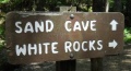
File:White Rocks - Sand Cave-White Rocks trail sign.JPG (448 × 241 (84 KB)) - 05:50, 26 August 2011


Page text matches
- ...OLETE" are not to be used and should be deleted in the usage if updating a trail page. They are left here for backward compatibility and will be removed onc {{Infobox Trail6 KB (844 words) - 11:01, 20 November 2018
- |Trail Map Link=https://www.nps.gov/cuga/planyourvisit/upload/CUGAmap1-3.pdf {{Park trail map}}4 KB (565 words) - 11:29, 16 June 2023
- #REDIRECT [[Ewing Trail]]25 bytes (3 words) - 23:17, 27 November 2019
- #REDIRECT [[Talk:Ewing Trail]]30 bytes (4 words) - 23:17, 27 November 2019
- [[Template:Trail]] [[Template:Infobox Trail]]1 KB (155 words) - 21:38, 20 February 2011
- '''Welcome to Tennessee Eastman Hiking and Canoeing Club's Trail WIKI''' Our online repository for everything trail related within a reasonable distance from our club's center in Kingsport TN9 KB (1,394 words) - 18:18, 14 July 2023
- {{#ask: [[Category:Waterfalls]][[Trail State::Virginia]]139 bytes (14 words) - 19:43, 31 August 2015
- ...Text|Text]]. It is used to hold the choice of Easy / Medium / Hard for the trail hike difficulty135 bytes (26 words) - 20:57, 17 September 2015
- ...ip distance one would take to get to this trail, hike the entirety of this trail and return to the starting area.486 bytes (75 words) - 10:32, 23 December 2019
- ...2.47760~[[WPSP Sinking Waters|Sinking Waters]]~Here is the location of the trail head~MarkerA.png~ ~This is where Putin Works ...reek_Loop_Trail|Fall Creek Loop]]<br>[[Image:To D Backbone Trail.jpg|150px|Trail head sign]]10 KB (1,633 words) - 12:12, 7 January 2023
- {{Trail |Banner Image=File:BMP Firetower Trail tower.jpg4 KB (529 words) - 22:07, 10 December 2019
- !Trail distance from Damascus1 KB (201 words) - 18:24, 20 February 2023
- ...distance, thus reported for annual data book update. This page, like the trail itself, is a work in progress to figure out how to best use the available t <br>- Backbone Rock Trail (blue blaze)7 KB (1,010 words) - 12:12, 7 January 2023
File:WPSP Main Split signs.JPG |Trail=Boneyard, Lake Road (Warriors Path State Park), Whitetail Loop, Zipline |Caption=Signs at main trail split(3,024 × 4,032 (4.76 MB)) - 11:45, 24 June 2023- Arguably the most unique shelter on the entire Appalachian Trail with a great view looking down into Roaring Creek Valley. A classic wooden ...d Carvers Gap. The shelter is 0.3 miles east of AT. on a blue-blazed side trail. In the Pisgah National Forest, Toecane Ranger District. Located on the [[C4 KB (605 words) - 07:28, 20 November 2023
- Water is found 100 yards from the shelter on a blue blaze trail. <!-- Place any pictures from this trail below. Add a picture by typing Image:imagename.extension -->2 KB (282 words) - 12:04, 21 December 2018
- ...il' template. It is expected to be typically used by the [[Form:Trail|Form Trail]]. This template creates the 'sidebar' with info about each trail like the state, nearest city, coordinates of the tail head. If not used, en9 KB (1,166 words) - 19:07, 15 April 2023
- <!-- Add additional columns for distance from Bristol/trail distance/AT or branch --> !Trail5 KB (506 words) - 17:26, 10 June 2023
- {{Trail |Trail Marking=Blue7 KB (1,046 words) - 15:35, 10 January 2023
- {{Trail |Trail Highlight=Your likely trail if you want to "go to The Channels"6 KB (906 words) - 10:47, 8 January 2023
File:The Great Channels1.jpg |Trail=The Channels Natural Area Preserve(768 × 1,024 (139 KB)) - 22:39, 15 November 2018
File:Sinking Waters information sign.jpg |Trail=Sinking Waters(768 × 576 (123 KB)) - 15:07, 20 November 2018- |Trail Map Link=https://baysmountainpa.wpengine.com/wp-content/uploads/Trail-Map-Brochure-Front-5-7-18.pdf 36.50803,-82.61255~Lakeside Trail~ ~MarkerG.png9 KB (1,288 words) - 15:10, 13 June 2023
File:Comparison of etrex and forerunner logging.PNG ...nta/pink. The eTrex track was more consistent upon trail returns and known trail locations/shape.(1,566 × 974 (3.49 MB)) - 00:39, 2 January 2020- {{Trail |Banner Image=File:Lakeside Trail - Bays Mountain Dam.jpg4 KB (663 words) - 17:12, 19 March 2023
- == Getting started adding a trail page == Steps to creating a new trail (or filling out a referenced one that has no page)10 KB (1,857 words) - 17:31, 8 March 2020
File:Sinking Waters sinkhole.jpg |Trail=Sinking Waters(2,048 × 1,536 (910 KB)) - 12:24, 19 November 2018- |Trail Map Link=https://tnstateparks.com/assets/pdf/additional-content/park-maps/4 |Park Trail Count=9 KB (1,271 words) - 11:59, 19 September 2021
- {{Trail |Trail Highlight=Three connected loops and a stream that disappears into a sinkhol9 KB (1,357 words) - 17:53, 14 December 2019
- |Trail Condition=Clear |Trail Comment=Good. Some decking felt loose and handrail is knocked off in wetlan520 bytes (81 words) - 10:42, 8 December 2018
- {{Trail |Trail Number=FS #1895 KB (728 words) - 20:56, 21 May 2023
File:IMG 3495.jpg |Trail=Margarette Falls(640 × 480 (161 KB)) - 21:05, 21 May 2023
File:Margarette Falls-profile.png |Trail=Margarette Falls(760 × 460 (22 KB)) - 22:32, 4 December 2018
File:Margarette falls 01.jpg |Trail=Margarette Falls(1,200 × 900 (620 KB)) - 22:08, 4 December 2018- ...slippery, but we made it, took in the sights, and quickly headed back down trail to the warmer weather. Overall it was barely frozen and compared to picture ...in the water. This popular falls is considerably easier to get to now. The trail work is top notch...3 KB (533 words) - 00:54, 14 May 2012

File:Dnr atv.png Trail logo to signify ATV use |Caption=Signifies that ATVs are allowed on at least some of the trail<br>'''Note''': Check with proper authorities for which specific trails allo(80 × 80 (2 KB)) - 18:29, 21 November 2018
File:Dnr bike.png |Caption=Signifies that bicycles are allowed on at least some of the trail<br>'''Note''': Check with proper authorities for which specific trails allo(80 × 80 (2 KB)) - 18:30, 21 November 2018
File:Dnr fishing.png ...ignifies that fishing might be allowed on at least some streams nearby the trail<br>'''Note:''' Check with proper authorities for locations and license requ(80 × 80 (1 KB)) - 18:21, 21 November 2018
File:Dnr hiking.png |Caption=Signifies that hiking is allowed on the trail(80 × 80 (2 KB)) - 17:44, 21 November 2018
File:Dnr skiing.png |Caption=Signifies that skiing is allowed on the trail and is common in the winter(80 × 80 (1 KB)) - 18:26, 21 November 2018
File:Dnr waterfall.png |Caption=There are waterfalls within the park or near the trail(80 × 80 (2 KB)) - 09:17, 23 November 2018- ...g'. It is normally used in infoboxes to display allowed use on or near the trail or at the park.474 bytes (72 words) - 10:57, 20 November 2018
- ...s'. It is normally used in infoboxes to display allowed use on or near the trail or at the park.460 bytes (72 words) - 10:51, 20 November 2018
- ...V'. It is normally used in infoboxes to display allowed use on or near the trail or at the park.457 bytes (72 words) - 10:45, 20 November 2018
- ...g'. It is normally used in infoboxes to display allowed use on or near the trail.456 bytes (68 words) - 10:50, 20 November 2018
- ...g'. It is normally used in infoboxes to display allowed use on or near the trail or at the park.475 bytes (72 words) - 10:51, 20 November 2018
- ...g'. It is normally used in infoboxes to display allowed use on or near the trail or at the park.481 bytes (72 words) - 10:56, 20 November 2018
- ...s'. It is normally used in infoboxes to display allowed use on or near the trail or at the park.483 bytes (73 words) - 10:57, 20 November 2018
- ...r'. It is normally used in infoboxes to display allowed use on or near the trail or at the park.481 bytes (72 words) - 11:35, 20 November 2018
- ...g'. It is normally used in infoboxes to display allowed use on or near the trail or at the park.474 bytes (72 words) - 11:35, 20 November 2018
- ...l'. It is normally used in infoboxes to display allowed use on or near the trail or at the park.493 bytes (72 words) - 11:41, 20 November 2018
- [[ClubWiki:Creating a Trail]] [[ClubWiki:Creating a Trail KML]]6 KB (877 words) - 18:29, 3 July 2020
- |Banner Image=File:White Rock Trail overlook.JPG |Trail Map Link=https://www.johnsoncitytn.org/document_center/Residents/Buffalo%205 KB (873 words) - 12:12, 7 January 2023
- {{Trail |Trail Highlight=An easy short trail to a remote and beautiful waterfall3 KB (486 words) - 14:14, 17 July 2023
- ...The river trail ends at the Clinch River, so I backtracked to Copper Ridge Trail and up a 350’ elevation climb to the overlook. (I would recommend the ove3 KB (462 words) - 07:50, 2 April 2014
- {{Trail |Trail Marking=Red9 KB (1,323 words) - 15:45, 24 June 2023
- |Trail Condition=Clear335 bytes (55 words) - 07:05, 7 July 2023
- |Trails=Ewing Trail |Trail Condition=Clear1 KB (224 words) - 18:13, 14 July 2023
- [[ClubWiki:Creating_a_Trail]] has information on how to add (or modify) a trail specific to this site When creating or modifying trail or park pages, applying wiki categories are not used. The templates will ap7 KB (1,001 words) - 13:36, 1 January 2020
File:Rock Creek Falls.jpg |Trail=Rock Creek Falls(900 × 1,200 (420 KB)) - 11:06, 19 September 2021
File:High Butte.jpg |Trail=Roaring Branch Trail(600 × 450 (71 KB)) - 22:19, 27 July 2020- {{Trail |Trail Highlight=Starting waterfall, view of the Powell River Valley5 KB (783 words) - 22:37, 27 July 2020
File:Roaring branch trail profile.png |File name=roaring branch trail profile.png |Trail=Roaring Branch Trail(1,160 × 660 (22 KB)) - 22:30, 27 July 2020- |Trail Condition=Clear |Trail Comment=The trail was in excellent condition.510 bytes (81 words) - 15:07, 28 July 2020
- |Trail Condition=Clear |Trail Comment=Little soggy, otherwise portions seen were clear. Bridge from wetla454 bytes (69 words) - 09:02, 1 August 2020
- Welcome to our online repository for everything trail related within a reasonable distance from our club's center in Kingsport TN ...a trailhead GPS coordinate. Click on the balloon title to take you to that trail.9 KB (1,664 words) - 09:07, 13 December 2019
- Below are the images seen on the trail infoboxes, what they mean, and how to use them if you edit trails. !Name in trail editing lists2 KB (295 words) - 15:22, 6 October 2019
- |Trail Condition=Clear |Trail Comment=A little dry362 bytes (55 words) - 08:46, 12 October 2019
- ...ngs with roughly a dozen folks of all ages hiking this “medium” difficulty trail. On this Sunday trek were Aaron Kelly and Vic Hasler. ...ly one slight slip and dip. The Cherokee National Forest has worked on the trail including putting in stepping stones at each crossing, but most were under3 KB (585 words) - 06:48, 3 April 2014
- {{Trail |Trail Highlight=Rock-lined gorge with sandstone cliffs and cascading creek to vie6 KB (962 words) - 11:06, 25 April 2024
- |Trail Condition=Problems156 bytes (22 words) - 15:49, 2 May 2024

File:Little stony creek falls profile.png |Trail=Little Stony Creek Falls |Caption=Trail Profile(1,160 × 660 (22 KB)) - 11:15, 19 January 2020- |Trail Map Link=https://www.fs.usda.gov/Internet/FSE_MEDIA/fseprd491178.jpg {{Park trail map}}2 KB (333 words) - 15:49, 19 January 2020
- ...lonial Heights for the 75 minute drive. For further information, check the trail wiki links or call/e-mail the hike leader. ...plans were to potentially partner with The Clinch Coalition to reroute the trail – especially above the first bridge from the recreation area.5 KB (876 words) - 16:36, 15 March 2014
File:Lakeside Trailhead from Dam.jpg |Trail=Lakeside Trail(600 × 450 (104 KB)) - 20:11, 10 November 2019File:Lakeside Trail - Bays Mountain Dam.jpg |File name=Lakeside Trail - Bays Mountain Dam.jpg |Trail=Lakeside Trail(600 × 450 (84 KB)) - 20:14, 10 November 2019File:Lakeside trail - evergreen grove.jpg |File name=Lakeside trail - evergreen grove.jpg |Trail=Lakeside Trail(500 × 375 (83 KB)) - 20:11, 10 November 2019File:Lakeside Trail - former aviary area.jpg |File name=Lakeside Trail - former aviary area.jpg |Trail=Lakeside Trail(600 × 450 (69 KB)) - 20:13, 10 November 2019
File:Lower Kiner Hollow Falls.jpg |Trail=Laurel Run Trail(768 × 1,024 (239 KB)) - 15:36, 10 November 2019- {{Trail |Trail Marking=White6 KB (1,004 words) - 13:20, 11 July 2021
- {{Trail |Trail Marking=Signs2 KB (310 words) - 15:29, 10 November 2019

File:GPS edit that needs enter.png Trail form GPS edit that needs to be committed.(920 × 282 (77 KB)) - 00:42, 13 December 2019- |Trail Condition=Clear |Trail Comment=Trail ok. Lots of downed leaves as to be expected.369 bytes (58 words) - 20:28, 13 December 2019
- This category was created to flag trail pages without a KML on their map3 members (0 subcategories, 0 files) - 21:26, 29 August 2015
File:Kiner Hollow Trailhead in Laurel Run Park.jpg |Trail=Laurel Run Trail |Caption=Trailhead for Laurel Run Trail - photo by Vic Hasler(768 × 576 (164 KB)) - 15:35, 10 November 2019File:Laurel Run Trail creek.jpg |Trail=Laurel Run Trail |Caption=Cascading creek below the Laurel Run Trail - photo by Vic Hasler(768 × 576 (175 KB)) - 15:36, 10 November 2019- {{Infobox Trail | Trail Use = {{Hike}}4 KB (628 words) - 11:14, 30 July 2018
- {{Trail |Banner Image=File:Devils Bathtub Trail splash pool.jpg7 KB (1,066 words) - 23:10, 10 January 2020

File:Devils bathtub profile.png |Trail=Devil's Bathtub(1,160 × 660 (24 KB)) - 23:04, 10 January 2020- -->{{Infobox Trail | Trail Use = {{Hike}} {{Skiing}}4 KB (508 words) - 11:21, 21 November 2015
- {{Trail |Trail Highlight=Access to the Sand Cave and White Rocks (the colloquially known n7 KB (1,173 words) - 23:19, 27 November 2019
File:Upper Falls of Little Stony Creek.jpg |Trail=Little Stony Creek Falls(385 × 450 (55 KB)) - 11:08, 19 January 2020- -->{{Infobox Trail | Trail Use = {{Hike}} {{Biking}} {{Dogs}}5 KB (760 words) - 12:12, 7 January 2023
- -->{{Infobox Trail | Trail Use = {{Hike}}{{Dogs}}4 KB (686 words) - 17:37, 19 March 2023
File:IMG 3502.jpg |Trail=Margarette Falls Short wooden bridge to cross muddy trail due to water trickling down the hill(480 × 640 (218 KB)) - 21:25, 21 May 2023
File:IMG 3505.jpg |Trail=Margarette Falls(480 × 640 (206 KB)) - 21:27, 21 May 2023- *[[Pinnacle Mountain Fire Tower]] - newly constructed trail to renovated fire tower *[[Carver's Gap to US19E|Carver's Gap]] to [[Grassy Ridge]] - spur trail off the AT to 360 degree overlook4 KB (690 words) - 17:06, 19 March 2023
- |Trail Condition=Clear ...rail. The rocky trail was covered in leaves but fairly easy to follow. The trail was marked using ribbons and some yellow paint. Ropes must be used to scale1 KB (202 words) - 12:34, 20 May 2021
- ...e temperature may drop more than you expect - and more wind on the exposed trail. A hiking stick or trekking poles can be of great use to protect against s23 members (0 subcategories, 0 files) - 07:21, 5 February 2012
File:SandCave.JPG |Trail=Ewing Trail(1,200 × 900 (205 KB)) - 23:24, 27 November 2019- Subjective (up or down) to other factors as ongoing trail condition, water crossings, and hiking speed.527 bytes (77 words) - 06:05, 29 September 2011

File:Dnr camp.png Signifies that camping is allowed along, or at least near, the trail (see details for sites vs. dispersed) |Caption=Signifies that camping is allowed near the trail<br>'''Note:''' Check with proper authorities for their registration, locati(80 × 80 (815 bytes)) - 18:19, 21 November 2018- {{Infobox Trail | Trail Use = {{Hike}}{{Dogs}}{{Camping}}6 KB (880 words) - 12:12, 7 January 2023
- {{Trail |Trail Highlight=Hike with 13-14 water crossings to double drop waterfall4 KB (549 words) - 22:15, 18 September 2021

File:Gentry Creek Falls profile.png |Trail=Gentry Creek Falls |Caption=Trail Profile(1,160 × 660 (22 KB)) - 23:31, 10 May 2021- |Trail Condition=Clear |Trail Comment=A lot of water still on the back side of Little Hump. Everything e579 bytes (103 words) - 08:16, 30 April 2021
- |Trail Condition=Problems ...be off location. Not sure if a bunch of water came through floating it off trail. Enough boards and dry spots to get across without a wet foot.605 bytes (100 words) - 15:50, 27 April 2020
- ...on't understand your final sentence in the Trail Description. We found the trail to be fairly well marked and nearly every portion clear where to continue. [[Category:Trail]]2 KB (339 words) - 19:24, 21 October 2015
File:WPSP SW bench at 2nd loop split.jpg |Trail=Sinking Waters(1,280 × 960 (305 KB)) - 23:35, 18 November 2018
File:WPSP SW bench at paved portion.jpg |Trail=Sinking Waters(1,280 × 960 (226 KB)) - 23:35, 18 November 2018
File:WPSP SW bench on North middle loop.jpg |Trail=Sinking Waters(1,280 × 960 (364 KB)) - 23:36, 18 November 2018
File:WPSP SW Boardwalk sign back.jpg Warriors Path Sinking Waters trail sign back at the boardwalk |Trail=Sinking Waters(1,280 × 960 (278 KB)) - 23:37, 18 November 2018
File:WPSP SW boardwalk sign front.jpg |Trail=Sinking Waters(1,280 × 960 (255 KB)) - 23:38, 18 November 2018
File:WPSP SW Boardwalk.jpg |Trail=Sinking Waters(1,280 × 960 (327 KB)) - 23:39, 18 November 2018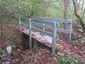
File:WPSP SW bridge.jpg |Trail=Sinking Waters(1,280 × 960 (310 KB)) - 23:39, 18 November 2018
File:WPSP SW Collapsed shed 1.jpg |Trail=Sinking Waters(1,280 × 960 (308 KB)) - 23:40, 18 November 2018
File:WPSP SW Collapsed shed 2.jpg |Trail=Sinking Waters(1,280 × 960 (229 KB)) - 23:40, 18 November 2018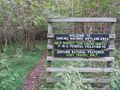
File:WPSP SW Golf Course Entrance.jpg |Trail=Sinking Waters(1,280 × 960 (322 KB)) - 23:41, 18 November 2018
File:WPSP SW parking lot.jpg |Trail=Sinking Waters(1,280 × 705 (249 KB)) - 15:07, 20 November 2018
File:WPSP SW sign at mid loop rejoin.jpg |Trail=Sinking Waters(1,280 × 960 (289 KB)) - 23:43, 18 November 2018
File:WPSP SW sign at sink hole.jpg |Trail=Sinking Waters(1,280 × 960 (262 KB)) - 23:45, 18 November 2018
File:WPSP SW sign on NorthEast loop.jpg |Trail=Sinking Waters(1,280 × 960 (287 KB)) - 23:46, 18 November 2018
File:WPSP SW Sign on South mid loop.jpg |Trail=Sinking Waters(1,280 × 960 (310 KB)) - 23:47, 18 November 2018
File:WPSP SW Sign on SouthEast Loop.jpg |Trail=Sinking Waters(1,280 × 960 (284 KB)) - 23:48, 18 November 2018
File:WPSP SW spring house.jpg |Trail=Sinking Waters(1,280 × 960 (292 KB)) - 23:48, 18 November 2018
File:WPSP SW Squirrel Attack 1.jpg |Trail=Sinking Waters(1,280 × 960 (257 KB)) - 23:49, 18 November 2018
File:WPSP SW stairs.jpg Warriors Path Sinking Waters trail stairs |Trail=Sinking Waters(768 × 1,024 (238 KB)) - 23:50, 18 November 2018File:WPSP SW trail sign near stairs.jpg |Trail=Sinking Waters(1,280 × 960 (314 KB)) - 23:51, 18 November 2018- |Trail Map Link=https://www.dcr.virginia.gov/natural-heritage/document/pgpinnacle. {{Park trail map}}5 KB (695 words) - 22:40, 19 December 2019
- |Trail Map Link=https://diyoutdoors.wvu.edu/files/d/c3b9272a-05aa-4123-ab25-2a7120 {{Park trail map}}3 KB (409 words) - 09:11, 19 December 2019
File:GentryCreek20070811-01.jpg |Trail=Gentry Creek Falls(314 × 235 (21 KB)) - 23:33, 10 May 2021
File:GentryCreek20070811-02.jpg |Trail=Gentry Creek Falls(336 × 448 (173 KB)) - 23:34, 10 May 2021
File:GentryCreek20070811-03.jpg |Trail=Gentry Creek Falls(251 × 188 (32 KB)) - 23:34, 10 May 2021- ...to the falls. Formerly there were a few bridges as indicated in the TEHCC Trail Wiki, but they are all gone. Fortunately the creek is not wide and is easy1 KB (233 words) - 06:12, 2 April 2014
- ![[TEHCC_AT|TEHCC Maintained Portion of the Appalachian Trail]]527 bytes (75 words) - 10:48, 20 November 2018
- {{#ask: [[Category:Trip Reports]][[Trail::Sinking Waters]][[Trip Date::>{{#time: F j, Y|-90 days}}]]|format=count}} ...Report Search|link text=Trip Report Search|query string=Trip_Report_Table[trail]=Sinking Waters&Trip_Report_Table[SortOrder]=desc&_run}}3 KB (380 words) - 02:07, 17 May 2024
- -->{{Infobox Trail | Trail Use = {{Hike}}{{Camping}}5 KB (803 words) - 12:12, 7 January 2023
- {{Trail |Trail Highlight=Secluded hike to balds with expansive views11 KB (1,595 words) - 22:13, 18 September 2021

File:NC-VA-TN Corner triangulation station disk.jpg |Trail=Rogers Ridge Horse Trail(600 × 450 (83 KB)) - 09:11, 8 December 2019- {{Park trail map}} The table below lists {{Park trail count}} trails covering {{Park trail miles}}. There are more trails within the park not yet documented on this w2 KB (274 words) - 12:12, 23 July 2020
File:Table rock summit trail profile.png |File name=table rock summit trail profile.png |Trail=Table Rock Summit Trail(1,160 × 660 (23 KB)) - 12:40, 23 July 2020- {{Trail |Trail Highlight=Steep trail to top of spectacular cliffs overlooking Linville Gorge3 KB (474 words) - 12:32, 23 July 2020

File:Hawksbill mountain profile.png |Trail=Hawksbill Mountain |Caption=Trail Profile(1,160 × 660 (23 KB)) - 12:31, 23 July 2020- {{Trail |Trail Highlight=Steep trail to top of spectacular cliffs overlooking Linville Gorge4 KB (621 words) - 13:20, 23 July 2020
- |Trail Map Link=http://www.dcr.virginia.gov/state-parks/document/data/trail-guide-graysonhighlands.pdf {{Park trail map}}4 KB (486 words) - 08:13, 29 August 2020
- {{Trail |Trail Highlight=Loop with a waterfall and a rhododendron tunnel2 KB (251 words) - 07:58, 29 August 2020
- -->{{Infobox Trail | Trail Use = {{Dogs}} {{Hike}}4 KB (632 words) - 08:03, 29 August 2020
- -->{{Infobox Trail | Trail Use = {{Hike}}{{Camping}}5 KB (678 words) - 16:21, 23 October 2015
- -->{{Infobox Trail | Trail Use = {{Hike}}{{Camping}}5 KB (828 words) - 17:29, 19 March 2023
- |Trail Condition=Clear ...n is very rocky (good for those with nimble feet) but appears an excellent trail crew is making improvements.688 bytes (115 words) - 21:46, 21 May 2023
File:GrassyRidge View.jpg Catawba rhododendron and view along trail to Grassy Ridge(850 × 560 (87 KB)) - 23:35, 10 March 2011- The old house is the park office, which will have trail maps (and a bathroom) available. There is a second trail access parking lot. Pass main park entrances and turn left (west) on Carro3 KB (459 words) - 12:12, 7 January 2023
- ...2013). Use the map below to explore the TEHCC’s section of the Appalachian Trail. You can also explore each section's individual page by using the table at [[TEHCC Trail Relocations]]2 KB (258 words) - 12:12, 7 January 2023
- {{Trail |Trail Marking=Signs2 KB (343 words) - 12:14, 15 December 2019

File:Food plot road profile.png |Trail=Food Plot Road |Caption=Trail Profile(1,160 × 660 (20 KB)) - 12:13, 15 December 2019- |Trail Map Link=http://www.friendsofsteelecreek.org/wp-content/uploads/2012/09/Ste ...lake, hiking trails, soccer fields, picnic tables with grills, a miniature trail, and more...6 KB (816 words) - 12:12, 7 January 2023
- |Trail Map Link=https://tnstateparks.com/assets/pdf/additional-content/park-maps/0 {{Park trail map}}3 KB (510 words) - 13:00, 16 November 2020
- {{Trail |Trail Highlight=Look out over Cherokee Lake or also walk down to the water4 KB (566 words) - 21:12, 11 September 2020
- |Trail Map Link=https://www.dcr.virginia.gov/state-parks/document/data/trail-guide-naturaltunnel.pdf {{Park trail map}}3 KB (340 words) - 22:10, 19 December 2019
File:Spivey gap - view from temple hill ridge.jpg |Trail=Spivey Gap to Nolichucky River(768 × 1,024 (234 KB)) - 17:26, 19 December 2018
File:Spivey gap - view from temple hill ridge 2.jpg |Trail=Spivey Gap to Nolichucky River(1,024 × 768 (233 KB)) - 17:25, 19 December 2018- {{Trail |Trail Marking=None9 KB (1,585 words) - 08:53, 17 April 2020
- {{Trail |Trail Marking=None492 bytes (65 words) - 20:33, 11 November 2019
File:Roaring Branch Trail - stone steps.JPG |File name=Roaring Branch Trail - stone steps.JPG |Trail=Roaring Branch Trail(1,154 × 2,086 (507 KB)) - 22:19, 27 July 2020File:Roaring Branch Trail - view from High Butte.JPG |File name=Roaring Branch Trail - view from High Butte.JPG |Trail=Roaring Branch Trail(448 × 336 (47 KB)) - 22:19, 27 July 2020
File:View from ChimneyTop.jpg |Trail=Chimney Top(600 × 450 (169 KB)) - 20:10, 11 November 2019- |Trail Condition=Problems |Trail Comment=Trail was in bad shape. Washed out, hard to navigate visually.5 KB (722 words) - 02:06, 17 May 2024
- |Trail Condition=Clear |Trail Comment=Fine334 bytes (51 words) - 09:20, 25 July 2020
- {{Trail |Banner Image=File:WPSP Overlook Trail sign.jpg4 KB (671 words) - 12:09, 7 January 2023
- <noinclude>This returns a map of the trails associated with the trail page it is called on. {{Trail Map|Main Trail={{PAGENAME}}|Other Trails= |Zoom Cancel=[any entry will trigger cancel]}}8 KB (992 words) - 13:30, 23 March 2023
- |Trail Condition=Clear |Trail Comment=Trails in good shape. Fallen leaves make identification a little tr381 bytes (56 words) - 23:44, 10 November 2019
- {{Trail |Banner Image=File:To Fall Creek Loop Trail.jpg5 KB (814 words) - 18:00, 2 May 2024
- |Trail Condition=Problems ...ny will likely snap back upon thaw. But some trees may remain blocking the trail until cleared.1 KB (175 words) - 16:42, 9 December 2018

File:Spivey gap - flower-white rhododendron.jpg |Trail=Spivey Gap to Nolichucky River(781 × 586 (69 KB)) - 17:25, 19 December 2018
File:To Fall Creek Loop Trail.jpg |File name=To Fall Creek Loop Trail.jpg |Trail=Fall Creek Loop(265 × 351 (29 KB)) - 22:38, 8 December 2018File:Roaring Branch Trail - first creek crossing.JPG |File name=Roaring Branch Trail - first creek crossing.JPG |Trail=Roaring Branch Trail(1,928 × 2,572 (1.21 MB)) - 22:19, 27 July 2020File:Roaring Branch Trail - wide creek crossing.JPG |File name=Roaring Branch Trail - wide creek crossing.JPG |Trail=Roaring Branch Trail(2,572 × 1,928 (1.01 MB)) - 22:19, 27 July 2020
File:Roaring Branch Trailhead.JPG |Trail=Roaring Branch Trail |Caption=Trailhead sign with no trail name(1,430 × 2,572 (1.07 MB)) - 22:20, 27 July 2020
File:Roaring Branch waterfall.JPG |Trail=Roaring Branch Trail(1,928 × 2,572 (1.07 MB)) - 22:20, 27 July 2020File:Holston Bluffs Trail profile.JPG |File name=Holston Bluffs Trail profile.JPG |Trail=Holston Bluffs(701 × 308 (28 KB)) - 08:09, 15 December 2018- Hike Report: Roaring Branch Trail up to High Butte, March 19th, 2011 ...en, except for several species of birds and a small snake on a rock in the trail.1 KB (209 words) - 16:25, 22 March 2011
- -->{{Infobox Trail | Trail Number =5 KB (817 words) - 12:12, 7 January 2023
File:Mendota Trail Elevation Profile.jpg Snipped from May 2023 trail newsletter(855 × 247 (35 KB)) - 18:54, 16 June 2023- {{Trail |Banner Image=File:WPSP Lakeshore Trail sign.JPG3 KB (508 words) - 12:14, 29 December 2018
- ** Reviewing pages to add new "[[Template:Trail page needs|trail page needs]]" template ** Tweaking pages as needed (eventually based on [[Trail needs list|needs list]])3 KB (483 words) - 12:50, 25 November 2016
File:Blue 2 Foundation.jpg |Trail=Blue 2(1,280 × 960 (347 KB)) - 22:45, 18 December 2019File:Blue 2 Trail Head.jpg |File name=Blue 2 Trail Head.jpg |Trail=Blue 2,Ridge Top (Roan Mountain State Park)(768 × 1,024 (194 KB)) - 10:35, 28 December 2019
File:Blue 2 View.jpg |Trail=Blue 2(1,280 × 960 (184 KB)) - 22:45, 18 December 2019
File:RMSP Ridge Top Trail.jpg |File name=RMSP Ridge Top Trail.jpg |Trail=Ridge Top (Roan Mountain State Park)(1,280 × 960 (362 KB)) - 10:36, 28 December 2019File:WPSP Overlook Trail sign.jpg |File name=WPSP Overlook Trail sign.jpg |Trail=Overlook(265 × 351 (25 KB)) - 13:58, 17 December 2018File:WPSP Overlook Trail path.jpg |File name=WPSP Overlook Trail path.jpg |Trail=Overlook(351 × 265 (23 KB)) - 14:00, 17 December 2018File:WPSP Overlook Trail - Viewing I-81 Bridge.jpg Overlook Trail path through woods |File name=WPSP Overlook Trail - Viewing I-81 Bridge.jpg(265 × 351 (18 KB)) - 14:00, 17 December 2018File:WPSP Holston Bluffs Trail sign.jpg |File name=WPSP Holston Bluffs Trail sign.jpg |Trail=Holston Bluffs(265 × 351 (24 KB)) - 08:07, 15 December 2018File:WPSP Holston Bluffs Trail gate sign.jpg |File name=WPSP Holston Bluffs Trail gate sign.jpg |Trail=Holston Bluffs(265 × 351 (22 KB)) - 08:09, 15 December 2018File:WPSP Holston Bluffs Trail path.jpg |File name=WPSP Holston Bluffs Trail path.jpg |Trail=Holston Bluffs(351 × 265 (25 KB)) - 08:08, 15 December 2018- {{Trail |Banner Image=File:WPSP Lake Hollow Trail sign1.JPG4 KB (560 words) - 12:12, 7 January 2023
- {{Trail |Banner Image=File:WPSP - Sign at Lakeshore and Connector Trail intersection.JPG4 KB (557 words) - 12:12, 7 January 2023
File:WPSP Lakeshore Trail sign.JPG |File name=WPSP Lakeshore Trail sign.JPG |Trail=Lakeshore(1,024 × 608 (198 KB)) - 11:31, 16 December 2018File:WPSP Riverbank Trail sign.JPG |File name=WPSP Riverbank Trail sign.JPG |Trail=Riverbank(1,024 × 497 (166 KB)) - 08:29, 21 December 2018File:WPSP Lakeshore Trail sign2.JPG |File name=WPSP Lakeshore Trail sign2.JPG |Trail=Lakeshore(448 × 336 (61 KB)) - 11:33, 16 December 2018- |Trail Map Link=https://tnstateparks.com/assets/pdf/additional-content/park-maps/3 {{Park trail map}}1 KB (184 words) - 09:32, 19 December 2019
- ...Smoky Mountains National Park] (GSMNP) offers 900 miles along an extensive trail network to explore. Those who "hike 'em all" can join the [http://www.900m 35.67548,-83.64643~[[GSMNP Curry Mountain Trail|Curry Mountain Trail]]2 KB (252 words) - 11:15, 22 August 2015
File:WPSP Lake Hollow Trail sign1.JPG |File name=WPSP Lake Hollow Trail sign1.JPG |Trail=Lake Hollow(1,024 × 702 (248 KB)) - 11:04, 16 December 2018File:WPSP Lake Hollow Trail - View towards Duck Island.JPG |File name=WPSP Lake Hollow Trail - View towards Duck Island.JPG |Trail=Lake Hollow(1,024 × 526 (83 KB)) - 11:11, 16 December 2018File:WPSP Lakeshore Trail bridge.JPG |File name=WPSP Lakeshore Trail bridge.JPG |Trail=Lakeshore(448 × 336 (64 KB)) - 11:32, 16 December 2018- {{Trail |Banner Image=File:WPSP Riverbank Trail sign.JPG3 KB (404 words) - 12:15, 29 December 2018
File:WPSP Boat Launch.JPG |Trail=Lakeshore,Riverbank(1,024 × 741 (299 KB)) - 08:28, 21 December 2018- |Trail Map Link=https://tnstateparks.com/assets/pdf/additional-content/park-maps/b {{Park trail map}}3 KB (353 words) - 08:10, 19 December 2019
File:WPSP Lakeshore Trail - View of Fall Creek Road bridge.JPG |File name=WPSP Lakeshore Trail - View of Fall Creek Road bridge.JPG |Trail=Lakeshore(448 × 283 (35 KB)) - 11:33, 16 December 2018File:WPSP Lakeshore Trail - View of Lone Cedar Overlook.JPG |File name=WPSP Lakeshore Trail - View of Lone Cedar Overlook.JPG |Trail=Lakeshore(448 × 336 (42 KB)) - 11:38, 16 December 2018File:WPSP - Sign at Lakeshore and Connector Trail intersection.JPG |File name=WPSP - Sign at Lakeshore and Connector Trail intersection.JPG |Trail=Connector,Lakeshore(448 × 264 (65 KB)) - 11:35, 16 December 2018File:WPSP Connector Trail - wooden bridges.JPG |File name=WPSP Connector Trail - wooden bridges.JPG |Trail=Connector(336 × 448 (57 KB)) - 22:26, 14 December 2018File:WPSP Connector Trail - Girls Inc bench.JPG |File name=WPSP Connector Trail - Girls Inc bench.JPG |Trail=Connector(448 × 336 (71 KB)) - 22:26, 14 December 2018File:WPSP Connector Trail fishing spot view.JPG |File name=WPSP Connector Trail fishing spot view.JPG |Trail=Connector(448 × 336 (39 KB)) - 22:24, 14 December 2018File:WPSP Lake Hollow Trail sign2.JPG |File name=WPSP Lake Hollow Trail sign2.JPG |Trail=Connector,Lake Hollow(448 × 255 (53 KB)) - 11:10, 16 December 2018File:WPSP Lake Hollow Trail - View towards main boat ramp.JPG |File name=WPSP Lake Hollow Trail - View towards main boat ramp.JPG |Trail=Lake Hollow(448 × 275 (30 KB)) - 11:10, 16 December 2018File:WPSP Lake Hollow Trail - Ulster Project Peach Bench.JPG |File name=WPSP Lake Hollow Trail - Ulster Project Peach Bench.JPG |Trail=Lake Hollow(448 × 288 (60 KB)) - 11:11, 16 December 2018File:Roaring Branch Trail - wading creek crossing.JPG |File name=Roaring Branch Trail - wading creek crossing.JPG |Trail=Roaring Branch Trail(448 × 287 (59 KB)) - 22:19, 27 July 2020File:Roaring Branch Trail - yet another creek crossing.JPG |File name=Roaring Branch Trail - yet another creek crossing.JPG |Trail=Roaring Branch Trail(448 × 336 (67 KB)) - 22:19, 27 July 2020File:Roaring Branch Trail - View of Stone Mountains from High Butte.JPG |File name=Roaring Branch Trail - View of Stone Mountains from High Butte.JPG |Trail=Roaring Branch Trail(1,024 × 364 (59 KB)) - 22:19, 27 July 2020- {{Trail |Trail System=Appalachian Trail2 KB (288 words) - 08:16, 21 December 2018
- Trails that allow horseback riding. Verify with the trail owners for exact locations of allowed horseback riding and all requirements3 members (0 subcategories, 0 files) - 23:05, 29 March 2011
- ...along the trail or in designated spots. Please check with the appropriate trail owners for camping specific requirements (registration, locations, restrict2 members (0 subcategories, 0 files) - 23:18, 29 March 2011
- Trails that are part of Warriors Path State Park trail system0 members (0 subcategories, 0 files) - 23:22, 29 March 2011
- ...l). There were also motorbikes (on their designated trail - not the hiking trail) that were a bit noisy at times. We were hiking at a fairly strong pace to ...few rest stops on the way if necessary. While leaves are on the trees, the trail is shaded the whole way. The 360-degree views from the top of the tower wer5 KB (959 words) - 20:04, 26 September 2016
- |Trail Map Link=https://tnstateparks.com/assets/pdf/additional-content/park-maps/r {{Park trail map}}4 KB (689 words) - 23:42, 19 December 2019
- -->{{Infobox Trail | Trail Use = {{Hike}} {{Waterfall}}6 KB (873 words) - 12:04, 7 January 2023
File:Spivey gap - no business knob shelter.jpg |Trail=Spivey Gap to Nolichucky River(432 × 299 (22 KB)) - 17:24, 19 December 2018
File:Spivey gap - nolichucky river gorge.jpg |Trail=Spivey Gap to Nolichucky River(781 × 586 (90 KB)) - 17:23, 19 December 2018- {{Trail |Trail System=Appalachian Trail2 KB (332 words) - 10:55, 20 December 2018
- {{Trail |Trail System=Appalachian Trail4 KB (495 words) - 12:57, 20 December 2018
- {{Trail |Trail System=Appalachian Trail5 KB (691 words) - 13:10, 20 December 2018
- {{Trail |Trail System=Appalachian Trail6 KB (821 words) - 18:32, 20 February 2023
- {{Trail |Trail System=Appalachian Trail3 KB (481 words) - 19:00, 20 December 2018
- {{Trail |Trail System=Appalachian Trail5 KB (812 words) - 12:53, 18 June 2020
- |Trail Condition=Clear |Trail Comment=Trail has been recently mowed. Easy traveling398 bytes (61 words) - 17:05, 20 June 2020
- ...kers. The rope was cut in one area and old trees have been laid across the trail on the ridge line to impede any hiking.169 bytes (33 words) - 08:51, 24 December 2018
- {{Trail |Trail System=Appalachian Trail3 KB (461 words) - 18:41, 20 February 2023
- |Trail Condition=Clear258 bytes (38 words) - 10:28, 6 March 2023
- {{Trail |Trail System=Appalachian Trail3 KB (373 words) - 21:38, 18 September 2021
- {{#ask: [[Category:Trail||Trails]] [[Land Owner::Cherokee National Forest]]3 KB (334 words) - 12:12, 7 January 2023
- {{Trail |Trail System=Appalachian Trail3 KB (371 words) - 22:02, 20 December 2018
- {{Trail |Trail Marking=Signs3 KB (465 words) - 13:45, 23 November 2019
- The Mountains-to-Sea Trail (MST) is one of the newest and most scenic long-distance trails in the regi Maintained by the Friends of the Mountains-to-Sea Trail and its affiliated groups & agencies, it travels from8 KB (1,087 words) - 23:19, 1 March 2020
File:WPSP Fall Creek Loop Trail - Ulster sign.jpg |File name=WPSP Fall Creek Loop Trail - Ulster sign.jpg |Trail=Fall Creek Loop(265 × 351 (21 KB)) - 22:39, 8 December 2018
File:WPSP Fall Creek Falls Loop Ulster Project.jpg |File name=To Fall Creek Loop Trail.jpg |Trail=Fall Creek Loop(265 × 351 (23 KB)) - 22:40, 8 December 2018
File:WPSP Fall Creek Falls Loop cascades.jpg |Trail=Fall Creek Loop(265 × 351 (18 KB)) - 22:41, 8 December 2018- -->{{Infobox Trail | Trail Use = {{Hike}}4 KB (580 words) - 12:12, 7 January 2023
- hike report for the Elk Park Trail written by Bill Stowell in Oct 1998 Elk Park Trail to Houston Ridge, December 8, 2007, Vic Hasler reporting219 bytes (33 words) - 21:56, 5 April 2011
File:WPSP Darrel's Dream playground.jpg |Trail=Overlook(600 × 450 (58 KB)) - 14:01, 17 December 2018- -->{{Infobox Trail | Trail Use = {{Hike}} {{Biking}} {{Dogs}} {{Fishing}}6 KB (825 words) - 12:12, 7 January 2023
- {{Trail |Trail Marking=None2 KB (397 words) - 12:12, 7 January 2023
- ...) of a park or trail. It is typically populated by invoking the [[ClubWIKI:Trail Use|use/features]] portion of the Infobox.240 bytes (42 words) - 21:41, 27 September 2015
File:Rocky Fork Trail Map.pdf Rocky Fork Trail Map (Provided by Dave Ramsey)(715 KB) - 13:22, 7 August 2014- {{Trail |Banner Image=File:BMP Dolan Branch Trail waterfall.JPG5 KB (746 words) - 07:45, 15 December 2019

File:Dolan branch trail profile.png |File name=Dolan branch trail.png |Trail=Dolan Branch Trail(1,160 × 660 (21 KB)) - 07:44, 15 December 2019- If you would like to either log your hikes, or contribute item locations and trail tracks, you'll need to record GPS tracks. I'll look into phones, but in the ...nta/pink. The eTrex track was more consistent upon trail returns and known trail locations/shape. The eTrex was typically noting accuracy at 9ft while the F2 KB (287 words) - 19:23, 12 April 2023
File:BMP Dolan Branch Trail waterfall.JPG |File name=BMP Dolan Branch Trail waterfall.JPG |Trail=Dolan Branch Trail(789 × 768 (205 KB)) - 00:02, 15 December 2019File:BMP Dolan Branch Trail waterpipe.JPG |File name=BMP Dolan Branch Trail waterpipe.JPG |Trail=Dolan Branch Trail(608 × 1,024 (306 KB)) - 00:01, 15 December 2019File:BMP Dolan Branch Trail footbridge1.JPG |File name=BMP Dolan Branch Trail footbridge1.JPG |Trail=Dolan Branch Trail(768 × 1,024 (268 KB)) - 00:01, 15 December 2019File:BMP Dolan Branch Trail footbridge2.JPG |File name=BMP Dolan Branch Trail footbridge2.JPG |Trail=Dolan Branch Trail(768 × 818 (215 KB)) - 00:01, 15 December 2019- {{Trail |Trail Marking=Signs5 KB (731 words) - 13:26, 14 December 2019
- ...ndian Pipes Trail,River Mountain Road,Fire Tower Trail,Fern Trail,Lakeside Trail |Trail Condition=Clear572 bytes (90 words) - 22:52, 10 November 2019
- {{Trail |Banner Image=File:BMP Firetower Trail tower.jpg3 KB (416 words) - 16:10, 10 November 2019
- |Trails=Laurel Run Trail,Back Hollow Road,Pretty Ridge Trail,Kiner Hollow Trail |Trail Condition=Clear518 bytes (79 words) - 17:08, 10 November 2019
File:BMP Firetower Trail tower.jpg |File name=BMP Firetower Trail tower.jpg |Trail=River Mountain Road, Fire Tower Trail(300 × 401 (34 KB)) - 15:59, 10 November 2019- {{Trail |Trail Marking=Signs2 KB (265 words) - 23:30, 15 December 2019
File:Towhee trail profile.png |File name=Towhee trail profile.png |Trail=Towhee Trail(1,160 × 660 (23 KB)) - 23:27, 15 December 2019File:Whitetail loop trail profile.png |File name=Whitetail loop trail profile.png |Trail=Whitetail Loop(1,160 × 660 (24 KB)) - 15:39, 29 December 2019- |Trail= |Trail distance round trip=3 KB (370 words) - 15:53, 25 September 2020
- {{Trail |Trail Highlight=Connects Lakeside Trail with Lake Road2 KB (281 words) - 15:51, 15 December 2019
File:Hemlock trail profile.png |File name=Hemlock trail profile.png |Trail=Hemlock Trail(1,160 × 660 (23 KB)) - 15:40, 15 December 2019- {{Trail |Banner Image=File:BMP Azalea Trail.JPG3 KB (372 words) - 20:34, 12 April 2023
- {{Trail |Trail Marking=Signs2 KB (260 words) - 23:22, 15 December 2019
File:Sweet gum trail profile.png |File name=Sweet gum trail profile.png |Trail=Sweet Gum Trail(1,160 × 660 (23 KB)) - 23:19, 15 December 2019- {{Trail |Trail Marking=Signs2 KB (262 words) - 17:03, 15 December 2019
File:Holly trail profile.png |File name=Holly trail profile.png |Trail=Holly Trail(1,160 × 660 (22 KB)) - 17:00, 15 December 2019- ...e of the waypoint number shortly after photographing your object (lookout, trail intersection, blowdown, etc.) ...ning in Google Earth. Return to [[ClubWiki:Creating a Trail KML|Creating a Trail KML]] for additional manipulation.5 KB (848 words) - 17:35, 8 March 2020
- {{Trail |Trail Marking=Signs5 KB (675 words) - 23:11, 14 December 2019
File:Cross ridges trail profile.png |File name=Cross ridges trail profile.png |Trail=Cross Ridges Trail(1,160 × 660 (24 KB)) - 23:07, 14 December 2019File:BMP Azalea Trail profile.JPG |File name=BMP Azalea Trail profile.JPG |Trail=Azalea(733 × 325 (33 KB)) - 23:22, 22 November 2019File:BMP Big Oak Trail profile.JPG |File name=BMP Big Oak Trail profile.JPG |Trail=Big Oak Trail(720 × 317 (32 KB)) - 00:02, 11 December 2019- {{Trail |Trail Marking=Signs2 KB (295 words) - 20:07, 15 December 2019
File:Whitetail loop view of bridge from ridge.jpeg |Trail=Whitetail Loop(4,032 × 3,024 (3.88 MB)) - 18:32, 20 December 2019File:Pine trail profile.png |File name=Pine trail profile.png |Trail=Pine Trail(1,160 × 660 (22 KB)) - 20:05, 15 December 2019- |Trail Map Link=https://www.dcr.virginia.gov/natural-heritage/document/the-channel {{Park trail map}}3 KB (385 words) - 10:59, 8 January 2023
- {{Trail |Trail Highlight=Artery trail for loop hikes on southwest end of park4 KB (628 words) - 13:40, 15 December 2019
File:BMP Lakeside Trail floating bridge.JPG |File name=BMP Lakeside Trail floating bridge.JPG |Trail=Lakeside Trail(768 × 1,024 (261 KB)) - 20:22, 10 November 2019
File:Chimney Top profile.JPG |Trail=Chimney Top(644 × 279 (27 KB)) - 20:10, 11 November 2019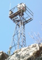
File:Chimney Top beacon.JPG |Trail=Chimney Top(725 × 1,024 (247 KB)) - 20:09, 11 November 2019
File:Chimney Top firetower.JPG |Trail=Chimney Top(882 × 768 (217 KB)) - 20:11, 11 November 2019File:WPSP Fall Creek Loop Trail wood duck box1.JPG |File name=WPSP Fall Creek Loop Trail wood duck box1.JPG |Trail=Fall Creek Loop(701 × 1,024 (238 KB)) - 22:41, 8 December 2018- {{Trail |Banner Image=File:BMP Orchid Trail sign.JPG2 KB (294 words) - 19:17, 15 December 2019
- {{Trail |Trail Marking=Signs4 KB (645 words) - 17:19, 15 December 2019

File:Jones road profile.png |Trail=Jones Road |Caption=Trail Profile(1,160 × 660 (23 KB)) - 17:12, 15 December 2019File:BMP Orchid Trail sign.JPG |File name=BMP Orchid Trail sign.JPG |Trail=Orchid Trail(252 × 448 (97 KB)) - 19:10, 15 December 2019
File:BMP Split at Azalea and Big Oak Trails.JPG |Trail=Azalea(448 × 336 (106 KB)) - 23:21, 22 November 2019File:BMP Cliffside Trail steps.JPG |File name=BMP Cliffside Trail steps.JPG |Trail=Cliffside Trail(768 × 1,024 (251 KB)) - 22:29, 14 December 2019- {{Trail |Banner Image=File:BMP Cliffside Trail view from obs tower towards firetower.JPG4 KB (520 words) - 22:48, 14 December 2019
File:Cliffside trail profile.png |File name=Cliffside trail profile.png |Trail=Cliffside Trail(1,160 × 660 (22 KB)) - 22:40, 14 December 2019- ...ning in Google Earth. Return to [[ClubWiki:Creating a Trail KML|Creating a Trail KML]] for additional manipulation.2 KB (329 words) - 12:21, 4 January 2020
File:BMP Bays Mountain Road gate.JPG |Trail=Bays Mountain Road(1,024 × 768 (270 KB)) - 08:54, 23 November 2019- {{Trail |Trail Marking=Signs4 KB (610 words) - 14:41, 14 December 2019
File:Cherry Knobs Trail Profile.png |File name=Cherry Knobs Trail Profile.png |Trail=Cherry Knobs(1,160 × 660 (28 KB)) - 13:03, 14 December 2019
File:BMP Cherry Knobs azaleas.JPG |Trail=Cherry Knobs(1,024 × 733 (288 KB)) - 13:03, 14 December 2019
File:BMP Big Oak.JPG |Trail=Jones Road(768 × 1,024 (256 KB)) - 17:08, 15 December 2019
File:BMP Jones Road.JPG |Trail=Jones Road(768 × 1,024 (250 KB)) - 17:08, 15 December 2019
File:BMP Bill Simpson cabin.JPG |Trail=Cross Ridges Trail(1,024 × 768 (284 KB)) - 22:58, 14 December 2019
File:BMP Bill Simpson barn.JPG |Trail=Cross Ridges Trail |Caption=Trail ends just past "Bill Simpson" barn(1,024 × 768 (301 KB)) - 22:58, 14 December 2019File:BMP Cross Ridges Trail Dwarf Violet Iris.JPG Seen along Cross Ridges Trail(768 × 881 (272 KB)) - 05:37, 25 April 2011
File:BMP Cherry Knobs Trail.JPG |File name=BMP Cherry Knobs Trail.JPG |Trail=Cherry Knobs(768 × 1,024 (257 KB)) - 13:03, 14 December 2019- ...evation change? There is a hiking site for the Smokies that then adds the trail distance and elevation change (divided by some factor) to create an overall ...for both on the trail pages. Would anyone come here looking for a list of trail high points? --[[User:WikiSysop|WikiSysop]] ([[User talk:WikiSysop|talk]])4 KB (674 words) - 16:19, 2 April 2015
File:Plaque on Houston Ridge for Stan Murray.JPG |Trail=Carver's Gap to US19E(1,024 × 752 (342 KB)) - 17:15, 20 December 2018- ...ieces will provide background information to allow more folks to enjoy the trail.6 members (0 subcategories, 0 files) - 05:48, 16 April 2012
File:BMP Cliffside Trail lower overlook.JPG |File name=BMP Cliffside Trail lower overlook.JPG |Trail=Cliffside Trail(448 × 336 (95 KB)) - 22:30, 14 December 2019File:BMP Cliffside Trail higher overlook.JPG |File name=BMP Cliffside Trail higher overlook.JPG |Trail=Cliffside Trail(448 × 270 (82 KB)) - 22:29, 14 December 2019File:BMP Cliffside Trail view from obs tower towards firetower.JPG |File name=BMP Cliffside Trail view from obs tower towards firetower.JPG |Trail=Cliffside Trail(448 × 282 (83 KB)) - 22:28, 14 December 2019File:BMP Cliffside Trail view from obs tower towards valley.JPG |File name=BMP Cliffside Trail view from obs tower towards valley.JPG |Trail=Cliffside Trail(336 × 448 (109 KB)) - 22:30, 14 December 2019- {{Trail |Trail Highlight=2 KB (238 words) - 22:05, 9 May 2020
- {{List trail template|#userparam=intro}} |?Listed Location=trail4 KB (459 words) - 19:32, 12 April 2023
- |Trail Condition=Clear |Trail Comment=Trail was a little wet, as expected during the springtime.495 bytes (79 words) - 09:35, 11 May 2020
- ...r trails. Park/Trail aware. Probably will make different ones for Park vs. Trail instead of one monolithic beast. * Trail name1 KB (177 words) - 13:41, 6 January 2021
- {{Trail |Trail Marking=Signs4 KB (599 words) - 22:45, 23 November 2019
- ...on of a trail (including park page defined stubs). Its expected use is for trail tables and map balloons.193 bytes (34 words) - 15:36, 24 November 2019
- {{Trail |Banner Image=File:BMP Bays Ridge Trail sign.JPG4 KB (595 words) - 23:09, 23 November 2019
- |Trail Condition=Clear |Trail Comment=Heavily covered in leaves but the path is largely able to be determ385 bytes (60 words) - 09:23, 24 November 2019
File:BMP Bays Ridge Road overlook.JPG |Trail=Bays Ridge Road(1,024 × 498 (180 KB)) - 22:30, 23 November 2019File:BMP Bays Ridge Trail sign.JPG |File name=BMP Bays Ridge Trail sign.JPG |Trail=Bays Ridge Trail(448 × 295 (111 KB)) - 22:58, 23 November 2019
File:BMP Bays Ridge Road profile.JPG |Trail=Bays Ridge Road(706 × 305 (32 KB)) - 22:30, 23 November 2019File:BMP Bays Ridge Trail profile.JPG |File name=BMP Bays Ridge Trail profile.JPG |Trail=Bays Ridge Trail(721 × 317 (33 KB)) - 22:58, 23 November 2019
File:Front hollow road profile.png |Trail=Front Hollow Road |Caption=Trail Profile(1,160 × 660 (22 KB)) - 12:23, 15 December 2019
File:MST Post.jpg Mountains-to-Sea Trail Marker post(307 × 500 (61 KB)) - 12:42, 3 May 2011- {{Trail |Trail Number=5014 KB (621 words) - 14:05, 17 July 2023
- |Trail Map Link=https://www.fs.usda.gov/Internet/FSE_DOCUMENTS/stelprdb5275541.pdf {{Park trail map}}1,017 bytes (126 words) - 11:14, 19 September 2021
- |Trail Map Link=https://tnstateparks.com/assets/pdf/additional-content/park-maps/0 {{Park trail map}}3 KB (503 words) - 11:25, 17 January 2021

File:BMP Antennas.JPG |Trail=Azalea(257 × 448 (82 KB)) - 23:21, 22 November 2019
File:BMP Antennas2.JPG |Trail=Bays Mountain Road(140 × 448 (79 KB)) - 08:54, 23 November 2019- -->{{Infobox Trail | Trail Use = {{Hike}}5 KB (745 words) - 12:05, 7 January 2023
File:OMVT1.jpg Overmountain Victory Trail @ Hampton Creek Cove Farmstead.(640 × 432 (66 KB)) - 10:10, 23 May 2011- -->{{Infobox Trail | Trail Use = {{Hike}}4 KB (571 words) - 12:12, 7 January 2023
- {{Trail |Trail Marking=Blue6 KB (988 words) - 16:33, 19 September 2021
- |Trail Condition=Clear |Trail Comment=Trails were in good shape and easy to navigate. No problems observe738 bytes (118 words) - 11:23, 19 September 2021
File:Iron Mountain Trail - South.kml KML for [[Iron Mountain Trail - South]](26 KB) - 00:24, 22 December 2018
File:White Rock - old fire tower.jpg |Trail=US19E to Dennis Cove Rd(231 × 350 (27 KB)) - 17:28, 20 December 2018
File:White Rock - panoramic view.jpg |Trail=US19E to Dennis Cove Rd(800 × 177 (192 KB)) - 17:28, 20 December 2018
File:WhiteRocksMountain.jpg |Trail=US19E to Dennis Cove Rd(1,024 × 686 (181 KB)) - 17:27, 20 December 2018
File:MtRogersSign.jpg |Trail=US421 to Damascus(1,200 × 1,600 (580 KB)) - 21:53, 20 December 2018
File:DennisCoveBarn.jpg |Trail=US19E to Dennis Cove Rd(1,600 × 1,200 (523 KB)) - 17:28, 20 December 2018
File:PotatoTop.jpg |Trail=Dennis Cove Rd to Wilbur Dam Rd, Laurel Fork Gorge(1,600 × 1,200 (419 KB)) - 10:05, 29 December 2018
File:FrogLevel.jpg |Trail=Laurel Fork Trail(1,024 × 768 (192 KB)) - 23:50, 21 December 2018
File:DennisCoveFalls.jpg Dennis Cove Falls along the Laurel Fork Trail. |Trail=Laurel Fork Trail(1,024 × 768 (215 KB)) - 23:49, 21 December 2018- -->{{Infobox Trail | Trail Use = {{Hike}}8 KB (1,255 words) - 12:12, 7 January 2023
- {{Trail |Trail Use=Hiking, Biking158 bytes (18 words) - 02:20, 17 May 2024
File:HumpMtn.jpg |Trail=Carver's Gap to US19E(1,600 × 1,200 (368 KB)) - 17:13, 20 December 2018
File:HumpMtn2.jpg |Trail=Carver's Gap to US19E(1,600 × 1,200 (371 KB)) - 17:13, 20 December 2018
File:Goats.jpg |Trail=Carver's Gap to US19E(1,600 × 1,200 (534 KB)) - 17:12, 20 December 2018- The newest shelter on the TEHCC section of the Appalachian Trail. Located near its name-sake Mountaineer Falls. A wooden A-frame with two ma ...t Mountain Road. The shelter is 70 yards off the AT on a blue-blazed side trail. In the Cherokee National Forest, Watauga Ranger District. Located on the [2 KB (295 words) - 05:21, 30 October 2017
File:NickGrindstaff.jpg |Trail=Wilbur Dam Rd to TN91(768 × 1,024 (287 KB)) - 21:04, 20 December 2018
File:OsborneTract.jpg |Trail=TN91 to US421(1,600 × 1,200 (542 KB)) - 21:31, 20 December 2018- ...ners have recorded some of the top hours volunteered in on the Appalachian Trail on a yearly basis. ...in, Roan Mountain, and Damascus. To scout out and build relocations, rehab trail, clear blowdowns, and shelter maintenance.2 KB (368 words) - 14:28, 31 May 2011
File:Laurelforkfalls2.jpg |Trail=Laurel Fork Gorge(300 × 200 (20 KB)) - 10:07, 29 December 2018- Holston Mn Trail Hike May 27-28,2011 ...howed us where the blue blaze trail was that is the end of the Holston Mn. Trail. It's at the top of the hill on the left going SOBO from the shelter. After2 KB (494 words) - 14:30, 6 June 2011
- {{Park trail map}} '''There is no longer an officially recognized Clarks Creek Trail to Buckeye Falls.''' The former difficult hike required a 3.6-3.8 mile tre3 KB (506 words) - 22:22, 18 September 2021
File:Stream view along trail.JPG |File name=stream view along trail.JPG |Trail=Sill Branch(3,024 × 4,032 (5.29 MB)) - 22:35, 25 August 2020
File:BMP View of downtown Kingsport.JPG |Trail=Azalea(448 × 252 (83 KB)) - 23:22, 22 November 2019- {{Trail |Banner Image=File:BMP Azalea Trail.JPG3 KB (525 words) - 23:34, 22 November 2019
- |Trail Map Link=https://files.nc.gov/ncparks/maps-and-brochures/elk-knob-park-map_ {{Park trail map}}3 KB (434 words) - 19:29, 19 December 2019
- {{Trail |Banner Image=File:BMP Big Oak Trail.JPG3 KB (460 words) - 00:12, 11 December 2019
File:BMP Azalea Trail sign.JPG |File name=BMP Azalea Trail sign.JPG |Trail=Azalea(140 × 448 (86 KB)) - 23:21, 22 November 2019
File:BMP Big Oak Trail.JPG |File name=BMP Big Oak Trail.JPG |Trail=Big Oak Trail(237 × 448 (98 KB)) - 00:01, 11 December 2019
File:BMP Azalea Trail.JPG |File name=BMP Azalea Trail.JPG |Trail=Fern Trail, Azalea(336 × 448 (106 KB)) - 22:43, 10 November 2019
File:CanutePlace.jpg |Trail=US19E to Dennis Cove Rd(800 × 540 (414 KB)) - 17:29, 20 December 2018
File:GrassyRidgeSplit.jpg |Trail=Carver's Gap to US19E |Caption=The post at AT & Grassy Ridge Trail split(800 × 600 (291 KB)) - 17:12, 20 December 2018
File:RockCreekFalls.jpg |Trail=Rock Creek Falls(2,592 × 1,944 (2.55 MB)) - 11:03, 19 September 2021
File:KonnarockOnLittleHump.jpg |Trail=Carver's Gap to US19E |Caption=Konnarock Trail Crew working on the Little Hump Relocation(800 × 600 (307 KB)) - 17:12, 20 December 2018
File:OverhangingRock.jpg |Trail=Iron Mountain Gap to Carver's Gap(800 × 600 (275 KB)) - 13:00, 20 December 2018
File:OldAppleOrchard.jpg |Trail=Iron Mountain Gap to Carver's Gap(800 × 600 (299 KB)) - 12:59, 20 December 2018
File:Wataugalake.jpg |Trail=Dennis Cove Rd to Wilbur Dam Rd(800 × 600 (329 KB)) - 19:02, 20 December 2018
File:DollFlatsOverlook.jpg |Trail=Carver's Gap to US19E(800 × 534 (260 KB)) - 17:14, 20 December 2018
File:HardcoreMarch.jpg |Trail=Carver's Gap to US19E(600 × 149 (26 KB)) - 17:11, 20 December 2018
File:RoaringForkValley.jpg |Trail=Carver's Gap to US19E(800 × 544 (145 KB)) - 17:10, 20 December 2018
File:ShookBranchBridge.jpg |Trail=Dennis Cove Rd to Wilbur Dam Rd(606 × 529 (176 KB)) - 19:03, 20 December 2018
File:Watauga Lake.jpg |Trail=Dennis Cove Rd to Wilbur Dam Rd(2,048 × 1,536 (842 KB)) - 19:04, 20 December 2018- {{Trail |Banner Image=File:BMP Chinquapin Trail.JPG3 KB (448 words) - 20:49, 14 December 2019
File:Chinquapin Trail Profile.png |File name=Chinquapin Trail Profile.png |Trail=Chinquapin Trail(1,160 × 660 (27 KB)) - 20:46, 14 December 2019File:BMP Chinquapin Trail bridge1.JPG |File name=BMP Chinquapin Trail bridge1.JPG |Trail=Chinquapin Trail(448 × 301 (105 KB)) - 20:35, 14 December 2019File:BMP Chinquapin Trail bridge2.JPG |File name=BMP Chinquapin Trail bridge2.JPG |Trail=Chinquapin Trail(336 × 430 (95 KB)) - 20:35, 14 December 2019
File:BMP Chinquapin Trail.JPG |File name=BMP Chinquapin Trail.JPG |Trail=Chinquapin Trail(336 × 448 (107 KB)) - 20:35, 14 December 2019- <br>and [http://users.mikrotec.com/johnpitt/etsc.html another trail review site] Wilderness Trail and much more. The leaves may be beginning to turn. The hike is 9 miles3 KB (550 words) - 23:17, 27 November 2019
File:Sand Cave 200809 view into.jpg |Trail=Ewing Trail(640 × 480 (73 KB)) - 23:24, 27 November 2019
File:Sand Cave 200809 group photo.jpg |Trail=Ewing Trail(640 × 480 (57 KB)) - 23:25, 27 November 2019- {{Trail |Trail Number=USFS #264 KB (575 words) - 11:12, 19 September 2021
- |Trail Condition=Clear |Trail Comment=Covered in leaves causing some slick spots and hiding tripping haza354 bytes (52 words) - 08:51, 16 November 2019
- ...ularly for knocking snow off the low hanging rhododendron which filled the trail, particularly toward the top. The views were beautiful. Fall Color Hike: Rattlesnake Ridge Trail to Unaka Mountain, October 11, 20085 KB (798 words) - 10:25, 1 September 2012
File:View from Rattlesnake Ridge.JPG |Trail=Rattlesnake Ridge(640 × 480 (148 KB)) - 22:58, 14 November 2019
File:Rattlesnake Ridge Trailhead.jpg |Trail=Rattlesnake Ridge, Rock Creek Falls(799 × 768 (351 KB)) - 11:02, 19 September 2021- -->{{Infobox Trail | Trail Use = {{Hike}} {{Dogs}} {{Biking}}7 KB (1,014 words) - 12:12, 7 January 2023
- ...d some of the more goat-like among us (Neil, Eric) on the trail - no, not "trail": on the way to the top of the falls. That's a real delight I'd never enjoy took the side trail to the summit of Potato Top, a steep knob around which Laurel Fork runs. No3 KB (489 words) - 06:02, 2 April 2014
- {{Trail |Trail Marking=None5 KB (719 words) - 16:06, 8 December 2019
File:Virginia Creeper Trail.kml KML for [[Virginia Creeper Trail]](26 KB) - 00:07, 22 December 2018
File:Virginia Creeper Trestle 12.jpg |Trail=Virginia Creeper Trail(768 × 576 (119 KB)) - 00:01, 22 December 2018File:Virginia Creeper Trail - Alvarado Station.jpg |File name=Virginia Creeper Trail - Alvarado Station.jpg |Trail=Virginia Creeper Trail(768 × 1,024 (180 KB)) - 00:02, 22 December 2018File:Virginia Creeper Trail - Abingdon Trailhead.jpg |File name=Virginia Creeper Trail - Abingdon Trailhead.jpg |Trail=Virginia Creeper Trail(768 × 576 (145 KB)) - 00:01, 22 December 2018- -->{{Infobox Trail | Trail Use = {{Hike}} {{Camping}}5 KB (783 words) - 12:12, 7 January 2023
- ...e. Those will need to be cleaned up, they are messing up the format of the trail page. The Trip Report Table is intended for personal pages to show your lis993 bytes (176 words) - 08:10, 17 May 2024
- ...Lake dam. Should be back by 5PM. For more information, check the club’s trail wiki or call the hike leader.2 KB (417 words) - 06:18, 2 April 2014
- |Trail Map Link=https://www.fs.usda.gov/recarea/cherokee/recarea/?recid=34922 {{Park trail map}}4 KB (563 words) - 20:34, 19 December 2019
- |Trail Map Link=https://jonesborough.com/locations/persimmon-ridge-park/ {{Park trail map}}2 KB (322 words) - 23:59, 29 December 2019
- !Trail |Bays Mountain [[BMP Lakeside Trail|Lakeside Trail]]23 members (0 subcategories, 0 files) - 15:13, 2 April 2023
- #REDIRECT [[Barred Owl Trail]]30 bytes (4 words) - 20:34, 12 April 2023
- Friday Hikers, Iron Mountain Trail, August 13, 2010<br> ...ance covered was 9.6 miles. There was a moderate amount of trash along the trail, and even more evidence of bear traffic -- we kept wondering if we would ha2 KB (295 words) - 21:48, 6 August 2011
- <!-- Place any pictures from this trail below. Add a picture by typing Image:imagename.extension -->2 KB (234 words) - 12:18, 21 December 2018
- Trail-north of Unaka Mountain between [[Indian Grave Gap to Iron Mountain Gap|Iro Spring is 250 feet southwest of shelter on blue-blazed side trail.2 KB (194 words) - 21:05, 25 September 2014
- ...zed side trail. (South on AT for 300 feet, then turn right on blue-blazed trail, and descend steeply to right on old road track 0.2 mile to saddle. Bear ri <!-- Place any pictures from this trail below. Add a picture by typing Image:imagename.extension -->2 KB (267 words) - 12:41, 21 December 2018
- ...ards down a hollow south of the shelter. Follow a fairly steep blue-blazed trail. Has two pipes. Flow depends on rainfall during the prior week. During summ <!-- Place any pictures from this trail below. Add a picture by typing Image:imagename.extension -->3 KB (344 words) - 16:26, 19 August 2016
- ...member to reach 1,000 volunteers hours proudly maintaining the Appalachian Trail from Spivey Gap to No Business Knob Shelter. A spring is located about 200 yards trail-south on AT.3 KB (367 words) - 15:22, 13 April 2019
- <!-- Place any pictures from this trail below. Add a picture by typing Image:imagename.extension -->2 KB (274 words) - 14:00, 9 July 2020
- -->{{Infobox Trail | Trail Use = {{Hike}} {{Biking}} {{Dogs}} {{Camping}} {{Horses}} {{Shelter}}4 KB (599 words) - 12:12, 7 January 2023
- {{Trail |Banner Image=File:CBST Trail Sign.JPG7 KB (1,125 words) - 07:42, 2 March 2020
- |Trail Condition=Problems |Trail Comment=Large trail blocking blowdown on ridge loop. A little blocked section on meadow loop.442 bytes (66 words) - 09:11, 8 March 2020
- {{Trail |Banner Image=File:BMP Pretty Ridge Trail sty.JPG3 KB (537 words) - 15:22, 10 November 2019
- [[Category:Trail Class Items]]854 bytes (124 words) - 19:27, 3 August 2020
- |Trail= * Remove the Trail page needs template2 KB (270 words) - 13:35, 14 December 2019
- {{Trail |Banner Image=File:BMP Bear Run Trail.JPG3 KB (482 words) - 18:15, 24 November 2019
File:BMP Bear Run Trail.JPG |File name=BMP Bear Run Trail.JPG |Trail=Bear Run Trail(336 × 448 (99 KB)) - 18:01, 24 November 2019- ...ap (too much clutter), but then leave pins on specific trail pages to show trail signs. Bit by bit we making progress on this project.--[[User:Vhasler|Vhas ...llows a download. Will use Google Earth to see if I can split it into the trail sections you had since different names are showing.--[[User:Vhasler|Vhasler819 bytes (150 words) - 21:31, 12 August 2011
- {{Trail |Trail Marking=Signs2 KB (340 words) - 15:51, 10 November 2019
- {{Trail |Trail Marking=Signs4 KB (555 words) - 18:23, 17 December 2019
- |Trail Condition=Clear |Trail Comment=Trails were in good condition. Some parts were wet due to recent ra512 bytes (78 words) - 11:58, 10 November 2019
- -->{{Infobox Trail | Trail Use = {{Hike}}{{Dogs}}4 KB (641 words) - 12:12, 7 January 2023

File:IMG 20210927 192623.jpg |Trail=White Rock Trail(4,624 × 3,472 (2.05 MB)) - 12:50, 12 December 2021
File:5374A196-26BA-4090-BFB4-CDD5C881E25E.jpeg |Trail=Chimney Top(4,032 × 3,024 (3.74 MB)) - 20:28, 29 January 2022- |Trails=John Tomko Trail -->{{Infobox Trail4 KB (645 words) - 14:18, 8 May 2024
- -->{{Infobox Trail | Trail Use = {{Hike}}{{Dogs}}4 KB (632 words) - 12:12, 7 January 2023
- #REDIRECT [[John Tomko Trail]]30 bytes (4 words) - 23:58, 29 December 2019
- #REDIRECT [[Luke Carter Trail]]31 bytes (4 words) - 23:58, 29 December 2019
- #REDIRECT [[Walter Hopkins Trail]]34 bytes (4 words) - 23:59, 29 December 2019
- ...rsion to the current Trail Template (or Park) format. This would place the trail in the category [[:Category:Trails|Trails]]. {{#ask: [[Category:Trail]]52 members (0 subcategories, 0 files) - 00:14, 30 December 2019
- |Trail Map Link=https://www.dcr.virginia.gov/state-parks/document/data/trail-guide-hungrymother.pdf {{Park trail map}}7 KB (1,117 words) - 10:51, 23 September 2020
- This trail name is used by more than one park. * [[Lake Trail (Big Ridge State Park)]]181 bytes (29 words) - 23:36, 30 November 2019
- ...l Map Link=https://www.breakspark.com/park-information-hours/park-maps-and-trail-info/ {{Park trail map}}6 KB (946 words) - 10:38, 30 May 2021
- |Trail Map Link=http://tnstateparks.com/assets/pdf/additional-content/park-maps/ro {{Park trail map}}5 KB (740 words) - 22:44, 22 December 2019
File:White Rocks - overlook.JPG |Trail=Ewing Trail(1,024 × 768 (223 KB)) - 23:25, 27 November 2019
File:White Rocks - Sand Cave.JPG |Trail=Ewing Trail(1,024 × 768 (280 KB)) - 23:25, 27 November 2019
File:White Rocks - Pit toilets at trailhead parking.JPG |Trail=Ewing Trail |Caption=Pit toilets at trail head(448 × 336 (101 KB)) - 23:25, 27 November 2019
File:BMP cabin.JPG |Trail=Back Hollow Road(448 × 336 (88 KB)) - 11:49, 10 November 2019File:BMP Pretty Ridge Trail sty.JPG |File name=BMP Pretty Ridge Trail sty.JPG |Trail=Pretty Ridge Trail(336 × 448 (107 KB)) - 15:18, 10 November 2019- |Trail Map Link=https://knoxcounty.org/parks/pdfs/hiking.pdf {{Park trail map}}4 KB (633 words) - 22:04, 20 November 2021

File:Lakes icon.png Icon used to show the park has lakes or the trail has at least portions along a lake. ...on=There are navigable lakes (bigger than a pond) in the park or along the trail(438 × 434 (29 KB)) - 22:57, 30 November 2019- |Trail Map Link=https://www.tn.gov/content/dam/tn/environment/documents/na_hampton 36.1255151269, -82.0512409479~Trail Junction Shelter Trail~[[Image:HCCSNA_Junctions_Shelter_Trail.jpg|150px]]~MarkerT.png5 KB (712 words) - 12:12, 7 January 2023
File:VCT - Green Cove station.JPG |Trail=Virginia Creeper Trail(1,024 × 625 (145 KB)) - 00:02, 22 December 2018- |Trail Map Link=https://www.nps.gov/blri/planyourvisit/julian-price-trails.htm {{Park trail map}}3 KB (514 words) - 19:37, 19 December 2019
- {{Trail |Trail Highlight=5,560' summit with view of northern highlands6 KB (930 words) - 22:36, 2 December 2019
- {{Trail |Trail Marking=White Diamond4 KB (635 words) - 12:36, 19 January 2020
File:Green knob tower trail profile.png |File name=Green knob tower trail profile.png |Trail=Green Knob Tower Trail(1,160 × 660 (21 KB)) - 10:50, 19 January 2020- {{Trail |Trail Number=FS #17917 KB (2,601 words) - 12:12, 7 January 2023
File:Trail edit with form.png Editing a trail page with the form(1,646 × 373 (446 KB)) - 23:11, 12 December 2019File:Three trail editing tabs.png trail editing tabs(620 × 329 (50 KB)) - 23:20, 12 December 2019- {{Trail |Trail System=Mountains-to-Sea Trail, SB6k4 KB (625 words) - 20:46, 3 December 2019
File:White Rocks - Limestone bench.jpg |Trail=Ewing Trail(448 × 324 (107 KB)) - 23:26, 27 November 2019- This trail wiki is using the following definition: ...evation up and down the highest peak in eastern USA. Black Mountain Crest Trail is the hardest overall listed below due to multiple ups and downs over high7 members (0 subcategories, 0 files) - 06:10, 12 October 2011
- The trail wiki is using this definition: ...ng of a lunch break. Allow at least half hour per mile - unless you are a trail runner.20 members (0 subcategories, 0 files) - 06:21, 12 October 2011
- {{Trail |Trail Marking=Signs3 KB (468 words) - 14:50, 14 December 2019
File:Chestnut trail profile.png |File name=Chestnut trail profile.png |Trail=Chestnut Trail(1,160 × 660 (28 KB)) - 14:45, 14 December 2019- [http://www.appalachiantrail.org/ Appalachian Trail Conservancy] - The governing body for the AT. [http://mratc.pbworks.com/w/page/8862374/FrontPage Mount Rogers Appalachian Trail Club] - A hiking club that also maintains the section of the AT to immediat2 KB (314 words) - 09:29, 18 March 2019
- -->{{Infobox Trail | Trail Number = FS# 534 KB (664 words) - 12:12, 7 January 2023
- -->{{Infobox Trail | Trail Use = {{Hike}} {{Dogs}}5 KB (718 words) - 12:12, 7 January 2023
- -->{{Infobox Trail | Trail Use = {{Hike}} {{Dogs}} {{Horses}}6 KB (946 words) - 12:07, 7 January 2023
File:HCCSNA Birchfield Creek Crossing.jpg Creek crossing on Birchfield Trail |Trail=Birchfield Trail(1,200 × 900 (245 KB)) - 16:05, 16 December 2018- |Trail Map Link=https://www.nps.gov/biso/planyourvisit/upload/BISO%20Brochure%2020 {{Park trail map}}5 KB (684 words) - 08:11, 19 December 2019
- -->{{Infobox Trail | Trail Number = 1544 KB (646 words) - 23:38, 27 November 2016
- -->{{Infobox Trail | Trail Number = FS# 1865 KB (683 words) - 12:12, 7 January 2023
- {{Trail |Trail Highlight=Connector trail between AT and Iron Mountain Trail - North4 KB (512 words) - 16:01, 19 January 2020
File:Beartree gap trail profile.png |File name=Beartree gap trail profile.png |Trail=Beartree Gap Trail(1,160 × 660 (23 KB)) - 15:58, 19 January 2020File:White house cliffs trail profile.png |File name=White house cliffs trail profile.png |Trail=White House Cliffs Trail(1,160 × 660 (25 KB)) - 23:15, 21 January 2020- |Trail Condition=Clear |Trail Comment=A little muddy but mostly clear. Was evidence of bikes on the trail405 bytes (63 words) - 13:03, 29 February 2020
- |Trail Condition=Problems |Trail Comment=One large blowdown on the upper green loop. One smaller blowdown on631 bytes (100 words) - 13:07, 29 February 2020
- -->{{Infobox Trail | Trail Number = 10005 KB (842 words) - 12:12, 7 January 2023
- -->{{Infobox Trail | Trail Number =5 KB (776 words) - 12:12, 7 January 2023
- -->{{Infobox Trail | Trail Use = {{Hike}} {{Biking}} {{Dogs}}4 KB (565 words) - 09:42, 31 October 2015
- Sheltowee Trace is a roughly 260-mile trail spanning the length of the Daniel Boone National Forest. Ten miles are in == Trail System Description==2 KB (343 words) - 12:12, 7 January 2023
- |Trails=Lakeside Trail,Lake Road (Bays Mountain Park),Hemlock Trail,Holly Trail |Trail Condition=Clear473 bytes (71 words) - 11:32, 15 March 2020
- {{Trail |Trail Highlight=Nice views of the viaduct and Grandfather Mountain3 KB (469 words) - 08:20, 7 December 2019
- |Trail Map Link=https://grandfather.com/wp-content/uploads/2019/06/GFM_TrailMap_8_ {{Park trail map}}6 KB (817 words) - 19:31, 19 December 2019
- |Trail Map Link=https://www.fs.usda.gov/recarea/nfsnc/recarea/?recid=48922 {{Park trail map}}3 KB (395 words) - 23:52, 19 December 2019
- -->{{Infobox Trail | Trail Use = {{Hike}} {{Dogs}}5 KB (666 words) - 12:12, 7 January 2023
- {{Trail |Trail Highlight=High ridge line hike with a great name for hike discussions6 KB (976 words) - 14:26, 5 January 2020
File:Big butt trail profile.png |File name=Big butt trail profile.png |Trail=Big Butt Trail(1,160 × 660 (23 KB)) - 11:11, 5 January 2020- ...eport:Whitetail_Loop-20191230033630|hike log]] as an example of a multiple trail hike, with uploaded GPS log. * Reporting of trail conditions717 bytes (121 words) - 11:52, 28 July 2020
- -->{{Infobox Trail | Trail Use = {{Hike}} {{Dogs}} {{Fishing}}5 KB (688 words) - 12:12, 7 January 2023
- -->{{Infobox Trail | Trail Use = {{Hike}} {{Biking}} {{Dogs}} {{Horses}}5 KB (742 words) - 10:28, 31 October 2015
- {{Trail |Banner Image=File:Daniel Boone Trail Banner.jpg5 KB (829 words) - 08:26, 27 July 2020
- |trail =136 bytes (11 words) - 13:31, 25 July 2020
- |trail =136 bytes (11 words) - 13:31, 25 July 2020
- |Trail Condition=Clear |Trail Comment=a few easy to pass blowdowns370 bytes (58 words) - 09:10, 25 July 2020
- |Trails=Table Rock Summit Trail |Trail Condition=Clear569 bytes (89 words) - 22:48, 24 July 2020
- {{Trail |Banner Image=File:Lone Oak Trail Dosser sign.JPG4 KB (686 words) - 13:40, 19 September 2021
File:Lone Oak Trail Dosser sign.JPG |File name=Lone Oak Trail Dosser sign.JPG |Trail=Lone Oak Trail(1,024 × 768 (334 KB)) - 09:34, 2 December 2018File:Lone Oak Trail trailhead.JPG |File name=Lone Oak Trail trailhead.JPG |Trail=Lone Oak Trail(480 × 640 (201 KB)) - 09:33, 2 December 2018- {{Trail |Banner Image=File:Tower Ridge Trail.JPG3 KB (419 words) - 22:52, 19 September 2021


