Loading map...
{"type":"TERRAIN","minzoom":false,"maxzoom":false,"types":["ROADMAP","SATELLITE","HYBRID","TERRAIN"],"mappingservice":"googlemaps3","width":"auto","height":"850px","centre":false,"title":"","label":"","icon":"","lines":[],"polygons":[],"circles":[],"rectangles":[],"copycoords":false,"static":false,"visitedicon":"","wmsoverlay":false,"zoom":14,"layers":[],"controls":["pan","zoom","type","scale","streetview","rotate"],"zoomstyle":"DEFAULT","typestyle":"DEFAULT","autoinfowindows":false,"resizable":false,"kmlrezoom":false,"poi":true,"cluster":false,"clustergridsize":60,"clustermaxzoom":20,"clusterzoomonclick":true,"clusteraveragecenter":true,"clusterminsize":2,"imageoverlays":[],"kml":[],"gkml":["https://tehcc.org/clubwiki/kml/BMP_Azalea_Trail.kml","https://tehcc.org/clubwiki/kml/BMP_bays_mountain_road.kml","https://tehcc.org/clubwiki/kml/BMP_Back_Hollow_Road.kml","https://tehcc.org/clubwiki/kml/BMP_Bays_Ridge_Road.kml","https://tehcc.org/clubwiki/kml/BMP_Bays_Ridge_Trail.kml","https://tehcc.org/clubwiki/kml/BMP_Bear_Run_Trail.kml","https://tehcc.org/clubwiki/kml/BMP_Big_Oak_Trail.kml","https://tehcc.org/clubwiki/kml/BMP_Cherry_Knobs_Trail.kml","https://tehcc.org/clubwiki/kml/BMP_Chestnut_Trail.kml","https://tehcc.org/clubwiki/kml/BMP_Cliffside_Trail.kml","https://tehcc.org/clubwiki/kml/BMP_Chinquapin_Trail.kml","https://tehcc.org/clubwiki/kml/BMP_Cross_Ridges_Trail.kml","https://tehcc.org/clubwiki/kml/BMP_Food_Plot_Trail.kml","https://tehcc.org/clubwiki/kml/BMP_Front_Hollow_Road.kml","https://tehcc.org/clubwiki/kml/BMP_Hemlock_Trail.kml","https://tehcc.org/clubwiki/kml/BMP_Holly_Trail.kml","https://tehcc.org/clubwiki/kml/BMP_Indian_Pipes_Trail.kml","https://tehcc.org/clubwiki/kml/BMP_Jones_Road.kml","https://tehcc.org/clubwiki/kml/BMP_Kiner_Hollow_Trail.kml","https://tehcc.org/clubwiki/kml/BMP_Lake_Road.kml","https://tehcc.org/clubwiki/kml/BMP_lakeside_trail.kml","https://tehcc.org/clubwiki/kml/BMP_Laurel_Run_Trail.kml","https://tehcc.org/clubwiki/kml/BMP_Orchid_Trail.kml","https://tehcc.org/clubwiki/kml/BMP_Pine_Trail.kml"],"searchmarkers":"","fullscreen":false,"scrollwheelzoom":false,"locations":[{"text":"\u003Cb\u003E\u003Cdiv class=\"mw-parser-output\"\u003E\u003Cp\u003EBays Mountain Park\n\u003C/p\u003E\u003C/div\u003E\u003C/b\u003E\u003Cdiv class=\"mw-parser-output\"\u003E\u003Cp\u003EMain entrance gate\n\u003C/p\u003E\u003C/div\u003E","title":"Bays Mountain Park\n","link":"","lat":36.49486999999999881083567743189632892608642578125,"lon":-82.6051700000000010959411156363785266876220703125,"icon":""},{"text":"\u003Cdiv class=\"mw-parser-output\"\u003E\u003Cp\u003ELakeside Trail\n\u003C/p\u003E\u003C/div\u003E","title":"Lakeside Trail\n","link":"","lat":36.50802999999999798319549881853163242340087890625,"lon":-82.61254999999999881765688769519329071044921875,"icon":"/clubwiki/images/MarkerG.png"},{"text":"\u003Cdiv class=\"mw-parser-output\"\u003E\u003Cp\u003EDolan Branch Trail\n\u003C/p\u003E\u003C/div\u003E","title":"Dolan Branch Trail\n","link":"","lat":36.5086299999999965848473948426544666290283203125,"lon":-82.611840000000000827640178613364696502685546875,"icon":"/clubwiki/images/MarkerG.png"},{"text":"\u003Cdiv class=\"mw-parser-output\"\u003E\u003Cp\u003EIntersection \u003Ca href=\"/wiki/Azalea\" title=\"Azalea\"\u003EAzalea\u003C/a\u003E and \u003Ca href=\"/wiki/Bays_Mountain_Road\" title=\"Bays Mountain Road\"\u003EBays Mountain Road\u003C/a\u003E\n\u003C/p\u003E\u003C/div\u003E","title":"Intersection Azalea and Bays Mountain Road\n","link":"","lat":36.52615999999999729652699897997081279754638671875,"lon":-82.5877799999999950841811369173228740692138671875,"icon":"/clubwiki/images/MarkerG.png"},{"text":"\u003Cdiv class=\"mw-parser-output\"\u003E\u003Cp\u003ECrossroads with \u003Ca href=\"/wiki/Back_Hollow_Road\" title=\"Back Hollow Road\"\u003EBack Hollow Road\u003C/a\u003E and \u003Ca href=\"/wiki/River_Mountain_Road\" title=\"River Mountain Road\"\u003ERiver Mountain Road\u003C/a\u003E\n\u003C/p\u003E\u003C/div\u003E","title":"Crossroads with Back Hollow Road and River Mountain Road\n","link":"","lat":36.50654800000000221871232497505843639373779296875,"lon":-82.6312779999999946767275105230510234832763671875,"icon":"/clubwiki/images/MarkerG.png"},{"text":"\u003Cdiv class=\"mw-parser-output\"\u003E\u003Cp\u003ECrossroads with \u003Ca href=\"/wiki/Bays_Ridge_Road\" title=\"Bays Ridge Road\"\u003EBays Ridge Road\u003C/a\u003E and \u003Ca href=\"/wiki/Front_Hollow_Road\" title=\"Front Hollow Road\"\u003EFront Hollow Road\u003C/a\u003E\n\u003C/p\u003E\u003C/div\u003E","title":"Crossroads with Bays Ridge Road and Front Hollow Road\n","link":"","lat":36.4979000000000013415046851150691509246826171875,"lon":-82.627712999999999965439201332628726959228515625,"icon":"/clubwiki/images/MarkerG.png"},{"text":"\u003Cdiv class=\"mw-parser-output\"\u003E\u003Cp\u003ECrossroads with \u003Ca href=\"/wiki/Back_Hollow_Road\" title=\"Back Hollow Road\"\u003EBack Hollow Road\u003C/a\u003E and \u003Ca href=\"/wiki/Lake_Road_(Bays_Mountain_Park)\" title=\"Lake Road (Bays Mountain Park)\"\u003ELake Road\u003C/a\u003E At Feagin's Gap\n\u003C/p\u003E\u003C/div\u003E","title":"Crossroads with Back Hollow Road and Lake Road At Feagin's Gap\n","link":"","lat":36.50654800000000221871232497505843639373779296875,"lon":-82.6312779999999946767275105230510234832763671875,"icon":"/clubwiki/images/MarkerG.png"},{"text":"\u003Cdiv class=\"mw-parser-output\"\u003E\u003Cp\u003EJunction of \u003Ca href=\"/wiki/Lakeside_Trail\" title=\"Lakeside Trail\"\u003ELakeside Trail\u003C/a\u003E and \u003Ca href=\"/clubwiki/index.php?title=Towee_Trail\u0026amp;action=edit\u0026amp;redlink=1\" class=\"new\" title=\"Towee Trail (page does not exist)\"\u003ETowee Trail\u003C/a\u003E\n\u003C/p\u003E\u003C/div\u003E","title":"Junction of Lakeside Trail and Towee Trail\n","link":"","lat":36.511470000000002755768946371972560882568359375,"lon":-82.6131400000000013505996321327984333038330078125,"icon":"/clubwiki/images/MarkerG.png"},{"text":"\u003Cdiv class=\"mw-parser-output\"\u003E\u003Cp\u003EJunction of \u003Ca href=\"/wiki/Lake_Road_(Bays_Mountain_Park)\" title=\"Lake Road (Bays Mountain Park)\"\u003ELake Road\u003C/a\u003E and \u003Ca href=\"/clubwiki/index.php?title=Towee_Trail\u0026amp;action=edit\u0026amp;redlink=1\" class=\"new\" title=\"Towee Trail (page does not exist)\"\u003ETowee Trail\u003C/a\u003E\n\u003C/p\u003E\u003C/div\u003E","title":"Junction of Lake Road and Towee Trail\n","link":"","lat":36.51272000000000161890056915581226348876953125,"lon":-82.6132999999999952933649183250963687896728515625,"icon":"/clubwiki/images/MarkerG.png"},{"text":"\u003Cdiv class=\"mw-parser-output\"\u003E\u003Cp\u003EJunction of \u003Ca href=\"/wiki/Lake_Road_(Bays_Mountain_Park)\" title=\"Lake Road (Bays Mountain Park)\"\u003ELake Road\u003C/a\u003E and \u003Ca href=\"/wiki/Hemlock_Trail\" title=\"Hemlock Trail\"\u003EHemlock Trail\u003C/a\u003E\n\u003C/p\u003E\u003C/div\u003E","title":"Junction of Lake Road and Hemlock Trail\n","link":"","lat":36.5119600000000019690560293383896350860595703125,"lon":-82.616569999999995843609212897717952728271484375,"icon":"/clubwiki/images/MarkerG.png"},{"text":"\u003Cdiv class=\"mw-parser-output\"\u003E\u003Cp\u003EJunction of \u003Ca href=\"/wiki/Lakeside_Trail\" title=\"Lakeside Trail\"\u003ELakeside Trail\u003C/a\u003E and \u003Ca href=\"/wiki/Hemlock_Trail\" title=\"Hemlock Trail\"\u003EHemlock Trail\u003C/a\u003E\n\u003C/p\u003E\u003C/div\u003E","title":"Junction of Lakeside Trail and Hemlock Trail\n","link":"","lat":36.51093999999999795136318425647914409637451171875,"lon":-82.6156299999999959027263685129582881927490234375,"icon":"/clubwiki/images/MarkerG.png"},{"text":"\u003Cdiv class=\"mw-parser-output\"\u003E\u003Cp\u003EJunction of \u003Ca href=\"/wiki/Lakeside_Trail\" title=\"Lakeside Trail\"\u003ELakeside Trail\u003C/a\u003E and \u003Ca href=\"/wiki/Sweet_Gum_Trail\" title=\"Sweet Gum Trail\"\u003ESweet Gum Trail\u003C/a\u003E\n\u003C/p\u003E\u003C/div\u003E","title":"Junction of Lakeside Trail and Sweet Gum Trail\n","link":"","lat":36.5090799999999973124431562609970569610595703125,"lon":-82.62115000000000009094947017729282379150390625,"icon":"/clubwiki/images/MarkerG.png"},{"text":"\u003Cdiv class=\"mw-parser-output\"\u003E\u003Cp\u003EJunction of \u003Ca href=\"/wiki/Lake_Road_(Bays_Mountain_Park)\" title=\"Lake Road (Bays Mountain Park)\"\u003ELake Road\u003C/a\u003E, \u003Ca href=\"/wiki/Sweet_Gum_Trail\" title=\"Sweet Gum Trail\"\u003ESweet Gum Trail\u003C/a\u003E, and \u003Ca href=\"/wiki/Chinquapin_Trail\" title=\"Chinquapin Trail\"\u003EChinquapin Trail\u003C/a\u003E\n\u003C/p\u003E\u003C/div\u003E","title":"Junction of Lake Road, Sweet Gum Trail, and Chinquapin Trail\n","link":"","lat":36.509489999999999554347596131265163421630859375,"lon":-82.62130999999999403371475636959075927734375,"icon":"/clubwiki/images/MarkerG.png"},{"text":"\u003Cdiv class=\"mw-parser-output\"\u003E\u003Cp\u003ESW junction of \u003Ca href=\"/wiki/Lakeside_Trail\" title=\"Lakeside Trail\"\u003ELakeside Trail\u003C/a\u003E and \u003Ca href=\"/wiki/Holly_Trail\" title=\"Holly Trail\"\u003EHolly Trail\u003C/a\u003E\n\u003C/p\u003E\u003C/div\u003E","title":"SW junction of Lakeside Trail and Holly Trail\n","link":"","lat":36.51115999999999672809281037189066410064697265625,"lon":-82.614069999999998117345967330038547515869140625,"icon":"/clubwiki/images/MarkerG.png"},{"text":"\u003Cdiv class=\"mw-parser-output\"\u003E\u003Cp\u003ENE junction of \u003Ca href=\"/wiki/Lakeside_Trail\" title=\"Lakeside Trail\"\u003ELakeside Trail\u003C/a\u003E and \u003Ca href=\"/wiki/Holly_Trail\" title=\"Holly Trail\"\u003EHolly Trail\u003C/a\u003E\n\u003C/p\u003E\u003C/div\u003E","title":"NE junction of Lakeside Trail and Holly Trail\n","link":"","lat":36.51142999999999716465026722289621829986572265625,"lon":-82.6121499999999997498889570124447345733642578125,"icon":"/clubwiki/images/MarkerG.png"},{"text":"\u003Cb\u003E\u003Cdiv class=\"mw-parser-output\"\u003E\u003Cp\u003EGarden Mountain/Kingsport Lookout Tower\n\u003C/p\u003E\u003C/div\u003E\u003C/b\u003E\u003Cdiv class=\"mw-parser-output\"\u003E\u003Cp\u003E\u003Ca href=\"/wiki/File:BMP_Firetower_Trail_tower.jpg\" class=\"image\"\u003E\u003Cimg alt=\"BMP Firetower Trail tower.jpg\" src=\"/clubwiki/images/thumb/BMP_Firetower_Trail_tower.jpg/150px-BMP_Firetower_Trail_tower.jpg\" decoding=\"async\" width=\"150\" height=\"201\" srcset=\"/clubwiki/images/thumb/BMP_Firetower_Trail_tower.jpg/225px-BMP_Firetower_Trail_tower.jpg 1.5x, /clubwiki/images/BMP_Firetower_Trail_tower.jpg 2x\" data-file-width=\"300\" data-file-height=\"401\" /\u003E\u003C/a\u003E\n\u003C/p\u003E\u003C/div\u003E","title":"Garden Mountain/Kingsport Lookout Tower\n","link":"","lat":36.5154500000000012960299500264227390289306640625,"lon":-82.6237799999999964484231895767152309417724609375,"icon":"/clubwiki/images/MarkerE.png"},{"text":"\u003Cdiv class=\"mw-parser-output\"\u003E\u003Cp\u003EJunction of \u003Ca href=\"/wiki/BMP_Lake_Road\" class=\"mw-redirect\" title=\"BMP Lake Road\"\u003ELake Road\u003C/a\u003E and \u003Ca href=\"/clubwiki/index.php?title=Firetower_Trail\u0026amp;action=edit\u0026amp;redlink=1\" class=\"new\" title=\"Firetower Trail (page does not exist)\"\u003EFiretower Trail\u003C/a\u003E\n\u003C/p\u003E\u003C/div\u003E","title":"Junction of Lake Road and Firetower Trail\n","link":"","lat":36.51201999999999969759301166050136089324951171875,"lon":-82.61669000000000551153789274394512176513671875,"icon":"/clubwiki/images/MarkerG.png"},{"text":"\u003Cdiv class=\"mw-parser-output\"\u003E\u003Cp\u003EJunction of \u003Ca href=\"/wiki/Lakeside_Trail\" title=\"Lakeside Trail\"\u003ELakeside Trail\u003C/a\u003E and \u003Ca href=\"/wiki/Pine_Trail\" title=\"Pine Trail\"\u003EPine Trail\u003C/a\u003E\n\u003C/p\u003E\u003C/div\u003E","title":"Junction of Lakeside Trail and Pine Trail\n","link":"","lat":36.5072100000000006048139766789972782135009765625,"lon":-82.6136900000000053978510550223290920257568359375,"icon":"/clubwiki/images/MarkerG.png"},{"text":"\u003Cdiv class=\"mw-parser-output\"\u003E\u003Cp\u003EJunction of \u003Ca href=\"/wiki/Lake_Road_(Bays_Mountain_Park)\" title=\"Lake Road (Bays Mountain Park)\"\u003ELake Road\u003C/a\u003E and \u003Ca href=\"/wiki/Pine_Trail\" title=\"Pine Trail\"\u003EPine Trail\u003C/a\u003E\n\u003C/p\u003E\u003C/div\u003E","title":"Junction of Lake Road and Pine Trail\n","link":"","lat":36.507080000000001973603502847254276275634765625,"lon":-82.6135799999999989040588843636214733123779296875,"icon":"/clubwiki/images/MarkerG.png"},{"text":"\u003Cdiv class=\"mw-parser-output\"\u003E\u003Cp\u003EJunction of \u003Ca href=\"/wiki/Bays_Ridge_Road\" title=\"Bays Ridge Road\"\u003EBays Ridge Road\u003C/a\u003E and \u003Ca href=\"/wiki/Pine_Trail\" title=\"Pine Trail\"\u003EPine Trail\u003C/a\u003E\n\u003C/p\u003E\u003C/div\u003E","title":"Junction of Bays Ridge Road and Pine Trail\n","link":"","lat":36.5063099999999991496224538423120975494384765625,"lon":-82.613110000000006039044819772243499755859375,"icon":"/clubwiki/images/MarkerG.png"},{"text":"\u003Cb\u003E\u003Cdiv class=\"mw-parser-output\"\u003E\u003Cp\u003EJunction of \u003Ca href=\"/wiki/Lake_Road_(Bays_Mountain_Park)\" title=\"Lake Road (Bays Mountain Park)\"\u003ELake Road\u003C/a\u003E and \u003Ca href=\"/wiki/Orchid_Trail\" title=\"Orchid Trail\"\u003EOrchid Trail\u003C/a\u003E\n\u003C/p\u003E\u003C/div\u003E\u003C/b\u003E\u003Cdiv class=\"mw-parser-output\"\u003E\u003Cp\u003E\u003Ca href=\"/wiki/File:BMP_Orchid_Trail_sign.JPG\" class=\"image\"\u003E\u003Cimg alt=\"BMP Orchid Trail sign.JPG\" src=\"/clubwiki/images/thumb/BMP_Orchid_Trail_sign.JPG/50px-BMP_Orchid_Trail_sign.JPG\" decoding=\"async\" width=\"50\" height=\"89\" srcset=\"/clubwiki/images/thumb/BMP_Orchid_Trail_sign.JPG/75px-BMP_Orchid_Trail_sign.JPG 1.5x, /clubwiki/images/thumb/BMP_Orchid_Trail_sign.JPG/100px-BMP_Orchid_Trail_sign.JPG 2x\" data-file-width=\"252\" data-file-height=\"448\" /\u003E\u003C/a\u003E\n\u003C/p\u003E\u003C/div\u003E","title":"Junction of Lake Road and Orchid Trail\n","link":"","lat":36.50348999999999932697392068803310394287109375,"lon":-82.618930000000005975380190648138523101806640625,"icon":"/clubwiki/images/MarkerG.png"},{"text":"\u003Cdiv class=\"mw-parser-output\"\u003E\u003Cp\u003EJunction of \u003Ca href=\"/wiki/Bays_Ridge_Road\" title=\"Bays Ridge Road\"\u003EBays Ridge Road\u003C/a\u003E and \u003Ca href=\"/wiki/Orchid_Trail\" title=\"Orchid Trail\"\u003EOrchid Trail\u003C/a\u003E\n\u003C/p\u003E\u003C/div\u003E","title":"Junction of Bays Ridge Road and Orchid Trail\n","link":"","lat":36.5004899999999992132870829664170742034912109375,"lon":-82.6178599999999931924321572296321392059326171875,"icon":"/clubwiki/images/MarkerG.png"},{"text":"\u003Cb\u003E\u003Cdiv class=\"mw-parser-output\"\u003E\u003Cp\u003EJunction of \u003Ca href=\"/wiki/Jones_Road\" title=\"Jones Road\"\u003EJones Road\u003C/a\u003E and \u003Ca href=\"/wiki/Front_Hollow_Road\" title=\"Front Hollow Road\"\u003EFront Hollow Road\u003C/a\u003E by \"Big Oak\"\n\u003C/p\u003E\u003C/div\u003E\u003C/b\u003E\u003Cdiv class=\"mw-parser-output\"\u003E\u003Cp\u003E\u003Ca href=\"/wiki/File:BMP_Big_Oak.JPG\" class=\"image\"\u003E\u003Cimg alt=\"BMP Big Oak.JPG\" src=\"/clubwiki/images/thumb/BMP_Big_Oak.JPG/100px-BMP_Big_Oak.JPG\" decoding=\"async\" width=\"100\" height=\"133\" srcset=\"/clubwiki/images/thumb/BMP_Big_Oak.JPG/150px-BMP_Big_Oak.JPG 1.5x, /clubwiki/images/thumb/BMP_Big_Oak.JPG/200px-BMP_Big_Oak.JPG 2x\" data-file-width=\"768\" data-file-height=\"1024\" /\u003E\u003C/a\u003E\n\u003C/p\u003E\u003C/div\u003E","title":"Junction of Jones Road and Front Hollow Road by \"Big Oak\"\n","link":"","lat":36.49602999999999752844814793206751346588134765625,"lon":-82.6315799999999995861799106933176517486572265625,"icon":"/clubwiki/images/MarkerG.png"},{"text":"\u003Cdiv class=\"mw-parser-output\"\u003E\u003Cp\u003EJunction of \u003Ca href=\"/wiki/Jones_Road\" title=\"Jones Road\"\u003EJones Road\u003C/a\u003E and\u003Ca href=\"/wiki/Bays_Ridge_Road\" title=\"Bays Ridge Road\"\u003EBays Ridge Road\u003C/a\u003E\n\u003C/p\u003E\u003C/div\u003E","title":"Junction of Jones Road andBays Ridge Road\n","link":"","lat":36.49210000000000064801497501321136951446533203125,"lon":-82.6337199999999967303665471263229846954345703125,"icon":"/clubwiki/images/MarkerG.png"},{"text":"\u003Cdiv class=\"mw-parser-output\"\u003E\u003Cp\u003EJunction of \u003Ca href=\"/wiki/Cross_Ridges_Trail\" title=\"Cross Ridges Trail\"\u003ECross Ridges Trail\u003C/a\u003E and \u003Ca href=\"/wiki/Back_Hollow_Road\" title=\"Back Hollow Road\"\u003EBack Hollow Road\u003C/a\u003E and \u003Ca href=\"/wiki/BMP_Pretty_Ridge_Trail\" class=\"mw-redirect\" title=\"BMP Pretty Ridge Trail\"\u003EPretty Ridge Trail\u003C/a\u003E\n\u003C/p\u003E\u003C/div\u003E","title":"Junction of Cross Ridges Trail and Back Hollow Road and Pretty Ridge Trail\n","link":"","lat":36.49777000000000271029421128332614898681640625,"lon":-82.6426900000000017598722479306161403656005859375,"icon":"/clubwiki/images/MarkerG.png"},{"text":"\u003Cb\u003E\u003Cdiv class=\"mw-parser-output\"\u003E\u003Cp\u003EJunction of \u003Ca href=\"/wiki/Cross_Ridges_Trail\" title=\"Cross Ridges Trail\"\u003ECross Ridges Trail\u003C/a\u003E and \u003Ca href=\"/wiki/Cherry_Knobs\" title=\"Cherry Knobs\"\u003ECherry Knobs\u003C/a\u003E\n\u003C/p\u003E\u003C/div\u003E\u003C/b\u003E\u003Cdiv class=\"mw-parser-output\"\u003E\u003Cp\u003E\u003Ca href=\"/wiki/File:BMP_CK-CR_sign.JPG\" class=\"image\"\u003E\u003Cimg alt=\"BMP CK-CR sign.JPG\" src=\"/clubwiki/images/thumb/BMP_CK-CR_sign.JPG/50px-BMP_CK-CR_sign.JPG\" decoding=\"async\" width=\"50\" height=\"142\" srcset=\"/clubwiki/images/thumb/BMP_CK-CR_sign.JPG/75px-BMP_CK-CR_sign.JPG 1.5x, /clubwiki/images/thumb/BMP_CK-CR_sign.JPG/100px-BMP_CK-CR_sign.JPG 2x\" data-file-width=\"158\" data-file-height=\"448\" /\u003E\u003C/a\u003E\n\u003C/p\u003E\u003C/div\u003E","title":"Junction of Cross Ridges Trail and Cherry Knobs\n","link":"","lat":36.4968300000000027694113668985664844512939453125,"lon":-82.636290000000002464730641804635524749755859375,"icon":"/clubwiki/images/MarkerG.png"},{"text":"\u003Cb\u003E\u003Cdiv class=\"mw-parser-output\"\u003E\u003Cp\u003EJunction of \u003Ca href=\"/wiki/Cross_Ridges_Trail\" title=\"Cross Ridges Trail\"\u003ECross Ridges Trail\u003C/a\u003E and \u003Ca href=\"/wiki/BMP_Front_Hollow_Road\" class=\"mw-redirect\" title=\"BMP Front Hollow Road\"\u003EFront Hollow Road\u003C/a\u003E\n\u003C/p\u003E\u003C/div\u003E\u003C/b\u003E\u003Cdiv class=\"mw-parser-output\"\u003E\u003Cp\u003E\u003Ca href=\"/wiki/File:BMP_CR_FHR_sign.JPG\" class=\"image\"\u003E\u003Cimg alt=\"BMP CR FHR sign.JPG\" src=\"/clubwiki/images/thumb/BMP_CR_FHR_sign.JPG/50px-BMP_CR_FHR_sign.JPG\" decoding=\"async\" width=\"50\" height=\"209\" srcset=\"/clubwiki/images/thumb/BMP_CR_FHR_sign.JPG/75px-BMP_CR_FHR_sign.JPG 1.5x, /clubwiki/images/thumb/BMP_CR_FHR_sign.JPG/100px-BMP_CR_FHR_sign.JPG 2x\" data-file-width=\"107\" data-file-height=\"448\" /\u003E\u003C/a\u003E\n\u003C/p\u003E\u003C/div\u003E","title":"Junction of Cross Ridges Trail and Front Hollow Road\n","link":"","lat":36.4951099999999968304109643213450908660888671875,"lon":-82.634379999999993060555425472557544708251953125,"icon":"/clubwiki/images/MarkerG.png"},{"text":"\u003Cdiv class=\"mw-parser-output\"\u003E\u003Cp\u003EJunction of \u003Ca href=\"/wiki/Cherry_Knobs\" title=\"Cherry Knobs\"\u003ECherry Knobs\u003C/a\u003E and \u003Ca href=\"/wiki/Lakeside_Trail\" title=\"Lakeside Trail\"\u003ELakeside Trail\u003C/a\u003E\n\u003C/p\u003E\u003C/div\u003E","title":"Junction of Cherry Knobs and Lakeside Trail\n","link":"","lat":36.50583999999999917918103164993226528167724609375,"lon":-82.618300000000004956746124662458896636962890625,"icon":"/clubwiki/images/MarkerG.png"},{"text":"\u003Cb\u003E\u003Cdiv class=\"mw-parser-output\"\u003E\u003Cp\u003EJunction of \u003Ca href=\"/wiki/Cherry_Knobs\" title=\"Cherry Knobs\"\u003ECherry Knobs\u003C/a\u003E and \u003Ca href=\"/wiki/Lake_Road_(Bays_Mountain_Park)\" title=\"Lake Road (Bays Mountain Park)\"\u003ELake Road\u003C/a\u003E\n\u003C/p\u003E\u003C/div\u003E\u003C/b\u003E\u003Cdiv class=\"mw-parser-output\"\u003E\u003Cp\u003E\u003Ca href=\"/wiki/File:BMP_CK_LR_sign1.JPG\" class=\"image\"\u003E\u003Cimg alt=\"BMP CK LR sign1.JPG\" src=\"/clubwiki/images/thumb/BMP_CK_LR_sign1.JPG/50px-BMP_CK_LR_sign1.JPG\" decoding=\"async\" width=\"50\" height=\"154\" srcset=\"/clubwiki/images/thumb/BMP_CK_LR_sign1.JPG/75px-BMP_CK_LR_sign1.JPG 1.5x, /clubwiki/images/thumb/BMP_CK_LR_sign1.JPG/100px-BMP_CK_LR_sign1.JPG 2x\" data-file-width=\"145\" data-file-height=\"448\" /\u003E\u003C/a\u003E\n\u003C/p\u003E\u003C/div\u003E","title":"Junction of Cherry Knobs and Lake Road\n","link":"","lat":36.50341999999999842430042917840182781219482421875,"lon":-82.6284699999999929787009023129940032958984375,"icon":"/clubwiki/images/MarkerG.png"},{"text":"\u003Cb\u003E\u003Cdiv class=\"mw-parser-output\"\u003E\u003Cp\u003EJunction of \u003Ca href=\"/wiki/Cherry_Knobs\" title=\"Cherry Knobs\"\u003ECherry Knobs\u003C/a\u003E and \u003Ca href=\"/wiki/Lake_Road_(Bays_Mountain_Park)\" title=\"Lake Road (Bays Mountain Park)\"\u003ELake Road\u003C/a\u003E\n\u003C/p\u003E\u003C/div\u003E\u003C/b\u003E\u003Cdiv class=\"mw-parser-output\"\u003E\u003Cp\u003E\u003Ca href=\"/wiki/File:BMP_CK_LR_sign2.JPG\" class=\"image\"\u003E\u003Cimg alt=\"BMP CK LR sign2.JPG\" src=\"/clubwiki/images/thumb/BMP_CK_LR_sign2.JPG/50px-BMP_CK_LR_sign2.JPG\" decoding=\"async\" width=\"50\" height=\"156\" srcset=\"/clubwiki/images/thumb/BMP_CK_LR_sign2.JPG/75px-BMP_CK_LR_sign2.JPG 1.5x, /clubwiki/images/thumb/BMP_CK_LR_sign2.JPG/100px-BMP_CK_LR_sign2.JPG 2x\" data-file-width=\"144\" data-file-height=\"448\" /\u003E\u003C/a\u003E\n\u003C/p\u003E\u003C/div\u003E","title":"Junction of Cherry Knobs and Lake Road\n","link":"","lat":36.50097199999999730835043010301887989044189453125,"lon":-82.6309739999999948167896945960819721221923828125,"icon":"/clubwiki/images/MarkerG.png"},{"text":"\u003Cb\u003E\u003Cdiv class=\"mw-parser-output\"\u003E\u003Cp\u003EOverlook of Kingsport downtown\n\u003C/p\u003E\u003C/div\u003E\u003C/b\u003E\u003Cdiv class=\"mw-parser-output\"\u003E\u003Cp\u003E\u003Ca href=\"/wiki/File:BMP_View_of_downtown_Kingsport.JPG\" class=\"image\" title=\"Overlook of Kingsport downtown\"\u003E\u003Cimg alt=\"Overlook of Kingsport downtown\" src=\"/clubwiki/images/thumb/BMP_View_of_downtown_Kingsport.JPG/150px-BMP_View_of_downtown_Kingsport.JPG\" decoding=\"async\" width=\"150\" height=\"84\" srcset=\"/clubwiki/images/thumb/BMP_View_of_downtown_Kingsport.JPG/225px-BMP_View_of_downtown_Kingsport.JPG 1.5x, /clubwiki/images/thumb/BMP_View_of_downtown_Kingsport.JPG/300px-BMP_View_of_downtown_Kingsport.JPG 2x\" data-file-width=\"448\" data-file-height=\"252\" /\u003E\u003C/a\u003E\u003Ca href=\"/wiki/File:BMP_Antennas.JPG\" class=\"image\" title=\"Antennas\"\u003E\u003Cimg alt=\"Antennas\" src=\"/clubwiki/images/thumb/BMP_Antennas.JPG/150px-BMP_Antennas.JPG\" decoding=\"async\" width=\"150\" height=\"261\" srcset=\"/clubwiki/images/thumb/BMP_Antennas.JPG/225px-BMP_Antennas.JPG 1.5x, /clubwiki/images/BMP_Antennas.JPG 2x\" data-file-width=\"257\" data-file-height=\"448\" /\u003E\u003C/a\u003E\n\u003C/p\u003E\u003C/div\u003E","title":"Overlook of Kingsport downtown\n","link":"","lat":36.5272599999999982856024871580302715301513671875,"lon":-82.5861000000000018417267710901796817779541015625,"icon":"/clubwiki/images/MarkerE.png"},{"text":"\u003Cb\u003E\u003Cdiv class=\"mw-parser-output\"\u003E\u003Cp\u003EJunction of \u003Ca href=\"/wiki/Lake_Road_(Bays_Mountain_Park)\" title=\"Lake Road (Bays Mountain Park)\"\u003ELake Road\u003C/a\u003E and \u003Ca href=\"/wiki/Azalea\" title=\"Azalea\"\u003EAzalea\u003C/a\u003E\n\u003C/p\u003E\u003C/div\u003E\u003C/b\u003E\u003Cdiv class=\"mw-parser-output\"\u003E\u003Cp\u003E\u003Ca href=\"/wiki/File:BMP_Azalea_Trail_sign.JPG\" class=\"image\"\u003E\u003Cimg alt=\"BMP Azalea Trail sign.JPG\" src=\"/clubwiki/images/thumb/BMP_Azalea_Trail_sign.JPG/50px-BMP_Azalea_Trail_sign.JPG\" decoding=\"async\" width=\"50\" height=\"160\" srcset=\"/clubwiki/images/thumb/BMP_Azalea_Trail_sign.JPG/75px-BMP_Azalea_Trail_sign.JPG 1.5x, /clubwiki/images/thumb/BMP_Azalea_Trail_sign.JPG/100px-BMP_Azalea_Trail_sign.JPG 2x\" data-file-width=\"140\" data-file-height=\"448\" /\u003E\u003C/a\u003E\n\u003C/p\u003E\u003C/div\u003E","title":"Junction of Lake Road and Azalea\n","link":"","lat":36.512619999999998299244907684624195098876953125,"lon":-82.605199999999996407495927996933460235595703125,"icon":"/clubwiki/images/MarkerG.png"},{"text":"\u003Cb\u003E\u003Cdiv class=\"mw-parser-output\"\u003E\u003Cp\u003EJunction of \u003Ca href=\"/wiki/Bays_Mountain_Road\" title=\"Bays Mountain Road\"\u003EBays Mountain Road\u003C/a\u003E and \u003Ca href=\"/wiki/Azalea\" title=\"Azalea\"\u003EAzalea\u003C/a\u003E\n\u003C/p\u003E\u003C/div\u003E\u003C/b\u003E\u003Cdiv class=\"mw-parser-output\"\u003E\u003Cp\u003E\u003Ca href=\"/wiki/File:BMP_Azalea_Trail_sign_at_BMR.JPG\" class=\"image\"\u003E\u003Cimg alt=\"BMP Azalea Trail sign at BMR.JPG\" src=\"/clubwiki/images/thumb/BMP_Azalea_Trail_sign_at_BMR.JPG/50px-BMP_Azalea_Trail_sign_at_BMR.JPG\" decoding=\"async\" width=\"50\" height=\"174\" srcset=\"/clubwiki/images/thumb/BMP_Azalea_Trail_sign_at_BMR.JPG/75px-BMP_Azalea_Trail_sign_at_BMR.JPG 1.5x, /clubwiki/images/thumb/BMP_Azalea_Trail_sign_at_BMR.JPG/100px-BMP_Azalea_Trail_sign_at_BMR.JPG 2x\" data-file-width=\"129\" data-file-height=\"448\" /\u003E\u003C/a\u003E\n\u003C/p\u003E\u003C/div\u003E","title":"Junction of Bays Mountain Road and Azalea\n","link":"","lat":36.52613999999999805368133820593357086181640625,"lon":-82.5877200000000044610715121962130069732666015625,"icon":"/clubwiki/images/MarkerG.png"},{"text":"\u003Cb\u003E\u003Cdiv class=\"mw-parser-output\"\u003E\u003Cp\u003EJunction of \u003Ca href=\"/wiki/Big_Oak_Trail\" title=\"Big Oak Trail\"\u003EBig Oak Trail\u003C/a\u003E and \u003Ca href=\"/wiki/Azalea\" title=\"Azalea\"\u003EAzalea\u003C/a\u003E\n\u003C/p\u003E\u003C/div\u003E\u003C/b\u003E\u003Cdiv class=\"mw-parser-output\"\u003E\u003Cp\u003E\u003Ca href=\"/wiki/File:BMP_Split_at_Azalea_and_Big_Oak_Trails.JPG\" class=\"image\"\u003E\u003Cimg alt=\"BMP Split at Azalea and Big Oak Trails.JPG\" src=\"/clubwiki/images/thumb/BMP_Split_at_Azalea_and_Big_Oak_Trails.JPG/50px-BMP_Split_at_Azalea_and_Big_Oak_Trails.JPG\" decoding=\"async\" width=\"50\" height=\"38\" srcset=\"/clubwiki/images/thumb/BMP_Split_at_Azalea_and_Big_Oak_Trails.JPG/75px-BMP_Split_at_Azalea_and_Big_Oak_Trails.JPG 1.5x, /clubwiki/images/thumb/BMP_Split_at_Azalea_and_Big_Oak_Trails.JPG/100px-BMP_Split_at_Azalea_and_Big_Oak_Trails.JPG 2x\" data-file-width=\"448\" data-file-height=\"336\" /\u003E\u003C/a\u003E\n\u003C/p\u003E\u003C/div\u003E","title":"Junction of Big Oak Trail and Azalea\n","link":"","lat":36.522210000000001173248165287077426910400390625,"lon":-82.5928300000000064073901739902794361114501953125,"icon":"/clubwiki/images/MarkerG.png"},{"text":"\u003Cb\u003E\u003Cdiv class=\"mw-parser-output\"\u003E\u003Cp\u003EJunction of \u003Ca href=\"/wiki/Lake_Road_(Bays_Mountain_Park)\" title=\"Lake Road (Bays Mountain Park)\"\u003ELake Road\u003C/a\u003E and \u003Ca href=\"/wiki/Big_Oak_Trail\" title=\"Big Oak Trail\"\u003EBig Oak Trail\u003C/a\u003E\n\u003C/p\u003E\u003C/div\u003E\u003C/b\u003E\u003Cdiv class=\"mw-parser-output\"\u003E\u003Cp\u003E\u003Ca href=\"/wiki/File:BMP_Lake_Road_sign_at_Big_Oak_Trail.JPG\" class=\"image\"\u003E\u003Cimg alt=\"BMP Lake Road sign at Big Oak Trail.JPG\" src=\"/clubwiki/images/thumb/BMP_Lake_Road_sign_at_Big_Oak_Trail.JPG/50px-BMP_Lake_Road_sign_at_Big_Oak_Trail.JPG\" decoding=\"async\" width=\"50\" height=\"76\" srcset=\"/clubwiki/images/thumb/BMP_Lake_Road_sign_at_Big_Oak_Trail.JPG/75px-BMP_Lake_Road_sign_at_Big_Oak_Trail.JPG 1.5x, /clubwiki/images/thumb/BMP_Lake_Road_sign_at_Big_Oak_Trail.JPG/100px-BMP_Lake_Road_sign_at_Big_Oak_Trail.JPG 2x\" data-file-width=\"296\" data-file-height=\"448\" /\u003E\u003C/a\u003E\n\u003C/p\u003E\u003C/div\u003E","title":"Junction of Lake Road and Big Oak Trail\n","link":"","lat":36.51368000000000080262907431460916996002197265625,"lon":-82.606030000000004065441316924989223480224609375,"icon":"/clubwiki/images/MarkerG.png"},{"text":"\u003Cb\u003E\u003Cdiv class=\"mw-parser-output\"\u003E\u003Cp\u003EJunction of \u003Ca href=\"/wiki/Chinquapin_Trail\" title=\"Chinquapin Trail\"\u003EChinquapin Trail\u003C/a\u003E and \u003Ca href=\"/wiki/Big_Oak_Trail\" title=\"Big Oak Trail\"\u003EBig Oak Trail\u003C/a\u003E\n\u003C/p\u003E\u003C/div\u003E\u003C/b\u003E\u003Cdiv class=\"mw-parser-output\"\u003E\u003Cp\u003E\u003Ca href=\"/wiki/File:BMP_Big_Oak_-_Chinquapin_Trail_sign.JPG\" class=\"image\"\u003E\u003Cimg alt=\"BMP Big Oak - Chinquapin Trail sign.JPG\" src=\"/clubwiki/images/thumb/BMP_Big_Oak_-_Chinquapin_Trail_sign.JPG/50px-BMP_Big_Oak_-_Chinquapin_Trail_sign.JPG\" decoding=\"async\" width=\"50\" height=\"175\" srcset=\"/clubwiki/images/thumb/BMP_Big_Oak_-_Chinquapin_Trail_sign.JPG/75px-BMP_Big_Oak_-_Chinquapin_Trail_sign.JPG 1.5x, /clubwiki/images/thumb/BMP_Big_Oak_-_Chinquapin_Trail_sign.JPG/100px-BMP_Big_Oak_-_Chinquapin_Trail_sign.JPG 2x\" data-file-width=\"128\" data-file-height=\"448\" /\u003E\u003C/a\u003E\n\u003C/p\u003E\u003C/div\u003E","title":"Junction of Chinquapin Trail and Big Oak Trail\n","link":"","lat":36.51451999999999742385625722818076610565185546875,"lon":-82.606009999999997717168298549950122833251953125,"icon":"/clubwiki/images/MarkerG.png"},{"text":"\u003Cb\u003E\u003Cdiv class=\"mw-parser-output\"\u003E\u003Cp\u003EJunction of \u003Ca href=\"/wiki/Chinquapin_Trail\" title=\"Chinquapin Trail\"\u003EChinquapin Trail\u003C/a\u003E and \u003Ca href=\"/clubwiki/index.php?title=Firetower_Trail\u0026amp;action=edit\u0026amp;redlink=1\" class=\"new\" title=\"Firetower Trail (page does not exist)\"\u003EFiretower Trail\u003C/a\u003E\n\u003C/p\u003E\u003C/div\u003E\u003C/b\u003E\u003Cdiv class=\"mw-parser-output\"\u003E\u003Cp\u003E\u003Ca href=\"/wiki/File:BMP_FT-CQ_sign.JPG\" class=\"image\"\u003E\u003Cimg alt=\"BMP FT-CQ sign.JPG\" src=\"/clubwiki/images/thumb/BMP_FT-CQ_sign.JPG/50px-BMP_FT-CQ_sign.JPG\" decoding=\"async\" width=\"50\" height=\"220\" srcset=\"/clubwiki/images/thumb/BMP_FT-CQ_sign.JPG/75px-BMP_FT-CQ_sign.JPG 1.5x, /clubwiki/images/thumb/BMP_FT-CQ_sign.JPG/100px-BMP_FT-CQ_sign.JPG 2x\" data-file-width=\"102\" data-file-height=\"448\" /\u003E\u003C/a\u003E\n\u003C/p\u003E\u003C/div\u003E","title":"Junction of Chinquapin Trail and Firetower Trail\n","link":"","lat":36.5127600000000001045918907038867473602294921875,"lon":-82.61763999999999441570253111422061920166015625,"icon":"/clubwiki/images/MarkerG.png"},{"text":"\u003Cdiv class=\"mw-parser-output\"\u003E\u003Cp\u003EJunction of \u003Ca href=\"/wiki/Chinquapin_Trail\" title=\"Chinquapin Trail\"\u003EChinquapin Trail\u003C/a\u003E and \u003Ca href=\"/wiki/Lake_Road_(Bays_Mountain_Park)\" title=\"Lake Road (Bays Mountain Park)\"\u003ELake Road\u003C/a\u003E\n\u003C/p\u003E\u003C/div\u003E","title":"Junction of Chinquapin Trail and Lake Road\n","link":"","lat":36.50950999999999879719325690530240535736083984375,"lon":-82.6213699999999988676790962927043437957763671875,"icon":"/clubwiki/images/MarkerG.png"}]}
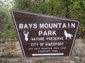
Expansive city park with
31 trails covering a total of
38.50 miles for hiking and mountain biking. Also unique additional amenities of an animal habitats, ropes course with zip line, planetarium, and more...
The most popular park hiking trails are Lakeside (with side trip on Holly) and Firetower. Those going mountain biking enjoy the main park roads (not the Hollows) and the Chinquapin and Bear Run trails.
No lodging of any type is offered on the premises. Eastman employees and retirees may use the nearby company owned campground, others can choose stay at nearby hotels and other campgrounds.
There is a $7/vehicle gate fee (effective 7/1/2023) to enter the park. (Or free as benefit for park association members: $35 individual, $60 family per year)
Dogs are allowed at Bays Mountain Park, but not around the animal habitats, thus please skirt using Lake Road.
Mountain bikes are allowed, upon inspection, on designated trails (thus carry a map to know where!).