Kitchen Rock Trail
| Kitchen Rock Trail (log in to submit report) | |
|---|---|

| |
| Highlight | Kitchen Rock is a large sandstone outcropping with an eroded small cave opening at its base. |
| Trail Number | 209 |
| Park | Bark Camp Lake |
| Land Owner | Virginia Department of Forestry |
| Located | Dungannon, VirginiaLocation inherited from associated park |
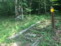
| Trail Marking | Yellow |
| Trail UseThings allowed to do on or near the trail |
|
| FeaturesThings to see on or near the trail |
|
| Difficulty Rating | Medium |
| Hiking TimeTime from car and back. Includes any time hiking to access this trail. | 1 hr0.0625 Days <br />60 Min <br /> round trip |
| Distance: | 0.64 mi1.03 km <br /> trailStrict non-repeating trail length / 0.640.64 mi <br />1.03 km <br /> round tripTypical or shortest length from the car, hike the trail, and return to car |
| Trail Type | Loop |
| Low / High Point | 2765 ft921.667 Yards <br />842.772 Meters <br /> / 2956 ft985.333 Yards <br />900.989 Meters <br /> |
| Elev. Gain/LossSee link for details of calculation. Gain/Loss is direction dependent. | {{{Elevation Gain}}}"{{{Elevation Gain}}}" is not a number. / ({{{Elevation Loss}}}"{{{Elevation Loss}}}" is not a number.) – Clockwise |
| Trip ReportsFrom user "hiked it" submissions<br />Recent is within last 90 days | 1 logged hikes (0 recent) |
| NearbyWithin 5 mi<br />Click link to view list | 2 trails / 6.3 mi of trail |
| Parking | 36° 51' 59.98" N, 82° 31' 27.01" W Map |
| Trailhead | 36° 52' 3.83" N, 82° 31' 22.51" W Map |
|
| |
| Show In Google Maps | |
Download KML / Upload new version / KML File Page / Create Profile Chart / gpsvisualizer Map
Trail Overview[edit]
A loop trail leaving the uphill side of the main parking to climb a low ridge above Bark Camp Lake. Kitchen Rock is a large sandstone outcropping with a small cave opening at its base.
How To Get There[edit]
Refer to the park page for directions from Kingsport. Pass the turn for the campground to parking lot for the fishing piers.
Route Description[edit]
Starting from the parking lot, you can go clockwise or counterclockwise on the loop trail. This basic description is clockwise from the main parking lot.
| Miles CW | Miles CCW | Elevation (ft) | Description |
|---|---|---|---|
| 0.0 | 0.6 | 2763 | At main parking lot |
| 0.3 | 0.3 | 2953 | Reach highpoint |
| 0.5 | 0.1 | 2936 | At access road |
| 0.6 | 0.0 | 2763 | Back at parking lot |
Typical Conditions[edit]
Hard dirt trail with multiple switchbacks.
Fees, Permits, etc.[edit]
$3 day use fee - pay at information kiosk in main parking lot.
Dogs are also able to use this trail but must be kept on leash.
After the Hike[edit]
Miscellaneous Information[edit]
Gallery[edit]
Starting stairs on eastern side
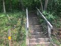
Starting stairs on west side

