Search results
Jump to navigation
Jump to search
Page title matches
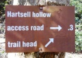
File:White Rock Trail - Hartsell Hollow trail sign.JPG |File name=White Rock Trail - Hartsell Hollow trail sign.JPG |Trail=White Rock Trail(448 × 317 (109 KB)) - 22:52, 23 December 2018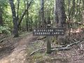
File:PCSP Point Lookout Trail - spur trail sign.JPG |File name=PCSP Point Lookout Trail - spur trail sign.JPG |Trail=Point Lookout Trail(4,032 × 3,024 (7.89 MB)) - 21:04, 11 September 2020
File:PCSP Norris Blackburn Trail - hiking trail marker.JPG |File name=PCSP Norris Blackburn Trail - hiking trail marker.JPG |Trail=Norris Blackburn Trail(3,024 × 4,032 (5.37 MB)) - 21:24, 11 September 2020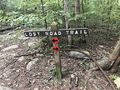
File:PCSP Lost Road Trail - trail junction sign.JPG |File name=PCSP Lost Road Trail - trail junction sign.JPG |Trail=Lost Road Trail(4,032 × 3,024 (5.83 MB)) - 07:50, 14 September 2020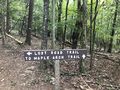
File:PCSP Lost Road Trail - another trail junction sign.JPG |File name=PCSP Lost Road Trail - another trail junction sign.JPG |Trail=Lost Road Trail(4,032 × 3,024 (5.76 MB)) - 08:02, 14 September 2020
File:Phipps Bend Trail - near trail end.jpg |File name=Phipps Bend Trail - near trail end.jpg |Trail=Phipps Bend Trail(600 × 450 (80 KB)) - 12:39, 28 July 2020- ...il' template. It is expected to be typically used by the [[Form:Trail|Form Trail]]. This template creates the 'sidebar' with info about each trail like the state, nearest city, coordinates of the tail head. If not used, en9 KB (1,166 words) - 19:07, 15 April 2023
- ...rsion to the current Trail Template (or Park) format. This would place the trail in the category [[:Category:Trails|Trails]]. {{#ask: [[Category:Trail]]52 members (0 subcategories, 0 files) - 00:14, 30 December 2019
- 119 bytes (22 words) - 23:47, 9 October 2015
- This is the "Trail" form. {{#forminput:form=Trail}}8 KB (1,248 words) - 22:29, 11 September 2020
- ...OLETE" are not to be used and should be deleted in the usage if updating a trail page. They are left here for backward compatibility and will be removed onc {{Infobox Trail6 KB (844 words) - 11:01, 20 November 2018
- {{Trail |Banner Image=File:Lakeside Trail - Bays Mountain Dam.jpg4 KB (663 words) - 17:12, 19 March 2023
- Below are the images seen on the trail infoboxes, what they mean, and how to use them if you edit trails. !Name in trail editing lists2 KB (295 words) - 15:22, 6 October 2019
- -->{{Infobox Trail | Trail Use = {{Hike}} {{Skiing}}4 KB (508 words) - 11:21, 21 November 2015
- {{Trail |Trail Highlight=Access to the Sand Cave and White Rocks (the colloquially known n7 KB (1,173 words) - 23:19, 27 November 2019
- <noinclude>This returns a map of the trails associated with the trail page it is called on. {{Trail Map|Main Trail={{PAGENAME}}|Other Trails= |Zoom Cancel=[any entry will trigger cancel]}}8 KB (992 words) - 13:30, 23 March 2023
- {{Trail |Trail Marking=Signs2 KB (265 words) - 23:30, 15 December 2019
- {{Trail |Trail Highlight=Connects Lakeside Trail with Lake Road2 KB (281 words) - 15:51, 15 December 2019
- {{Trail |Banner Image=File:BMP Azalea Trail.JPG3 KB (372 words) - 20:34, 12 April 2023
- {{Trail |Trail Marking=Signs2 KB (262 words) - 17:03, 15 December 2019
- {{Trail |Trail Marking=Signs2 KB (295 words) - 20:07, 15 December 2019
- {{Trail |Banner Image=File:BMP Orchid Trail sign.JPG2 KB (294 words) - 19:17, 15 December 2019
- {{Trail |Banner Image=File:BMP Cliffside Trail view from obs tower towards firetower.JPG4 KB (520 words) - 22:48, 14 December 2019
- ...ieces will provide background information to allow more folks to enjoy the trail.6 members (0 subcategories, 0 files) - 05:48, 16 April 2012
- ...on of a trail (including park page defined stubs). Its expected use is for trail tables and map balloons.193 bytes (34 words) - 15:36, 24 November 2019
- {{Trail |Banner Image=File:BMP Chinquapin Trail.JPG3 KB (448 words) - 20:49, 14 December 2019
- #REDIRECT [[Barred Owl Trail]]30 bytes (4 words) - 20:34, 12 April 2023
- This trail name is used by more than one park. * [[Lake Trail (Big Ridge State Park)]]181 bytes (29 words) - 23:36, 30 November 2019
- {{Trail |Trail Highlight=5,560' summit with view of northern highlands6 KB (930 words) - 22:36, 2 December 2019
- {{Trail |Trail Marking=Signs3 KB (468 words) - 14:50, 14 December 2019
- -->{{Infobox Trail | Trail Number =5 KB (776 words) - 12:12, 7 January 2023
- -->{{Infobox Trail | Trail Use = {{Hike}} {{Biking}} {{Dogs}}4 KB (565 words) - 09:42, 31 October 2015
- {{Trail |Trail Highlight=Nice views of the viaduct and Grandfather Mountain3 KB (469 words) - 08:20, 7 December 2019
- -->{{Infobox Trail | Trail Use = {{Hike}} {{Dogs}}5 KB (666 words) - 12:12, 7 January 2023
- {{Trail |Trail Marking=White3 KB (493 words) - 14:01, 19 September 2021
- |Trail Condition=Problems147 bytes (21 words) - 18:04, 2 May 2024
- ...of the hike is in the shade. It is a great opportunity to get out on the trail even if you or your family don’t have a lot of experience hiking. <br>'''F/B: Bays Mountain Park - Lakeside Trail, Saturday, May 24''', 2:00 pm – 3:30 pm2 KB (267 words) - 15:32, 30 May 2019
- ...d back down towards the parking lot. We picked up the 2.1-mile Cabin Creek Trail to see the waterfall and ate lunch along the rocks in front of it.2 KB (295 words) - 13:38, 15 June 2014
- -->{{Infobox Trail | Trail Use = {{Hike}} {{Biking}} {{Dogs}}3 KB (501 words) - 15:53, 20 May 2019
- {{Trail |Trail Highlight=A Rails-to-Trail between Bristol and Mendota, VA5 KB (792 words) - 20:01, 16 June 2023
- ...s. This is different than a Park. Most distinct example is the Appalachian Trail System which is made up of trails in many parks, regions, states, etc.254 bytes (46 words) - 14:01, 6 December 2018
- ...the type [[Has type::Page|Page]]. It was created to be the used to log the trail hiked for a hike event.115 bytes (25 words) - 20:35, 29 September 2015
- 37 bytes (4 words) - 21:57, 10 September 2015
- These pages are trail stubs typically expected to be created on Park pages using the form. {{#ask: [[Category:Trail Stubs]]0 members (0 subcategories, 0 files) - 09:09, 26 November 2019
- ..., would be 2.5 mi, where as the field [[Property:Trail distance round trip|Trail distance round trip]] would be 3.0 mi.589 bytes (91 words) - 21:15, 18 September 2015
- ...d to hold the choice of Loop / Segment / In-and-Out to signify roughly the trail type. ...'' hikes are those hikes where a significant portion, at least half of the trail, can be completed without repeating large sections in the reverse. Addition841 bytes (146 words) - 10:08, 4 October 2015
- ...is a property of type [[Has type::Text|Text]]. It is used to describe the trail blaze, unless otherwise unique, simply the color name should suffice.154 bytes (27 words) - 12:25, 26 April 2018
- ...he 'Trail Search' template. It should be called via the [[Special:RunQuery/Trail Search]] form. {{#if: {{{trail uses|}}}|[[Allowed activities::{{{trail uses|}}}]]}}873 bytes (90 words) - 14:25, 24 June 2023
- This is the "Trail Search" form. {{#forminput:form=Trail Search}}844 bytes (114 words) - 14:27, 24 June 2023
- ...ype [[Has type::Text|Text]]. It is used to list the updates needed for the trail page. Intent is to make it easier to find trails that need various updates. ...description;Photos;Winter photos;Stub;Remove trail in name;Update infobox;Trail pins;Update mileage|+sep=;918 bytes (146 words) - 18:47, 16 October 2015
- ...specific trail number (if applicable). Typically this is a Forest Service Trail Number.192 bytes (33 words) - 00:05, 4 October 2015
- ...ed in [[Property:Page needs reviewed on]]. See [[Property:Trail page needs|Trail page needs]] for the current and previous designations. {{Trail page needs3 KB (465 words) - 22:06, 21 October 2015
- Here's the list of trail page needs. {{#ask: [[Category:Trail]]196 bytes (25 words) - 22:41, 2 January 2016
- -->{{Infobox Trail | Trail Use = {{Hike}}5 KB (598 words) - 12:12, 7 January 2023
- ...Please scroll down to edit the main content of the article. -->{{Infobox Trail | Trail Number = USFS Trail #6035 KB (730 words) - 18:24, 16 April 2023
- {{Trail |Trail Marking=Pink2 KB (315 words) - 21:57, 19 September 2021
- {{Trail |Trail Highlight=A hike up the west side of Holston Mountain past an overlook4 KB (621 words) - 10:17, 4 January 2023
- This is the "Trail Stub" template. Its use is for the [[Form:Park|Park Form]] to list trails t {{Trail Stub778 bytes (102 words) - 15:34, 24 November 2019
- Not too surprising there are multiple uses of Summit Trail. The following are known. *[[Summit Trail (Elk Knob)|Summit Trail in Elk Knob State Park]] North Carolina256 bytes (40 words) - 22:39, 2 December 2019
- ...is a property of type [[Has type::Text|Text]]. It is used to describe the trail blaze, unless otherwise unique, simply the color name should suffice.154 bytes (27 words) - 13:43, 15 November 2018
- '''Trail Lows and Highs''' are as simple as it sounds. If using a GPS points or trac '''Trail elevations and elevation changes''' is trickier than one would initially be2 KB (313 words) - 08:19, 7 December 2019
- 46 bytes (9 words) - 11:22, 18 November 2018
- ...holds comments from a trail trip report focusing on the conditions of the trail. Not to be confused with [[Property:Hike Comment]] which holds general comm227 bytes (39 words) - 14:17, 18 November 2018
- {{Trail |Trail Highlight=Although your likely goal, not the typical access6 KB (865 words) - 10:56, 7 January 2023
File:Trail Markers.JPG |File name=Trail Markers.JPG |Trail=Phipps Bend Trail(3,024 × 4,032 (5.68 MB)) - 08:55, 9 August 2020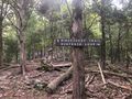
File:Trail intersection.jpg |File name=Trail intersection.jpg |Trail=Ridge Crest Trail(640 × 480 (165 KB)) - 17:24, 6 September 2020- {{Trail |Trail Highlight=Good for beginners2 KB (343 words) - 19:04, 11 September 2020
- {{Trail |Trail Highlight=Wander around more than seven sinkholes1 KB (205 words) - 21:28, 11 September 2020
- {{Trail |Trail Highlight=One mile extension to Raider's Run1 KB (162 words) - 10:09, 21 September 2020
- {{Trail |Trail Highlight=A steep climb to a 180° stunning view of the countryside1 KB (181 words) - 10:34, 21 September 2020
- {{Trail |Trail Highlight=Additional hike option to Molly's Knob and Vista Trail2 KB (235 words) - 09:17, 22 September 2020
- 244 bytes (33 words) - 11:59, 2 December 2018
- ...distance, thus reported for annual data book update. This page, like the trail itself, is a work in progress to figure out how to best use the available t <br>- Backbone Rock Trail (blue blaze)7 KB (1,010 words) - 12:12, 7 January 2023
- {{Trail |Trail Highlight=Your likely trail if you want to "go to The Channels"6 KB (906 words) - 10:47, 8 January 2023
- |Trails=Ewing Trail |Trail Condition=Clear1 KB (224 words) - 18:13, 14 July 2023
- {{Trail |Trail Highlight=Starting waterfall, view of the Powell River Valley5 KB (783 words) - 22:37, 27 July 2020
File:Trail Wiki Layout.png (1,006 × 541 (28 KB)) - 00:27, 12 December 2019- {{Trail |Trail Marking=White6 KB (1,004 words) - 13:20, 11 July 2021
- {{Trail |Trail Marking=Signs2 KB (310 words) - 15:29, 10 November 2019
- This category was created to flag trail pages without a KML on their map3 members (0 subcategories, 0 files) - 21:26, 29 August 2015
- {{Infobox Trail | Trail Use = {{Hike}}{{Dogs}}{{Camping}}6 KB (880 words) - 12:12, 7 January 2023
- {{Trail |Trail Highlight=Loop with a waterfall and a rhododendron tunnel2 KB (251 words) - 07:58, 29 August 2020
- {{Trail |Trail Highlight=Look out over Cherokee Lake or also walk down to the water4 KB (566 words) - 21:12, 11 September 2020
- Hike Report: Roaring Branch Trail up to High Butte, March 19th, 2011 ...en, except for several species of birds and a small snake on a rock in the trail.1 KB (209 words) - 16:25, 22 March 2011
- -->{{Infobox Trail | Trail Use = {{Hike}}4 KB (580 words) - 12:12, 7 January 2023
- hike report for the Elk Park Trail written by Bill Stowell in Oct 1998 Elk Park Trail to Houston Ridge, December 8, 2007, Vic Hasler reporting219 bytes (33 words) - 21:56, 5 April 2011
- 23 bytes (2 words) - 11:42, 27 September 2015
- {{Trail |Banner Image=File:BMP Dolan Branch Trail waterfall.JPG5 KB (746 words) - 07:45, 15 December 2019
- {{Trail |Banner Image=File:BMP Firetower Trail tower.jpg3 KB (416 words) - 16:10, 10 November 2019

File:Towhee trail profile.png |File name=Towhee trail profile.png |Trail=Towhee Trail(1,160 × 660 (23 KB)) - 23:27, 15 December 2019
File:Hemlock trail profile.png |File name=Hemlock trail profile.png |Trail=Hemlock Trail(1,160 × 660 (23 KB)) - 15:40, 15 December 2019- {{Trail |Trail Marking=Signs2 KB (260 words) - 23:22, 15 December 2019

File:Holly trail profile.png |File name=Holly trail profile.png |Trail=Holly Trail(1,160 × 660 (22 KB)) - 17:00, 15 December 2019- {{Trail |Trail Marking=Signs5 KB (675 words) - 23:11, 14 December 2019

File:Pine trail profile.png |File name=Pine trail profile.png |Trail=Pine Trail(1,160 × 660 (22 KB)) - 20:05, 15 December 2019
File:Cliffside trail profile.png |File name=Cliffside trail profile.png |Trail=Cliffside Trail(1,160 × 660 (22 KB)) - 22:40, 14 December 2019- ...r trails. Park/Trail aware. Probably will make different ones for Park vs. Trail instead of one monolithic beast. * Trail name1 KB (177 words) - 13:41, 6 January 2021
- {{Trail |Banner Image=File:BMP Bays Ridge Trail sign.JPG4 KB (595 words) - 23:09, 23 November 2019
- {{Trail |Trail Marking=Blue6 KB (988 words) - 16:33, 19 September 2021
- Holston Mn Trail Hike May 27-28,2011 ...howed us where the blue blaze trail was that is the end of the Holston Mn. Trail. It's at the top of the hill on the left going SOBO from the shelter. After2 KB (494 words) - 14:30, 6 June 2011


Page text matches
- ...OLETE" are not to be used and should be deleted in the usage if updating a trail page. They are left here for backward compatibility and will be removed onc {{Infobox Trail6 KB (844 words) - 11:01, 20 November 2018
- |Trail Map Link=https://www.nps.gov/cuga/planyourvisit/upload/CUGAmap1-3.pdf {{Park trail map}}4 KB (565 words) - 11:29, 16 June 2023
- #REDIRECT [[Ewing Trail]]25 bytes (3 words) - 23:17, 27 November 2019
- #REDIRECT [[Talk:Ewing Trail]]30 bytes (4 words) - 23:17, 27 November 2019
- [[Template:Trail]] [[Template:Infobox Trail]]1 KB (155 words) - 21:38, 20 February 2011
- '''Welcome to Tennessee Eastman Hiking and Canoeing Club's Trail WIKI''' Our online repository for everything trail related within a reasonable distance from our club's center in Kingsport TN9 KB (1,394 words) - 18:18, 14 July 2023
- {{#ask: [[Category:Waterfalls]][[Trail State::Virginia]]139 bytes (14 words) - 19:43, 31 August 2015
- ...Text|Text]]. It is used to hold the choice of Easy / Medium / Hard for the trail hike difficulty135 bytes (26 words) - 20:57, 17 September 2015
- ...ip distance one would take to get to this trail, hike the entirety of this trail and return to the starting area.486 bytes (75 words) - 10:32, 23 December 2019
- ...2.47760~[[WPSP Sinking Waters|Sinking Waters]]~Here is the location of the trail head~MarkerA.png~ ~This is where Putin Works ...reek_Loop_Trail|Fall Creek Loop]]<br>[[Image:To D Backbone Trail.jpg|150px|Trail head sign]]10 KB (1,633 words) - 12:12, 7 January 2023
- {{Trail |Banner Image=File:BMP Firetower Trail tower.jpg4 KB (529 words) - 22:07, 10 December 2019
- !Trail distance from Damascus1 KB (201 words) - 18:24, 20 February 2023
- ...distance, thus reported for annual data book update. This page, like the trail itself, is a work in progress to figure out how to best use the available t <br>- Backbone Rock Trail (blue blaze)7 KB (1,010 words) - 12:12, 7 January 2023
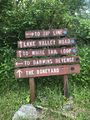
File:WPSP Main Split signs.JPG |Trail=Boneyard, Lake Road (Warriors Path State Park), Whitetail Loop, Zipline |Caption=Signs at main trail split(3,024 × 4,032 (4.76 MB)) - 11:45, 24 June 2023- Arguably the most unique shelter on the entire Appalachian Trail with a great view looking down into Roaring Creek Valley. A classic wooden ...d Carvers Gap. The shelter is 0.3 miles east of AT. on a blue-blazed side trail. In the Pisgah National Forest, Toecane Ranger District. Located on the [[C4 KB (605 words) - 07:28, 20 November 2023
- Water is found 100 yards from the shelter on a blue blaze trail. <!-- Place any pictures from this trail below. Add a picture by typing Image:imagename.extension -->2 KB (282 words) - 12:04, 21 December 2018
- ...il' template. It is expected to be typically used by the [[Form:Trail|Form Trail]]. This template creates the 'sidebar' with info about each trail like the state, nearest city, coordinates of the tail head. If not used, en9 KB (1,166 words) - 19:07, 15 April 2023
- <!-- Add additional columns for distance from Bristol/trail distance/AT or branch --> !Trail5 KB (506 words) - 17:26, 10 June 2023
- {{Trail |Trail Marking=Blue7 KB (1,046 words) - 15:35, 10 January 2023
- {{Trail |Trail Highlight=Your likely trail if you want to "go to The Channels"6 KB (906 words) - 10:47, 8 January 2023
File:The Great Channels1.jpg |Trail=The Channels Natural Area Preserve(768 × 1,024 (139 KB)) - 22:39, 15 November 2018
File:Sinking Waters information sign.jpg |Trail=Sinking Waters(768 × 576 (123 KB)) - 15:07, 20 November 2018- |Trail Map Link=https://baysmountainpa.wpengine.com/wp-content/uploads/Trail-Map-Brochure-Front-5-7-18.pdf 36.50803,-82.61255~Lakeside Trail~ ~MarkerG.png9 KB (1,288 words) - 15:10, 13 June 2023
File:Comparison of etrex and forerunner logging.PNG ...nta/pink. The eTrex track was more consistent upon trail returns and known trail locations/shape.(1,566 × 974 (3.49 MB)) - 00:39, 2 January 2020- {{Trail |Banner Image=File:Lakeside Trail - Bays Mountain Dam.jpg4 KB (663 words) - 17:12, 19 March 2023
- == Getting started adding a trail page == Steps to creating a new trail (or filling out a referenced one that has no page)10 KB (1,857 words) - 17:31, 8 March 2020
File:Sinking Waters sinkhole.jpg |Trail=Sinking Waters(2,048 × 1,536 (910 KB)) - 12:24, 19 November 2018- |Trail Map Link=https://tnstateparks.com/assets/pdf/additional-content/park-maps/4 |Park Trail Count=9 KB (1,271 words) - 11:59, 19 September 2021
- {{Trail |Trail Highlight=Three connected loops and a stream that disappears into a sinkhol9 KB (1,357 words) - 17:53, 14 December 2019
- |Trail Condition=Clear |Trail Comment=Good. Some decking felt loose and handrail is knocked off in wetlan520 bytes (81 words) - 10:42, 8 December 2018
- {{Trail |Trail Number=FS #1895 KB (728 words) - 20:56, 21 May 2023
File:IMG 3495.jpg |Trail=Margarette Falls(640 × 480 (161 KB)) - 21:05, 21 May 2023
File:Margarette Falls-profile.png |Trail=Margarette Falls(760 × 460 (22 KB)) - 22:32, 4 December 2018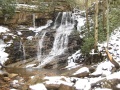
File:Margarette falls 01.jpg |Trail=Margarette Falls(1,200 × 900 (620 KB)) - 22:08, 4 December 2018- ...slippery, but we made it, took in the sights, and quickly headed back down trail to the warmer weather. Overall it was barely frozen and compared to picture ...in the water. This popular falls is considerably easier to get to now. The trail work is top notch...3 KB (533 words) - 00:54, 14 May 2012

File:Dnr atv.png Trail logo to signify ATV use |Caption=Signifies that ATVs are allowed on at least some of the trail<br>'''Note''': Check with proper authorities for which specific trails allo(80 × 80 (2 KB)) - 18:29, 21 November 2018
File:Dnr bike.png |Caption=Signifies that bicycles are allowed on at least some of the trail<br>'''Note''': Check with proper authorities for which specific trails allo(80 × 80 (2 KB)) - 18:30, 21 November 2018
File:Dnr fishing.png ...ignifies that fishing might be allowed on at least some streams nearby the trail<br>'''Note:''' Check with proper authorities for locations and license requ(80 × 80 (1 KB)) - 18:21, 21 November 2018
File:Dnr hiking.png |Caption=Signifies that hiking is allowed on the trail(80 × 80 (2 KB)) - 17:44, 21 November 2018
File:Dnr skiing.png |Caption=Signifies that skiing is allowed on the trail and is common in the winter(80 × 80 (1 KB)) - 18:26, 21 November 2018
File:Dnr waterfall.png |Caption=There are waterfalls within the park or near the trail(80 × 80 (2 KB)) - 09:17, 23 November 2018- ...g'. It is normally used in infoboxes to display allowed use on or near the trail or at the park.474 bytes (72 words) - 10:57, 20 November 2018
- ...s'. It is normally used in infoboxes to display allowed use on or near the trail or at the park.460 bytes (72 words) - 10:51, 20 November 2018
- ...V'. It is normally used in infoboxes to display allowed use on or near the trail or at the park.457 bytes (72 words) - 10:45, 20 November 2018
- ...g'. It is normally used in infoboxes to display allowed use on or near the trail.456 bytes (68 words) - 10:50, 20 November 2018
- ...g'. It is normally used in infoboxes to display allowed use on or near the trail or at the park.475 bytes (72 words) - 10:51, 20 November 2018
- ...g'. It is normally used in infoboxes to display allowed use on or near the trail or at the park.481 bytes (72 words) - 10:56, 20 November 2018
- ...s'. It is normally used in infoboxes to display allowed use on or near the trail or at the park.483 bytes (73 words) - 10:57, 20 November 2018
- ...r'. It is normally used in infoboxes to display allowed use on or near the trail or at the park.481 bytes (72 words) - 11:35, 20 November 2018
- ...g'. It is normally used in infoboxes to display allowed use on or near the trail or at the park.474 bytes (72 words) - 11:35, 20 November 2018
- ...l'. It is normally used in infoboxes to display allowed use on or near the trail or at the park.493 bytes (72 words) - 11:41, 20 November 2018
- [[ClubWiki:Creating a Trail]] [[ClubWiki:Creating a Trail KML]]6 KB (877 words) - 18:29, 3 July 2020
- |Banner Image=File:White Rock Trail overlook.JPG |Trail Map Link=https://www.johnsoncitytn.org/document_center/Residents/Buffalo%205 KB (873 words) - 12:12, 7 January 2023
- {{Trail |Trail Highlight=An easy short trail to a remote and beautiful waterfall3 KB (486 words) - 14:14, 17 July 2023
- ...The river trail ends at the Clinch River, so I backtracked to Copper Ridge Trail and up a 350’ elevation climb to the overlook. (I would recommend the ove3 KB (462 words) - 07:50, 2 April 2014
- {{Trail |Trail Marking=Red9 KB (1,323 words) - 15:45, 24 June 2023
- |Trail Condition=Clear335 bytes (55 words) - 07:05, 7 July 2023
- |Trails=Ewing Trail |Trail Condition=Clear1 KB (224 words) - 18:13, 14 July 2023
- [[ClubWiki:Creating_a_Trail]] has information on how to add (or modify) a trail specific to this site When creating or modifying trail or park pages, applying wiki categories are not used. The templates will ap7 KB (1,001 words) - 13:36, 1 January 2020
File:Rock Creek Falls.jpg |Trail=Rock Creek Falls(900 × 1,200 (420 KB)) - 11:06, 19 September 2021
File:High Butte.jpg |Trail=Roaring Branch Trail(600 × 450 (71 KB)) - 22:19, 27 July 2020- {{Trail |Trail Highlight=Starting waterfall, view of the Powell River Valley5 KB (783 words) - 22:37, 27 July 2020

File:Roaring branch trail profile.png |File name=roaring branch trail profile.png |Trail=Roaring Branch Trail(1,160 × 660 (22 KB)) - 22:30, 27 July 2020- |Trail Condition=Clear |Trail Comment=The trail was in excellent condition.510 bytes (81 words) - 15:07, 28 July 2020
- |Trail Condition=Clear |Trail Comment=Little soggy, otherwise portions seen were clear. Bridge from wetla454 bytes (69 words) - 09:02, 1 August 2020
- Welcome to our online repository for everything trail related within a reasonable distance from our club's center in Kingsport TN ...a trailhead GPS coordinate. Click on the balloon title to take you to that trail.9 KB (1,664 words) - 09:07, 13 December 2019
- Below are the images seen on the trail infoboxes, what they mean, and how to use them if you edit trails. !Name in trail editing lists2 KB (295 words) - 15:22, 6 October 2019
- |Trail Condition=Clear |Trail Comment=A little dry362 bytes (55 words) - 08:46, 12 October 2019
- ...ngs with roughly a dozen folks of all ages hiking this “medium” difficulty trail. On this Sunday trek were Aaron Kelly and Vic Hasler. ...ly one slight slip and dip. The Cherokee National Forest has worked on the trail including putting in stepping stones at each crossing, but most were under3 KB (585 words) - 06:48, 3 April 2014
- {{Trail |Trail Highlight=Rock-lined gorge with sandstone cliffs and cascading creek to vie6 KB (962 words) - 11:06, 25 April 2024
- |Trail Condition=Problems156 bytes (22 words) - 15:49, 2 May 2024

File:Little stony creek falls profile.png |Trail=Little Stony Creek Falls |Caption=Trail Profile(1,160 × 660 (22 KB)) - 11:15, 19 January 2020- |Trail Map Link=https://www.fs.usda.gov/Internet/FSE_MEDIA/fseprd491178.jpg {{Park trail map}}2 KB (333 words) - 15:49, 19 January 2020
- ...lonial Heights for the 75 minute drive. For further information, check the trail wiki links or call/e-mail the hike leader. ...plans were to potentially partner with The Clinch Coalition to reroute the trail – especially above the first bridge from the recreation area.5 KB (876 words) - 16:36, 15 March 2014
File:Lakeside Trailhead from Dam.jpg |Trail=Lakeside Trail(600 × 450 (104 KB)) - 20:11, 10 November 2019
File:Lakeside Trail - Bays Mountain Dam.jpg |File name=Lakeside Trail - Bays Mountain Dam.jpg |Trail=Lakeside Trail(600 × 450 (84 KB)) - 20:14, 10 November 2019
File:Lakeside trail - evergreen grove.jpg |File name=Lakeside trail - evergreen grove.jpg |Trail=Lakeside Trail(500 × 375 (83 KB)) - 20:11, 10 November 2019
File:Lakeside Trail - former aviary area.jpg |File name=Lakeside Trail - former aviary area.jpg |Trail=Lakeside Trail(600 × 450 (69 KB)) - 20:13, 10 November 2019
File:Lower Kiner Hollow Falls.jpg |Trail=Laurel Run Trail(768 × 1,024 (239 KB)) - 15:36, 10 November 2019- {{Trail |Trail Marking=White6 KB (1,004 words) - 13:20, 11 July 2021
- {{Trail |Trail Marking=Signs2 KB (310 words) - 15:29, 10 November 2019

File:GPS edit that needs enter.png Trail form GPS edit that needs to be committed.(920 × 282 (77 KB)) - 00:42, 13 December 2019- |Trail Condition=Clear |Trail Comment=Trail ok. Lots of downed leaves as to be expected.369 bytes (58 words) - 20:28, 13 December 2019
- This category was created to flag trail pages without a KML on their map3 members (0 subcategories, 0 files) - 21:26, 29 August 2015
File:Kiner Hollow Trailhead in Laurel Run Park.jpg |Trail=Laurel Run Trail |Caption=Trailhead for Laurel Run Trail - photo by Vic Hasler(768 × 576 (164 KB)) - 15:35, 10 November 2019
File:Laurel Run Trail creek.jpg |Trail=Laurel Run Trail |Caption=Cascading creek below the Laurel Run Trail - photo by Vic Hasler(768 × 576 (175 KB)) - 15:36, 10 November 2019- {{Infobox Trail | Trail Use = {{Hike}}4 KB (628 words) - 11:14, 30 July 2018
- {{Trail |Banner Image=File:Devils Bathtub Trail splash pool.jpg7 KB (1,066 words) - 23:10, 10 January 2020

File:Devils bathtub profile.png |Trail=Devil's Bathtub(1,160 × 660 (24 KB)) - 23:04, 10 January 2020- -->{{Infobox Trail | Trail Use = {{Hike}} {{Skiing}}4 KB (508 words) - 11:21, 21 November 2015
- {{Trail |Trail Highlight=Access to the Sand Cave and White Rocks (the colloquially known n7 KB (1,173 words) - 23:19, 27 November 2019
File:Upper Falls of Little Stony Creek.jpg |Trail=Little Stony Creek Falls(385 × 450 (55 KB)) - 11:08, 19 January 2020- -->{{Infobox Trail | Trail Use = {{Hike}} {{Biking}} {{Dogs}}5 KB (760 words) - 12:12, 7 January 2023
- -->{{Infobox Trail | Trail Use = {{Hike}}{{Dogs}}4 KB (686 words) - 17:37, 19 March 2023
File:IMG 3502.jpg |Trail=Margarette Falls Short wooden bridge to cross muddy trail due to water trickling down the hill(480 × 640 (218 KB)) - 21:25, 21 May 2023
File:IMG 3505.jpg |Trail=Margarette Falls(480 × 640 (206 KB)) - 21:27, 21 May 2023- *[[Pinnacle Mountain Fire Tower]] - newly constructed trail to renovated fire tower *[[Carver's Gap to US19E|Carver's Gap]] to [[Grassy Ridge]] - spur trail off the AT to 360 degree overlook4 KB (690 words) - 17:06, 19 March 2023
- |Trail Condition=Clear ...rail. The rocky trail was covered in leaves but fairly easy to follow. The trail was marked using ribbons and some yellow paint. Ropes must be used to scale1 KB (202 words) - 12:34, 20 May 2021
- ...e temperature may drop more than you expect - and more wind on the exposed trail. A hiking stick or trekking poles can be of great use to protect against s23 members (0 subcategories, 0 files) - 07:21, 5 February 2012
File:SandCave.JPG |Trail=Ewing Trail(1,200 × 900 (205 KB)) - 23:24, 27 November 2019


