Trip Report: Laurel Falls from Dennis Cove – July 6th

We were blessed with a very comfortable Sunday afternoon for our 2.6 mile round-trip hike to Laurel Falls. This is a very family-friendly hike with the only somewhat challenging part being the actual walk down and back from the waterfall. This path is make of large stepping stones some of which are easier to navigate than others. But with reasonable care the route is well worth the reward.

There was a decent amount of flow over the falls, but the water level was lower than I had seen it before. Lydia and Paul enjoyed cooling their heels in the creek and several other hikers at the falls were swimming. Extreme care should be taken in the water below the falls since a father and son tragically lost their lives here in July, 2012. There is a small plaque in their memory attached to a rock at the bottom of the steps. Probably the most excitement today came from watching some swimmers (not part of our group) try to capture/kill(?) a small water snake of some kind. We weren’t close enough to tell what kind it was, but they were approaching it like it was a man-eating python. The snake eventually made its escape swimming on down the creek.

Our hiking group consisted of Chris Garrett, Patti Garrett, Lydia Garrett, Paul Garrett, Leticia Brock, Beverly Griggs and Barry Griggs


Oliver Hollow Use Restriction Due to Bear Activity

The National Forest Service lands are closed to most recreation from north of Shook Branch to a half mile north of Wilbur Dam Rd.  Bears are active in this area.  Individuals are only permitted to hike through this area.  Please continue hiking through this area without stopping.  Watauga Lake Shelter is closed.  No preparation or consumption of food or overnight stays allowed.  This closure is effective until December 1, 2015.

Oliver Hollow bear closure map

Mt Rogers Short Loop Hike: Massie Gap, AT, Wilburn Ridge – Trip Report

Garry Luttrell reporting
Event Date: October 19th
Fred Mullner, Serita Blankenbecler, Paula Cahill, and Garry Luttrell enjoyed the stroll, and sometimes rock climbing, up to the summit of Wilburn Ridge. Along the way we saw lots of ponies; in fact, more than I’ve ever seen before on a day’s trip. And, we could say the same for the number of hikers, scouts, groups, dogs, etc. We sat down on the top, opened our snacks, food, and drink; and, it seemed like the wind increased and temperature fell, as if some voice was saying: it’s time for you to move on, and let someone else enjoy the great 360 degree view.

AT: Hughes Gap to Little Rock Knob, Sunday August 26, 2012

This hike is along the [[Iron Mountain Gap to Carver’s Gap|Appalachian Trail]] through hardwood forest to great views at Little Rock Knob (elevation 4918′).  The round trip distance is 4.6 to 5 miles with 900’ rise (similar climb to Bays Mountain Firetower trail but over 3-4 times the distance).  Let’s leave promptly at 1pm from the parking lot below [[Meeting locations for TEHCC hikes|McDonalds in Colonial Heights]] for the hour (45-mile) drive.  Bring water, snack, comfortable footwear, rain gear, bug spray, and trekking poles.  Expected return is by 7pm depending on our hiking speed and desire to tarry at the overlook.  Please call/e-mail the hike leader for headcount to arrange transportation.

From the Chair

Vic Hasler, Steering Committee Chair

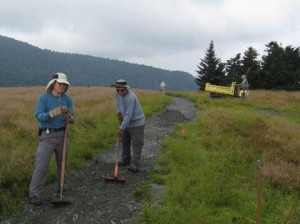
This month brings the 75th anniversary for the Appalachian Trail which was originally deemed “complete” on August 14, 1937 after 15 years of construction.  Since then, the trail has been an ongoing work-in-progress with major changes to the route (such as moving to cross the Roan Mountains) and path (elimination of PUDs*), and the addition of shelters in the 1960s.  A famous quote by Frank Oglesby was “I’m now relocating my relocations!”  This labor of love continues to improve the trail experience, with the assistance of the Konnarock Crew, Hardcore, and college groups.  In addition to the trail construction activities, volunteers are always needed to keep the trail open for the world to enjoy – by clipping back the growth, removing small blowdowns, and checking the shelters along the path.  Please consider joining one of the light maintenance trips… also known as “Hiking with Tools”!

*pointless ups and downs

Friday Hikers: AT – Chestoa to Curley Maple Gap Shelter, Trip Report

Bob Harvey reporting

Event Date: March 30th

The hike of March 30 was on the Appalachian Trail from Chestoa to the shelter near Curley Maple Gap, where we ate lunch, and then returned to Chestoa.

This hike was one that had been planned for quite a while, but postponed either to bad weather or to expected bad weather. This time, though, we could hardly have had it any better. Spring flowers were making their appearances and the trail was in perfect condition.  Ordinarily, the northbound through-hikers get to Erwin and vicinity about this time of the year, but we saw only two, both from Destin, Florida.  The hikers were Olin Babb, Bob Harvey, Jerry Jones, Susie Seiler, Jerry Sluder and Lowell Toof.