F/B: Warrior’s Path State Park – Devil’s Backbone and Fall Creek Loop Trails, Sunday June 3

Leader: Ian Powell (423-217-8193)

Rating: Moderate – Four miles with steep climb up and over Lone Cedar Overlook

Enjoy a short local hike which provides views from overlooks, a stroll along a creek, and walk around open fields of a former farm. Anyone is welcome to attend.  Meet at the north end of the Fall Creek Road bridge by the golf course in Warriors Path State Park at 1:00 PM.  Dress appropriately for a summer hike and bring some drinking water for hydration.  For further information, check the trail wiki or call the hike leader.

Friday Hikers: AT – AT from Carvers Gap to Hughes Gap, Trip Report

Collins Chew reporting

Event Date: April 20th

We had a great hike on the AT over Roan Mountain today.  The day started chilly and foggy but warmed and cleared.  Until we started down from the top, we saw no wildflowers, but they began to show up as we descended toward Ash Gap.  With each increment of descent, a different assemblage of flowers appeared.  We ended up with a really great day of flowers with great diversity.  There were carpets of various flowers at different places.  The trout lilies were very large as well as numerous.  We rolled the relocation with a wheel and mapped it with GPS.  It was 0.4 miles longer because of a long switchback added recently.  Hikers were: Olin Babb, Kathy and Jerry Case, June Donaldson, Howard Guinn, Carol Idol, Lowell Toof, Jane Whitson and Collins Chew.

Lake Santeetlah Paddle/Camp, Trip Report

Debbie Briscoe reporting

Event Date: April 20th – 22nd

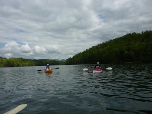
I headed out on Thursday night right after work to drive the 3 hours to the campground at Cheoah Point.  Islander had already arrived early that morning.  I got there right at dark:30 as usual.  With help from Islander and his incredibly bright flashlight (what was that thing?), I set up down in the woods.  It was a really nice place with good bathrooms and hot showers!  I pulled out my Bushbuddy and fixed a little coffee to wind down a bit before heading to my hammock. Continue reading “Lake Santeetlah Paddle/Camp, Trip Report”

Margarette Falls, Trip Report

Joe DeLoach reporting

Event Date: April 7th

The most frequent question I received on this hike was “How far ahead did you plan it?” as it turned out to be a gorgeous day with lots of water and 17 species of wildflowers in bloom.  Although the warm winter and spring resulted in the early spring flowers having already bloomed and gone, later spring flowers including vernal and crested dwarf iris, erect trilliums, foamflower, and a particularly nice patch of bleeding heart made for a very nice display.  Seven of us hiked together up the 1.3-mile trail, which had been improved by the Forest Service with three of the former stream crossings removed by relocations and a new bridge.  Everyone navigated the one remaining crossing without incident.  The crossing of Dry Creek to reach the rough Phillips Hollow Trail at the former parking area is no longer evident.  While having lunch at the falls, Ken Weakley and his family arrived; they had other plans which kept them from going with us, but used the route from the Trail Wiki to find the trail and us.  Hikers included Donna Ashby, Rhoda Bliese, Alan Gamble, Chris Neglia and his 7-year old son Joe, Monika Wiedmann, and Joe DeLoach.

Friday Hikers: Max Patch, Trip Report

Collins Chew reporting

Event Date, April 13th

We had a beautiful day with pleasant temperatures for our annual trillium hike over Max Patch.  The veterans all think we saw more trillium this year than ever before, with at least four varieties/colors.  There were a number of other flowers with a carpet of trout lily in one place.  Hikers were Gary Bailey, Lee Bockman, Kathy and Jerry Case, Andy Gilbert, Ryan Sheeley, Jane Whitson, Laura Ward, and Collins Chew.

Bluestone River Trip Postponed

Reporting: Ed “Happy Hour Coordinator” Montgomery

Our trip leader just called and informed me that our upcoming Bluestone River trip will be postponed due to the Mountain Creek Lodge being closed because the tram is down. The tram is Swiss made and they are getting a part from across the pond. The trip has been moved to June 15-17, 2012. All lodging reservations have been moved. If you cannot attend at this time, please call the Pipestem lodge and cancel your room. Please respond to this note and let us know your status. This delay is going to put more pressure on us to have an even bigger HAPPY HOUR event. Stay tuned for details.

Note: If the Bluestone is running low, Terry will evaluate the New River (Class 2) and Greenbrier (Class 2) as alternatives.

F/B: Bays Mountain Park – Leader’s Choice to Antennas – Sunday, May 27, 2012

Leader: Barry Griggs (423-239-5676)

Rating:  Easy 4-5 mile hike with ~400 ft elevation change

You’ve seen them from Kingsport – the antennas up on Bays Mountain.  Now imagine the view of looking back down into the city.  It’s leader’s choice of which trails to take based on the group.  Possible routes could involve Bays Mountain Road, Azalea Trail, Lake Road, and/or the new Chestnut Trail.  Meet at 1:30 PM in Bays Mountain Park ($4 entrance fee) near the front entrance to the Nature Center.  We should be done by 4:30 PM, leaving time for further park enjoyment before the park closes at 8:00 PM.  For more information, check the club’s trail wiki or call the hike leader.

Appalachian Trail Conservancy Hosting Environmental Monitoring Workshop on May 26

On May 26, 2012 ATC will be hosting a training workshop for environmental monitoring efforts on the A.T. The workshop will be held at Chestoa, near Erwin, and will commence at 9 am. The morning session will provide an overview of ATC’s efforts to monitor the seasonal life or phenological cycles of common plants including leaf-out, flowering, fruiting, and leaf-drop in the fall. The workshop will provide instruction on how to collect and report observations from established sites in the A.T. corridor. Phenology monitoring is a very intuitive exercise that does not require technical experience or botanical skills. People of all ages are encouraged to participate. The afternoon will be spent discussing rare plant monitoring. The workshop will serve as an introduction for new monitors and a refresher for past and current rare plant monitors. Participants will discuss how to locate monitoring sites using GPS technology, how to collect monitoring data, and how to report findings. For those interested in monitoring this field season, there will be a brief discussion of site assignments. There is no cost for the workshop and ATC will provide handouts and other training materials. Equipment will be provided by ATC staff, but participants are encouraged to bring their own GPS, binoculars, compass, or other equipment which may be used in the field. Participants are also asked to provide their own lunch and water, wear long-pants, boots, and layer appropriately for variable weather. To register for the workshop or get more information, please contact ATC’s Resource Management Coordinator John Odell, telephone (828) 254-3708, jodell@appalachiantrail.org.