Beginner/Novice Whitewater Kayak Clinic, Trip Report

July 14-15, 2012
Scott Fisher reporting

We had a great group of new kayakers take the beginner class this past weekend.  The weather cooperated for the most part and we had a great time meeting new friends on the water.  We had three existing members and seven new APEs participate.  Please join me in congratulating Kelmara Kelly, Michelle Frazee, Todd Emma, Jeremiah Tomlinson, Penny Morgan, Marie Bradford, Haley Werth, Buck Mayzes, Mark Crass and Wade McKeehan.  All did a fantastic job and their progress throughout the weekend was obvious.  As is the APE way, let’s reach out to these folks to welcome them and include them in upcoming trips.

Special thanks to our AIs Steve Hagood, Stacey Lowe, Dave Walters, Donna Kestner and Sonia Millan for their time and expertise. Special thanks also to everyone who stepped up to loan our newcomers the gear they needed, especially Wes Bradley who year after year is there to provide boats and equipment for those who need them.

Mt. LeConte Lodge, Trip Report


Vic Hasler Reporting

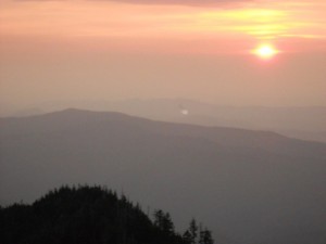
This year’s reservation was split into two hiking pairs.  Clark and Vic Hasler headed up Rainbow Falls Trail, while Steven Clark and Lindsey Renfro took the Alum Cave Trail up.  (Note:  The lodge register indicates that 90+% use this latter route.)  Clark Hasler had an up-close view of a bear which crossed the trail.  The clear and sunny day was 20oF cooler up on top, so a pleasant 50-70s versus the heat wave below.  Both groups arrived by early afternoon, thus time for naps and/or exploring.  After a rosy sunset, those in the office building were entertained by an informal bluegrass gig, playing in the light of kerosene lanterns, consisting of two guitars, a harmonica, and percussion using a plastic storage tub.  The morning had a crisp sunrise for any eyes that were open.  After breakfast, the two hiking pairs headed down with the Haslers taking the lesser used Bull Head Trail (only meeting two folks along the way).

F/B: Laurel Fork Falls Hike, Trip Report

Sunday June 24th, 2012
Ian Powell reporting

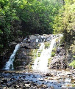
Vic Hasler and I quickly carpooled from Colonial Heights to the Hampton trail entrance.  The day was a hot one in the 90s.  This route to the falls is an easy 2.4 miles.  Once there, we saw Bob Peoples and family.  Vic went up the rock stairs to the “High Water” trail to check on some geocaches while I hiked back the original route until we met at their intersection.  Overall, we saw several snakes and lizards, plus plenty of roadside fireworks stands on the way home.  The wiki for this trail (link) was updated with photos and map trace.

AT: Hughes Gap to Little Rock Knob, Sunday August 26, 2012

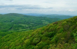
This hike is along the [[Iron Mountain Gap to Carver’s Gap|Appalachian Trail]] through hardwood forest to great views at Little Rock Knob (elevation 4918′).  The round trip distance is 4.6 to 5 miles with 900’ rise (similar climb to Bays Mountain Firetower trail but over 3-4 times the distance).  Let’s leave promptly at 1pm from the parking lot below [[Meeting locations for TEHCC hikes|McDonalds in Colonial Heights]] for the hour (45-mile) drive.  Bring water, snack, comfortable footwear, rain gear, bug spray, and trekking poles.  Expected return is by 7pm depending on our hiking speed and desire to tarry at the overlook.  Please call/e-mail the hike leader for headcount to arrange transportation.

Southeastern Foot Trails Coalition Gathering

Southeastern Foot Trails Coalition invites TEHCC members to Tennessee’s Cumberland Plateau Gathering in September.

Members of the 40 hiking and trail maintenance clubs in the Southeast interested in hiking the trails on the Cumberland Plateau or wanting to know more about all aspects of trails and trail building/maintenance are invited to the 7th biennial meeting of the Southeastern Foot Trails Coalition (SEFTC) at Fall Creek Falls State Park in southeastern Tennessee near Pikeville on the Cumberland Plateau on September 20-23, 2012, about 70 miles north of Chattanooga.

The SEFTC is a coalition of most all the hiking and trail maintenance organizations in the Southeast, representing over 40 such clubs from Florida to Virginia and Kentucky.

The coalition leadership has planned a fun and informative four days.  There will be numerous trail-related workshops led by experts in the field.  A variety of hikes are planned, both inside this 25,000-acre state park and in the surrounding state/protected areas of the Cumberland Plateau.  Trail fellowship and a wide exchange of ideas are part of the offering.  Special speakers and entertainment will be yours each evening.

Much of the beautiful lakeview lodge, cabins, and campground have been reserved by SEFTC for this weekend.  Part-weekend registration and attendance is available for those not able to be present the full time.

Early registration now is encouraged. Some fees go up August 1, and there is a limit to housing with almost no alternatives nearby outside the park.

Go to website www.southeastfoottrails.org to learn more about the conference and for the registration form.  The website provides the basic information with links to the pages for registration, housing, meals, workshops, and hikes.

July Maintenance Reports

Reporting: Richard Carter
Date: 6/26/2012
Purpose: Cut weeds
Location: Section 14b, Stan Murray Shelter to one mile south of shelter
People: Richard Carter
Summary: I cut weeds with a string trimmer along approximately the first mile south of the shelter, removed one minor blowdown, and did some lopping of bushes.

Reporting: Steve Wilson
Date: 6/30/2012
Purpose: Cut weeds and briars
Location: Section 3a, Abingdon Gap Shelter to Spring 2.3 Mile North of Low Gap
People: Steve Perri, Steve Wilson
Summary: Scythes were used to cut weeds and briars on this 3.5-mile section.  In spite of the dry weather, we found some stinging nettles were chest high and needed cutting.  The trail and water diversions looked good.  Water was found at the Abington Gap Shelter’s spring and at Double springs.  We gave two thru hikers, Squirrel Fist and Lunatic, a ride to Damascus on our way home.

Reporting: Bill Berry
Date: 6/30/2012
Purpose: Cut weeds and clear blowdowns
Location: Section 20b, Temple Hill to No Business Shelter
People: Bill Berry
Summary: I cut weeds, blazed, and cleared blowdowns.

Reporting: Terry Oldfield
Date: 7/1/2012
Purpose: Maintain Mountaineer Falls Shelter
Location: Section 12b, Walnut Mountain Road to Mountaineer Falls Shelter
People: Terry Oldfield
Summary: I hiked with my daughters and trimmed a few overhanging branches on the way to the shelter from Walnut Mountain Road.  At the shelter, we picked up trash and replaced the log book.  I also picked up some trash at Walnut Mountain Road.  Thanks to the Third-Saturday crew, the trail is in great shape and there wasn’t much trash to pick up.

Reporting: Carl Fritz
Date: 7/3/2012
Purpose: Cut blowdowns
Location: Section 2a, Backbone Rock Trail south for one mile
People: Carl Fritz, Bob Peoples
Summary: We used Backbone Rock Trail to access AT.  We cut four blowdowns, the largest being just a couple of hundred feet from AT on Backbone Rock Trail.

Reporting: Carl Fritz
Date: 7/3/2012
Purpose: Clear relocation
Location: Backbone Rock Trail
People: Dave Clark, Jim Foster, Pat Loven, Ted Mowery, Ed Oliver
Summary: Tuesday Crew cut and lopped growth in the relocation that ASU will work on. Fourteen-hundred feet have been prepared with flags and divided into seven sections of 200 feet each.

Reporting: Bill Berry
Date: 7/6/2012
Purpose: Inspect trail and clear blowdowns
Location: Section 20b, Spivey Gap to No Business Shelter
People: Bill Berry
Summary: I inspected the trail and cleared blowdowns.

Reporting: Brian Paley
Date: 7/12/2012
Purpose: Clear blowdowns
Location: Section 8, Wilbur Dam Road to Watauga Shelter
People: Brian Paley, Bob Peoples
Summary: We cleared several large blowdowns caused by the recent storms.

Reporting: Brian Paley
Date: 7/17/2012
Purpose: Clear blowdowns
Location: Section 12d, North of US19E toward Bishop Hollow
People: Brian Paley, Jim Chambers
Summary: We cleared one regular blowdown, one 24-inch step-around log, and two large clusters of blowdowns.

Reporting: Carl Fritz
Date: 7/17/2012
Purpose: Inspect trail on Round Bald
Location: Section 14b, Engine Gap to Carvers Gap
People: Paul Benfield, Ken Buchanan, Pat Buchanan, Dave Clark, Carl Fritz, Frank Klein,
Ted Mowery, Ed Oliver, Bob Peoples
Summary:
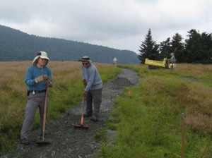
We inspected trail from Carvers Gap to Engine Gap and developed a plan for work to be completed with Konnarock Crew to hopefully finish major trail repairs to this section for twenty years.  Four of us went to Banner Elk to purchase supplies including rebar for this project.

Reporting: Tim McClain
Date: 7/21/2012
Purpose: Cut weeds
Location: Section 3b, Spring to US421
People: Tim McClain, Peggy McClain
Summary: We cut weeds and cut back limbs and woody growth on the south half of this section.

Reporting: Tim McClain
Date: 7/22/2012
Purpose: Cut weeds and remove blowdowns
Location: Section 3b, Spring to US421
People: Tim McClain
Summary: I finished cutting weeds on this section and removed six small blowdowns with a handsaw.

Reporting: Richard Carter
Date: 7/22/2012
Purpose: Cut weeds
Location: Section 14b, North side of Grassy Ridge
People: Richard Carter
Summary: I cut weeds and briars with a string trimmer along about three-quarters of a mile of trail on the north side of Grassy Ridge.


Intermediate Whitewater Kayak Clinic

Improve your fun and increase your proficiency with a class on paddling Class III-IV Whitewater.

Where: French Broad (Sect IX) or Nolichucky Gorge
When: Sat, Sep 1, 2012
Time: 8:00 am-5:00 pm (EST)
Cost: $60

The Intermediate Whitewater Kayak Course (IWWK) is one in a series of paddling clinics offered through the American Canoe Association (ACA). This one day course is designed to refine and extend the judgment and technique of intermediate paddlers on class III-IV whitewater, with significant focus on improving fundamentals, boat control and river running technique. If you are just getting comfortable on class III water or already have solid class III skills and want to take it the next level, this class is for you. It will he held either on the Nolichucky Gorge or French Broad Sect 9, dependent on water level and overall skill level of the group. Having a somewhat reliable roll is encouraged. Course will be limited to 10 people.  More info for what you need to bring and prerequisites.

Registration: download the form with link below, complete and return form with your check made out to Scott Fisher by August 25, 2012 to:
Scott Fisher, 109 Highland Gate Dr., Johnson City, TN 37615

Click Here for Registration Form