Spring Wildflower Hike April 7 – Margarette Falls

Joe DeLoach hike notice
(Scheduled for Saturday, April 7, 2012)

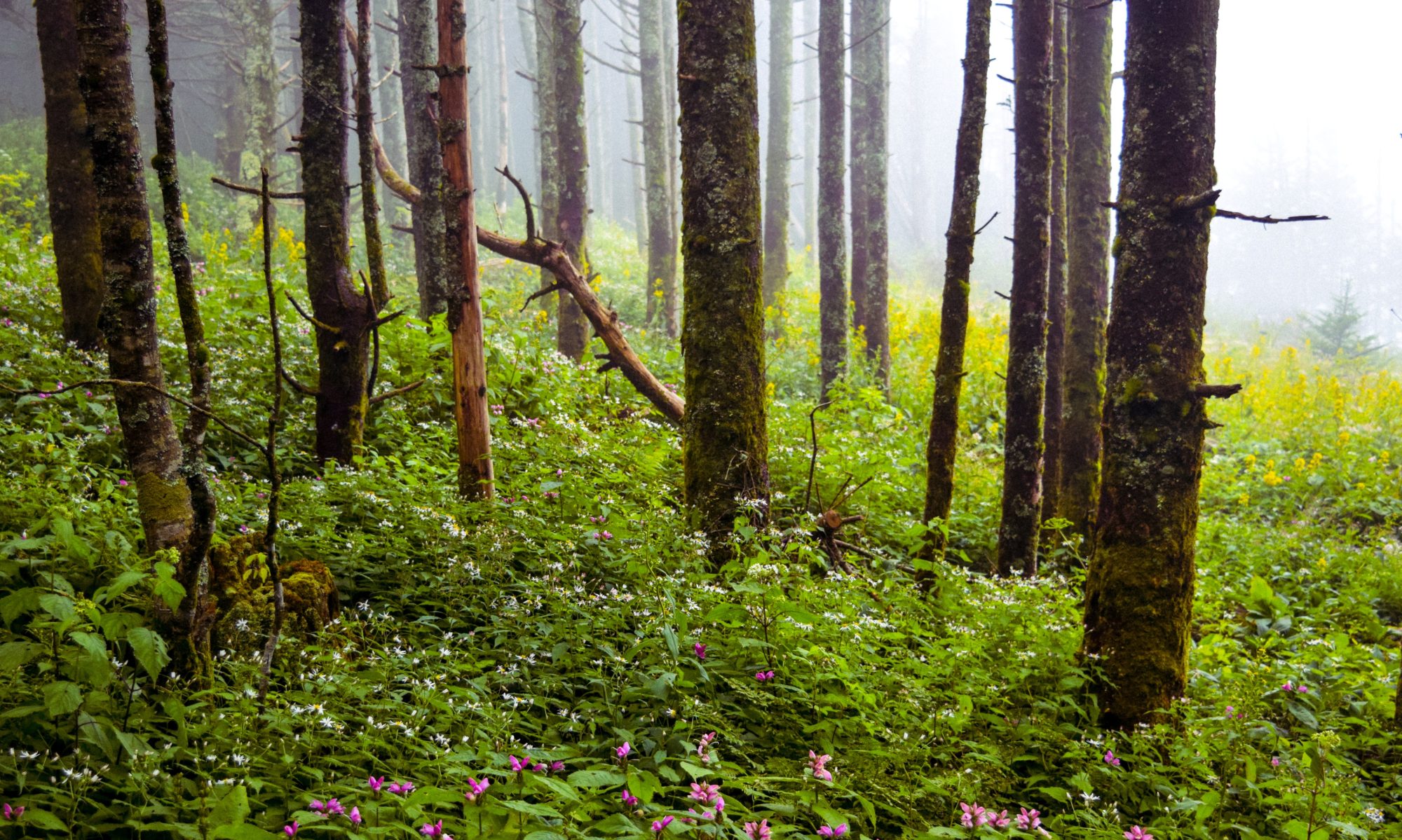
The combination of wildflowers and waterfalls has led to some popular Club hikes, and we’re hoping for the same with this short hike to Margarette Falls.  One of our prettiest area waterfalls, Margarette Falls drops about 60 feet and descends through a rocky canyon adorned by many spring flowers.  The Unaka Ranger District of the Cherokee National Forest has improved the trail with some relocation and a bridge, and the trail makes a great family hike suitable for young children.  Round-trip distance is about 3 miles with an elevation gain of around 700 feet; see [[Margarette Falls|our listing in the Trail Wiki]] for more information.  The flowers are early this year with all the warm weather, but early April can be cold, wet, and fickle so bring layers of clothes and good raingear.  We’ll meet at 9:00 AM in the parking lot between McDonald’s and State of Franklin Bank in Colonial Heights.  A meeting point in Boones Creek can be arranged for people who live towards Johnson City.  We’ll plan on lunch at the falls and get you back in the early afternoon.  Please contact Joe if you’d like to go or for more information.
From the Chair – March 2012

Vic Hasler, Steering Committee Chair – chair@tehcc.org  

In this column, I would like to highlight a few upcoming opportunities.  First is the Spring Dinner Meeting to hear the high moments and challenges of a thru-hiker – someone who used the national scenic trail that the club spends hours maintaining.  The second is a request for hike leaders to guide local Girl Scouts on easy sections of the AT during their centennial celebration in 2012.   Several hikes have been identified, so the need is for knowledgeable folks to explain the path to the girls.  Lastly (spouses, take note) is an alert to start cleaning those storage spaces where the equipment for outdoor activities is stashed.  TEHCC will again host a Gear Swap in April – with publicity forthcoming once the details are set.  Sell what is not being used to clear out the space, or swap for what you really want to try this year.  The club is active in several ways, so join in as you are available for your enjoyment.

New Chestnut Trail at Bays Mountain Park

Vic Hasler reporting

A new single track trail for beginning mountain bikers at Bays Mountain Park has been designed and constructed by Northeast Tennessee Mountain Bike Association.  While no trail signage or blazes exist yet, the designated “Chestnut Trail” is an easy 1.1 mile path running straight through the hardwood forest along the 1900 foot contour from Bays Mountain Road at the gate by the maintenance shop over to the Azalea Trail.   For a longer (~5 mile) loop hike/ride, take Chestnut Trail from the gate, then head up Azalea Trail to Big Oak Trail, down to Chinquapin Trail, and finally back on Lake Road.  Details for the new Chestnut Trail can be found on the [[BMP Chestnut Trail|trail wiki]].

The Week Ahead – October 17th

You may be thinking that with Fall quickly approaching (or is it here already?) the activities will be slowing down. Well they have according to our schedule, except for our Fall Dinner this Friday of course. Rehash your summer adventures with friends and good food from Firehouse Restaurant. Stick around for (or come just for) Toney Scales as he discusses the Southwest Virginia Trilogy: Natural Tunnel, the Breaks, and Cumberland Gap. Details in the newsletter.

Elk Knob – Saturday October 8

Leader: Joe DeLoach, 423-753-7263
Trail 4 miles round trip with 1000 ft elevation gain

North of Boone are some high but seldom visited mountains sometimes referred to as the Amphibolite Mountains, for the hard, alkaline rock that underlies them. The alkaline soil and high elevations create a habitat that harbors a large number of rare plants, with some species reaching their highest population density along the rocky cliffs and mountain bogs in this area. That scenery and biodiversity, coupled with a lack of public land, has led to land trusts working to preserve areas within these mountains such as Bluff Mountain and Long Hope Valley. One such area is [[Elk Knob State Park]]. In 2002, 5540′ Elk Knob was purchased by The Nature Conservancy and later conveyed to the State of North Carolina as first a natural area, then a state park. Initially the summit could be reached by a very steep gravel road, but some excellent trail construction work has resulted in completion of a new, hardened sidehill trail not unlike the A. T. heading up Round Bald. The new trail leads 2 miles to the top of Elk Knob which has two very nice overlooks, one at the summit looking north towards Mt. Rogers and the Grayson Highlands and one a little below the top looking south towards Grandfather and Roan Mountains. Though this is a great wildflower hike with many trillium in early May and Gray’s lilies and flame azalea in June, the Club’s first hike of Elk Knob will be a fall color hike. We’ll meet in Colonial Heights in the parking lot between McDonald’s and State of Franklin Bank on Saturday, October 8 at 8:30. We’ll have a pretty but curvy drive through Blountville and across Holston and Iron Mountains to Mountain City, then continue to Trade where gravel Rich Mountain Road crosses a high gap between Rich and Snake Mountains and deposits us near 4500′ Pottertown Gap, the entrance to Elk Knob State Park. We’ll take time to enjoy the woods along the way, the views and lunch at the top, and should be back to Kingsport by 4:00 pm. The hike is suitable for children; families are encouraged. Bring lunch, water, and layers of clothing including rain gear as October in the high country can be unpredictable. For more information or to sign up, please contact Joe.

Explore the Holston River series – Wadlow Gap to Weber City, June 18

Deb Reynolds reporting

The flat water series continued on 6/18 with a new section for me and most others.  We had a large group of eight folks who were looking for a relaxing paddle and new territory.  Jamie and Eric decided to go upriver a bit as we only expected to cover two miles today and they added on a mile or so.  The rest of us cruised on down to Weber City counting the times that I got stuck on the shoals.  The river was lower today with quite a few shoals.  I managed to show everyone how not to go down on the river.  I did triumph at the end, as I was the only one in the front group not to get stuck on the last set of shoals, but only because Kent went first to show me where not to go.  The river today was exceptionally clean and very very private.  Just like last time, we had a protective blue heron that flew ahead of us, waiting patiently for us to catch up before starting off again.  We just barely made it off the river before the thunder started.  I think Jamie and I were the only ones who were still strapping our kayaks on the cars when the sky opened up. Continue reading “Explore the Holston River series – Wadlow Gap to Weber City, June 18”

Friday Hikers: Carvers Gap to Grassy Ridge, June 17

Collins Chew reporting

We had ideal weather for our 4.8-mile hike from Carvers Gap to Grassy Ridge and return and then another 0.5 mile (about) hike through the Rhododendron Gardens.  Along the AT, the rhododendrons were upstaged by a nearly continuous, beautiful display of flame azalea with many colors showing.  The rhododendrons were also very nice, particularly near the top of Grassy Ridge and in the Gardens.  There were many other wildflowers, including American Mountain Ash, Grays Lily, bluets, ragwort, and more.  Many others shared our enjoyment of the day.  There was the usual stop for peaches as well.  Hikers were:  Olin Babb, Lee Bockman, Anne Cosby, Carol and Dave Dunham, Judith Foster, Bob Harvey, Jerry Sluder, Judy and Bill Tindall, Lowell Toof, first timers Rikki Rhoton and Sharon Trumley, and Collins Chew.

Friday Hikers: AT – Braemar to Shook Branch, June 10

Collins Chew reporting

We hiked from Braemar over Pond Mountain on the AT to Shook Branch to measure a new relocation near the top of Pond Mountain.  The relocation measured 1851 feet long and the entire section ended up 0.1 miles shorter than the guide book distance.  We walked about 7 miles including the mile on the blue-blaze trail from Braemar.  There were a fair number of wildflowers with Mountain Laurel the showiest.  I was also fascinated by the white and pink-flowered shrub at low elevations at both ends.  I guess it is Corymbed Spirea.  The flower spikes of Galax got the most comments.  Some flame azalea was still blooming.  Hikers were:  Bob Harvey, Lowell Toof, and Collins Chew.

Fun Fest 2011 Moon Light Hike at Bays Mountain Park

Ian A. Powell Reporting

TEHCC needs your help. On Thursday July 21 the club is co-sponsoring a moon light hike at Bays Mountain Park. For those who haven’t attended or volunteered, it’s a fun 2.4 mile hike along [[BMP Lakeside Trail|Lakeside Trail]]. It kicks off at 8 o’clock and goes to about 10 PM. Previous community attendance has been in the 200’s.  The club needs people to help with head count and to help guide attendees through trail intersections. Volunteers should meet on the end of the dam closest to the visitors center at 7:30 PM. All that volunteers need to bring are a flashlight and insect repellant.  Please contact Tom Boyd at tomboyd@eastman.com or call 229-1395 if you would like to volunteer/help with the event. Please contact Tom if you plan to help out so that we can ensure we have enough people to support the event. Hope to see you there.