For the Record: A.T.: Fall Colors at Osborne Farm, Sunday, October 11, 2015

Vic Hasler Reporting

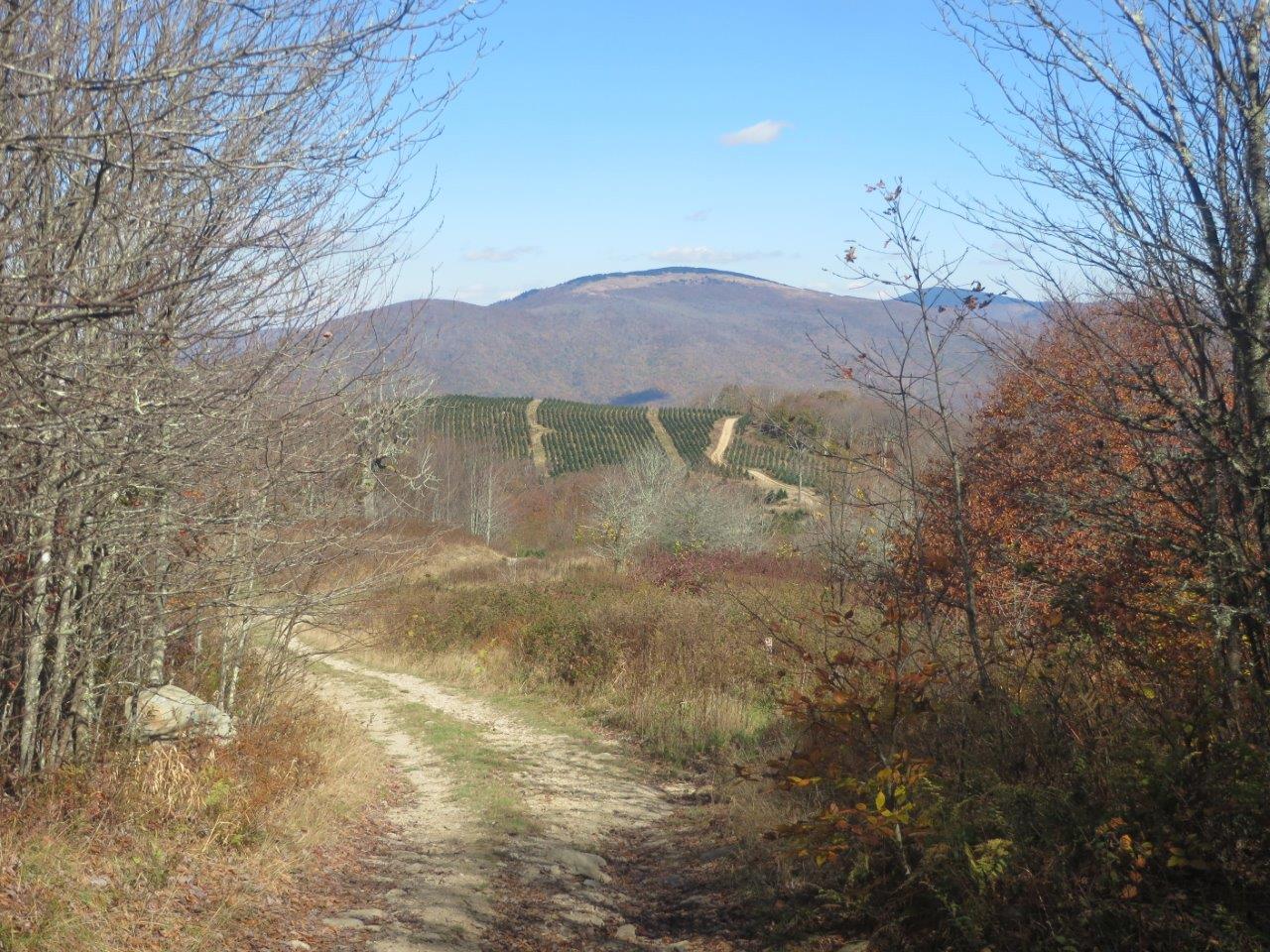
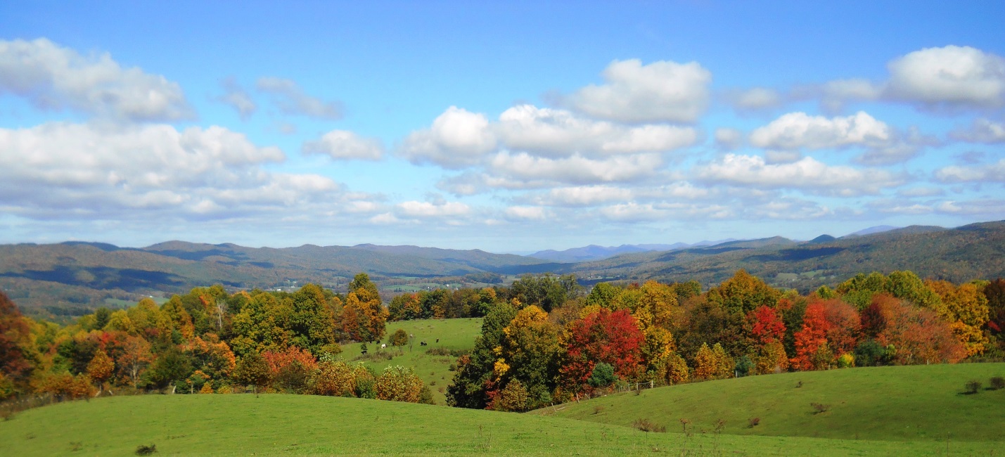
The cold and rainy day prior turned into a beautiful autumn Sunday afternoon; however, I ended up hiking alone, although a dozen backpackers were seen proceeding north on the Trail and one south. The fall color was a few days before peak with some individual trees providing dazzling displays. The hike started as planned with the 0.8-mile crossing of the open farm pasture with views north up the valley. The cattle were ready to be let in from the middle field to be fed at the barn. The walk continued roughly another half hour into the woods, and then returned to the parking lot. I decided to check out the new trail relocation south of the Cross Mountain parking lot, so proceeded a mile south just past the bog bridges. The falling leaves allowed the tread to be less muddy. With the remaining afternoon, I visited two places at Shady Valley managed by The Nature Conservancy at Schoolyard Springs and Orchard Bog. The winding drive on US 421 was enjoyed in the fading daylight.

osborne farm
Looking north from Osborne Farm

For the Record: Rogers Ridge Horse Trail, October 17, 2015

Tim Schaefer reporting October 17th 2015

A Rogers_Ridge_Balds_View_2
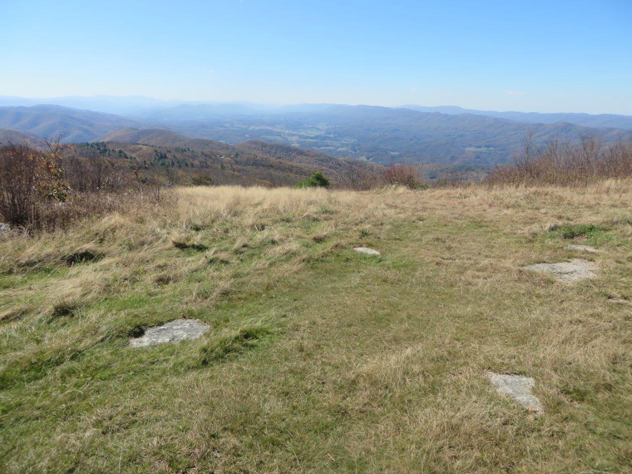
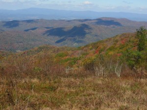
day prior, we decided to do a last minute change up. Based on prior reports of the fire tower being popular for fall hikers we decided to look for a road less traveled. We settled on Rogers Ridge Horse Trail. See the wiki page or this month’s Feature of the Month for technical trail details, but it turned out to be a fantastic day of hiking. With our few side trips, the GPS logged us for a 15.5 mile day of hiking. It was also a very solitary hike. On a weekend when many should have been heading out to bald vistas like this, we saw absolutely no one except for a couple in a truck near the Tri-State Corner Knob of TN-VA-NC. Although we had decent glimpses of the surrounding ridges, we were truly rewarded at 5.33 miles when we entered the first bald clearing. We took a side trip to the left for some early views before resuming the ridge hike to the right. A vandalized cabin on the bald ridge peak of Stone Mountain, provided many topics of conversation. We completed the outbound hike with a view of the prior mentioned Tri-State Corner Knob. Some maps suggested that we could have returned by way of the doing Gentry Creek Falls in the reverse, but how was not clear. After hiking 8+mi at that point, we didn’t want to inadvertently add a few more by taking a wrong turn to only have to turn back. Overall the trail was fairly well marked for the specified trail, but none of the many well used connections were marked. Also, despite many signs at the trail head saying differently, the trail is obviously used routinely by Off-Road Vehicle riders. Joining me on this hike was Charlie Outlaw.

Rogers_Ridge_Whitetop_and_Mt_Rogers
View of Whitetop Mountain and Mt. Rogers near Tri-State Corner Knob
Rogers_Ridge_Balds_View_3
View from the balds
NC-VA-TN_Corner_triangulation_station_disk
View of the survey marker at the junction of TN-VA-NC

The Search for Wild Ponies of Grayson Highlands

Event Date: October 9, 2014

Garry S. Luttrell, reporting

Our son Billy, his wife Joy, and seven kids, are becoming missionaries, serving the Caribbean Ministries Association of Chattanooga. They have heard me talk about Grayson Highlands and the ponies. They decided to add seeing the ponies to their “Bucket List” of things to do before they leave the country. The original plan was to leave Joy and the three youngest at our house; but at the last minute, they decided that everyone would go, even 10 month old Zeke. And, it was a good decision: the Fall colors were great, it was a lovely day, we saw lots of ponies, as seen in the photos. As we were driving on HW 58 back to Tennessee, we noticed a black cloud in the western sky. We were told that the only gas station for miles around in any direction was at Whitetop Mtn, but before we could pump enough gas to make it home, the sky opened-up, and you guessed it – it rained by the buckets full. On the next day, the rain, forced us to postpone the next “Bucket List” item: Canoeing on Warrior’s Path Lake.

Trip Report – Keokee Lake Loop Trail

Reporting: Terry Dougherty
Trip Date: September 21, 2014

We started our four mile hike on the eastern side of the lake in very light rain.
The trail was in poor condition with lots of over growth, 15 or more blow downs,
many foot log bridges rotted out, but the trail tread was good. There were very
limited views of the lake from that side. After 3 mi. of borderline bushwhacking we
came to the dam with very nice views of the lake. The trail was well marked, but the last serious maintenance was probably ten or more years ago for that side of the lake.
The mile of trail from the dam back to the starting point on the western side was in very good condition with nice views of the lake. A few ducks was the only wildlife we saw.
This area is isolated and if one wanted to hike without seeing anyone this might
be a good place. Hikers were Mary Tennant ,Thresa and Terry Dougherty.

Trip Report – Pinnacle Mountain Fire Tower

Reporting: Barry Griggs
Trip date: 10/19/14

What a beautiful day for a fall hike in the mountains of east Tennessee! We honestly could not have ordered a more perfect day. Our illustrious group of seven gathered at the trailhead to begin our nine-mile round-trip up to Pinnacle Mountain Fire Tower. The restrooms in the relatively new building at the trailhead provide a convenient beginning in preparation for the lengthy hike.
Several other hikers and bikers were also taking advantage of the beautiful day to get out and enjoy God’s creation. The trails many switchbacks make the trail probably the most doable 4.5-mile hike up a mountain anywhere in these parts. It can be completed by even the most casual hiker with a few rest stops on the way if necessary. While leaves are on the trees, the trail is shaded the whole way. The 360-degree views from the top of the tower were spectacular with the reds and yellows really outstanding! Although overall peak color was probably just a few days away, there were many trees that were already in full color. The bright blue sky and clear air allowed maximum visibility for many, many miles.
The hike downhill back to the parking area went very quickly and our group headed for home with mental pictures of beautiful views and several new friends among fellow hikers and lovers of the outdoors. Hikers were Zhufang Liu, Junjia Liu, Lin Liu, Jackie Liu, Jinghua Yuan, Jim Floyd and Barry Griggs.

Trip Report-Tweetsie Trail

Barry Griggs reporting
Trip date: September 28, 2014

On a warm, but comfortable Sunday afternoon our hike began at the trailhead at the intersection of Legion Street and Alabama Street in Johnson City, TN. The parking lot at the trailhead was overflowing, but parking was available in other nearby gravel areas. The trail is obviously very popular with walkers, runners and bikers, especially on weekends, as we were never out of sight of one or more people. With two cancellations and one no-show, this became a Griggs/Metcalf family hike. My wife Beverly and I were joined by our daughter, Jill Metcalf and her husband, Josh Metcalf. We walked out two miles and back to make it a four-mile hike. The trail has markers every 0.2 miles, so it’s very easy to make the walk/ride whatever distance you like. The finished portion of the trail from JC to Elizabethton is 4.5 miles. It should be a very easy walk for most anyone, with a slight uphill grade when returning to JC. The trail is a very nice addition to our region.

Trip Report – Devils Bathtub Hike

Terry Dougherty reporting
Hike date: June 8th

This started out as trip to Lake Keokee, but the leader was out voted by popular
demand. The water level was low in Devils Fork which made the fifteen or so
creek crossings much easier. There were lots of hikers on the trail that day
because of the good weather. Attending were Brenda Hitch, Gabriela Bruggeman, Thresa Dougherty, and Terry Dougherty.

Trip Report – Bays Mountain Bays Ridge Loop

Tim McClain reporting
Hike date: August 17th

Another in the TEHCC Sunday Hike series, on August 17th the featured hike was in Kingsport at Bays Mountain. The Bays Ridge Loop covers about 5.3 miles to the southwestern side of the park and back. Weather was warm but rain free for a pleasureable Sunday outing. Enjoying this hike were Peggy McClain and Tim McClain.

Purchase Ridge Trail – Trip Report

Barry Griggs Reporting
Hike Date: Aug 24, 2014

The warm, sunny afternoon with a chance of thundershowers did not deter our feisty group of hikers. They weren’t even too discouraged by the leader’s difficulty in locating the planned starting point for the hike – a little whiny, but not discouraged. My wife, Beverly, and I met good friends, Lowell and Betsy Biller at Natural Tunnel State Park to hike the Purchase Ridge trail. The plan was to get on this trail in the campground, compete the loop at the end of this trail and return via the Cabin Trail and the campground road.
The starting point proved to be a little hard to find, so it was decided to do the planned route in reverse. We walked up the road to the Cabin Trail and hiked to where it joined the Purchase Ridge Trail. Since we had already some extra walking on the Gorge Ridge Trail to Lover’s Leap Overlook and because of more whining from certain hikers, it was decided to omit the loop and head back to our originally planned starting point on the Purchase Ridge Trail. It was cooler after we actually got in the woods on the trail. The leader no longer feared a mutiny. But seriously, it was a fun afternoon with friends in a beautiful part of our region. Our total distance was about 3.5 miles, not much more than the 3.25 we had planned.
We discovered the planned starting point is actually off the right side of the road about 100 yards past the camp store. It is off the road several yards at the edge of the woods and there is no sign marking the trail by name. There is a sign showing all the trails, but it’s easy to miss if driving down the road.