Trip Report: Rocky Fork White House Cliffs

Tim McClain Reporting
Sunday July 13, 2014

The first thing we saw when arriving at the Rocky Fork parking area was a whole lot of cars – a rare sight for this area! The second thing we saw, and the explanation for all the parked cars, was a church group gathered at the creek bank for a baptism surrounded by some of the prettiest scenery for many miles. After finding our own parking spots, five of us made the relatively short but steep trek to the top of the first high point inside Tennessee’s newest State Park. The weather was hot and muggy, but rhododendrons were still blooming in the shady forest. A branch trail, which is on the right about 1/2 mile up the main trail from the parking area, leads up the White House Cliffs. The route has some flags marking the way, but it is by no means a well-established trail. Vic Hasler turned this hike into somewhat of a work trip too as he brought clippers and a GPS to get the trail route recorded in his GPS (to be posted on our Trail Wiki). Vic also was able to locate 3 or 4 geocaches along the trail. Those participating in the hike were Vic Hasler, William Werner, Jianhui Zhou, Xiaofang Dong, and Tim McClain. This hike would also be a great fall color hike as the destination provides a very rewarding 360 degree view from the top (approximately 3300 ft elevation).

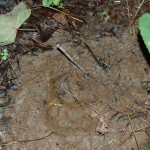
Fresh Bear Tracks!
Fresh Bear Tracks!
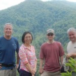
Left to Right: Tim McClain, Xiaofang Dong, William Werner, Vic Hasler
2014-07 White House Cliffs 02
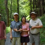
Left to Right: William Werner, Jianhui Zhou, Xiaofang Dong, Vic Hasler

Hike Report: Rocky Fork—Flint Creek Battle Site, Nov 10, 2013

Vic Hasler reporting
On a gorgeous, late fall, Sunday afternoon, one car carrying David Kossor, Gerald Scott, Marc Schurger, and Vic Hasler took the 50-minute drive to the trailhead arriving at 2PM. With an early 5:30PM sunset, long shadows were already creeping into the valley. Leaves thickly covered the gravel road which runs along the cascading Rocky Fork stream. Back on wintery January 10, 1789 morning, John Sevier and his men had to walk or ride horses in snow along or in the cold flow – pulling “grasshopper” field cannon with three pound balls/canister shot. A portion of the troops were also sent over Flint Mountain to close the retreat path. Upon reaching Flint Creek, we discovered that a large blowdown across the stream has been converted into a simple bridge, thus affording a quick and dry passage. The Indian encampment site was in the bottomlands where the two creeks merged. Sevier reported determining their exact location from the smoke of their campfires. The wet weather caused the gunpowder to not function, so the battle quickly evolved into hand-to-hand combat with sword and tomahawk. The encounter was no longer than an hour, leaving a “bloody field” per the governor’s report. For the hikers, we could see the regrowth forest in the lowlands, but could only imagine what occurred on that snowy morning. We hiked to the upper end where the Flint Trail continues following the creek up to the ridgeline at the A.T., and then turned back. A nice easy three-mile hike was enjoyed.  Some will be back next year to pursue fishing, and a hike to the top of White House Cliffs as a newly cut trail was observed.