Shelter:McQueens Knob: Difference between revisions
Jump to navigation
Jump to search
(→Photo Gallery: Added photo from TEHCC image library) |
(→Location: Adding information found on old website) |
||
| Line 5: | Line 5: | ||
== Location == | == Location == | ||
<!-- describe general location info --> | <!-- describe general location info --> | ||
Mile south of Abingdon Gap Shelter. Nearby used to be a fire tower (long dismantled). | On Holston Mountain between Damascus and U.S. 421. Mile south of Abingdon Gap Shelter. About 30 feet from the AT. Nearby used to be a fire tower (long dismantled). | ||
== Water == | == Water == | ||
Revision as of 21:35, 12 April 2012
Description
Emergency shelter built of logs suitable for three or four in a pinch. Built in 1934, thus one of the oldest along the entire AT. Also known as the "Holiday Inn".
Location
On Holston Mountain between Damascus and U.S. 421. Mile south of Abingdon Gap Shelter. About 30 feet from the AT. Nearby used to be a fire tower (long dismantled).
Water
No water source near this emergency shelter.
Maintenance History
- 2008: Metal roof did not leak during heavy rain.
- 1934: Originally constructed.
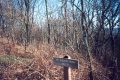
Photo Gallery
3883 Feet McQueens Knob

| Shelter name | Section | Trail distance from Damascus |
|---|---|---|
| Abingdon Gap Shelter | US421 to Damascus | 10.2 |
| McQueens Knob Shelter (emergency shelter) | US421 to Damascus | 11.7 |
| Double Springs Shelter | TN91 to US421 | 18.5 |
| Iron Mountain Shelter | Wilbur Dam Rd to TN91 | 26.2 |
| Vandeventer Shelter | Wilbur Dam Rd to TN91 | 33.0 |
| Laurel Fork Shelter | Dennis Cove Rd to Wilbur Dam Rd | 49.5 |
| Moreland Gap Shelter | US19E to Dennis Cove Rd | 57.0 |
| Mountaineer Falls Shelter | US19E to Dennis Cove Rd | 66.6 |
| Stan Murray Shelter | Carver's Gap to US19E | 86.5 |
| Roan High Knob Shelter | Iron Mountain Gap to Carver's Gap | 91.7 |
| Clyde Smith Shelter | Iron Mountain Gap to Carver's Gap | 100.2 |
| Cherry Gap Shelter | Indian Grave Gap to Iron Mountain Gap | 109.3 |
| Curley Maple Gap Shelter | Nolichucky River to Indian Grave Gap | 122.2 |
| No Business Knob Shelter | Spivey Gap to Nolichucky River | 132.7 |
Per the 2021 AT Data Book.