Search results
Jump to navigation
Jump to search
Page title matches
- 244 bytes (33 words) - 11:59, 2 December 2018
- ...distance, thus reported for annual data book update. This page, like the trail itself, is a work in progress to figure out how to best use the available t <br>- Backbone Rock Trail (blue blaze)7 KB (1,010 words) - 12:12, 7 January 2023
- {{Trail |Trail Highlight=Your likely trail if you want to "go to The Channels"6 KB (906 words) - 10:47, 8 January 2023
- |Trails=Ewing Trail |Trail Condition=Clear1 KB (224 words) - 18:13, 14 July 2023
- {{Trail |Trail Highlight=Starting waterfall, view of the Powell River Valley5 KB (783 words) - 22:37, 27 July 2020
File:Trail Wiki Layout.png (1,006 × 541 (28 KB)) - 00:27, 12 December 2019- {{Trail |Trail Marking=White6 KB (1,004 words) - 13:20, 11 July 2021
- {{Trail |Trail Marking=Signs2 KB (310 words) - 15:29, 10 November 2019
- This category was created to flag trail pages without a KML on their map3 members (0 subcategories, 0 files) - 21:26, 29 August 2015
- {{Infobox Trail | Trail Use = {{Hike}}{{Dogs}}{{Camping}}6 KB (880 words) - 12:12, 7 January 2023
- {{Trail |Trail Highlight=Loop with a waterfall and a rhododendron tunnel2 KB (251 words) - 07:58, 29 August 2020
- {{Trail |Trail Highlight=Look out over Cherokee Lake or also walk down to the water4 KB (566 words) - 21:12, 11 September 2020
- Hike Report: Roaring Branch Trail up to High Butte, March 19th, 2011 ...en, except for several species of birds and a small snake on a rock in the trail.1 KB (209 words) - 16:25, 22 March 2011
- -->{{Infobox Trail | Trail Use = {{Hike}}4 KB (580 words) - 12:12, 7 January 2023
- hike report for the Elk Park Trail written by Bill Stowell in Oct 1998 Elk Park Trail to Houston Ridge, December 8, 2007, Vic Hasler reporting219 bytes (33 words) - 21:56, 5 April 2011
- 23 bytes (2 words) - 11:42, 27 September 2015
- {{Trail |Banner Image=File:BMP Dolan Branch Trail waterfall.JPG5 KB (746 words) - 07:45, 15 December 2019
- {{Trail |Banner Image=File:BMP Firetower Trail tower.jpg3 KB (416 words) - 16:10, 10 November 2019

File:Towhee trail profile.png |File name=Towhee trail profile.png |Trail=Towhee Trail(1,160 × 660 (23 KB)) - 23:27, 15 December 2019
File:Hemlock trail profile.png |File name=Hemlock trail profile.png |Trail=Hemlock Trail(1,160 × 660 (23 KB)) - 15:40, 15 December 2019


Page text matches

File:Little stony creek falls profile.png |Trail=Little Stony Creek Falls |Caption=Trail Profile(1,160 × 660 (22 KB)) - 11:15, 19 January 2020- |Trail Map Link=https://www.fs.usda.gov/Internet/FSE_MEDIA/fseprd491178.jpg {{Park trail map}}2 KB (333 words) - 15:49, 19 January 2020
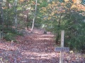
- ...lonial Heights for the 75 minute drive. For further information, check the trail wiki links or call/e-mail the hike leader. ...plans were to potentially partner with The Clinch Coalition to reroute the trail – especially above the first bridge from the recreation area.5 KB (876 words) - 16:36, 15 March 2014
File:Lakeside Trailhead from Dam.jpg |Trail=Lakeside Trail(600 × 450 (104 KB)) - 20:11, 10 November 2019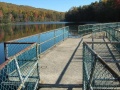
File:Lakeside Trail - Bays Mountain Dam.jpg |File name=Lakeside Trail - Bays Mountain Dam.jpg |Trail=Lakeside Trail(600 × 450 (84 KB)) - 20:14, 10 November 2019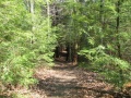
File:Lakeside trail - evergreen grove.jpg |File name=Lakeside trail - evergreen grove.jpg |Trail=Lakeside Trail(500 × 375 (83 KB)) - 20:11, 10 November 2019
File:Lakeside Trail - former aviary area.jpg |File name=Lakeside Trail - former aviary area.jpg |Trail=Lakeside Trail(600 × 450 (69 KB)) - 20:13, 10 November 2019
File:Lower Kiner Hollow Falls.jpg |Trail=Laurel Run Trail(768 × 1,024 (239 KB)) - 15:36, 10 November 2019- {{Trail |Trail Marking=White6 KB (1,004 words) - 13:20, 11 July 2021
- {{Trail |Trail Marking=Signs2 KB (310 words) - 15:29, 10 November 2019

File:GPS edit that needs enter.png Trail form GPS edit that needs to be committed.(920 × 282 (77 KB)) - 00:42, 13 December 2019- |Trail Condition=Clear |Trail Comment=Trail ok. Lots of downed leaves as to be expected.369 bytes (58 words) - 20:28, 13 December 2019
- This category was created to flag trail pages without a KML on their map3 members (0 subcategories, 0 files) - 21:26, 29 August 2015
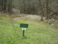
File:Kiner Hollow Trailhead in Laurel Run Park.jpg |Trail=Laurel Run Trail |Caption=Trailhead for Laurel Run Trail - photo by Vic Hasler(768 × 576 (164 KB)) - 15:35, 10 November 2019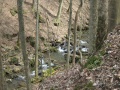
File:Laurel Run Trail creek.jpg |Trail=Laurel Run Trail |Caption=Cascading creek below the Laurel Run Trail - photo by Vic Hasler(768 × 576 (175 KB)) - 15:36, 10 November 2019- {{Infobox Trail | Trail Use = {{Hike}}4 KB (628 words) - 11:14, 30 July 2018
- {{Trail |Banner Image=File:Devils Bathtub Trail splash pool.jpg7 KB (1,066 words) - 23:10, 10 January 2020
File:Devils bathtub profile.png |Trail=Devil's Bathtub(1,160 × 660 (24 KB)) - 23:04, 10 January 2020- -->{{Infobox Trail | Trail Use = {{Hike}} {{Skiing}}4 KB (508 words) - 11:21, 21 November 2015
- {{Trail |Trail Highlight=Access to the Sand Cave and White Rocks (the colloquially known n7 KB (1,173 words) - 23:19, 27 November 2019


