|
|
| Line 1: |
Line 1: |
| <!-- The following few lines create the "Infobox" table template. Please scroll down to edit the main content of the article. --> | | <!-- The following few lines create the "Infobox" table template. Please scroll down to edit the main content of the article. --> |
| {{Infobox Trail | | {{Infobox Trail |
| | Image Name = BMP_Chestnut_Trail1.JPG
| | | Image Name = BMP_Chestnut_Trail1.JPG |
| | City = Kingsport
| | | Park = Bays Mountain Park |
| | State = Tennessee
| | | City = Kingsport |
| | Marking = Junction Signs
| | | State = Tennessee |
| | Trail Use = {{Hike}} {{Biking}} {{Dogs}}
| | | Marking = Signs |
| | Difficulty Rating = Easy
| | | Trail Use = {{Hike}} {{Biking}} {{Dogs}} |
| | Hike Time = 0.5
| | | Difficulty Rating = Easy |
| | Distance = 1.6
| | | Hike Time = 30 Min |
| | Elevation Gain = 213
| | | Round Trip Distance = 3.2 Mi |
| | High Point = 2151
| | | Trail Distance = 1.6 Mi |
| | Latitude = 36.50724
| | | Trail Type = Segment |
| | Longitude = -82.60955
| | | Elevation Gain = 213 Ft |
| | Medical = Kingsport, TN
| | | Elevation Loss = |
| | | High Point = 2,151 Ft |
| | | Parking coords = 36.508821,-82.609545 |
| | | Trailhead coords = 36.50724,-82.60955 |
| | | Medical = Kingsport, TN |
| }} | | }} |
| <!-- End Infobox template table--> | | <!-- End Infobox template table--> |
|
| |
| <!-- Start of Main Page --> | | <!-- Start of Main Page --> |
|
| |
| == Trail Overview == | | == Trail Overview == |
| <!-- Enter a overview of the trail. What attracts you to this trail, points of interest, types of flowers, lakes, and peaks that you see along the way. --> | | <!-- Enter a overview of the trail. What attracts you to this trail, points of interest, types of flowers, lakes, and peaks that you see along the way. --> |
| Line 45: |
Line 47: |
| Green line is the Chestnut Trail. Yellow is Azalea Trail. Red line on the left (NW) is the Big Oak Trail. Red trace on the right (SE) is Bays Mountain Road. | | Green line is the Chestnut Trail. Yellow is Azalea Trail. Red line on the left (NW) is the Big Oak Trail. Red trace on the right (SE) is Bays Mountain Road. |
|
| |
|
| <googlemap version="0.9" lat="36.516" lon="-82.612" type="terrain" zoom="14" width="625" icons="http://tehcc.org/clubwiki/kml/marker{label}.png"> | | <display_map center="36.516,-82.612" type="terrain" zoom="14" width="auto" height="550" gkml="http://tehcc.org/clubwiki/kml/BMP_Chestnut_Trail.kml, |
| http://tehcc.org/clubwiki/kml/BMP_Chestnut_Trail.kml | | http://tehcc.org/clubwiki/kml/BMP_lake_road.kml, |
| http://tehcc.org/clubwiki/kml/BMP_lake_road.kml | | http://tehcc.org/clubwiki/kml/BMP_bays_mountain_road.kml, |
| http://tehcc.org/clubwiki/kml/BMP_bays_mountain_road.kml | | http://tehcc.org/clubwiki/kml/BMP_Azalea_Trail.kml, |
| http://tehcc.org/clubwiki/kml/BMP_Azalea_Trail.kml | | http://tehcc.org/clubwiki/kml/BMP_Big_Oak_Trail.kml"> |
| http://tehcc.org/clubwiki/kml/BMP_Big_Oak_Trail.kml | |
|
| |
|
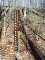
| (G) 36.50724,-82.60955
| | 36.50724,-82.60955~Trailhead at Bays Mountain Road~[[Image:BMP_Chestnut_Trail1.JPG|50px]]~MarkerT.png |
| Trailhead at Bays Mountain Road | | 36.52238,-82.59285~Trailhead at Azalea/Big Oak~[[Image:BMP_Chestnut_Trail3.JPG|50px]]~MarkerT.png |
| [[Image:BMP_Chestnut_Trail1.JPG|50px]] | | </display_map> |
| (G) 36.52238,-82.59285
| |
| Trailhead at Azalea/Big Oak | |
| [[Image:BMP_Chestnut_Trail3.JPG|50px]] | |
| </googlemap> | |
|
| |
|
| == Photos == | | == Photos == |
| Line 71: |
Line 68: |
| <!-- Finally add the trail to any Categories it should belong to. --> | | <!-- Finally add the trail to any Categories it should belong to. --> |
| [[Category:Tennessee]] [[Category:Kingsport]] [[Category:Bays Mountain Park]] [[Category:Easy]] [[Category:Hiking]] [[Category:Biking]] [[Category:Dog Friendly]] | | [[Category:Tennessee]] [[Category:Kingsport]] [[Category:Bays Mountain Park]] [[Category:Easy]] [[Category:Hiking]] [[Category:Biking]] [[Category:Dog Friendly]] |
| | {{#set: |
| | |Trail page needs=Updated KML;Remove prefixes;Detail route description;Photos;Remove trail in name;Update infobox;Trail pins;Update mileage|+sep=; |
| | }} |
|
|
|
|
|
| Trail Name
|
Chestnut Trail
|
| Park
|
Bays Mountain Park
|
| Nearest City
|
Kingsport
|
| State
|
Tennessee
|
| Trail Marking
|
Signs
|
| Trail Use/Features
|
  
|
| Difficulty Rating
|
Easy
|
| Hiking Time
|
30 Min0.5 Hours <br />0.0313 Days <br />
|
Distance:
round-trip/trail only
|
3.2 Mi5.15 km <br /> / 1.6 Mi2.575 km <br />
|
| Trail Type
|
Segment
|
| Climb/Descent Elevation
|
213 Ft64.922 Meters <br /> /
|
| High Point
|
2,151 Ft717 Yards <br />655.625 Meters <br />
|
| Parking
|
36° 30' 31.76" N, 82° 36' 34.36" W
|
| Trailhead
|
36° 30' 26.06" N, 82° 36' 34.38" W
|
| Nearest Medical
|
Kingsport, TN
|
| Trip Reports
|
Click Here
|
|
|
Loading map... {"type":"ROADMAP","minzoom":false,"maxzoom":false,"types":["ROADMAP","SATELLITE","HYBRID","TERRAIN"],"mappingservice":"googlemaps3","width":"270px","height":"180px","centre":false,"title":"","label":"","icon":"","lines":[],"polygons":[],"circles":[],"rectangles":[],"copycoords":false,"static":false,"visitedicon":"","wmsoverlay":false,"zoom":8,"layers":[],"controls":["zoom"],"zoomstyle":"DEFAULT","typestyle":"DEFAULT","autoinfowindows":false,"resizable":false,"kmlrezoom":false,"poi":true,"cluster":false,"clustergridsize":60,"clustermaxzoom":20,"clusterzoomonclick":true,"clusteraveragecenter":true,"clusterminsize":2,"imageoverlays":[],"kml":[],"gkml":[],"searchmarkers":"","fullscreen":false,"scrollwheelzoom":false,"locations":[{"text":"","title":"","link":"","lat":36.5088209999999975252649164758622646331787109375,"lon":-82.609544999999997116901795379817485809326171875,"icon":""}]} |
|
| Show Large Map
|
|
Trail Overview
Located in Bays Mountain Park. Beginner single track mountain biking trail constructed by the Northeast Tennessee Mountain Bike Association. Good for an easy ride or hike through hardwood forest.
How to get there
From the main parking lot, head up Bays Mountain Road to the locked service gate near the maintenance parking area. To the west is the marked trail heading into the forest. Or take Lake Road around to Azalea Trail and head uphill to the other end.
Route Description
Straight level (< 1% grade) 1.6 mile single track biking path through the forest. (Trailhead sign says 1.7 mi., but measured 1.6 mi. twice.)
For a 70 minute loop hike, take Chestnut Trail from the gate to Big Oak Trail, and back on Lake Road.
For a 5 mile loop hike/ride, start with the same route, but from Big Oak Trail take the Chinquapin Trail around to Lake Road.
Typical Conditions
Hard packed trail with groove down the middle from the mountain bikes. No designed passing zones, so be careful of riders coming both ways!
Misc. Information
Maps
Green line is the Chestnut Trail. Yellow is Azalea Trail. Red line on the left (NW) is the Big Oak Trail. Red trace on the right (SE) is Bays Mountain Road.
Loading map...
{"type":"TERRAIN","minzoom":false,"maxzoom":false,"types":["ROADMAP","SATELLITE","HYBRID","TERRAIN"],"mappingservice":"googlemaps3","width":"auto","height":"550px","centre":{"text":"","title":"","link":"","lat":36.51599999999999823785401531495153903961181640625,"lon":-82.611999999999994770405464805662631988525390625,"icon":""},"title":"","label":"","icon":"","lines":[],"polygons":[],"circles":[],"rectangles":[],"copycoords":false,"static":false,"visitedicon":"","wmsoverlay":false,"zoom":14,"layers":[],"controls":["pan","zoom","type","scale","streetview","rotate"],"zoomstyle":"DEFAULT","typestyle":"DEFAULT","autoinfowindows":false,"resizable":false,"kmlrezoom":false,"poi":true,"cluster":false,"clustergridsize":60,"clustermaxzoom":20,"clusterzoomonclick":true,"clusteraveragecenter":true,"clusterminsize":2,"imageoverlays":[],"kml":[],"gkml":["http://tehcc.org/clubwiki/kml/BMP_Chestnut_Trail.kml","http://tehcc.org/clubwiki/kml/BMP_lake_road.kml","http://tehcc.org/clubwiki/kml/BMP_bays_mountain_road.kml","http://tehcc.org/clubwiki/kml/BMP_Azalea_Trail.kml","http://tehcc.org/clubwiki/kml/BMP_Big_Oak_Trail.kml"],"searchmarkers":"","fullscreen":false,"scrollwheelzoom":false,"locations":[{"text":"\u003Cb\u003E\u003Cdiv class=\"mw-parser-output\"\u003E\u003Cp\u003ETrailhead at Bays Mountain Road\n\u003C/p\u003E\u003C/div\u003E\u003C/b\u003E\u003Cdiv class=\"mw-parser-output\"\u003E\u003Cp\u003E\u003Ca href=\"/wiki/File:BMP_Chestnut_Trail1.JPG\" class=\"image\"\u003E\u003Cimg alt=\"BMP Chestnut Trail1.JPG\" src=\"/clubwiki/images/thumb/BMP_Chestnut_Trail1.JPG/50px-BMP_Chestnut_Trail1.JPG\" decoding=\"async\" width=\"50\" height=\"67\" srcset=\"/clubwiki/images/thumb/BMP_Chestnut_Trail1.JPG/75px-BMP_Chestnut_Trail1.JPG 1.5x, /clubwiki/images/thumb/BMP_Chestnut_Trail1.JPG/100px-BMP_Chestnut_Trail1.JPG 2x\" data-file-width=\"336\" data-file-height=\"448\" /\u003E\u003C/a\u003E\n\u003C/p\u003E\u003C/div\u003E","title":"Trailhead at Bays Mountain Road\n","link":"","lat":36.50724000000000302179614664055407047271728515625,"lon":-82.6095499999999987039700499735772609710693359375,"icon":"/clubwiki/images/MarkerT.png"},{"text":"\u003Cb\u003E\u003Cdiv class=\"mw-parser-output\"\u003E\u003Cp\u003ETrailhead at Azalea/Big Oak\n\u003C/p\u003E\u003C/div\u003E\u003C/b\u003E\u003Cdiv class=\"mw-parser-output\"\u003E\u003Cp\u003E\u003Ca href=\"/wiki/File:BMP_Chestnut_Trail3.JPG\" class=\"image\"\u003E\u003Cimg alt=\"BMP Chestnut Trail3.JPG\" src=\"/clubwiki/images/thumb/BMP_Chestnut_Trail3.JPG/50px-BMP_Chestnut_Trail3.JPG\" decoding=\"async\" width=\"50\" height=\"38\" srcset=\"/clubwiki/images/thumb/BMP_Chestnut_Trail3.JPG/75px-BMP_Chestnut_Trail3.JPG 1.5x, /clubwiki/images/thumb/BMP_Chestnut_Trail3.JPG/100px-BMP_Chestnut_Trail3.JPG 2x\" data-file-width=\"448\" data-file-height=\"336\" /\u003E\u003C/a\u003E\n\u003C/p\u003E\u003C/div\u003E","title":"Trailhead at Azalea/Big Oak\n","link":"","lat":36.5223799999999982901499606668949127197265625,"lon":-82.5928499999999985448084771633148193359375,"icon":"/clubwiki/images/MarkerT.png"}]}
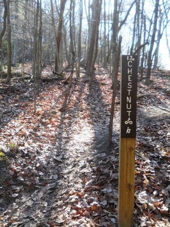
Photos
Intersection with Azalea and Big Oak