|
|
| (25 intermediate revisions by 3 users not shown) |
| Line 1: |
Line 1: |
| <!-- The following few lines create the "Infobox" table template. Please scroll down to edit the main content of the article. -->
| | {{Park |
| {{Infobox Park | | |Banner Image=File:BMP Bays Mountain Park Sign.jpg |
| | Image Name = BMP Bays Mountain Park Sign.jpg
| | |Park Type=City Park |
| | Type = City Park
| | |Park Website=http://www.baysmountain.com |
| | City = Kingsport
| | |Trail Map Link=https://baysmountainpa.wpengine.com/wp-content/uploads/Trail-Map-Brochure-Front-5-7-18.pdf |
| | State = Tennessee
| | |Entrance Fee=5.00 |
| | Park Use = {{Biking}} {{Dogs}} {{Fishing}} {{Hike}}
| | |Entrance Fee Type=per vehicle |
| | Area = 3,550 acres
| | |Activities=Hiking, Biking, Geocaching, Fishing, Climbing |
| | High Point =
| | |Features=Vistas, Rivers, Lakes, Mountains |
| | Operated By =
| | |Park Amenities=Picnicking |
| | Parking coords = 36.508821,-82.609545
| | |City=Kingsport |
| | |Area=3,550 acres |
| | |Operated By=City of Kingsport |
| | |Main Location=36.50847, -82.61035 |
| }} | | }} |
| <!-- End Infobox template table--> | | <display_map type="terrain" zoom="14" height="850" width="auto" gkml="https://tehcc.org/clubwiki/kml/BMP_Azalea_Trail.kml,https://tehcc.org/clubwiki/kml/BMP_bays_mountain_road.kml, |
| <!-- Start of Main Page -->
| | https://tehcc.org/clubwiki/kml/BMP_Back_Hollow_Road.kml, |
| | https://tehcc.org/clubwiki/kml/BMP_Bays_Ridge_Road.kml, |
| | https://tehcc.org/clubwiki/kml/BMP_Bays_Ridge_Trail.kml, |
| | https://tehcc.org/clubwiki/kml/BMP_Bear_Run_Trail.kml, |
| | https://tehcc.org/clubwiki/kml/BMP_Big_Oak_Trail.kml, |
| | https://tehcc.org/clubwiki/kml/BMP_Cherry_Knobs_Trail.kml, |
| | https://tehcc.org/clubwiki/kml/BMP_Chestnut_Trail.kml, |
| | https://tehcc.org/clubwiki/kml/BMP_Cliffside_Trail.kml, |
| | https://tehcc.org/clubwiki/kml/BMP_Chinquapin_Trail.kml, |
| | https://tehcc.org/clubwiki/kml/BMP_Cross_Ridges_Trail.kml, |
| | https://tehcc.org/clubwiki/kml/BMP_Food_Plot_Trail.kml, |
| | https://tehcc.org/clubwiki/kml/BMP_Front_Hollow_Road.kml, |
| | https://tehcc.org/clubwiki/kml/BMP_Hemlock_Trail.kml, |
| | https://tehcc.org/clubwiki/kml/BMP_Holly_Trail.kml, |
| | https://tehcc.org/clubwiki/kml/BMP_Indian_Pipes_Trail.kml, |
| | https://tehcc.org/clubwiki/kml/BMP_Jones_Road.kml, |
| | https://tehcc.org/clubwiki/kml/BMP_Kiner_Hollow_Trail.kml, |
| | https://tehcc.org/clubwiki/kml/BMP_Lake_Road.kml, |
| | https://tehcc.org/clubwiki/kml/BMP_lakeside_trail.kml, |
| | https://tehcc.org/clubwiki/kml/BMP_Laurel_Run_Trail.kml, |
| | https://tehcc.org/clubwiki/kml/BMP_Orchid_Trail.kml, |
| | https://tehcc.org/clubwiki/kml/BMP_Pine_Trail.kml"> |
| | 36.49487, -82.60517~Bays Mountain Park~Main entrance gate |
| | 36.50803,-82.61255~Lakeside Trail~ ~MarkerG.png |
| | 36.50863,-82.61184~Dolan Branch Trail~ ~MarkerG.png |
| | 36.52616,-82.58778~Intersection [[Azalea]] and [[Bays Mountain Road]]~ ~MarkerG.png |
| | 36.506548,-82.631278~Crossroads with [[Back Hollow Road]] and [[River Mountain Road]]~ ~MarkerG.png |
| | 36.497900,-82.627713~Crossroads with [[Bays Ridge Road]] and [[Front Hollow Road]]~ ~MarkerG.png |
| | 36.506548,-82.631278~Crossroads with [[Back Hollow Road]] and [[Lake Road (Bays Mountain Park)|Lake Road]] At Feagin's Gap~ ~MarkerG.png |
| | 36.51147,-82.61314~Junction of [[Lakeside Trail]] and [[Towee Trail]]~ ~MarkerG.png |
| | 36.51272,-82.61330~Junction of [[Lake Road (Bays Mountain Park)|Lake Road]] and [[Towee Trail]]~ ~MarkerG.png |
| | 36.51196,-82.61657~Junction of [[Lake Road (Bays Mountain Park)|Lake Road]] and [[Hemlock Trail]]~ ~MarkerG.png |
| | 36.51094,-82.61563~Junction of [[Lakeside Trail]] and [[Hemlock Trail]]~ ~MarkerG.png |
| | 36.50908,-82.62115~Junction of [[Lakeside Trail]] and [[Sweet Gum Trail]]~ ~MarkerG.png |
| | 36.50949,-82.62131~Junction of [[Lake Road (Bays Mountain Park)|Lake Road]], [[Sweet Gum Trail]], and [[Chinquapin Trail]]~ ~MarkerG.png |
| | 36.51116,-82.61407~SW junction of [[Lakeside Trail]] and [[Holly Trail]]~ ~MarkerG.png |
| | 36.51143,-82.61215~NE junction of [[Lakeside Trail]] and [[Holly Trail]]~ ~MarkerG.png |
| | 36.51545, -82.62378~Garden Mountain/Kingsport Lookout Tower~[[Image:BMP_Firetower_Trail_tower.jpg|150px]]~MarkerE.png |
| | 36.51202, -82.61669~Junction of [[BMP Lake Road|Lake Road]] and [[Firetower Trail]]~ ~MarkerG.png |
| | 36.50721,-82.61369~Junction of [[Lakeside Trail]] and [[Pine Trail]]~ ~MarkerG.png |
| | 36.50708,-82.61358~Junction of [[Lake Road (Bays Mountain Park)|Lake Road]] and [[Pine Trail]]~ ~MarkerG.png |
| | 36.50631,-82.61311~Junction of [[Bays Ridge Road]] and [[Pine Trail]]~ ~MarkerG.png |
| | 36.50349,-82.61893~Junction of [[Lake Road (Bays Mountain Park)|Lake Road]] and [[Orchid Trail]]~[[Image:BMP Orchid Trail sign.JPG|50px]]~MarkerG.png |
| | 36.50049,-82.61786~Junction of [[Bays Ridge Road]] and [[Orchid Trail]]~ ~MarkerG.png |
| | 36.49603,-82.63158~Junction of [[Jones Road]] and [[Front Hollow Road]] by "Big Oak"~[[Image:BMP Big Oak.JPG|100px]]~MarkerG.png |
| | 36.49210,-82.63372~Junction of [[Jones Road]] and[[Bays Ridge Road]]~ ~MarkerG.png |
| | 36.49777,-82.64269~Junction of [[Cross Ridges Trail]] and [[Back Hollow Road]] and [[BMP Pretty Ridge Trail|Pretty Ridge Trail]]~ ~MarkerG.png |
| | 36.49683,-82.63629~Junction of [[Cross Ridges Trail]] and [[Cherry Knobs]]~[[Image:BMP CK-CR sign.JPG|50px]]~MarkerG.png |
| | 36.49511,-82.63438~Junction of [[Cross Ridges Trail]] and [[BMP Front Hollow Road|Front Hollow Road]]~[[Image:BMP CR FHR sign.JPG|50px]]~MarkerG.png |
| | 36.50584,-82.61830~Junction of [[Cherry Knobs]] and [[Lakeside Trail]]~ ~MarkerG.png |
| | 36.50342,-82.62847~Junction of [[Cherry Knobs]] and [[Lake Road (Bays Mountain Park)|Lake Road]]~[[Image:BMP CK LR sign1.JPG|50px]]~MarkerG.png |
| | 36.500972,-82.630974~Junction of [[Cherry Knobs]] and [[Lake Road (Bays Mountain Park)|Lake Road]]~[[Image:BMP CK LR sign2.JPG|50px]]~MarkerG.png |
| | 36.52726, -82.5861~Overlook of Kingsport downtown~[[Image:BMP View of downtown Kingsport.JPG|Overlook of Kingsport downtown|150px]][[Image:BMP Antennas.JPG|Antennas|150px]]~MarkerE.png |
| | 36.51262,-82.60520~Junction of [[Lake Road (Bays Mountain Park)|Lake Road]] and [[Azalea]]~[[Image:BMP Azalea Trail sign.JPG|50px]]~MarkerG.png |
| | 36.52614,-82.58772~Junction of [[Bays Mountain Road]] and [[Azalea]]~[[Image:BMP Azalea Trail sign at BMR.JPG|50px]]~MarkerG.png |
| | 36.52221,-82.59283~Junction of [[Big Oak Trail]] and [[Azalea]]~[[Image:BMP Split at Azalea and Big Oak Trails.JPG|50px]]~MarkerG.png |
| | 36.51368,-82.60603~Junction of [[Lake Road (Bays Mountain Park)|Lake Road]] and [[Big Oak Trail]]~[[Image:BMP Lake Road sign at Big Oak Trail.JPG|50px]]~MarkerG.png |
| | 36.51452,-82.60601~Junction of [[Chinquapin Trail]] and [[Big Oak Trail]]~[[Image:BMP Big Oak - Chinquapin Trail sign.JPG|50px]]~MarkerG.png |
| | 36.51276,-82.61764~Junction of [[Chinquapin Trail]] and [[Firetower Trail]]~[[Image:BMP FT-CQ sign.JPG|50px]]~MarkerG.png |
| | 36.50951,-82.62137~Junction of [[Chinquapin Trail]] and [[Lake Road (Bays Mountain Park)|Lake Road]]~ ~MarkerG.png |
| | </display_map> |
| | __TOC__ |
| == Park Overview == | | == Park Overview == |
| <!-- Enter a overview of the park. What attracts you to this park, points of interest, types of flowers, lakes, and peaks that you see along the way. --> | | <!-- Enter a overview of the park. What attracts you to this park, points of interest, types of flowers, lakes, and peaks that you see along the way. --> |
| Expansive city park with {{Park trail count}} trails covering a total of {{Park trail miles}} for hiking and mountain biking. Also unique additional amenities of an animal habitats, ropes course with zip line, planetarium, and more... | | Expansive city park with {{Park trail count|Park={{PAGENAME}}}} trails covering a total of {{Park trail miles|Park={{PAGENAME}}}} for hiking and mountain biking. Also unique additional amenities of an animal habitats, ropes course with zip line, planetarium, and more... |
|
| |
|
| == How to get there == | | == How to get there == |
| Line 28: |
Line 92: |
| # Proceed about 2 miles. | | # Proceed about 2 miles. |
| # Turn right on Bays Mountain Road. | | # Turn right on Bays Mountain Road. |
| # Proceed to the left and into park to pay $4 entrance fee (effective 9/1/2011) or present pass. | | # Proceed to the left and into park to pay entrance fee or present pass. |
|
| |
|
| GPS Address: 853 Bays Mountain Park Road | | GPS Address: 853 Bays Mountain Park Road |
| Line 36: |
Line 100: |
| === Park Trails === | | === Park Trails === |
| <!-- A list of trails in the park. Ideally automatically generated from trail pages listing here as its "park" --> | | <!-- A list of trails in the park. Ideally automatically generated from trail pages listing here as its "park" --> |
| The most popular park hiking trails are Lakeside (with side trip on Holly) and Firetower. Those going mountain biking enjoy the main park roads (not the Hollows) and the newly constructed Chinquapin and Bear Run trails. | | The most popular park hiking trails are Lakeside (with side trip on Holly) and Firetower. Those going mountain biking enjoy the main park roads (not the Hollows) and the Chinquapin and Bear Run trails. |
|
| |
|
| {{Park trail list}} | | {{Park trail table|Park={{PAGENAME}}}} |
|
| |
|
| === Hike Plans === | | === Hike Plans === |
| {{Park hike plan list}} | | {{Park hike plan list|Park={{PAGENAME}}}} |
|
| |
|
| == Park Lodging == | | == Park Lodging == |
| Line 59: |
Line 123: |
| ==Fees, Permits, etc. == | | ==Fees, Permits, etc. == |
| <!-- Please list any Fees, Permits, Regulations, etc. that may be required on this trail.--> | | <!-- Please list any Fees, Permits, Regulations, etc. that may be required on this trail.--> |
| There is a $4 gate fee (increased 9/1/2011) to enter the park. (Or free as benefit for park association members: $25 individual, $35 family per year) | | There is a $7/vehicle gate fee (effective 7/1/2023) to enter the park. (Or free as benefit for park association members: $35 individual, $60 family per year) |
|
| |
|
| The park grounds are open | | The park grounds are open |
| Line 71: |
Line 135: |
| Dogs are allowed at Bays Mountain Park, but not around the animal habitats, thus please skirt using Lake Road. | | Dogs are allowed at Bays Mountain Park, but not around the animal habitats, thus please skirt using Lake Road. |
| <br>Mountain bikes are allowed, upon inspection, on designated trails (thus carry a map to know where!). | | <br>Mountain bikes are allowed, upon inspection, on designated trails (thus carry a map to know where!). |
|
| |
| == Misc. Information ==
| |
| <!-- Enter any additional information that doesn't fit an any other fields. Any seasonal features, factoids, etc...? -->
| |
| Bays Mountain Park website [http://www.baysmountain.com link]<br>
| |
| Bays Mountain Hiking and Biking Trail Map [http://www.baysmountain.com/wp-content/uploads/2011/12/BMP-Trail-Map-2013.jpg link]<br>
| |
|
| |
| == After the Hike ==
| |
| <!-- Other things to check out while you're in the area. Restaurants, attractions, monuments, etc... -->
| |
|
| |
| == Maps ==
| |
| <!-- You can place pictures, PDF's, links, or even create a Google map with your waypoints and place it here. -->
| |
| The most popular park hiking trails are Lakeside (with side trip on Holly) and Firetower. Those going mountain biking enjoy the main park roads (not the Hollows) and the newly constructed Chinquapin and Bear Run trails.
| |
| <display_map type="terrain" zoom="14" height="850" width="auto" gkml="http://tehcc.org/clubwiki/kml/BMP_Azalea_Trail.kml,http://tehcc.org/clubwiki/kml/BMP_bays_mountain_road.kml,
| |
| http://tehcc.org/clubwiki/kml/BMP_Back_Hollow_Road.kml,
| |
| http://tehcc.org/clubwiki/kml/BMP_Bays_Ridge_Road.kml,
| |
| http://tehcc.org/clubwiki/kml/BMP_Bays_Ridge_Trail.kml
| |
| ,http://tehcc.org/clubwiki/kml/BMP_Bear_Run_Trail.kml,
| |
| http://tehcc.org/clubwiki/kml/BMP_Big_Oak_Trail.kml,
| |
| http://tehcc.org/clubwiki/kml/BMP_Cherry_Knobs_Trail.kml,
| |
| http://tehcc.org/clubwiki/kml/BMP_Chestnut_Trail.kml,
| |
| http://tehcc.org/clubwiki/kml/BMP_Cliffside_Trail.kml,
| |
| http://tehcc.org/clubwiki/kml/BMP_Chinquapin_Trail.kml,
| |
| http://tehcc.org/clubwiki/kml/BMP_Cross_Ridges_Trail.kml,
| |
| http://tehcc.org/clubwiki/kml/BMP_Fern_Trail.kml,
| |
| http://tehcc.org/clubwiki/kml/BMP_Food_Plot_Trail.kml,
| |
| http://tehcc.org/clubwiki/kml/BMP_Front_Hollow_Road.kml,
| |
| http://tehcc.org/clubwiki/kml/BMP_Hemlock_Trail.kml,
| |
| http://tehcc.org/clubwiki/kml/BMP_Holly_Trail.kml,
| |
| http://tehcc.org/clubwiki/kml/BMP_Indian_Pipes_Trail.kml,
| |
| http://tehcc.org/clubwiki/kml/BMP_Jones_Road.kml,
| |
| http://tehcc.org/clubwiki/kml/BMP_Kiner_Hollow_Trail.kml,
| |
| http://tehcc.org/clubwiki/kml/BMP_Lake_Road.kml,
| |
| http://tehcc.org/clubwiki/kml/BMP_lakeside_trail.kml,
| |
| http://tehcc.org/clubwiki/kml/BMP_Laurel_Run_Trail.kml,
| |
| http://tehcc.org/clubwiki/kml/BMP_Orchid_Trail.kml,
| |
| http://tehcc.org/clubwiki/kml/BMP_Pine_Trail.kml">
| |
|
| |
| 36.49487, -82.60517~Bays Mountain Park~Main entrance gate
| |
| 36.50803,-82.61255~Lakeside Trail~ ~MarkerG.png
| |
| 36.50863,-82.61184~Dolan Branch Trail~ ~MarkerG.png
| |
| 36.52616,-82.58778~Intersection [[BMP Azalea Trail]] and [[BMP Bays Mountain Road]]~ ~MarkerG.png
| |
| 36.506548,-82.631278~Crossroads with [[BMP Back Hollow Road|Back Hollow Road]] and [[BMP River Mountain Road|River Mountain Road]]~ ~MarkerG.png
| |
| 36.497900,-82.627713~Crossroads with [[BMP Bays Ridge Road|Bays Ridge Road]] and [[BMP Front Hollow Road|Front Hollow Road]]~ ~MarkerG.png
| |
| 36.506548,-82.631278~Crossroads with [[BMP Back Hollow Road|Back Hollow Road]] and [[BMP Lake Road|Lake Road]] At Feagin's Gap~ ~MarkerG.png
| |
| 36.51147,-82.61314~Junction of [[BMP Lakeside Trail|Lakeside Trail]] and [[BMP Towee Trail|Towee Trail]]~ ~MarkerG.png
| |
| 36.51272,-82.61330~Junction of [[BMP Lake Road|Lake Road]] and [[BMP Towee Trail|Towee Trail]]~ ~MarkerG.png
| |
| 36.51196,-82.61657~Junction of [[BMP Lake Road|Lake Road]] and [[BMP Hemlock Trail|Hemlock Trail]]~ ~MarkerG.png
| |
| 36.51094,-82.61563~Junction of [[BMP Lakeside Trail|Lakeside Trail]] and [[BMP Hemlock Trail|Hemlock Trail]]~ ~MarkerG.png
| |
| 36.51206,-82.60772~Junction of [[BMP Lakeside Trail|Lakeside Trail]] and [[BMP Fern Trail|Fern Trail]]~ ~MarkerG.png
| |
| 36.51337,-82.60574~Junction of [[BMP Lake Road|Lake Road]] and [[BMP Fern Trail|Fern Trail]]~ ~MarkerG.png
| |
| 36.50908,-82.62115~Junction of [[BMP Lakeside Trail|Lakeside Trail]] and [[BMP Sweet Gum Trail|Sweet Gum Trail]]~ ~MarkerG.png
| |
| 36.50949,-82.62131~Junction of [[BMP Lake Road|Lake Road]], [[BMP Sweet Gum Trail|Sweet Gum Trail]], and [[BMP Chinquapin Trail|Chinquapin Trail]]~ ~MarkerG.png
| |
| 36.51116,-82.61407~SW junction of [[BMP Lakeside Trail|Lakeside Trail]] and [[BMP Holly Trail|Holly Trail]]~ ~MarkerG.png
| |
| 36.51143,-82.61215~NE junction of [[BMP Lakeside Trail|Lakeside Trail]] and [[BMP Holly Trail|Holly Trail]]~ ~MarkerG.png
| |
| 36.51545, -82.62378~Garden Mountain/Kingsport Lookout Tower~[[Image:BMP_Firetower_Trail_tower.jpg|150px]]~MarkerE.png
| |
| 36.51202, -82.61669~Junction of [[BMP Lake Road|Lake Road]] and [[BMP Firetower Trail|Firetower Trail]]~ ~MarkerG.png
| |
| 36.50721,-82.61369~Junction of [[BMP Lakeside Trail|Lakeside Trail]] and [[BMP Pine Trail|Pine Trail]]~ ~MarkerG.png
| |
| 36.50708,-82.61358~Junction of [[BMP Lake Road|Lake Road]] and [[BMP Pine Trail|Pine Trail]]~ ~MarkerG.png
| |
| 36.50631,-82.61311~Junction of [[BMP Bays Ridge Road|Bays Ridge Road]] and [[BMP Pine Trail|Pine Trail]]~ ~MarkerG.png
| |
| 36.50349,-82.61893~Junction of [[BMP Lake Road|Lake Road]] and [[BMP Orchid Trail|Orchid Trail]]~[[Image:BMP Orchid Trail sign.JPG|50px]]~MarkerG.png
| |
| 36.50049,-82.61786~Junction of [[BMP Bays Ridge Road|Bays Ridge Road]] and [[BMP Orchid Trail|Orchid Trail]]~ ~MarkerG.png
| |
| 36.49603,-82.63158~Junction of [[BMP Jones Road|Jones Road]] and [[BMP Front Hollow Road|Front Hollow Road]] by "Big Oak"~[[Image:BMP Big Oak.JPG|100px]]~MarkerG.png
| |
| 36.49210,-82.63372~Junction of [[BMP Jones Road|Jones Road]] and[[BMP Bays Ridge Road|Bays Ridge Road]]~ ~MarkerG.png
| |
| 36.49777,-82.64269~Junction of [[BMP Cross Ridges Trail|Cross Ridges Trail]] and [[BMP Back Hollow Road|Back Hollow Road]] and [[BMP Pretty Ridge Trail|Pretty Ridge Trail]]~ ~MarkerG.png
| |
| 36.49683,-82.63629~Junction of [[BMP Cross Ridges Trail|Cross Ridges Trail]] and [[BMP Cherry Knobs Trail|Cherry Knobs Trail]]~[[Image:BMP CK-CR sign.JPG|50px]]~MarkerG.png
| |
| 36.49511,-82.63438~Junction of [[BMP Cross Ridges Trail|Cross Ridges Trail]] and [[BMP Front Hollow Road|Front Hollow Road]]~[[Image:BMP CR FHR sign.JPG|50px]]~MarkerG.png
| |
| 36.50584,-82.61830~Junction of [[BMP Cherry Knobs Trail|Cherry Knobs Trail]] and [[BMP Lakeside Trail|Lakeside Trail]]~ ~MarkerG.png
| |
| 36.50342,-82.62847~Junction of [[BMP Cherry Knobs Trail|Cherry Knobs Trail]] and [[BMP Lake Road|Lake Road]]~[[Image:BMP CK LR sign1.JPG|50px]]~MarkerG.png
| |
| 36.500972,-82.630974~Junction of [[BMP Cherry Knobs Trail|Cherry Knobs Trail]] and [[BMP Lake Road|Lake Road]]~[[Image:BMP CK LR sign2.JPG|50px]]~MarkerG.png
| |
| 36.52726, -82.5861~Overlook of Kingsport downtown~[[Image:BMP View of downtown Kingsport.JPG|Overlook of Kingsport downtown|150px]][[Image:BMP Antennas.JPG|Antennas|150px]]~MarkerE.png
| |
| 36.51262,-82.60520~Junction of [[BMP Lake Road|Lake Road]] and [[BMP Azalea Trail|Azalea Trail]]~[[Image:BMP Azalea Trail sign.JPG|50px]]~MarkerG.png
| |
| 36.52614,-82.58772~Junction of [[BMP Bays Mountain Road|Bays Mountain Road]] and [[BMP Azalea Trail|Azalea Trail]]~[[Image:BMP Azalea Trail sign at BMR.JPG|50px]]~MarkerG.png
| |
| 36.52221,-82.59283~Junction of [[BMP Big Oak Trail|Big Oak Trail]] and [[BMP Azalea Trail|Azalea Trail]]~[[Image:BMP Split at Azalea and Big Oak Trails.JPG|50px]]~MarkerG.png
| |
| 36.51368,-82.60603~Junction of [[BMP Lake Road|Lake Road]] and [[BMP Big Oak Trail|Big Oak Trail]]~[[Image:BMP Lake Road sign at Big Oak Trail.JPG|50px]]~MarkerG.png
| |
| 36.51452,-82.60601~Junction of [[BMP Chinquapin Trail|Chinquapin Trail]] and [[BMP Big Oak Trail|Big Oak Trail]]~[[Image:BMP Big Oak - Chinquapin Trail sign.JPG|50px]]~MarkerG.png
| |
| 36.51276,-82.61764~Junction of [[BMP Chinquapin Trail|Chinquapin Trail]] and [[BMP Firetower Trail|Firetower Trail]]~[[Image:BMP FT-CQ sign.JPG|50px]]~MarkerG.png
| |
| 36.50951,-82.62137~Junction of [[BMP Chinquapin Trail|Chinquapin Trail]] and [[BMP Lake Road|Lake Road]]~ ~MarkerG.png
| |
| </display_map>
| |
|
| |
|
| == Photos == | | == Photos == |
| <gallery>
| | {{Park trail gallery|Park={{PAGENAME}}}} |
| <!-- Place any pictures from this trail below. Ideally we would have a picture of the trailhead to help people know when they found it -->
| |
| <!-- Add a picture by typing Image:imagename.extension -->
| |
| | |
| <!-- Do not remove the end gallery code.-->
| |
| </gallery>
| |
| | |
| <!-- Finally add the trail to any Categories it should belong to. -->
| |
| [[Category:Tennessee]] [[Category:Medium]]
| |
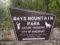
| Bays Mountain Park
|

|
|
|
| Park Type
|
City Park
|
| Located
|
Kingsport, Tennessee
|
| External Links
|
Official Website
Official Trail Map
|
| Entrance Fee
|
$5.00 per vehicle
|
| ActivitiesThings to do at the park
|
    
|
| Park AmenitiesThings built to enjoy or use at the park
|

|
| FeaturesNatural things to see at the park
|
   
|
| Park Trails
|
31 Trails / Total of
38.50 miles61.96 km <br />
|
| Lodging Types
|
None
|
| Park Area
|
3,550 acres14.366 km² <br />
|
| Operated By
|
City of Kingsport
|
| Main Location
|
36° 30' 30.49" N, 82° 36' 37.26" W Map
|
Loading map... {"type":"ROADMAP","minzoom":false,"maxzoom":false,"types":["ROADMAP","SATELLITE","HYBRID","TERRAIN"],"mappingservice":"googlemaps3","width":"100%","height":"180px","centre":false,"title":"","label":"","icon":"","lines":[],"polygons":[],"circles":[],"rectangles":[],"copycoords":false,"static":false,"visitedicon":"","wmsoverlay":false,"zoom":8,"layers":[],"controls":[""],"zoomstyle":"DEFAULT","typestyle":"DEFAULT","autoinfowindows":false,"resizable":false,"kmlrezoom":false,"poi":true,"cluster":false,"clustergridsize":60,"clustermaxzoom":20,"clusterzoomonclick":true,"clusteraveragecenter":true,"clusterminsize":2,"imageoverlays":[],"kml":[],"gkml":[],"searchmarkers":"","fullscreen":false,"scrollwheelzoom":false,"locations":[{"text":"\u003Cb\u003E\u003Cdiv class=\"mw-parser-output\"\u003E\u003Cp\u003EBays Mountain Park\n\u003C/p\u003E\u003C/div\u003E\u003C/b\u003E\u003Cdiv class=\"mw-parser-output\"\u003E\u003Cp\u003EMain Parking Location\n\u003C/p\u003E\u003C/div\u003E","title":"Bays Mountain Park\n","link":"","lat":36.5084700000000026420821086503565311431884765625,"lon":-82.6103499999999968395059113390743732452392578125,"icon":""}]} |
| Show In Google Maps
|
Loading map...
{"type":"TERRAIN","minzoom":false,"maxzoom":false,"types":["ROADMAP","SATELLITE","HYBRID","TERRAIN"],"mappingservice":"googlemaps3","width":"auto","height":"850px","centre":false,"title":"","label":"","icon":"","lines":[],"polygons":[],"circles":[],"rectangles":[],"copycoords":false,"static":false,"visitedicon":"","wmsoverlay":false,"zoom":14,"layers":[],"controls":["pan","zoom","type","scale","streetview","rotate"],"zoomstyle":"DEFAULT","typestyle":"DEFAULT","autoinfowindows":false,"resizable":false,"kmlrezoom":false,"poi":true,"cluster":false,"clustergridsize":60,"clustermaxzoom":20,"clusterzoomonclick":true,"clusteraveragecenter":true,"clusterminsize":2,"imageoverlays":[],"kml":[],"gkml":["https://tehcc.org/clubwiki/kml/BMP_Azalea_Trail.kml","https://tehcc.org/clubwiki/kml/BMP_bays_mountain_road.kml","https://tehcc.org/clubwiki/kml/BMP_Back_Hollow_Road.kml","https://tehcc.org/clubwiki/kml/BMP_Bays_Ridge_Road.kml","https://tehcc.org/clubwiki/kml/BMP_Bays_Ridge_Trail.kml","https://tehcc.org/clubwiki/kml/BMP_Bear_Run_Trail.kml","https://tehcc.org/clubwiki/kml/BMP_Big_Oak_Trail.kml","https://tehcc.org/clubwiki/kml/BMP_Cherry_Knobs_Trail.kml","https://tehcc.org/clubwiki/kml/BMP_Chestnut_Trail.kml","https://tehcc.org/clubwiki/kml/BMP_Cliffside_Trail.kml","https://tehcc.org/clubwiki/kml/BMP_Chinquapin_Trail.kml","https://tehcc.org/clubwiki/kml/BMP_Cross_Ridges_Trail.kml","https://tehcc.org/clubwiki/kml/BMP_Food_Plot_Trail.kml","https://tehcc.org/clubwiki/kml/BMP_Front_Hollow_Road.kml","https://tehcc.org/clubwiki/kml/BMP_Hemlock_Trail.kml","https://tehcc.org/clubwiki/kml/BMP_Holly_Trail.kml","https://tehcc.org/clubwiki/kml/BMP_Indian_Pipes_Trail.kml","https://tehcc.org/clubwiki/kml/BMP_Jones_Road.kml","https://tehcc.org/clubwiki/kml/BMP_Kiner_Hollow_Trail.kml","https://tehcc.org/clubwiki/kml/BMP_Lake_Road.kml","https://tehcc.org/clubwiki/kml/BMP_lakeside_trail.kml","https://tehcc.org/clubwiki/kml/BMP_Laurel_Run_Trail.kml","https://tehcc.org/clubwiki/kml/BMP_Orchid_Trail.kml","https://tehcc.org/clubwiki/kml/BMP_Pine_Trail.kml"],"searchmarkers":"","fullscreen":false,"scrollwheelzoom":false,"locations":[{"text":"\u003Cb\u003E\u003Cdiv class=\"mw-parser-output\"\u003E\u003Cp\u003EBays Mountain Park\n\u003C/p\u003E\u003C/div\u003E\u003C/b\u003E\u003Cdiv class=\"mw-parser-output\"\u003E\u003Cp\u003EMain entrance gate\n\u003C/p\u003E\u003C/div\u003E","title":"Bays Mountain Park\n","link":"","lat":36.49486999999999881083567743189632892608642578125,"lon":-82.6051700000000010959411156363785266876220703125,"icon":""},{"text":"\u003Cdiv class=\"mw-parser-output\"\u003E\u003Cp\u003ELakeside Trail\n\u003C/p\u003E\u003C/div\u003E","title":"Lakeside Trail\n","link":"","lat":36.50802999999999798319549881853163242340087890625,"lon":-82.61254999999999881765688769519329071044921875,"icon":"/clubwiki/images/MarkerG.png"},{"text":"\u003Cdiv class=\"mw-parser-output\"\u003E\u003Cp\u003EDolan Branch Trail\n\u003C/p\u003E\u003C/div\u003E","title":"Dolan Branch Trail\n","link":"","lat":36.5086299999999965848473948426544666290283203125,"lon":-82.611840000000000827640178613364696502685546875,"icon":"/clubwiki/images/MarkerG.png"},{"text":"\u003Cdiv class=\"mw-parser-output\"\u003E\u003Cp\u003EIntersection \u003Ca href=\"/wiki/Azalea\" title=\"Azalea\"\u003EAzalea\u003C/a\u003E and \u003Ca href=\"/wiki/Bays_Mountain_Road\" title=\"Bays Mountain Road\"\u003EBays Mountain Road\u003C/a\u003E\n\u003C/p\u003E\u003C/div\u003E","title":"Intersection Azalea and Bays Mountain Road\n","link":"","lat":36.52615999999999729652699897997081279754638671875,"lon":-82.5877799999999950841811369173228740692138671875,"icon":"/clubwiki/images/MarkerG.png"},{"text":"\u003Cdiv class=\"mw-parser-output\"\u003E\u003Cp\u003ECrossroads with \u003Ca href=\"/wiki/Back_Hollow_Road\" title=\"Back Hollow Road\"\u003EBack Hollow Road\u003C/a\u003E and \u003Ca href=\"/wiki/River_Mountain_Road\" title=\"River Mountain Road\"\u003ERiver Mountain Road\u003C/a\u003E\n\u003C/p\u003E\u003C/div\u003E","title":"Crossroads with Back Hollow Road and River Mountain Road\n","link":"","lat":36.50654800000000221871232497505843639373779296875,"lon":-82.6312779999999946767275105230510234832763671875,"icon":"/clubwiki/images/MarkerG.png"},{"text":"\u003Cdiv class=\"mw-parser-output\"\u003E\u003Cp\u003ECrossroads with \u003Ca href=\"/wiki/Bays_Ridge_Road\" title=\"Bays Ridge Road\"\u003EBays Ridge Road\u003C/a\u003E and \u003Ca href=\"/wiki/Front_Hollow_Road\" title=\"Front Hollow Road\"\u003EFront Hollow Road\u003C/a\u003E\n\u003C/p\u003E\u003C/div\u003E","title":"Crossroads with Bays Ridge Road and Front Hollow Road\n","link":"","lat":36.4979000000000013415046851150691509246826171875,"lon":-82.627712999999999965439201332628726959228515625,"icon":"/clubwiki/images/MarkerG.png"},{"text":"\u003Cdiv class=\"mw-parser-output\"\u003E\u003Cp\u003ECrossroads with \u003Ca href=\"/wiki/Back_Hollow_Road\" title=\"Back Hollow Road\"\u003EBack Hollow Road\u003C/a\u003E and \u003Ca href=\"/wiki/Lake_Road_(Bays_Mountain_Park)\" title=\"Lake Road (Bays Mountain Park)\"\u003ELake Road\u003C/a\u003E At Feagin's Gap\n\u003C/p\u003E\u003C/div\u003E","title":"Crossroads with Back Hollow Road and Lake Road At Feagin's Gap\n","link":"","lat":36.50654800000000221871232497505843639373779296875,"lon":-82.6312779999999946767275105230510234832763671875,"icon":"/clubwiki/images/MarkerG.png"},{"text":"\u003Cdiv class=\"mw-parser-output\"\u003E\u003Cp\u003EJunction of \u003Ca href=\"/wiki/Lakeside_Trail\" title=\"Lakeside Trail\"\u003ELakeside Trail\u003C/a\u003E and \u003Ca href=\"/clubwiki/index.php?title=Towee_Trail\u0026amp;action=edit\u0026amp;redlink=1\" class=\"new\" title=\"Towee Trail (page does not exist)\"\u003ETowee Trail\u003C/a\u003E\n\u003C/p\u003E\u003C/div\u003E","title":"Junction of Lakeside Trail and Towee Trail\n","link":"","lat":36.511470000000002755768946371972560882568359375,"lon":-82.6131400000000013505996321327984333038330078125,"icon":"/clubwiki/images/MarkerG.png"},{"text":"\u003Cdiv class=\"mw-parser-output\"\u003E\u003Cp\u003EJunction of \u003Ca href=\"/wiki/Lake_Road_(Bays_Mountain_Park)\" title=\"Lake Road (Bays Mountain Park)\"\u003ELake Road\u003C/a\u003E and \u003Ca href=\"/clubwiki/index.php?title=Towee_Trail\u0026amp;action=edit\u0026amp;redlink=1\" class=\"new\" title=\"Towee Trail (page does not exist)\"\u003ETowee Trail\u003C/a\u003E\n\u003C/p\u003E\u003C/div\u003E","title":"Junction of Lake Road and Towee Trail\n","link":"","lat":36.51272000000000161890056915581226348876953125,"lon":-82.6132999999999952933649183250963687896728515625,"icon":"/clubwiki/images/MarkerG.png"},{"text":"\u003Cdiv class=\"mw-parser-output\"\u003E\u003Cp\u003EJunction of \u003Ca href=\"/wiki/Lake_Road_(Bays_Mountain_Park)\" title=\"Lake Road (Bays Mountain Park)\"\u003ELake Road\u003C/a\u003E and \u003Ca href=\"/wiki/Hemlock_Trail\" title=\"Hemlock Trail\"\u003EHemlock Trail\u003C/a\u003E\n\u003C/p\u003E\u003C/div\u003E","title":"Junction of Lake Road and Hemlock Trail\n","link":"","lat":36.5119600000000019690560293383896350860595703125,"lon":-82.616569999999995843609212897717952728271484375,"icon":"/clubwiki/images/MarkerG.png"},{"text":"\u003Cdiv class=\"mw-parser-output\"\u003E\u003Cp\u003EJunction of \u003Ca href=\"/wiki/Lakeside_Trail\" title=\"Lakeside Trail\"\u003ELakeside Trail\u003C/a\u003E and \u003Ca href=\"/wiki/Hemlock_Trail\" title=\"Hemlock Trail\"\u003EHemlock Trail\u003C/a\u003E\n\u003C/p\u003E\u003C/div\u003E","title":"Junction of Lakeside Trail and Hemlock Trail\n","link":"","lat":36.51093999999999795136318425647914409637451171875,"lon":-82.6156299999999959027263685129582881927490234375,"icon":"/clubwiki/images/MarkerG.png"},{"text":"\u003Cdiv class=\"mw-parser-output\"\u003E\u003Cp\u003EJunction of \u003Ca href=\"/wiki/Lakeside_Trail\" title=\"Lakeside Trail\"\u003ELakeside Trail\u003C/a\u003E and \u003Ca href=\"/wiki/Sweet_Gum_Trail\" title=\"Sweet Gum Trail\"\u003ESweet Gum Trail\u003C/a\u003E\n\u003C/p\u003E\u003C/div\u003E","title":"Junction of Lakeside Trail and Sweet Gum Trail\n","link":"","lat":36.5090799999999973124431562609970569610595703125,"lon":-82.62115000000000009094947017729282379150390625,"icon":"/clubwiki/images/MarkerG.png"},{"text":"\u003Cdiv class=\"mw-parser-output\"\u003E\u003Cp\u003EJunction of \u003Ca href=\"/wiki/Lake_Road_(Bays_Mountain_Park)\" title=\"Lake Road (Bays Mountain Park)\"\u003ELake Road\u003C/a\u003E, \u003Ca href=\"/wiki/Sweet_Gum_Trail\" title=\"Sweet Gum Trail\"\u003ESweet Gum Trail\u003C/a\u003E, and \u003Ca href=\"/wiki/Chinquapin_Trail\" title=\"Chinquapin Trail\"\u003EChinquapin Trail\u003C/a\u003E\n\u003C/p\u003E\u003C/div\u003E","title":"Junction of Lake Road, Sweet Gum Trail, and Chinquapin Trail\n","link":"","lat":36.509489999999999554347596131265163421630859375,"lon":-82.62130999999999403371475636959075927734375,"icon":"/clubwiki/images/MarkerG.png"},{"text":"\u003Cdiv class=\"mw-parser-output\"\u003E\u003Cp\u003ESW junction of \u003Ca href=\"/wiki/Lakeside_Trail\" title=\"Lakeside Trail\"\u003ELakeside Trail\u003C/a\u003E and \u003Ca href=\"/wiki/Holly_Trail\" title=\"Holly Trail\"\u003EHolly Trail\u003C/a\u003E\n\u003C/p\u003E\u003C/div\u003E","title":"SW junction of Lakeside Trail and Holly Trail\n","link":"","lat":36.51115999999999672809281037189066410064697265625,"lon":-82.614069999999998117345967330038547515869140625,"icon":"/clubwiki/images/MarkerG.png"},{"text":"\u003Cdiv class=\"mw-parser-output\"\u003E\u003Cp\u003ENE junction of \u003Ca href=\"/wiki/Lakeside_Trail\" title=\"Lakeside Trail\"\u003ELakeside Trail\u003C/a\u003E and \u003Ca href=\"/wiki/Holly_Trail\" title=\"Holly Trail\"\u003EHolly Trail\u003C/a\u003E\n\u003C/p\u003E\u003C/div\u003E","title":"NE junction of Lakeside Trail and Holly Trail\n","link":"","lat":36.51142999999999716465026722289621829986572265625,"lon":-82.6121499999999997498889570124447345733642578125,"icon":"/clubwiki/images/MarkerG.png"},{"text":"\u003Cb\u003E\u003Cdiv class=\"mw-parser-output\"\u003E\u003Cp\u003EGarden Mountain/Kingsport Lookout Tower\n\u003C/p\u003E\u003C/div\u003E\u003C/b\u003E\u003Cdiv class=\"mw-parser-output\"\u003E\u003Cp\u003E\u003Ca href=\"/wiki/File:BMP_Firetower_Trail_tower.jpg\" class=\"image\"\u003E\u003Cimg alt=\"BMP Firetower Trail tower.jpg\" src=\"/clubwiki/images/thumb/BMP_Firetower_Trail_tower.jpg/150px-BMP_Firetower_Trail_tower.jpg\" decoding=\"async\" width=\"150\" height=\"201\" srcset=\"/clubwiki/images/thumb/BMP_Firetower_Trail_tower.jpg/225px-BMP_Firetower_Trail_tower.jpg 1.5x, /clubwiki/images/BMP_Firetower_Trail_tower.jpg 2x\" data-file-width=\"300\" data-file-height=\"401\" /\u003E\u003C/a\u003E\n\u003C/p\u003E\u003C/div\u003E","title":"Garden Mountain/Kingsport Lookout Tower\n","link":"","lat":36.5154500000000012960299500264227390289306640625,"lon":-82.6237799999999964484231895767152309417724609375,"icon":"/clubwiki/images/MarkerE.png"},{"text":"\u003Cdiv class=\"mw-parser-output\"\u003E\u003Cp\u003EJunction of \u003Ca href=\"/wiki/BMP_Lake_Road\" class=\"mw-redirect\" title=\"BMP Lake Road\"\u003ELake Road\u003C/a\u003E and \u003Ca href=\"/clubwiki/index.php?title=Firetower_Trail\u0026amp;action=edit\u0026amp;redlink=1\" class=\"new\" title=\"Firetower Trail (page does not exist)\"\u003EFiretower Trail\u003C/a\u003E\n\u003C/p\u003E\u003C/div\u003E","title":"Junction of Lake Road and Firetower Trail\n","link":"","lat":36.51201999999999969759301166050136089324951171875,"lon":-82.61669000000000551153789274394512176513671875,"icon":"/clubwiki/images/MarkerG.png"},{"text":"\u003Cdiv class=\"mw-parser-output\"\u003E\u003Cp\u003EJunction of \u003Ca href=\"/wiki/Lakeside_Trail\" title=\"Lakeside Trail\"\u003ELakeside Trail\u003C/a\u003E and \u003Ca href=\"/wiki/Pine_Trail\" title=\"Pine Trail\"\u003EPine Trail\u003C/a\u003E\n\u003C/p\u003E\u003C/div\u003E","title":"Junction of Lakeside Trail and Pine Trail\n","link":"","lat":36.5072100000000006048139766789972782135009765625,"lon":-82.6136900000000053978510550223290920257568359375,"icon":"/clubwiki/images/MarkerG.png"},{"text":"\u003Cdiv class=\"mw-parser-output\"\u003E\u003Cp\u003EJunction of \u003Ca href=\"/wiki/Lake_Road_(Bays_Mountain_Park)\" title=\"Lake Road (Bays Mountain Park)\"\u003ELake Road\u003C/a\u003E and \u003Ca href=\"/wiki/Pine_Trail\" title=\"Pine Trail\"\u003EPine Trail\u003C/a\u003E\n\u003C/p\u003E\u003C/div\u003E","title":"Junction of Lake Road and Pine Trail\n","link":"","lat":36.507080000000001973603502847254276275634765625,"lon":-82.6135799999999989040588843636214733123779296875,"icon":"/clubwiki/images/MarkerG.png"},{"text":"\u003Cdiv class=\"mw-parser-output\"\u003E\u003Cp\u003EJunction of \u003Ca href=\"/wiki/Bays_Ridge_Road\" title=\"Bays Ridge Road\"\u003EBays Ridge Road\u003C/a\u003E and \u003Ca href=\"/wiki/Pine_Trail\" title=\"Pine Trail\"\u003EPine Trail\u003C/a\u003E\n\u003C/p\u003E\u003C/div\u003E","title":"Junction of Bays Ridge Road and Pine Trail\n","link":"","lat":36.5063099999999991496224538423120975494384765625,"lon":-82.613110000000006039044819772243499755859375,"icon":"/clubwiki/images/MarkerG.png"},{"text":"\u003Cb\u003E\u003Cdiv class=\"mw-parser-output\"\u003E\u003Cp\u003EJunction of \u003Ca href=\"/wiki/Lake_Road_(Bays_Mountain_Park)\" title=\"Lake Road (Bays Mountain Park)\"\u003ELake Road\u003C/a\u003E and \u003Ca href=\"/wiki/Orchid_Trail\" title=\"Orchid Trail\"\u003EOrchid Trail\u003C/a\u003E\n\u003C/p\u003E\u003C/div\u003E\u003C/b\u003E\u003Cdiv class=\"mw-parser-output\"\u003E\u003Cp\u003E\u003Ca href=\"/wiki/File:BMP_Orchid_Trail_sign.JPG\" class=\"image\"\u003E\u003Cimg alt=\"BMP Orchid Trail sign.JPG\" src=\"/clubwiki/images/thumb/BMP_Orchid_Trail_sign.JPG/50px-BMP_Orchid_Trail_sign.JPG\" decoding=\"async\" width=\"50\" height=\"89\" srcset=\"/clubwiki/images/thumb/BMP_Orchid_Trail_sign.JPG/75px-BMP_Orchid_Trail_sign.JPG 1.5x, /clubwiki/images/thumb/BMP_Orchid_Trail_sign.JPG/100px-BMP_Orchid_Trail_sign.JPG 2x\" data-file-width=\"252\" data-file-height=\"448\" /\u003E\u003C/a\u003E\n\u003C/p\u003E\u003C/div\u003E","title":"Junction of Lake Road and Orchid Trail\n","link":"","lat":36.50348999999999932697392068803310394287109375,"lon":-82.618930000000005975380190648138523101806640625,"icon":"/clubwiki/images/MarkerG.png"},{"text":"\u003Cdiv class=\"mw-parser-output\"\u003E\u003Cp\u003EJunction of \u003Ca href=\"/wiki/Bays_Ridge_Road\" title=\"Bays Ridge Road\"\u003EBays Ridge Road\u003C/a\u003E and \u003Ca href=\"/wiki/Orchid_Trail\" title=\"Orchid Trail\"\u003EOrchid Trail\u003C/a\u003E\n\u003C/p\u003E\u003C/div\u003E","title":"Junction of Bays Ridge Road and Orchid Trail\n","link":"","lat":36.5004899999999992132870829664170742034912109375,"lon":-82.6178599999999931924321572296321392059326171875,"icon":"/clubwiki/images/MarkerG.png"},{"text":"\u003Cb\u003E\u003Cdiv class=\"mw-parser-output\"\u003E\u003Cp\u003EJunction of \u003Ca href=\"/wiki/Jones_Road\" title=\"Jones Road\"\u003EJones Road\u003C/a\u003E and \u003Ca href=\"/wiki/Front_Hollow_Road\" title=\"Front Hollow Road\"\u003EFront Hollow Road\u003C/a\u003E by \"Big Oak\"\n\u003C/p\u003E\u003C/div\u003E\u003C/b\u003E\u003Cdiv class=\"mw-parser-output\"\u003E\u003Cp\u003E\u003Ca href=\"/wiki/File:BMP_Big_Oak.JPG\" class=\"image\"\u003E\u003Cimg alt=\"BMP Big Oak.JPG\" src=\"/clubwiki/images/thumb/BMP_Big_Oak.JPG/100px-BMP_Big_Oak.JPG\" decoding=\"async\" width=\"100\" height=\"133\" srcset=\"/clubwiki/images/thumb/BMP_Big_Oak.JPG/150px-BMP_Big_Oak.JPG 1.5x, /clubwiki/images/thumb/BMP_Big_Oak.JPG/200px-BMP_Big_Oak.JPG 2x\" data-file-width=\"768\" data-file-height=\"1024\" /\u003E\u003C/a\u003E\n\u003C/p\u003E\u003C/div\u003E","title":"Junction of Jones Road and Front Hollow Road by \"Big Oak\"\n","link":"","lat":36.49602999999999752844814793206751346588134765625,"lon":-82.6315799999999995861799106933176517486572265625,"icon":"/clubwiki/images/MarkerG.png"},{"text":"\u003Cdiv class=\"mw-parser-output\"\u003E\u003Cp\u003EJunction of \u003Ca href=\"/wiki/Jones_Road\" title=\"Jones Road\"\u003EJones Road\u003C/a\u003E and\u003Ca href=\"/wiki/Bays_Ridge_Road\" title=\"Bays Ridge Road\"\u003EBays Ridge Road\u003C/a\u003E\n\u003C/p\u003E\u003C/div\u003E","title":"Junction of Jones Road andBays Ridge Road\n","link":"","lat":36.49210000000000064801497501321136951446533203125,"lon":-82.6337199999999967303665471263229846954345703125,"icon":"/clubwiki/images/MarkerG.png"},{"text":"\u003Cdiv class=\"mw-parser-output\"\u003E\u003Cp\u003EJunction of \u003Ca href=\"/wiki/Cross_Ridges_Trail\" title=\"Cross Ridges Trail\"\u003ECross Ridges Trail\u003C/a\u003E and \u003Ca href=\"/wiki/Back_Hollow_Road\" title=\"Back Hollow Road\"\u003EBack Hollow Road\u003C/a\u003E and \u003Ca href=\"/wiki/BMP_Pretty_Ridge_Trail\" class=\"mw-redirect\" title=\"BMP Pretty Ridge Trail\"\u003EPretty Ridge Trail\u003C/a\u003E\n\u003C/p\u003E\u003C/div\u003E","title":"Junction of Cross Ridges Trail and Back Hollow Road and Pretty Ridge Trail\n","link":"","lat":36.49777000000000271029421128332614898681640625,"lon":-82.6426900000000017598722479306161403656005859375,"icon":"/clubwiki/images/MarkerG.png"},{"text":"\u003Cb\u003E\u003Cdiv class=\"mw-parser-output\"\u003E\u003Cp\u003EJunction of \u003Ca href=\"/wiki/Cross_Ridges_Trail\" title=\"Cross Ridges Trail\"\u003ECross Ridges Trail\u003C/a\u003E and \u003Ca href=\"/wiki/Cherry_Knobs\" title=\"Cherry Knobs\"\u003ECherry Knobs\u003C/a\u003E\n\u003C/p\u003E\u003C/div\u003E\u003C/b\u003E\u003Cdiv class=\"mw-parser-output\"\u003E\u003Cp\u003E\u003Ca href=\"/wiki/File:BMP_CK-CR_sign.JPG\" class=\"image\"\u003E\u003Cimg alt=\"BMP CK-CR sign.JPG\" src=\"/clubwiki/images/thumb/BMP_CK-CR_sign.JPG/50px-BMP_CK-CR_sign.JPG\" decoding=\"async\" width=\"50\" height=\"142\" srcset=\"/clubwiki/images/thumb/BMP_CK-CR_sign.JPG/75px-BMP_CK-CR_sign.JPG 1.5x, /clubwiki/images/thumb/BMP_CK-CR_sign.JPG/100px-BMP_CK-CR_sign.JPG 2x\" data-file-width=\"158\" data-file-height=\"448\" /\u003E\u003C/a\u003E\n\u003C/p\u003E\u003C/div\u003E","title":"Junction of Cross Ridges Trail and Cherry Knobs\n","link":"","lat":36.4968300000000027694113668985664844512939453125,"lon":-82.636290000000002464730641804635524749755859375,"icon":"/clubwiki/images/MarkerG.png"},{"text":"\u003Cb\u003E\u003Cdiv class=\"mw-parser-output\"\u003E\u003Cp\u003EJunction of \u003Ca href=\"/wiki/Cross_Ridges_Trail\" title=\"Cross Ridges Trail\"\u003ECross Ridges Trail\u003C/a\u003E and \u003Ca href=\"/wiki/BMP_Front_Hollow_Road\" class=\"mw-redirect\" title=\"BMP Front Hollow Road\"\u003EFront Hollow Road\u003C/a\u003E\n\u003C/p\u003E\u003C/div\u003E\u003C/b\u003E\u003Cdiv class=\"mw-parser-output\"\u003E\u003Cp\u003E\u003Ca href=\"/wiki/File:BMP_CR_FHR_sign.JPG\" class=\"image\"\u003E\u003Cimg alt=\"BMP CR FHR sign.JPG\" src=\"/clubwiki/images/thumb/BMP_CR_FHR_sign.JPG/50px-BMP_CR_FHR_sign.JPG\" decoding=\"async\" width=\"50\" height=\"209\" srcset=\"/clubwiki/images/thumb/BMP_CR_FHR_sign.JPG/75px-BMP_CR_FHR_sign.JPG 1.5x, /clubwiki/images/thumb/BMP_CR_FHR_sign.JPG/100px-BMP_CR_FHR_sign.JPG 2x\" data-file-width=\"107\" data-file-height=\"448\" /\u003E\u003C/a\u003E\n\u003C/p\u003E\u003C/div\u003E","title":"Junction of Cross Ridges Trail and Front Hollow Road\n","link":"","lat":36.4951099999999968304109643213450908660888671875,"lon":-82.634379999999993060555425472557544708251953125,"icon":"/clubwiki/images/MarkerG.png"},{"text":"\u003Cdiv class=\"mw-parser-output\"\u003E\u003Cp\u003EJunction of \u003Ca href=\"/wiki/Cherry_Knobs\" title=\"Cherry Knobs\"\u003ECherry Knobs\u003C/a\u003E and \u003Ca href=\"/wiki/Lakeside_Trail\" title=\"Lakeside Trail\"\u003ELakeside Trail\u003C/a\u003E\n\u003C/p\u003E\u003C/div\u003E","title":"Junction of Cherry Knobs and Lakeside Trail\n","link":"","lat":36.50583999999999917918103164993226528167724609375,"lon":-82.618300000000004956746124662458896636962890625,"icon":"/clubwiki/images/MarkerG.png"},{"text":"\u003Cb\u003E\u003Cdiv class=\"mw-parser-output\"\u003E\u003Cp\u003EJunction of \u003Ca href=\"/wiki/Cherry_Knobs\" title=\"Cherry Knobs\"\u003ECherry Knobs\u003C/a\u003E and \u003Ca href=\"/wiki/Lake_Road_(Bays_Mountain_Park)\" title=\"Lake Road (Bays Mountain Park)\"\u003ELake Road\u003C/a\u003E\n\u003C/p\u003E\u003C/div\u003E\u003C/b\u003E\u003Cdiv class=\"mw-parser-output\"\u003E\u003Cp\u003E\u003Ca href=\"/wiki/File:BMP_CK_LR_sign1.JPG\" class=\"image\"\u003E\u003Cimg alt=\"BMP CK LR sign1.JPG\" src=\"/clubwiki/images/thumb/BMP_CK_LR_sign1.JPG/50px-BMP_CK_LR_sign1.JPG\" decoding=\"async\" width=\"50\" height=\"154\" srcset=\"/clubwiki/images/thumb/BMP_CK_LR_sign1.JPG/75px-BMP_CK_LR_sign1.JPG 1.5x, /clubwiki/images/thumb/BMP_CK_LR_sign1.JPG/100px-BMP_CK_LR_sign1.JPG 2x\" data-file-width=\"145\" data-file-height=\"448\" /\u003E\u003C/a\u003E\n\u003C/p\u003E\u003C/div\u003E","title":"Junction of Cherry Knobs and Lake Road\n","link":"","lat":36.50341999999999842430042917840182781219482421875,"lon":-82.6284699999999929787009023129940032958984375,"icon":"/clubwiki/images/MarkerG.png"},{"text":"\u003Cb\u003E\u003Cdiv class=\"mw-parser-output\"\u003E\u003Cp\u003EJunction of \u003Ca href=\"/wiki/Cherry_Knobs\" title=\"Cherry Knobs\"\u003ECherry Knobs\u003C/a\u003E and \u003Ca href=\"/wiki/Lake_Road_(Bays_Mountain_Park)\" title=\"Lake Road (Bays Mountain Park)\"\u003ELake Road\u003C/a\u003E\n\u003C/p\u003E\u003C/div\u003E\u003C/b\u003E\u003Cdiv class=\"mw-parser-output\"\u003E\u003Cp\u003E\u003Ca href=\"/wiki/File:BMP_CK_LR_sign2.JPG\" class=\"image\"\u003E\u003Cimg alt=\"BMP CK LR sign2.JPG\" src=\"/clubwiki/images/thumb/BMP_CK_LR_sign2.JPG/50px-BMP_CK_LR_sign2.JPG\" decoding=\"async\" width=\"50\" height=\"156\" srcset=\"/clubwiki/images/thumb/BMP_CK_LR_sign2.JPG/75px-BMP_CK_LR_sign2.JPG 1.5x, /clubwiki/images/thumb/BMP_CK_LR_sign2.JPG/100px-BMP_CK_LR_sign2.JPG 2x\" data-file-width=\"144\" data-file-height=\"448\" /\u003E\u003C/a\u003E\n\u003C/p\u003E\u003C/div\u003E","title":"Junction of Cherry Knobs and Lake Road\n","link":"","lat":36.50097199999999730835043010301887989044189453125,"lon":-82.6309739999999948167896945960819721221923828125,"icon":"/clubwiki/images/MarkerG.png"},{"text":"\u003Cb\u003E\u003Cdiv class=\"mw-parser-output\"\u003E\u003Cp\u003EOverlook of Kingsport downtown\n\u003C/p\u003E\u003C/div\u003E\u003C/b\u003E\u003Cdiv class=\"mw-parser-output\"\u003E\u003Cp\u003E\u003Ca href=\"/wiki/File:BMP_View_of_downtown_Kingsport.JPG\" class=\"image\" title=\"Overlook of Kingsport downtown\"\u003E\u003Cimg alt=\"Overlook of Kingsport downtown\" src=\"/clubwiki/images/thumb/BMP_View_of_downtown_Kingsport.JPG/150px-BMP_View_of_downtown_Kingsport.JPG\" decoding=\"async\" width=\"150\" height=\"84\" srcset=\"/clubwiki/images/thumb/BMP_View_of_downtown_Kingsport.JPG/225px-BMP_View_of_downtown_Kingsport.JPG 1.5x, /clubwiki/images/thumb/BMP_View_of_downtown_Kingsport.JPG/300px-BMP_View_of_downtown_Kingsport.JPG 2x\" data-file-width=\"448\" data-file-height=\"252\" /\u003E\u003C/a\u003E\u003Ca href=\"/wiki/File:BMP_Antennas.JPG\" class=\"image\" title=\"Antennas\"\u003E\u003Cimg alt=\"Antennas\" src=\"/clubwiki/images/thumb/BMP_Antennas.JPG/150px-BMP_Antennas.JPG\" decoding=\"async\" width=\"150\" height=\"261\" srcset=\"/clubwiki/images/thumb/BMP_Antennas.JPG/225px-BMP_Antennas.JPG 1.5x, /clubwiki/images/BMP_Antennas.JPG 2x\" data-file-width=\"257\" data-file-height=\"448\" /\u003E\u003C/a\u003E\n\u003C/p\u003E\u003C/div\u003E","title":"Overlook of Kingsport downtown\n","link":"","lat":36.5272599999999982856024871580302715301513671875,"lon":-82.5861000000000018417267710901796817779541015625,"icon":"/clubwiki/images/MarkerE.png"},{"text":"\u003Cb\u003E\u003Cdiv class=\"mw-parser-output\"\u003E\u003Cp\u003EJunction of \u003Ca href=\"/wiki/Lake_Road_(Bays_Mountain_Park)\" title=\"Lake Road (Bays Mountain Park)\"\u003ELake Road\u003C/a\u003E and \u003Ca href=\"/wiki/Azalea\" title=\"Azalea\"\u003EAzalea\u003C/a\u003E\n\u003C/p\u003E\u003C/div\u003E\u003C/b\u003E\u003Cdiv class=\"mw-parser-output\"\u003E\u003Cp\u003E\u003Ca href=\"/wiki/File:BMP_Azalea_Trail_sign.JPG\" class=\"image\"\u003E\u003Cimg alt=\"BMP Azalea Trail sign.JPG\" src=\"/clubwiki/images/thumb/BMP_Azalea_Trail_sign.JPG/50px-BMP_Azalea_Trail_sign.JPG\" decoding=\"async\" width=\"50\" height=\"160\" srcset=\"/clubwiki/images/thumb/BMP_Azalea_Trail_sign.JPG/75px-BMP_Azalea_Trail_sign.JPG 1.5x, /clubwiki/images/thumb/BMP_Azalea_Trail_sign.JPG/100px-BMP_Azalea_Trail_sign.JPG 2x\" data-file-width=\"140\" data-file-height=\"448\" /\u003E\u003C/a\u003E\n\u003C/p\u003E\u003C/div\u003E","title":"Junction of Lake Road and Azalea\n","link":"","lat":36.512619999999998299244907684624195098876953125,"lon":-82.605199999999996407495927996933460235595703125,"icon":"/clubwiki/images/MarkerG.png"},{"text":"\u003Cb\u003E\u003Cdiv class=\"mw-parser-output\"\u003E\u003Cp\u003EJunction of \u003Ca href=\"/wiki/Bays_Mountain_Road\" title=\"Bays Mountain Road\"\u003EBays Mountain Road\u003C/a\u003E and \u003Ca href=\"/wiki/Azalea\" title=\"Azalea\"\u003EAzalea\u003C/a\u003E\n\u003C/p\u003E\u003C/div\u003E\u003C/b\u003E\u003Cdiv class=\"mw-parser-output\"\u003E\u003Cp\u003E\u003Ca href=\"/wiki/File:BMP_Azalea_Trail_sign_at_BMR.JPG\" class=\"image\"\u003E\u003Cimg alt=\"BMP Azalea Trail sign at BMR.JPG\" src=\"/clubwiki/images/thumb/BMP_Azalea_Trail_sign_at_BMR.JPG/50px-BMP_Azalea_Trail_sign_at_BMR.JPG\" decoding=\"async\" width=\"50\" height=\"174\" srcset=\"/clubwiki/images/thumb/BMP_Azalea_Trail_sign_at_BMR.JPG/75px-BMP_Azalea_Trail_sign_at_BMR.JPG 1.5x, /clubwiki/images/thumb/BMP_Azalea_Trail_sign_at_BMR.JPG/100px-BMP_Azalea_Trail_sign_at_BMR.JPG 2x\" data-file-width=\"129\" data-file-height=\"448\" /\u003E\u003C/a\u003E\n\u003C/p\u003E\u003C/div\u003E","title":"Junction of Bays Mountain Road and Azalea\n","link":"","lat":36.52613999999999805368133820593357086181640625,"lon":-82.5877200000000044610715121962130069732666015625,"icon":"/clubwiki/images/MarkerG.png"},{"text":"\u003Cb\u003E\u003Cdiv class=\"mw-parser-output\"\u003E\u003Cp\u003EJunction of \u003Ca href=\"/wiki/Big_Oak_Trail\" title=\"Big Oak Trail\"\u003EBig Oak Trail\u003C/a\u003E and \u003Ca href=\"/wiki/Azalea\" title=\"Azalea\"\u003EAzalea\u003C/a\u003E\n\u003C/p\u003E\u003C/div\u003E\u003C/b\u003E\u003Cdiv class=\"mw-parser-output\"\u003E\u003Cp\u003E\u003Ca href=\"/wiki/File:BMP_Split_at_Azalea_and_Big_Oak_Trails.JPG\" class=\"image\"\u003E\u003Cimg alt=\"BMP Split at Azalea and Big Oak Trails.JPG\" src=\"/clubwiki/images/thumb/BMP_Split_at_Azalea_and_Big_Oak_Trails.JPG/50px-BMP_Split_at_Azalea_and_Big_Oak_Trails.JPG\" decoding=\"async\" width=\"50\" height=\"38\" srcset=\"/clubwiki/images/thumb/BMP_Split_at_Azalea_and_Big_Oak_Trails.JPG/75px-BMP_Split_at_Azalea_and_Big_Oak_Trails.JPG 1.5x, /clubwiki/images/thumb/BMP_Split_at_Azalea_and_Big_Oak_Trails.JPG/100px-BMP_Split_at_Azalea_and_Big_Oak_Trails.JPG 2x\" data-file-width=\"448\" data-file-height=\"336\" /\u003E\u003C/a\u003E\n\u003C/p\u003E\u003C/div\u003E","title":"Junction of Big Oak Trail and Azalea\n","link":"","lat":36.522210000000001173248165287077426910400390625,"lon":-82.5928300000000064073901739902794361114501953125,"icon":"/clubwiki/images/MarkerG.png"},{"text":"\u003Cb\u003E\u003Cdiv class=\"mw-parser-output\"\u003E\u003Cp\u003EJunction of \u003Ca href=\"/wiki/Lake_Road_(Bays_Mountain_Park)\" title=\"Lake Road (Bays Mountain Park)\"\u003ELake Road\u003C/a\u003E and \u003Ca href=\"/wiki/Big_Oak_Trail\" title=\"Big Oak Trail\"\u003EBig Oak Trail\u003C/a\u003E\n\u003C/p\u003E\u003C/div\u003E\u003C/b\u003E\u003Cdiv class=\"mw-parser-output\"\u003E\u003Cp\u003E\u003Ca href=\"/wiki/File:BMP_Lake_Road_sign_at_Big_Oak_Trail.JPG\" class=\"image\"\u003E\u003Cimg alt=\"BMP Lake Road sign at Big Oak Trail.JPG\" src=\"/clubwiki/images/thumb/BMP_Lake_Road_sign_at_Big_Oak_Trail.JPG/50px-BMP_Lake_Road_sign_at_Big_Oak_Trail.JPG\" decoding=\"async\" width=\"50\" height=\"76\" srcset=\"/clubwiki/images/thumb/BMP_Lake_Road_sign_at_Big_Oak_Trail.JPG/75px-BMP_Lake_Road_sign_at_Big_Oak_Trail.JPG 1.5x, /clubwiki/images/thumb/BMP_Lake_Road_sign_at_Big_Oak_Trail.JPG/100px-BMP_Lake_Road_sign_at_Big_Oak_Trail.JPG 2x\" data-file-width=\"296\" data-file-height=\"448\" /\u003E\u003C/a\u003E\n\u003C/p\u003E\u003C/div\u003E","title":"Junction of Lake Road and Big Oak Trail\n","link":"","lat":36.51368000000000080262907431460916996002197265625,"lon":-82.606030000000004065441316924989223480224609375,"icon":"/clubwiki/images/MarkerG.png"},{"text":"\u003Cb\u003E\u003Cdiv class=\"mw-parser-output\"\u003E\u003Cp\u003EJunction of \u003Ca href=\"/wiki/Chinquapin_Trail\" title=\"Chinquapin Trail\"\u003EChinquapin Trail\u003C/a\u003E and \u003Ca href=\"/wiki/Big_Oak_Trail\" title=\"Big Oak Trail\"\u003EBig Oak Trail\u003C/a\u003E\n\u003C/p\u003E\u003C/div\u003E\u003C/b\u003E\u003Cdiv class=\"mw-parser-output\"\u003E\u003Cp\u003E\u003Ca href=\"/wiki/File:BMP_Big_Oak_-_Chinquapin_Trail_sign.JPG\" class=\"image\"\u003E\u003Cimg alt=\"BMP Big Oak - Chinquapin Trail sign.JPG\" src=\"/clubwiki/images/thumb/BMP_Big_Oak_-_Chinquapin_Trail_sign.JPG/50px-BMP_Big_Oak_-_Chinquapin_Trail_sign.JPG\" decoding=\"async\" width=\"50\" height=\"175\" srcset=\"/clubwiki/images/thumb/BMP_Big_Oak_-_Chinquapin_Trail_sign.JPG/75px-BMP_Big_Oak_-_Chinquapin_Trail_sign.JPG 1.5x, /clubwiki/images/thumb/BMP_Big_Oak_-_Chinquapin_Trail_sign.JPG/100px-BMP_Big_Oak_-_Chinquapin_Trail_sign.JPG 2x\" data-file-width=\"128\" data-file-height=\"448\" /\u003E\u003C/a\u003E\n\u003C/p\u003E\u003C/div\u003E","title":"Junction of Chinquapin Trail and Big Oak Trail\n","link":"","lat":36.51451999999999742385625722818076610565185546875,"lon":-82.606009999999997717168298549950122833251953125,"icon":"/clubwiki/images/MarkerG.png"},{"text":"\u003Cb\u003E\u003Cdiv class=\"mw-parser-output\"\u003E\u003Cp\u003EJunction of \u003Ca href=\"/wiki/Chinquapin_Trail\" title=\"Chinquapin Trail\"\u003EChinquapin Trail\u003C/a\u003E and \u003Ca href=\"/clubwiki/index.php?title=Firetower_Trail\u0026amp;action=edit\u0026amp;redlink=1\" class=\"new\" title=\"Firetower Trail (page does not exist)\"\u003EFiretower Trail\u003C/a\u003E\n\u003C/p\u003E\u003C/div\u003E\u003C/b\u003E\u003Cdiv class=\"mw-parser-output\"\u003E\u003Cp\u003E\u003Ca href=\"/wiki/File:BMP_FT-CQ_sign.JPG\" class=\"image\"\u003E\u003Cimg alt=\"BMP FT-CQ sign.JPG\" src=\"/clubwiki/images/thumb/BMP_FT-CQ_sign.JPG/50px-BMP_FT-CQ_sign.JPG\" decoding=\"async\" width=\"50\" height=\"220\" srcset=\"/clubwiki/images/thumb/BMP_FT-CQ_sign.JPG/75px-BMP_FT-CQ_sign.JPG 1.5x, /clubwiki/images/thumb/BMP_FT-CQ_sign.JPG/100px-BMP_FT-CQ_sign.JPG 2x\" data-file-width=\"102\" data-file-height=\"448\" /\u003E\u003C/a\u003E\n\u003C/p\u003E\u003C/div\u003E","title":"Junction of Chinquapin Trail and Firetower Trail\n","link":"","lat":36.5127600000000001045918907038867473602294921875,"lon":-82.61763999999999441570253111422061920166015625,"icon":"/clubwiki/images/MarkerG.png"},{"text":"\u003Cdiv class=\"mw-parser-output\"\u003E\u003Cp\u003EJunction of \u003Ca href=\"/wiki/Chinquapin_Trail\" title=\"Chinquapin Trail\"\u003EChinquapin Trail\u003C/a\u003E and \u003Ca href=\"/wiki/Lake_Road_(Bays_Mountain_Park)\" title=\"Lake Road (Bays Mountain Park)\"\u003ELake Road\u003C/a\u003E\n\u003C/p\u003E\u003C/div\u003E","title":"Junction of Chinquapin Trail and Lake Road\n","link":"","lat":36.50950999999999879719325690530240535736083984375,"lon":-82.6213699999999988676790962927043437957763671875,"icon":"/clubwiki/images/MarkerG.png"}]}
Park Overview[edit]
Expansive city park with
31 trails covering a total of
38.50 miles for hiking and mountain biking. Also unique additional amenities of an animal habitats, ropes course with zip line, planetarium, and more...
How to get there[edit]
From I-26/I-81 crossing
- Head north on I-26.
- Get off at exit 3 (Meadow View Parkway).
- Turn left on Meadowview Parkway for about ¼ mile.
- Bear left at fork on to Reservoir Road.
- Proceed about 2 miles.
- Reservoir Road bears right (blue Bays Mountain sign).
- Proceed about 2 miles.
- Turn right on Bays Mountain Road.
- Proceed to the left and into park to pay entrance fee or present pass.
GPS Address: 853 Bays Mountain Park Road
Park Trails[edit]
The most popular park hiking trails are Lakeside (with side trip on Holly) and Firetower. Those going mountain biking enjoy the main park roads (not the Hollows) and the Chinquapin and Bear Run trails.
Hike Plans[edit]
The following hike plans have been created within the park
Park Lodging[edit]
No lodging of any type is offered on the premises. Eastman employees and retirees may use the nearby company owned campground, others can choose stay at nearby hotels and other campgrounds.
Other Park Amenities[edit]
- Picnic areas
- Nature center
- Planetarium
- Zip line and ropes course
- Lake barge rides
- Animal exhibits
- Homestead museum
Fees, Permits, etc.[edit]
There is a $7/vehicle gate fee (effective 7/1/2023) to enter the park. (Or free as benefit for park association members: $35 individual, $60 family per year)
The park grounds are open
- During March-May/September-October
- Mon-Fri: 8:30AM-5:00PM, Sat: 8:30AM-8:00PM, Sun: 12:00PM-8:00PM
- During June-August
- Same as above, plus until 8:00PM weekdays
- During November-February
- Closing at 5:00PM every day.
Dogs are allowed at Bays Mountain Park, but not around the animal habitats, thus please skirt using Lake Road.
Mountain bikes are allowed, upon inspection, on designated trails (thus carry a map to know where!).