Bays Mountain Park: Difference between revisions
m (→Overall Park Map: Firetower Trail is renamed BMP Firetower Trail, correcting pin) |
m (→Overall Park Map: Added Towee Trail kml) |
||
| Line 17: | Line 17: | ||
http://tehcc.org/clubwiki/kml/BMP_river_mountain_road.kml | http://tehcc.org/clubwiki/kml/BMP_river_mountain_road.kml | ||
http://tehcc.org/clubwiki/kml/BMP_lakeside_trail.kml | http://tehcc.org/clubwiki/kml/BMP_lakeside_trail.kml | ||
http://tehcc.org/clubwiki/kml/BMP_Towee_Trail.kml | |||
36.49487, -82.60517, Bays Mountain Park | 36.49487, -82.60517, Bays Mountain Park | ||
Revision as of 12:13, 16 April 2011
Driving Directions
From I-26/I-81 crossing
- Head north on I-26.
- Get off at exit 3 (Meadow View Parkway).
- Turn left on Meadowview Parkway for about ¼ mile.
- Bear left at fork on to Reservoir Road.
- Proceed about 2 miles.
- Reservoir Road bears right (blue Bays Mountain sign).
- Proceed about 2 miles.
- Turn right on Bays Mountain Road.
- Proceed to the left and into park to pay $3 entrance fee or present pass.
Overall Park Map
<googlemap version="0.9" lat="36.51" lon="-82.6032" type="map" zoom="14" height="600" width="1000" overview="yes" icons="http://tehcc.org/clubwiki/kml/marker{label}.png"> http://tehcc.org/clubwiki/kml/BMP_bays_mountain_road.kml http://tehcc.org/clubwiki/kml/BMP_lake_road-partial.kml http://tehcc.org/clubwiki/kml/BMP_river_mountain_road.kml http://tehcc.org/clubwiki/kml/BMP_lakeside_trail.kml http://tehcc.org/clubwiki/kml/BMP_Towee_Trail.kml
36.49487, -82.60517, Bays Mountain Park
Main entrance gate
(G) 36.50803,-82.61255, Lakeside Trail
(G) 36.50863,-82.61184, Dolan Branch Trail
(G) 36.52616,-82.58778
Intersection BMP Azalea Trail and BMP Bays Mountain Road
(G) 36.506548,-82.631278
Crossroads with Back Hollow Road and [[BMP River Mountain Road|River Mountain Road
(G) 36.497900,-82.627713
Crossroads with Bays Ridge Road and Front Hollow Road
(G) 36.506548,-82.631278
Crossroads with Back Hollow Road and Lake Road
At Feagin's Gap
(G) 36.51149,-82.61326
Junction of Lakeside Trail and Towee Trail
(G) 36.51272,-82.61330
Junction of Lake Road and Towee Trail
(G) 36.51196,-82.61657
Junction of Lake Road and Hemlock Trail
(G) 36.51094,-82.61563
Junction of Lakeside Trail and Hemlock Trail
(G) 36.51206,-82.60772
Junction of Lakeside Trail and Fern Trail
(G) 36.51337,-82.60574
Junction of Lake Road and Fern Trail
(G) 36.50911,-82.62115
Junction of Lakeside Trail and Sweet Gum Trail
(G) 36.50949,-82.62131
Junction of Lake Road, Sweet Gum Trail, and Chinquapin Trail
(G) 36.51116,-82.61407
SW junction of Lakeside Trail and Holly Trail
(G) 36.51143,-82.61215
NE junction of Lakeside Trail and Holly Trail
(E) 36.51545, -82.62378
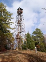
Garden Mountain/Kingsport Lookout Tower
 (G) 36.51202, -82.61669
Junction of Lake Road and Firetower Trail
(G) 36.50721,-82.61369
Junction of Lakeside Trail and Pine Trail
(G) 36.50708,-82.61358
Junction of Lake Road and Pine Trail
(G) 36.50631,-82.61311
Junction of Bays Ridge Road and Pine Trail
</googlemap>
Fees, Hours, Restrictions
There is a $3 gate fee to enter the park. (Or free as benefit for park association members: $25 individual, $35 family per year)
The park grounds are open
- During March-May/September-October
- Mon-Fri: 8:30AM-5:00PM, Sat: 8:30AM-8:00PM, Sun: 12:00PM-8:00PM
- During June-August
- Same as above, plus until 8:00PM weekdays
- During November-February
- Closing at 5:00PM every day.
Dogs are allowed at Bays Mountain Park, but not around the animal habitats, thus please skirt using Lake Road.
Mountain bikes are allowed, upon inspection, on designated trails (thus carry a map to know where!).
Trails
The most popular park hiking trails are Lakeside (with side trip on Holly) and Firetower. Those going mountain biking enjoy the main park roads (not the Hollows) and the newly constructed Chinquapin and Bear Run trails.
Links
Bays Mountain Park website link
Bays Mountain Hiking and Biking Trail Map link
Hiking Bill Fuller's trail logs - http://www.hikingbill.com/trail_systems/bays_mtn_trails.htm