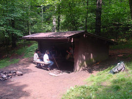
Shelter:Double Springs
Jump to navigation
Jump to search

| ||
| Shelter | Double Springs | |
| Capacity | 6 People | |
| Privy | No | |
| Trail Head Distance N | 3.5 Miles | |
| Trail Head Distance S | 3.0 Miles | |
| Elevation | 4,060 Feet | |
| Latitude | {{#lat_deg2dms: 36.50911}} | |
| Longitude | {{#long_deg2dms: -81.98605}} | |
| Nearest Medical | Bristol, TN | |
|
|
||
| Show Large Map | ||
Description[edit]
Basic three-sided concrete block/metal roof shelter with wooden sleeping platform.
Location[edit]
Just west of the trail at the junction of Holston and Cross Mountains between US421 and TN91.
Water[edit]
A spring is located 100 yards downhill west of the shelter.
Recent Information[edit]
A bear was encountered at the shelter on October 21st, 2015. While it showed no signs of aggression, when hikers arrived, it didn't leave the area.
Maintenance History[edit]
- Oct 2017: Repainted the graffiti board.
- Mar 2016: Attempted to repair roof leak by placing pieces of expanding foam under the ridge cap in the back.
- 2011: Repaired sleeping platform with some new plywood, painted inside of shelter, and caulked roofing nails.
- 1992: New roof support system installed and roof replaced. Painted shelter inside and out. Added gutter on front, drainage in back. Installed picnic table.
- 1991: Roof repaired.
- 1960: Built by US Forest Service.
Photo Gallery[edit]
| Shelter name | Section | Trail distance from Damascus |
|---|---|---|
| Abingdon Gap Shelter | US421 to Damascus | 10.2 |
| McQueens Knob Shelter (emergency shelter) | US421 to Damascus | 11.7 |
| Double Springs Shelter | TN91 to US421 | 18.5 |
| Iron Mountain Shelter | Wilbur Dam Rd to TN91 | 26.2 |
| Vandeventer Shelter | Wilbur Dam Rd to TN91 | 33.0 |
| Laurel Fork Shelter | Dennis Cove Rd to Wilbur Dam Rd | 49.5 |
| Moreland Gap Shelter | US19E to Dennis Cove Rd | 57.0 |
| Mountaineer Falls Shelter | US19E to Dennis Cove Rd | 66.6 |
| Stan Murray Shelter | Carver's Gap to US19E | 86.5 |
| Roan High Knob Shelter | Iron Mountain Gap to Carver's Gap | 91.7 |
| Clyde Smith Shelter | Iron Mountain Gap to Carver's Gap | 100.2 |
| Cherry Gap Shelter | Indian Grave Gap to Iron Mountain Gap | 109.3 |
| Curley Maple Gap Shelter | Nolichucky River to Indian Grave Gap | 122.2 |
| No Business Knob Shelter | Spivey Gap to Nolichucky River | 132.7 |
Per the 2021 AT Data Book.
