Uploads by Tim
Jump to navigation
Jump to search
This special page shows all uploaded files.
| Date | Name | Thumbnail | Size | Description | Versions |
|---|---|---|---|---|---|
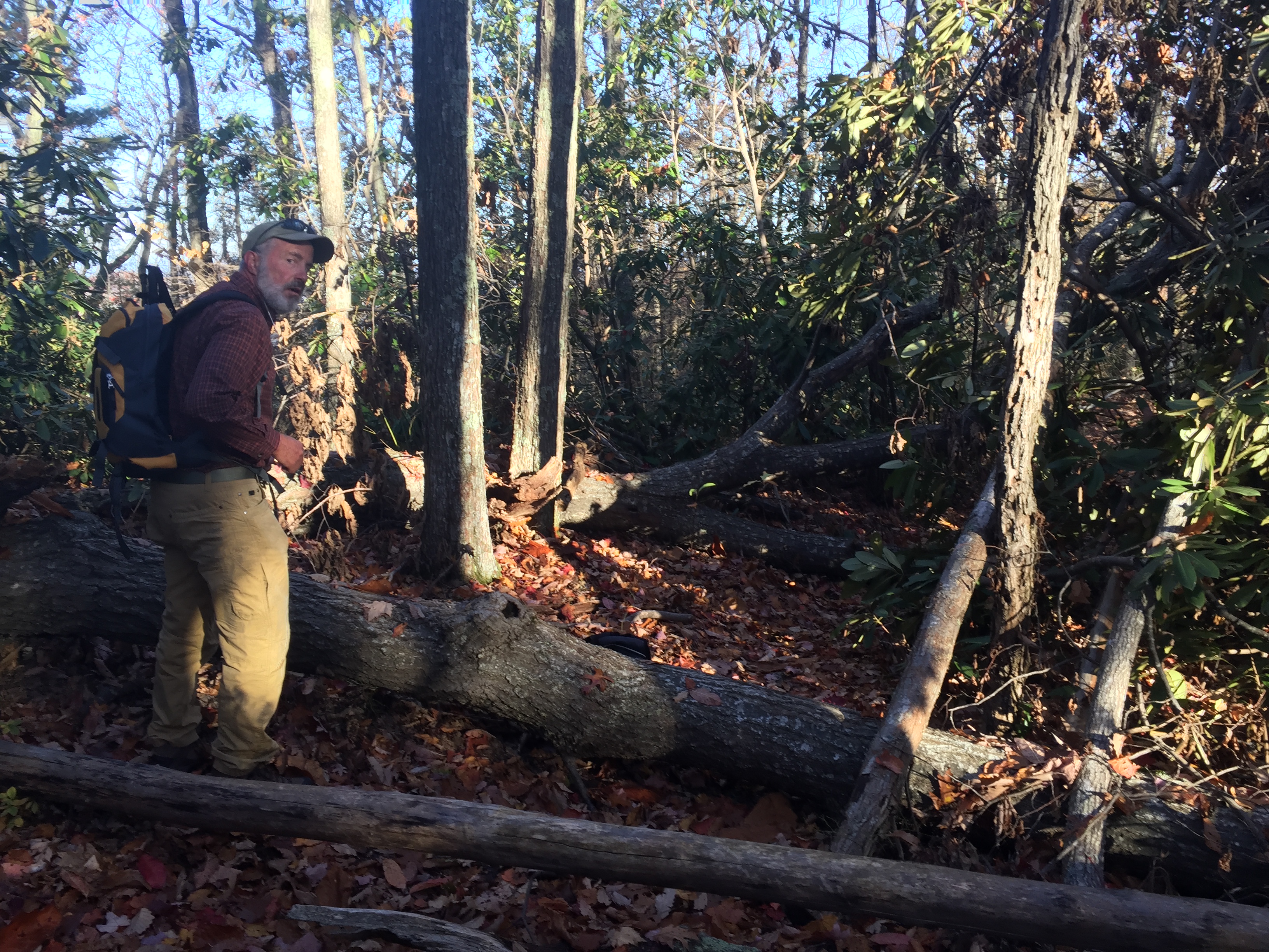
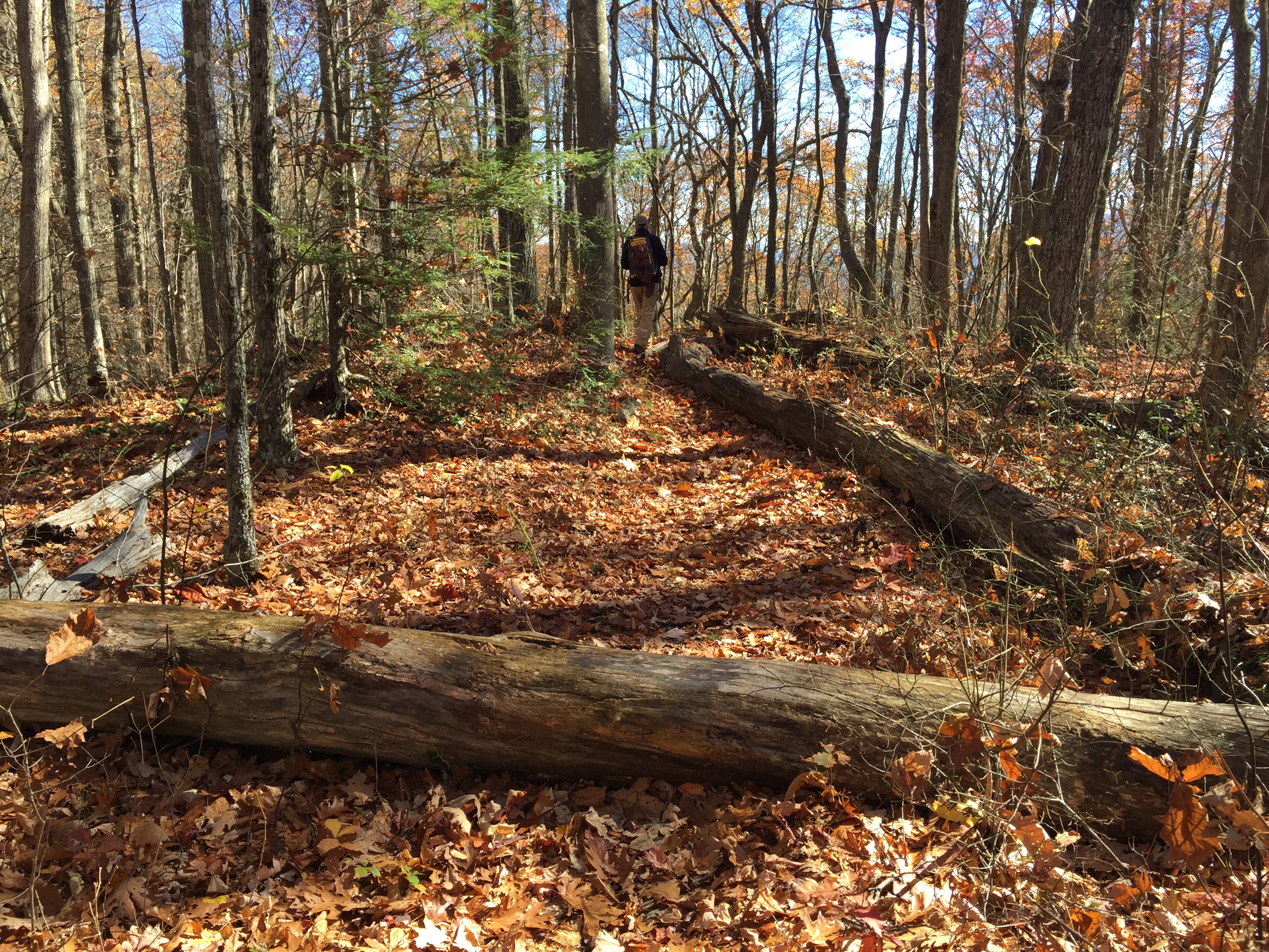
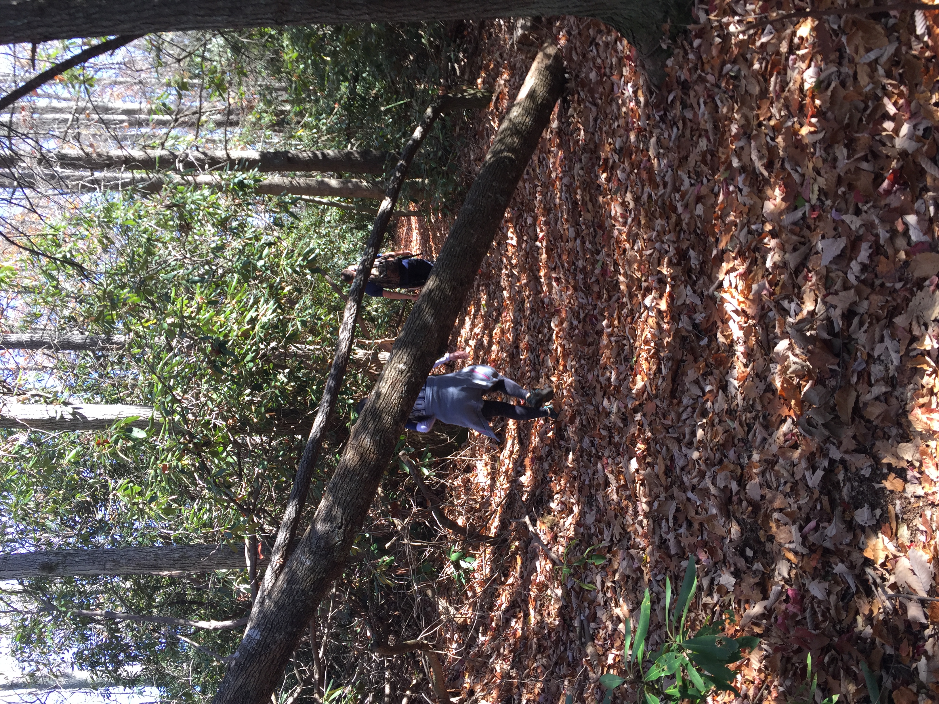
| 22:16, 8 November 2016 | 2016-11-05 Blowdown 72.JPG (file) |  |
3.38 MB | Blowdown seen on [US19E to Dennis Cove Rd]] trail on 11/5/2016 | 1 |
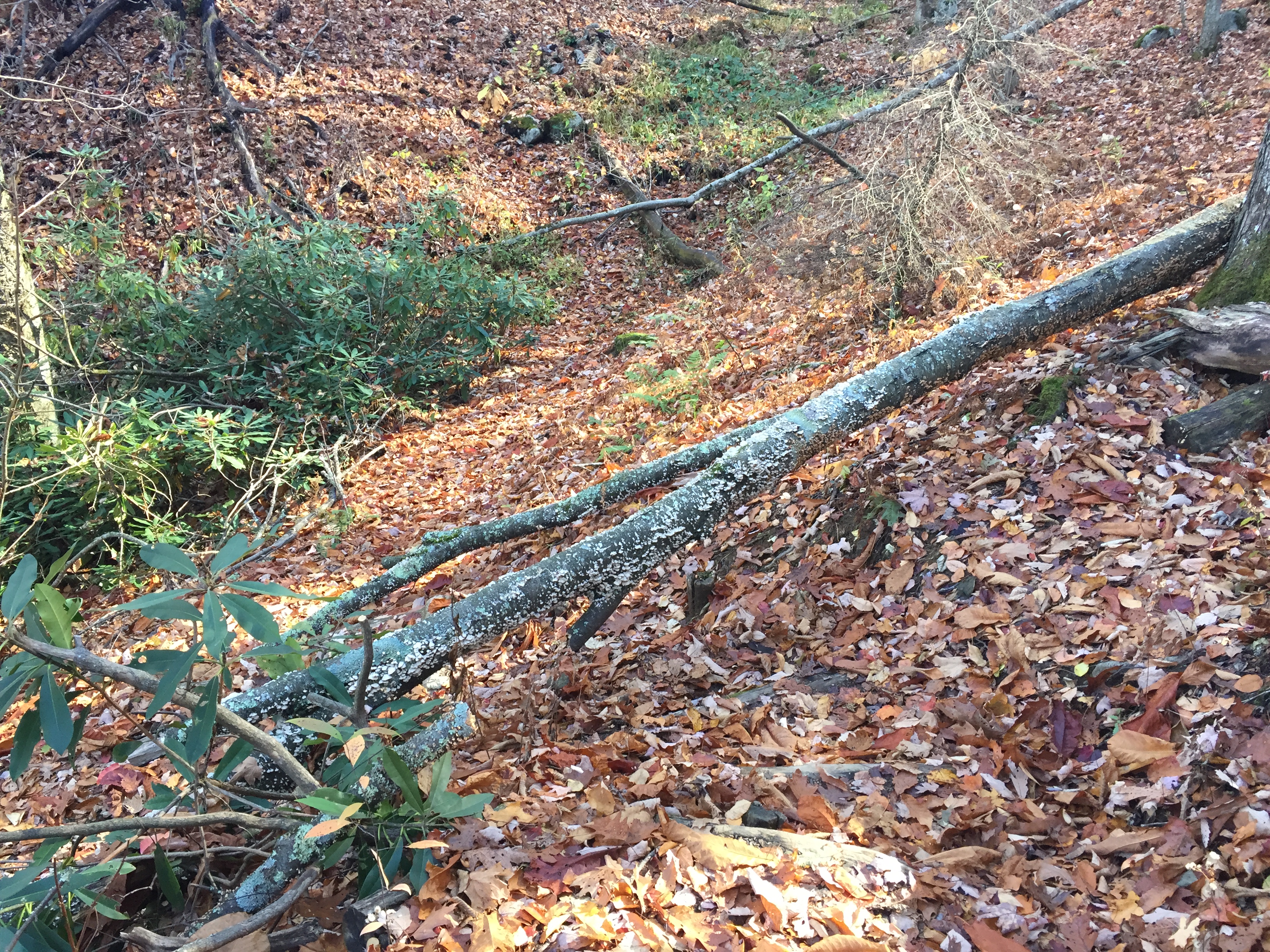
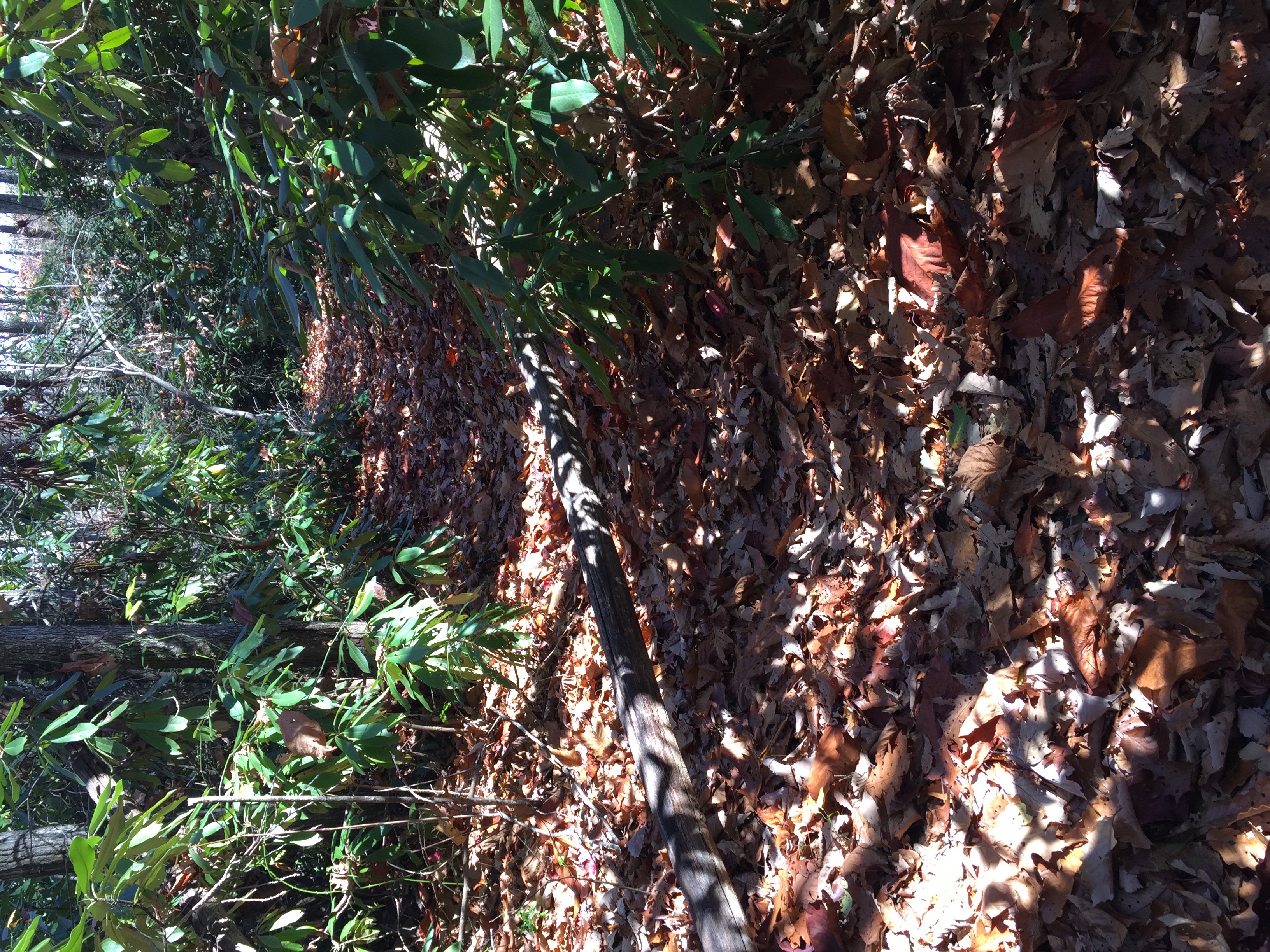
| 22:18, 8 November 2016 | 2016-11-05 Blowdown 73.JPG (file) |  |
4.84 MB | Blowdown seen on [US19E to Dennis Cove Rd]] trail on 11/5/2016 | 1 |
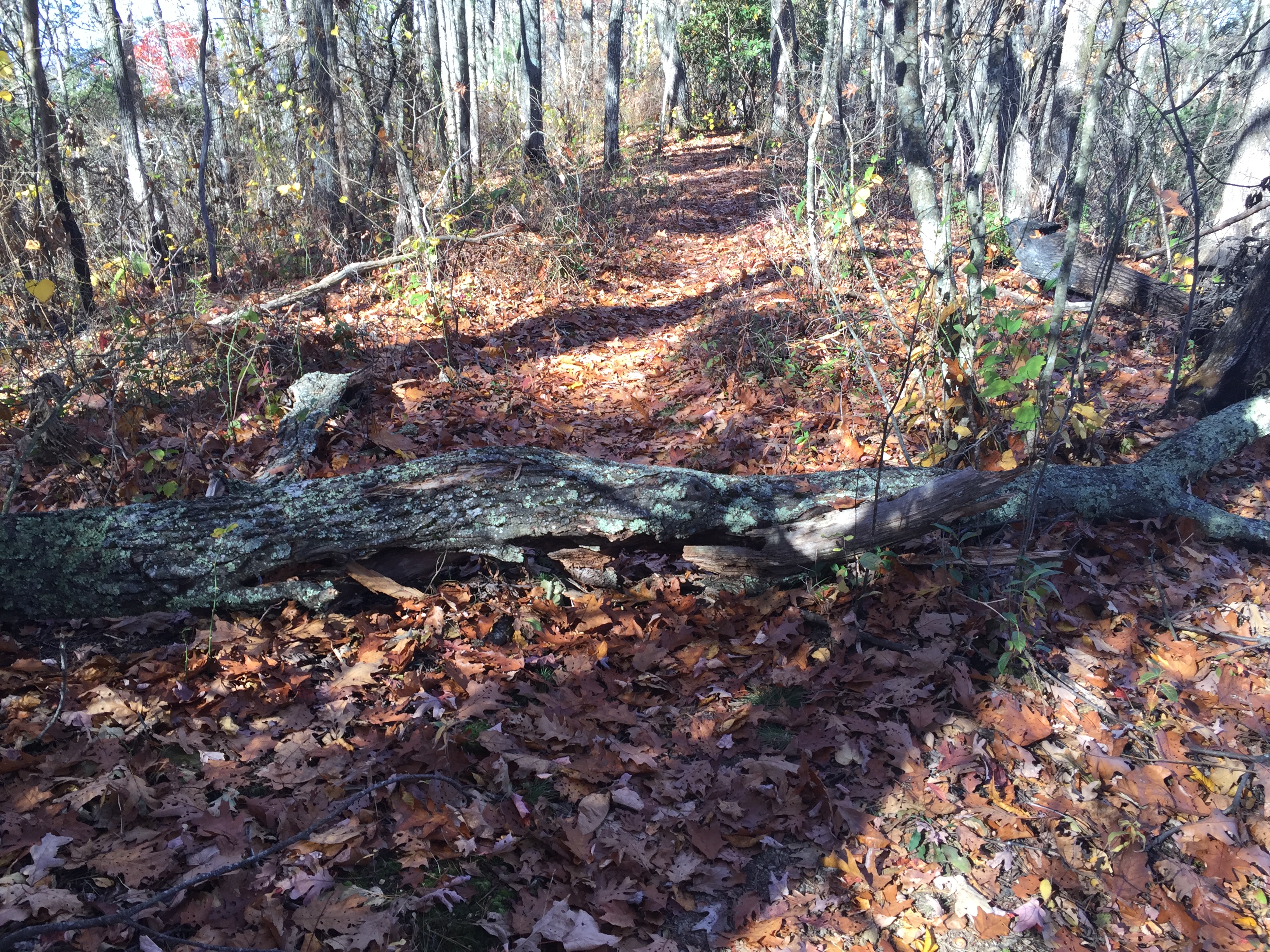
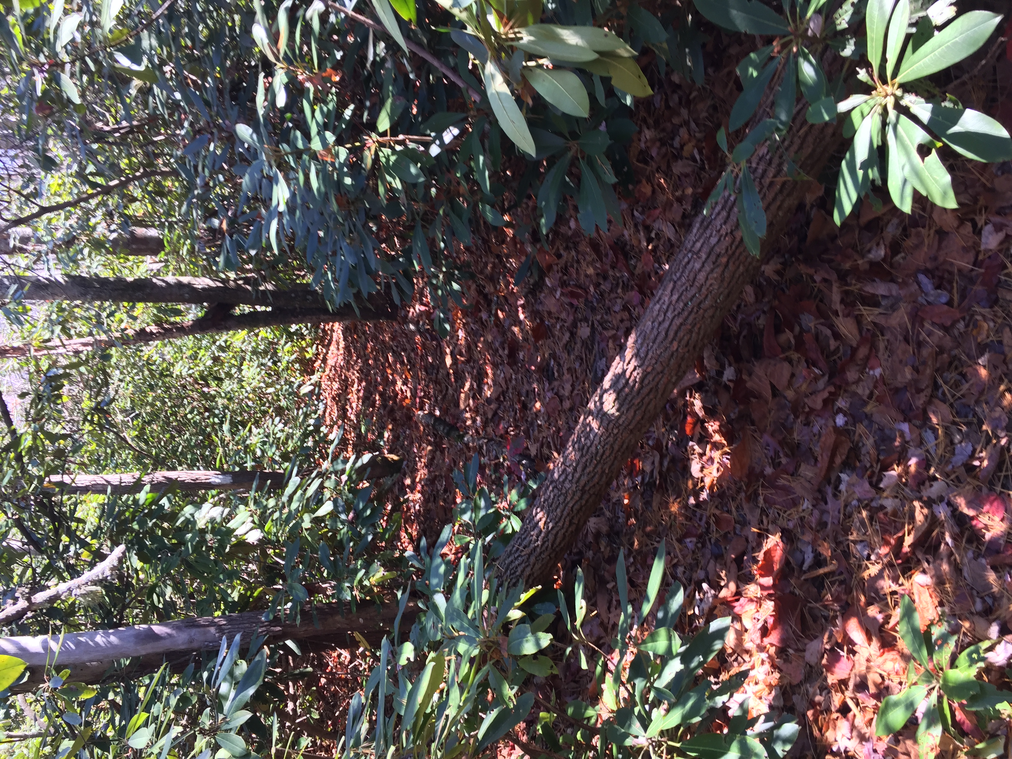
| 22:19, 8 November 2016 | 2016-11-05 Blowdown 74.JPG (file) |  |
4.25 MB | Blowdown seen on US19E to Dennis Cove Rd trail on 11/5/2016 | 1 |
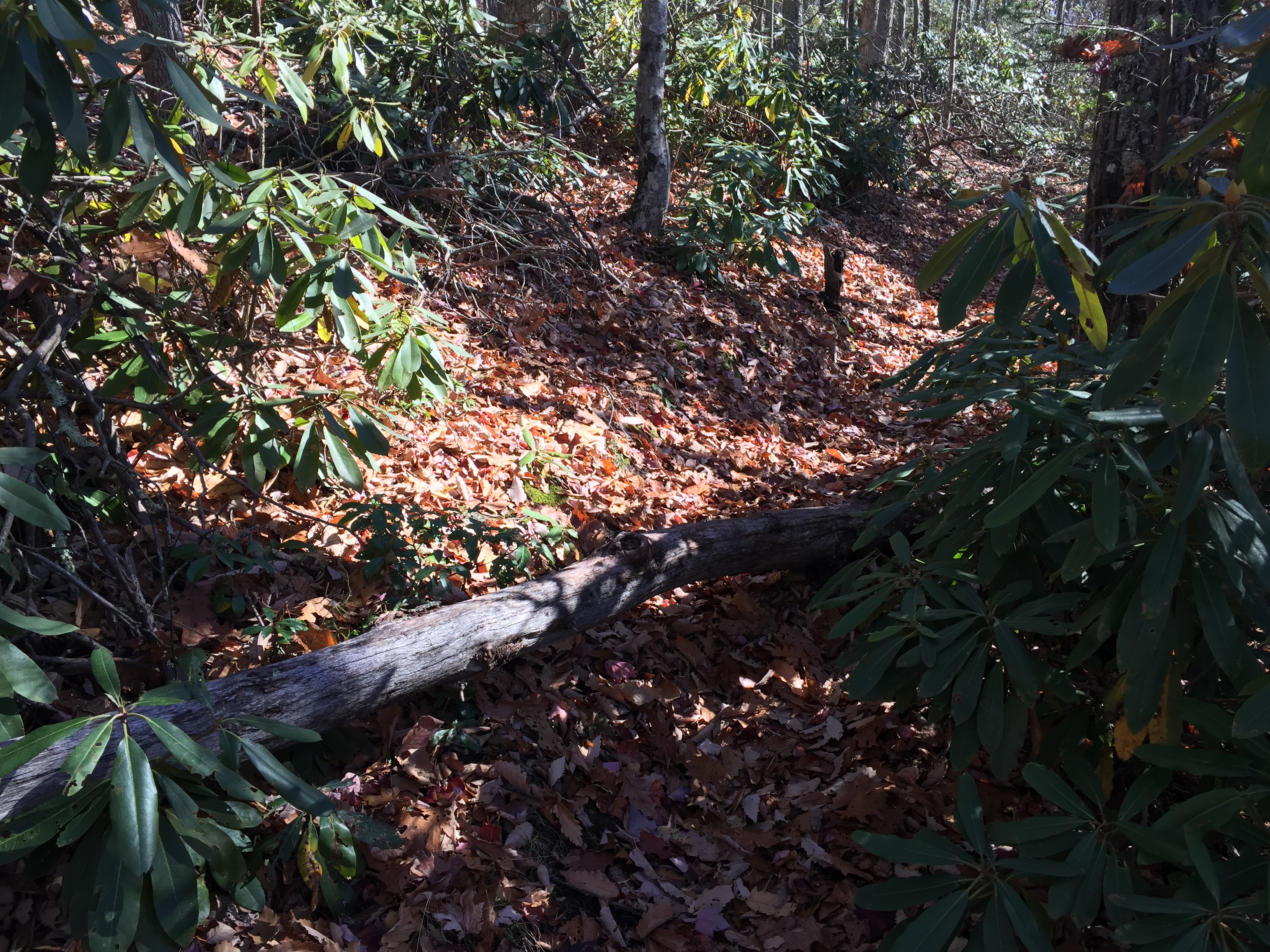
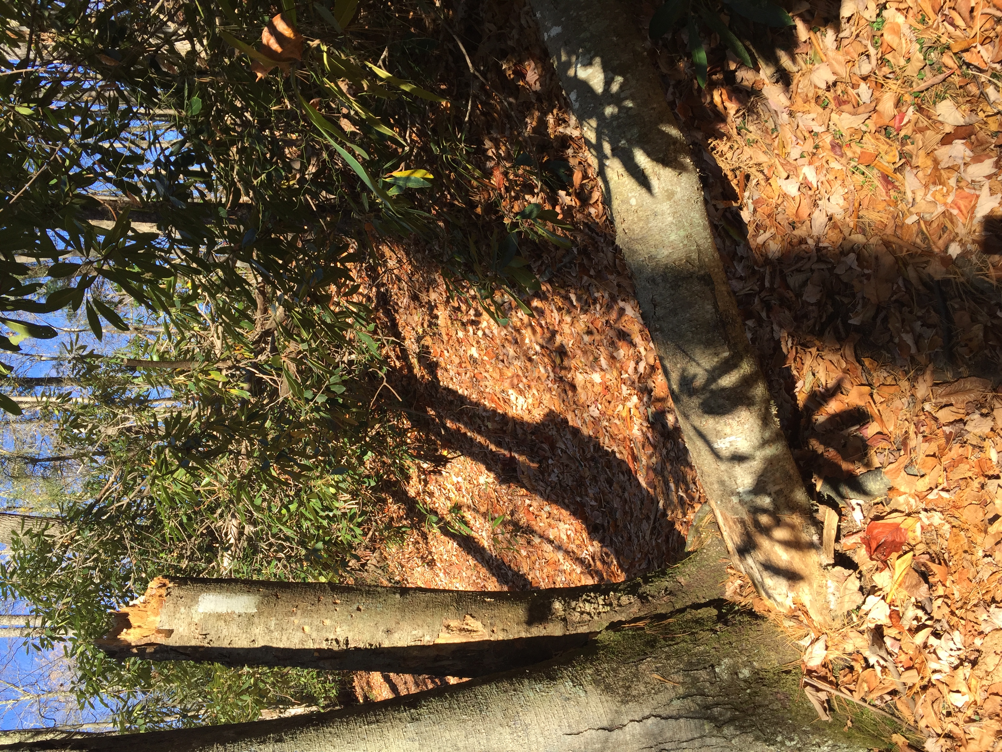
| 22:21, 8 November 2016 | 2016-11-05 Blowdown 75.JPG (file) |  |
3.5 MB | Blowdown seen on US19E to Dennis Cove Rd trail on 11/5/2016 | 1 |
| 22:24, 8 November 2016 | 2016-11-05 Blowdown 76.JPG (file) |  |
4.72 MB | Blowdown seen on US19E to Dennis Cove Rd trail on 11/5/2016 | 1 |
| 22:26, 8 November 2016 | 2016-11-05 Blowdown 77.JPG (file) |  |
3.66 MB | Blowdown seen on US19E to Dennis Cove Rd trail on 11/5/2016 | 1 |
| 22:28, 8 November 2016 | 2016-11-05 Blowdown 79.JPG (file) |  |
3.39 MB | Blowdown seen on US19E to Dennis Cove Rd trail on 11/5/2016 | 1 |
| 22:30, 8 November 2016 | 2016-11-05 Blowdown 81.JPG (file) |  |
4.22 MB | Blowdown seen on US19E to Dennis Cove Rd trail on 11/5/2016 | 1 |
| 22:33, 8 November 2016 | 2016-11-05 Blowdown 82.JPG (file) |  |
4.1 MB | Blowdown seen on US19E to Dennis Cove Rd trail on 11/5/2016 | 1 |
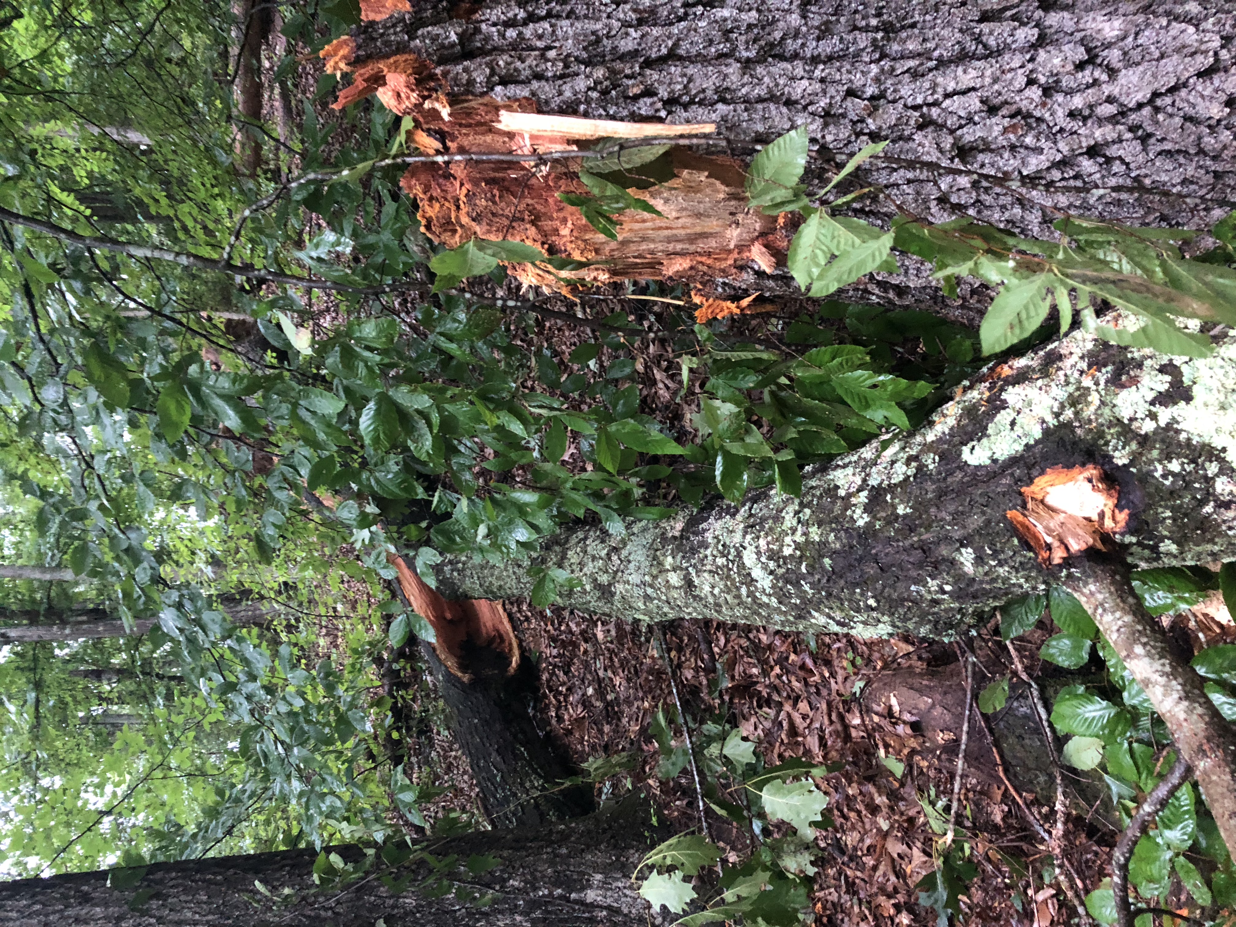
| 13:12, 22 July 2018 | 2018-07-22 Blowdown near Creek.jpeg (file) |  |
5.05 MB | Massive blowdown descending to creek on Meadow Loop | 1 |
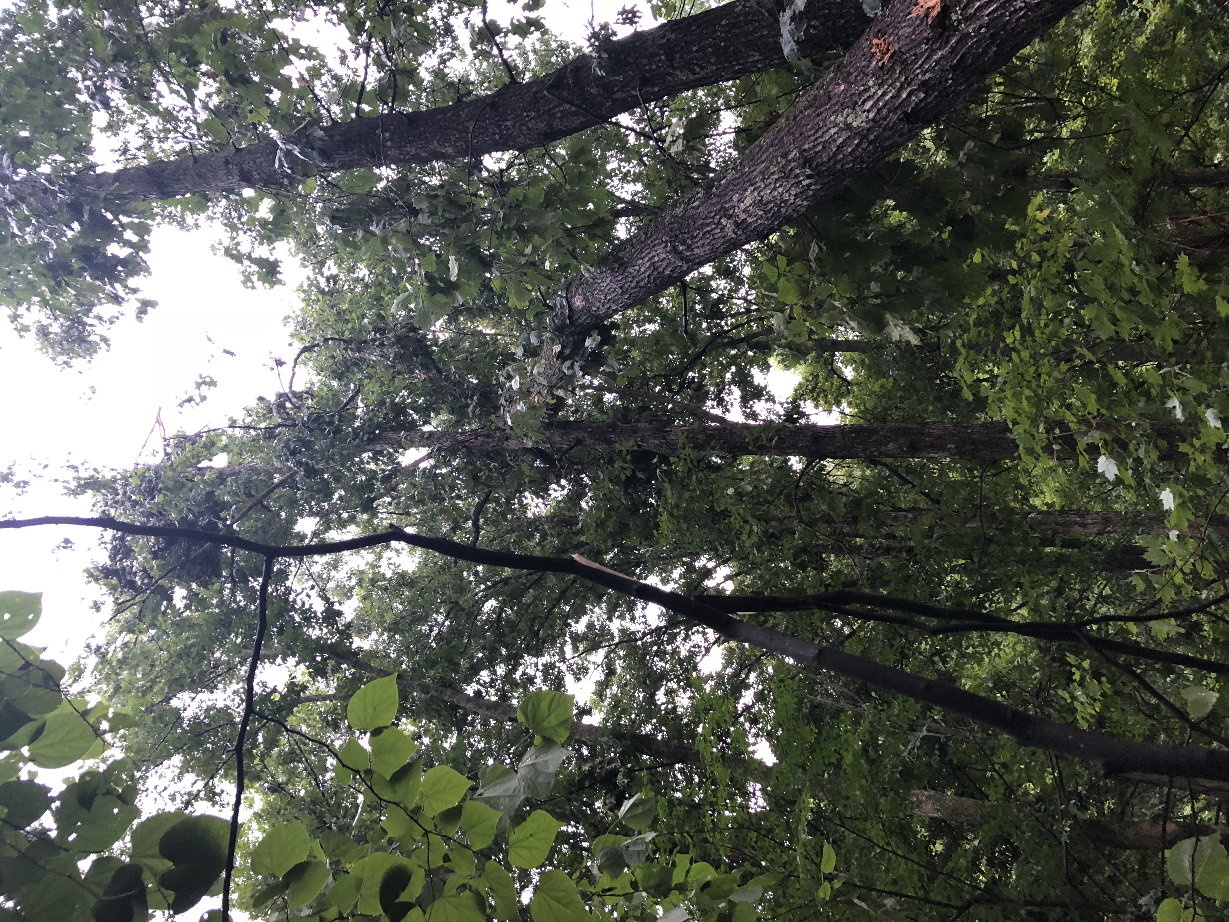
| 13:14, 22 July 2018 | 2018-07-22 Blowdown near Creek 2.jpeg (file) |  |
5.07 MB | Showing partial blowdown suspended by other tree | 1 |
| 13:13, 22 July 2018 | 2018-07-22 Blowdown near Sycamore.jpeg (file) |  |
4.66 MB | Blowdown near Sycamore tree on lower meadow loop | 1 |
| 12:55, 4 January 2020 | 2020-01-04 Forerunner Darwin Hike.kml (file) | 19 KB | 1 | ||
| 12:56, 4 January 2020 | 2020-01-04 Gaia Darwin Hike.kml (file) | 10 KB | 1 | ||
| 13:24, 19 May 2020 | 82532482 3020937654596526 8659480441918586880 n.jpg (file) |  |
128 KB | 1 | |
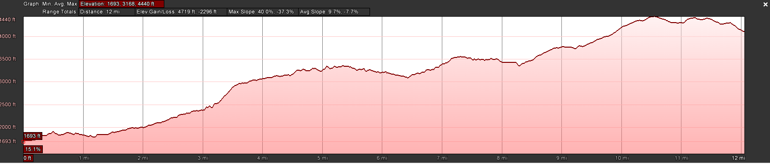
| 19:47, 10 October 2016 | AT2016Hike-19E to Walnut Mountain Road.PNG (file) | 59 KB | Hike profile of AT section from 19E to Walnut Mountain Road | 1 | |
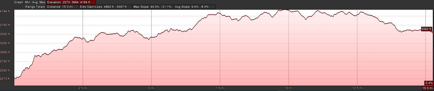
| 07:36, 29 January 2017 | AT2016Hike-321 to Wilbur Dam Rd.PNG (file) | 59 KB | Profile of the Shook Branch Rd on US321 to Wilbur Dam Rd along Watauga Lake section of the A.T. | 1 | |
| 20:42, 16 August 2016 | AT2016Hike-Barn to 19E.PNG (file) | 58 KB | Elevation profile of hike from OMVT Barn to 19E | 1 | |
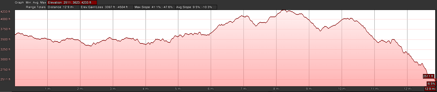
| 08:31, 30 May 2016 | AT2016Hike-Deep Gap to Greasy Creek.PNG (file) | 57 KB | Profile of June 2016 AT Hike | 1 | |
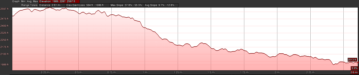
| 10:17, 2 July 2016 | AT2016Hike-Deep Gap to Hughes Gap.PNG (file) | 55 KB | Profile view of AT hike from Deep Gap to Hughes Gap (Hughes Gap on the left) | 1 | |
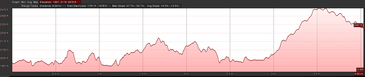
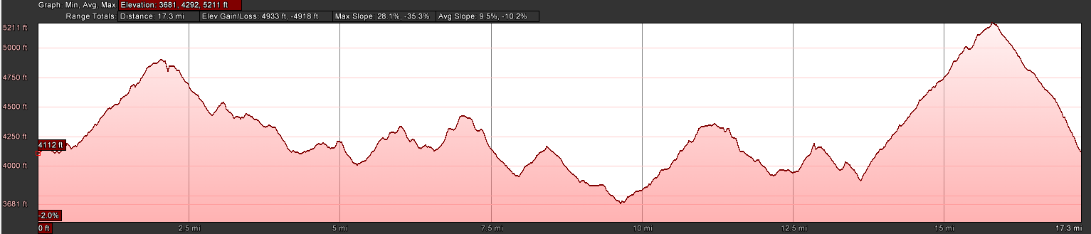
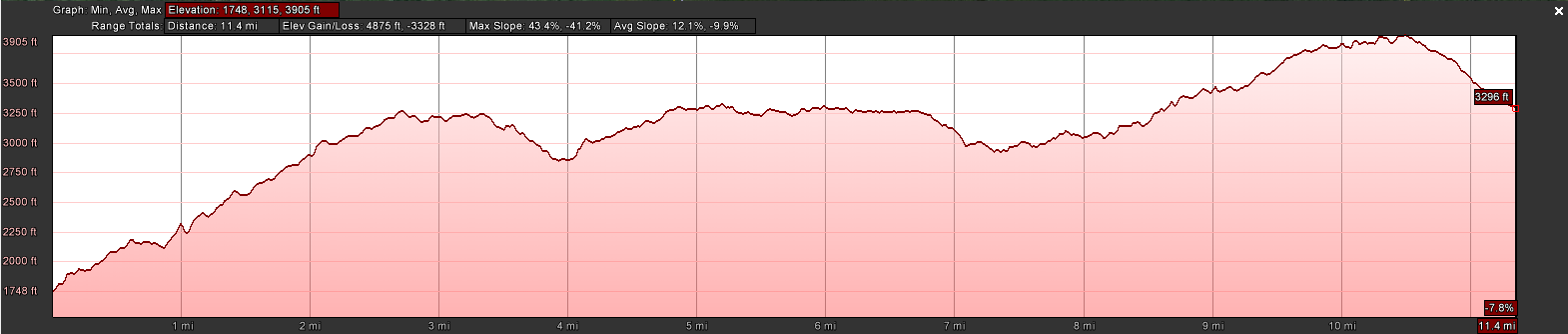
| 07:35, 29 January 2017 | AT2016Hike-Dennis Cove to Laurel Fork Trail.PNG (file) | 59 KB | Profile of the Dennis Cove to Laurel Fork Trail section of the A.T. | 1 | |
| 07:36, 29 January 2017 | AT2016Hike-Laurel Fork Trail to 321.PNG (file) | 56 KB | Profile of the Laurel Fork Trail on to Pond Mountain to Shook Branch Rd on US321 section of the A.T. | 1 | |
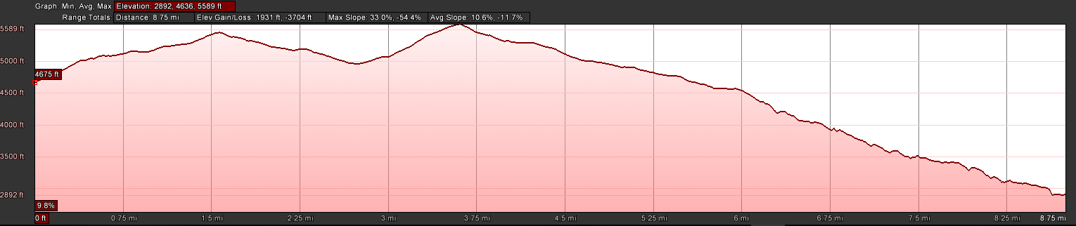
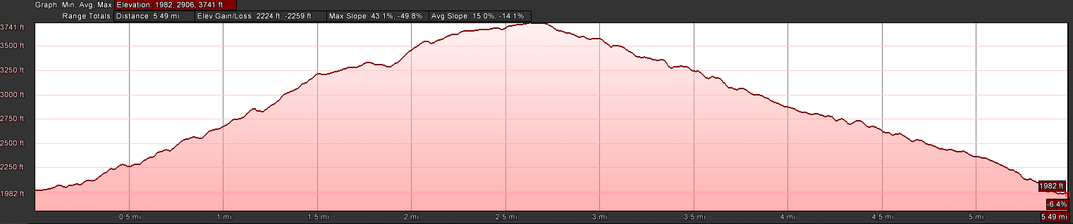
| 08:55, 30 May 2016 | AT2016Hike-Nolichucky to Deep Gap.PNG (file) | 57 KB | Profile of Nolichucky to Deep Gap for 2016 AT Hike | 1 | |
| 08:52, 30 May 2016 | AT2016Hike-Spivey Gap to Nolichucky.PNG (file) | 66 KB | Profile of Nolichucky to Spivey Gap for 2016 AT Hike | 1 | |
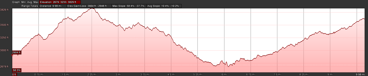
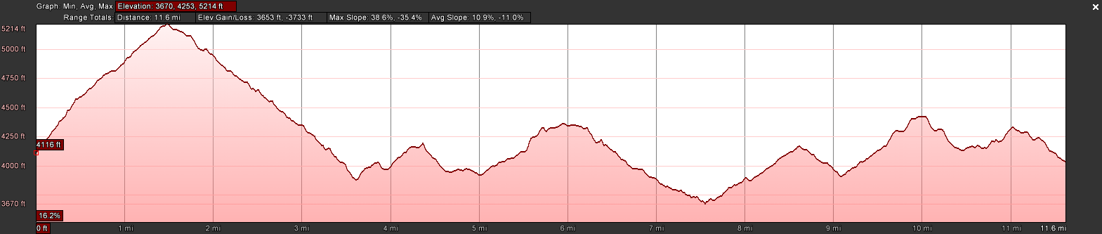
| 20:47, 1 November 2016 | AT2016Hike-Walnut Mountain Road to Dennis Cove Road.PNG (file) | 63 KB | Profile of Walnut Mountain Road to Dennis Cove Road | 1 | |
| 08:02, 29 January 2017 | AT2016Hike-Wilbur Dam Rd to TN91.PNG (file) | 60 KB | Profile of Wilbur Dam Rd across Iron Mountain to TN91 portion of the A.T. | 1 | |
| 23:27, 22 November 2019 | Azalea.kml (file) | 3 KB | 1 | ||
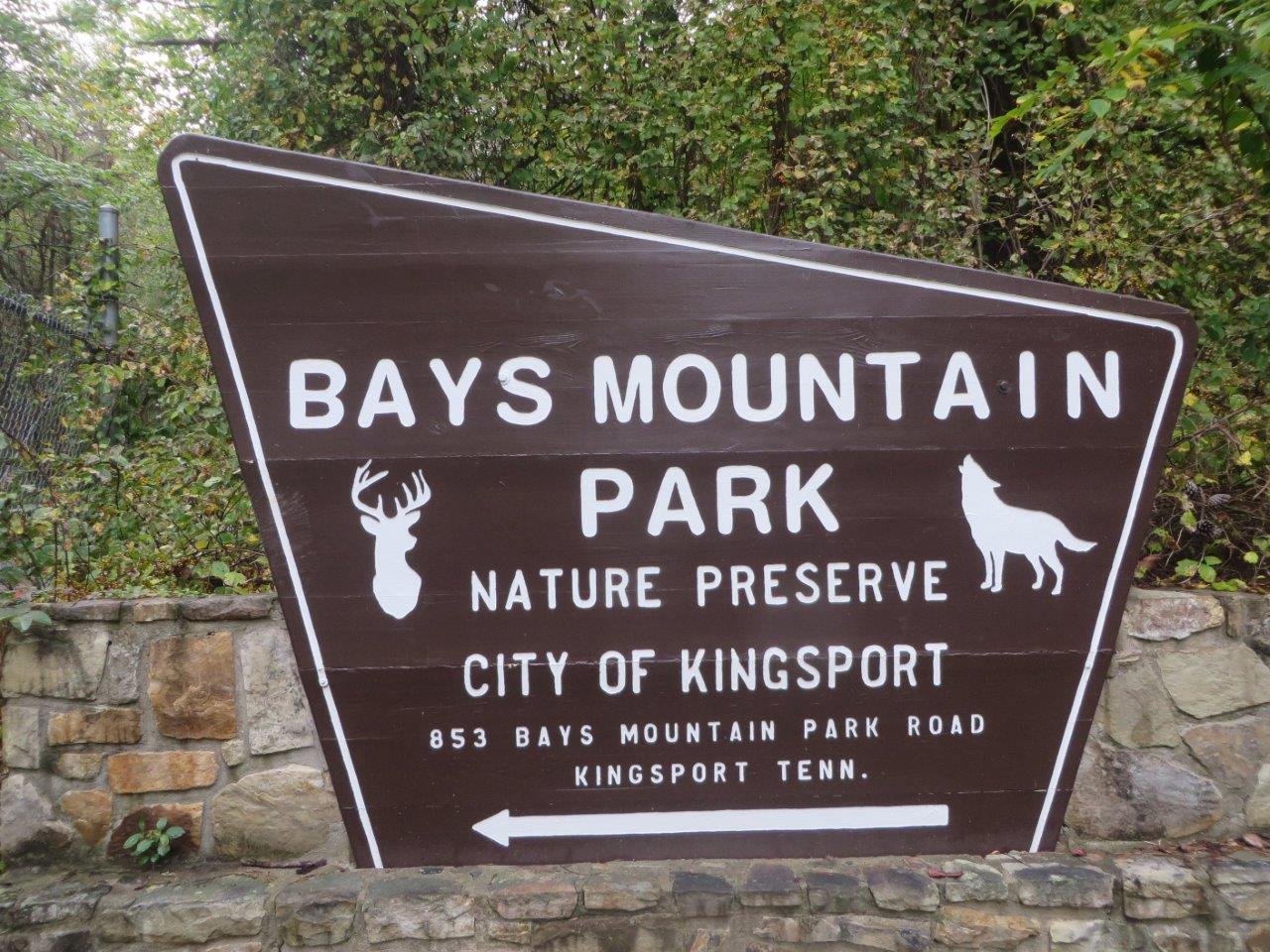
| 00:41, 4 October 2015 | BMP Bays Mountain Park Sign.jpg (file) |  |
248 KB | Front entrance sign to Bays Mountain Park | 1 |
| 11:45, 10 November 2019 | Back Hollow Road.kml (file) | 3 KB | 1 | ||
| 08:59, 23 November 2019 | Bays Mountain Road.kml (file) | 4 KB | 1 | ||
| 22:37, 23 November 2019 | Bays Ridge Road.kml (file) | 2 KB | 1 | ||
| 23:04, 23 November 2019 | Bays Ridge Trail.kml (file) | 3 KB | 1 | ||
| 08:31, 12 May 2018 | Beaches icon.jpg (file) | 36 KB | Icon to signify that a park (or trail?) has beaches from which to swim. | 1 | |
| 18:04, 24 November 2019 | Bear Run Trail.kml (file) | 4 KB | 1 | ||
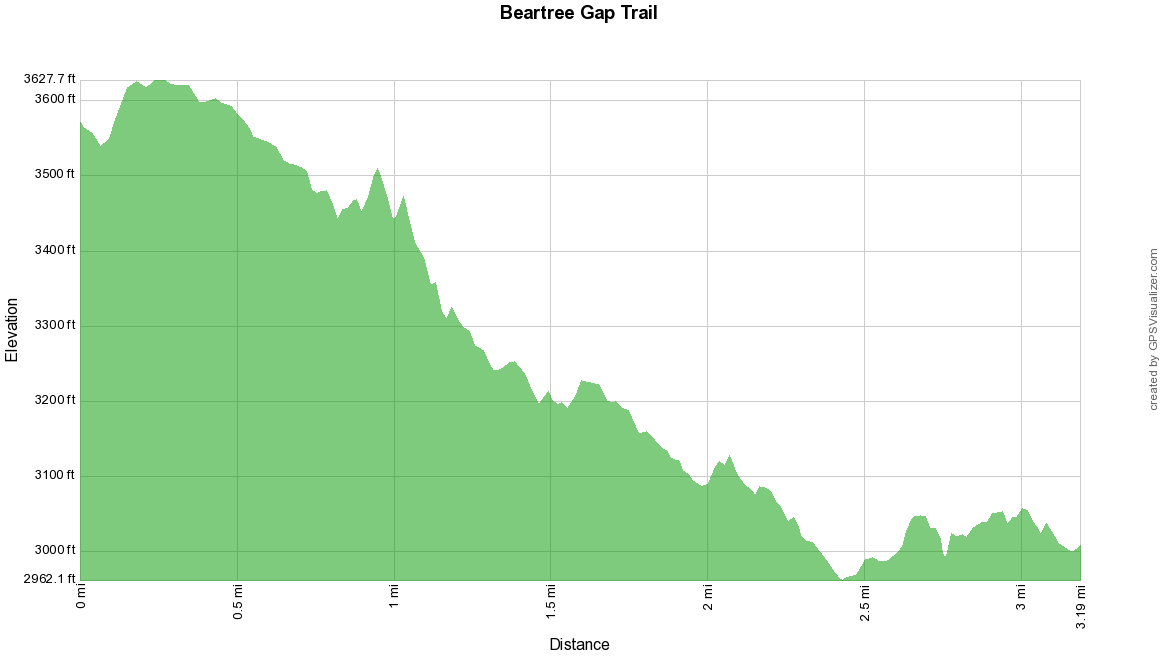
| 15:56, 19 January 2020 | Beartree Gap Trail.kml (file) | 7 KB | 1 | ||
| 15:58, 19 January 2020 | Beartree gap trail profile.png (file) |  |
23 KB | 1 | |
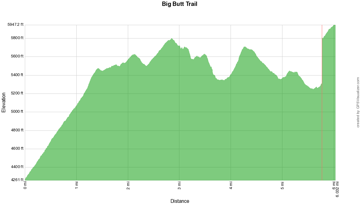
| 11:07, 5 January 2020 | Big Butt Trail.kml (file) | 33 KB | 2 | ||
| 00:07, 11 December 2019 | Big Oak Trail.kml (file) | 2 KB | 1 | ||
| 22:21, 19 December 2019 | Big South Fork National Recreation Area.kml (file) | 80 KB | 1 | ||
| 11:11, 5 January 2020 | Big butt trail profile.png (file) |  |
23 KB | 1 | |
| 15:51, 20 December 2019 | Blackwater Falls State Park.kml (file) | 13 KB | 1 | ||
| 23:18, 18 December 2019 | Blue 2.kml (file) | 17 KB | 1 | ||
| 22:12, 25 October 2015 | Blue 2 Foundation.jpg (file) |  |
347 KB | Foundation found along Blue 2 | 1 |
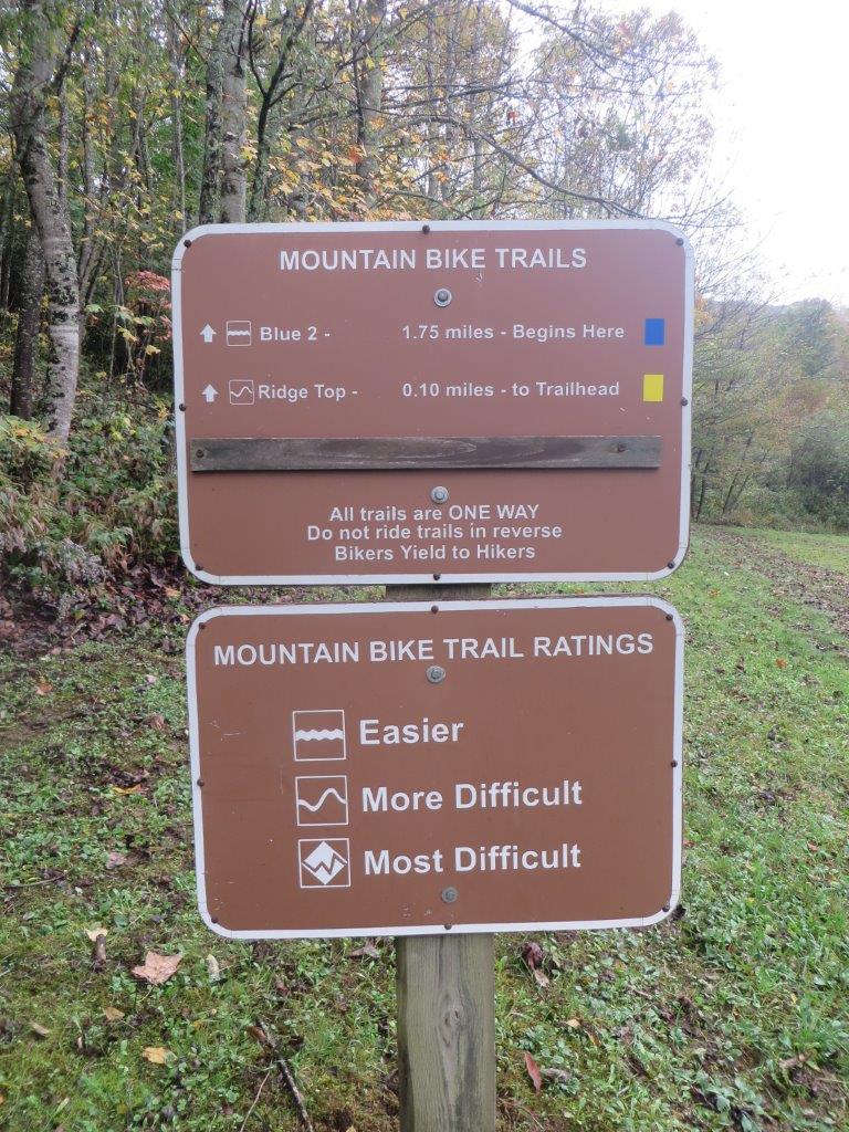
| 22:13, 25 October 2015 | Blue 2 Trail Head.jpg (file) |  |
194 KB | Blue 2 and Ridge Top trail head | 1 |
| 22:14, 25 October 2015 | Blue 2 View.jpg (file) |  |
184 KB | View along Blue 2 | 1 |
| 23:22, 18 December 2019 | Blue 2 profile.png (file) |  |
25 KB | 1 | |
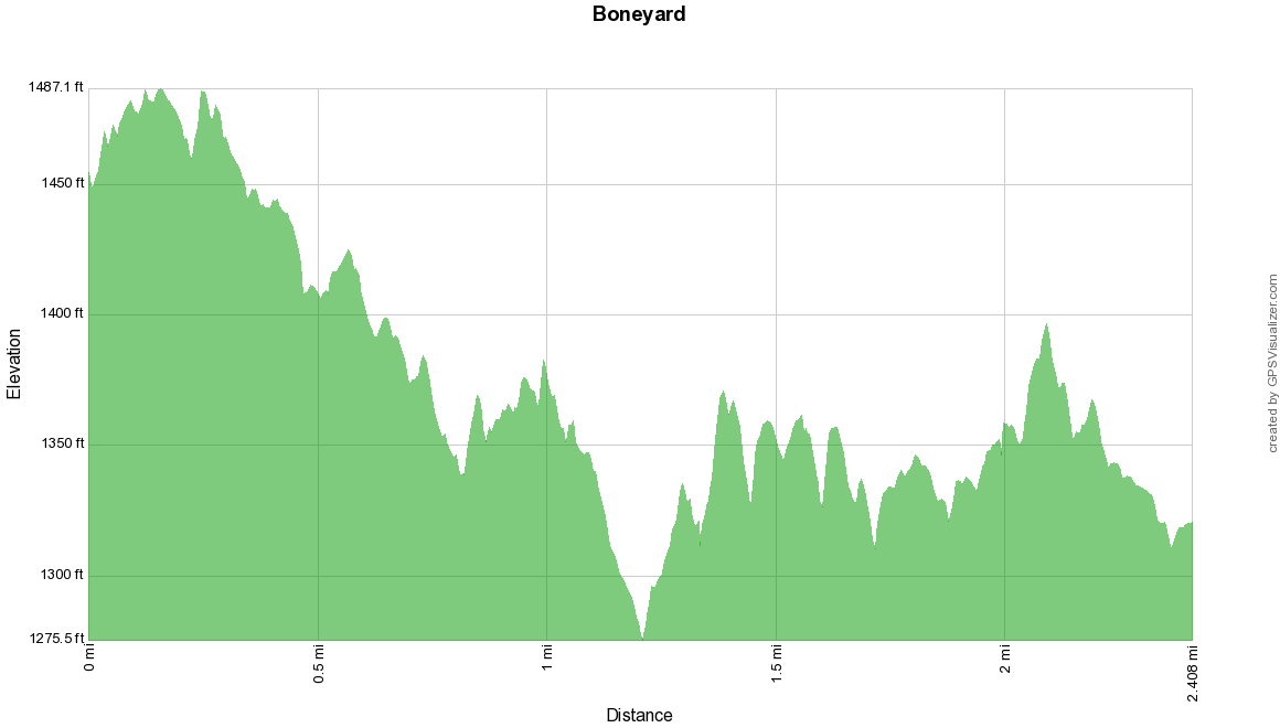
| 00:48, 29 December 2019 | Boneyard-profile.png (file) |  |
21 KB | redo of map with current settings and recent hike trimming to actual trail segment | 2 |
| 11:33, 24 June 2023 | Boneyard.kml (file) | 11 KB | 3 | ||
| 01:02, 29 December 2019 | Boneyard Connector.kml (file) | 1 KB | 1 | ||
| 22:36, 18 December 2019 | Brumley Mountain Trail.kml (file) | 15 KB | 1 |