Ridge Top (Roan Mountain State Park)
Jump to navigation
Jump to search
| Ridge Top (Roan Mountain State Park) (log in to submit report) | |
|---|---|

| |
| Highlight | One of the two trail mountain bike system at the park |
| Park | Roan Mountain State Park |
| Located | Roan Mountain, TennesseeLocation inherited from associated park |
| Trail Marking | Yellow |
| Trail UseThings allowed to do on or near the trail |
|
| FeaturesThings to see on or near the trail |
|
| Difficulty Rating | Easy |
| Hiking TimeTime from car and back. Includes any time hiking to access this trail. | 30 min0.5 Hours <br />0.0313 Days <br /> round trip |
| Distance: | 0.2287 mi0.368 km <br /> trailStrict non-repeating trail length / 0.5 mi0.805 km <br /> round tripTypical or shortest length from the car, hike the trail, and return to car |
| Trail Type | Segment |
| Low / High Point | 2,906 ft968.667 Yards <br />885.749 Meters <br /> / 3,013 ft1,004.333 Yards <br />918.362 Meters <br /> |
| Elev. Gain/LossSee link for details of calculation. Gain/Loss is direction dependent. | 96 ft29.261 Meters <br /> / (0 ft0 Meters <br />) – East-to-West |
| Trip ReportsFrom user "hiked it" submissions<br />Recent is within last 90 days | No hikes logged yet |
| NearbyWithin 5 mi<br />Click link to view list | 12 trails / 50.4 mi of trail |
| Parking | 36° 10' 4.33" N, 82° 5' 49.09" W Map |
| Trailhead | 36° 10' 2.71" N, 82° 5' 55.68" W Map |
|
| |
| Show In Google Maps | |
Download KML / Upload new version / KML File Page / Create Profile Chart / gpsvisualizer Map
Trail Overview[edit]
This is part of the Roan Mountain State Park trail system and along with Blue 2 constitutes the Mountain Bike Trails of Roan Mountain State Park
How to get there[edit]
From Johnson City (I-26 Exit 24):
- Take TN67/US321 over to Elizabethton (about eight miles).
- Turn right/south at traffic light for TN37/US19E/US321 and travel for 17 miles.
- Turn right/south for TN143 for five miles to park visitors center.
- Trailheads are in several places around the park.
GPS address is 1015 Hwy 143 Roan Mountain, TN 37687.
Route Description[edit]

A short alternate option of riding around the mountain bike trails.
Accessible from this trail is Blue 2.
Typical Conditions[edit]
The trails are fairly well maintained and blazed fairly clearly with the exception of the Ridge Top connector. As I now recall, it may have been blazed blue as well.
Photos[edit]
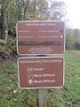
Trail head sign
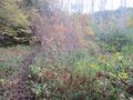
View along trail

Trail Profile
