Riverbank: Difference between revisions
(Adding new IB park field) |
(→Maps: Updating for new Maps extension) |
||
| Line 52: | Line 52: | ||
The path shown below in red is this Riverbank Trail. The section in orange is the [[WPSP Lakeshore Trail]]. | The path shown below in red is this Riverbank Trail. The section in orange is the [[WPSP Lakeshore Trail]]. | ||
< | <display_map center="36.5,-82.485" type="terrain" zoom="15" width="auto" height="550" gkml="http://tehcc.org/clubwiki/kml/WPSP_Riverbank_Trail.kml, | ||
http://tehcc.org/clubwiki/kml/WPSP_Riverbank_Trail.kml | http://tehcc.org/clubwiki/kml/WPSP_Lakeshore_Trail.kml"> | ||
http://tehcc.org/clubwiki/kml/WPSP_Lakeshore_Trail.kml | |||
36.50057,-82.4858~Trailhead at Fall Creek Road~ ~MarkerA.png | |||
Trailhead at Fall Creek Road | 36.49870,-82.48225~Trailhead by boat launch~ ~MarkerA.png | ||
</display_map> | |||
Trailhead by boat launch | |||
</ | |||
[http://www.state.tn.us/environment/parks/WarriorsPath/pdf/WPTRL.pdf State Park Map and Trail Brochure] | [http://www.state.tn.us/environment/parks/WarriorsPath/pdf/WPTRL.pdf State Park Map and Trail Brochure] | ||
Revision as of 08:21, 30 August 2015
| |||||||||||||||||||||||||||||||||||||||

Trail Overview
Located in Warriors Path State Park. A 0.27 mile walk on the sloping hillside along Ft. Patrick Henry Lake/Holston River.
How to get there
Directions to main entrance found on Warriors Path State Park webpage. There are two trailheads. One is at Fall Creek Road just south of the bridge; while the other is at the boat launch in the park campground.
Route Description
Path follows the north shoreline below the main park campground. There are dark blue trail blazes. Sometimes the route splits into an upper and lower path due to folks working their way along the steep hillside. At boat launch, can continue onto WPSP Lakeshore Trail. And right below Fall Creek Road at the bridge is an extremely popular fishing spot.
Typical Conditions
Well worn path with detours as the trees fall.
Fees, Permits, etc.
No fee required.
After the Hike
Misc. Information
The park map brochure (link below) incorrectly states 0.5 mile trail length versus 0.27 mile actual/sign information.
Maps
The path shown below in red is this Riverbank Trail. The section in orange is the WPSP Lakeshore Trail.
State Park Map and Trail Brochure
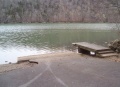
Photos
Boat Launch
