|
|
| (13 intermediate revisions by 4 users not shown) |
| Line 1: |
Line 1: |
| <!-- The following few lines create the "Infobox" table template. Please scroll down to edit the main content of the article. -->
| | {{Trail |
| {{Infobox Trail | | |Banner Image=File:BMP Pretty Ridge Trail sty.JPG |
| | Image Name = Placeholder.JPG
| | |Park=Bays Mountain Park |
| | City = Kingsport
| | |City=Kingsport |
| | State = Tennessee
| | |Land Owner=City of Kingsport |
| | Trail Use = {{Hike}} {{Biking}} {{Dogs}}
| | |Trail Marking=Signs |
| | Difficulty Rating = Difficult
| | |Trail Use=Hiking, Biking, Geocaching |
| | Hike Time = 1.5
| | |Difficulty Rating=Hard |
| | Distance = 1.7
| | |Hike Time=1.5 hrs |
| | Elevation Gain = ~470
| | |Trail Distance=1.716 mi |
| | High Point = 2081
| | |Round Trip Distance=6.8 mi |
| | Latitude = N36°29.860
| | |Trail Type=Segment |
| | Longitude = W82°38.596
| | |High Point=2,078 Ft |
| | Medical = Kingsport, TN
| | |Low Point=1,608 ft |
| <!-- DON'T EDIT THE GOOGLEMAP TAG -->
| | |Elevation Gain=386 Ft |
| | googlemap =
| | |Elevation Loss=461 Ft |
| <googlemap lat="36.49487" lon="-82.60517" zoom="9" width="270" type="map" height="180" selector="no" controls="small">
| | |Elevation Change Direction=East-to-West |
| 36.49487, -82.60517, Bays Mountain Park | | |Parking location=36.50882, -82.60955 |
| Main entrance gate
| | |Trailhead location=36.49764, -82.6433 |
| </googlemap>
| |
| }} | | }} |
| <!-- End Infobox template table-->
| | {{Trail Map|Other Trails=Back Hollow Road}} |
| | |
| <!-- Start of Main Page -->
| |
|
| |
|
| | __TOC__ |
| == Trail Overview == | | == Trail Overview == |
| <!-- Enter a overview of the trail. What attracts you to this trail, points of interest, types of flowers, lakes, and peaks that you see along the way. --> | | <!-- Enter a overview of the trail. What attracts you to this trail, points of interest, types of flowers, lakes, and peaks that you see along the way. --> |
| Located in [[Bays Mountain Park]]. Pretty Ridge, up on the ridge, is a nice extension of [[BMP Indian Pipes Trail|Indian Pipes Trail]], but difficult hiking between [[BMP Back Hollow Road|Back Hollow Road]]. | | Located in [[Bays Mountain Park]]. Pretty Ridge, up on the ridge, is a nice extension of [[Indian Pipes Trail|Indian Pipes Trail]], but difficult hiking between [[Back Hollow Road|Back Hollow Road]]. |
|
| |
|
| == How to get there == | | == How to get there == |
| <!-- Please enter detailed instruction on how to find the trail head. --> | | <!-- Please enter detailed instruction on how to find the trail head. --> |
| Take either Indian Pipes Trail from near Firetower or Back Hollow Road. | | Take either Indian Pipes Trail from near Fire Tower or Back Hollow Road. |
|
| |
|
| == Route Description== | | == Route Description== |
| <!-- Detailed description of the route. Is there any side trails that are worth traveling? --> | | <!-- Detailed description of the route. Is there any side trails that are worth traveling? --> |
| On paper, a U-shaped path up from Back Hollow Road, along the ridgeline, and back down. The western segment has been abandoned by the park at this time. White plastic blazes. | | On paper, a U-shaped path up from Back Hollow Road, along the ridgeline, and back down with connections to [[Trail connects to::Back Hollow Road]], [[Trail connects to::Cross Ridges Trail]], [[Trail connects to::Indian Pipes Trail]], [[Trail connects to::Kiner Hollow Trail]], [[Trail connects to::Front Hollow Road]], and [[Trail connects to::Bays Ridge Trail]]. The trail is marked with white plastic blazes. |
|
| |
|
| {| class="wikitable" border="1" | | {| class="wikitable" border="1" |
| Line 47: |
Line 45: |
| |- | | |- |
| |0.45 | | |0.45 |
| |Intersection with [[BMP Indian Pipes Trail|Indian Pipes Trail]] and [[Kiner Hollow Trail]] | | |Intersection with [[Indian Pipes Trail|Indian Pipes Trail]] and [[Kiner Hollow Trail]] |
| |1980 | | |1980 |
| |- | | |- |
| Line 68: |
Line 66: |
| == Typical Conditions == | | == Typical Conditions == |
| <!-- Typical conditions throughout the year of what to expect on the trail. Rocky, muddy, sandy, flowers, lots of downed trees? --> | | <!-- Typical conditions throughout the year of what to expect on the trail. Rocky, muddy, sandy, flowers, lots of downed trees? --> |
| Nice hard dirt path up on the ridge. Eastern section was redug after a major winter storm in the 90s. The western section has been abandoned by the park after 2009 winter storms with many, many blowdowns and missing blazes, thus no maintenance being done. | | Nice hard dirt path up on the ridge. Eastern section was redug after a major winter storm in the 90s. |
| | |
| == Misc. Information ==
| |
| <!-- Enter any additional information that doesn't fit an any other fields. Any seasonal features, factoids, etc...? -->
| |
| | |
| == Maps ==
| |
| <!-- You can place pictures, PDF's, links, or even create a Google map with your waypoints and place it here. -->
| |
| Brown is Pretty Ridge Trail. Yellow is Kiner Hollow Trail. Red is Indian Pipes Trail. Green is Back Hollow Road.
| |
| | |
| <googlemap version="0.9" lat="36.4949" lon="-82.65" type="terrain" zoom="15" width="725" scale="yes" icons="http://tehcc.org/clubwiki/kml/marker{label}.png">
| |
| http://tehcc.org/clubwiki/kml/BMP_Back_Hollow_Road.kml
| |
| http://tehcc.org/clubwiki/kml/BMP_Kiner_Hollow_Trail.kml
| |
| http://tehcc.org/clubwiki/kml/BMP_Pretty_Ridge_Trail.kml
| |
| http://tehcc.org/clubwiki/kml/BMP_Indian_Pipes_Trail.kml
| |
| | |
|
| |
|
| (G) 36.491574,-82.657148
| | The western section from Back Hollow Road to the top of the ridgeline is cleaned up as of 2015. The trail is faint especially the middle part of the climb but you should be able to follow it. If you lose the trail just bushwhack uphill and you will reconnect to it back at the top anyway. It's a short climb and not hard either way. Blazes are sporadic still so keep an eye on your path. Not great but better than what is used to be. |
| Western descent from ridge
| |
| (G) 36.4976,-82.6433
| |
| Intersection at [[BMP Back Hollow Road|Back Hollow Road]]
| |
| 36.48915,-82.65420
| |
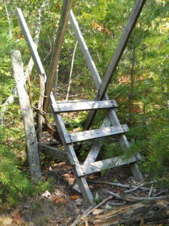
| Sty across fence
| |
| [[Image:BMP_Pretty_Ridge_Trail_sty.JPG|150px]]
| |
| </googlemap>
| |
|
| |
|
| == Photos == | | == Photos == |
| <gallery>
| | {{Park trail gallery|Trail={{PAGENAME}}}} |
| <!-- Place any pictures from this trail below. Ideally we would have a picture of the trailhead to help people know when they found it -->
| | {{Map Marker |
| <!-- Add a picture by typing Image:imagename.extension -->
| | |Icon Type=Point of interest |
| Image:BMP Pretty Ridge Trail sty.JPG|Sty across fence - key location
| | |Marker Title=Western descent from ridge |
| </gallery>
| | |Marker Location=36.491574,-82.657148 |
| | | }} |
| <!-- Finally add the trail to any Categories it should belong to. -->
| | {{Map Marker |
| [[Category:Tennessee]] [[Category:Kingsport]] [[Category:Bays Mountain Park]] [[Category:Difficult]] [[Category:Hiking]] [[Category:Biking]] [[Category:Dog Friendly]] | | |Icon Type=Trail sign |
| | |Marker Title=Intersection at [[Back Hollow Road|Back Hollow Road]] |
| | |Marker Location=36.4976,-82.6433 |
| | }} |
| | {{Map Marker |
| | |Icon Type=Point of interest |
| | |Marker Title=Sty across fence |
| | |Marker Description=[[Image:BMP_Pretty_Ridge_Trail_sty.JPG|150px]] |
| | |Marker Location=36.48915,-82.65420 |
| | }} |
| | {{Map Marker |
| | |Icon Type=Trail sign |
| | |Marker Title=Intersection at [[Back Hollow Road|Back Hollow Road]] |
| | |Marker Location=36.488182,-82.653777 |
| | }} |
| Pretty Ridge Trail
(log in to submit report)
|
|
|
|
| Park
|
Bays Mountain Park
|
| Land Owner
|
City of Kingsport
|
| Located
|
Kingsport, Tennessee
|
| Trail Marking
|
Signs
|
| Trail UseThings allowed to do on or near the trail
|
  
|
| FeaturesThings to see on or near the trail
|
|
| Difficulty Rating
|
Hard
|
| Hiking TimeTime from car and back. Includes any time hiking to access this trail.
|
1.5 hrs0.0938 Days <br />90 Min <br /> round trip
|
| Distance:
|
1.716 mi2.762 km <br /> trailStrict non-repeating trail length / 6.8 mi10.944 km <br /> round tripTypical or shortest length from the car, hike the trail, and return to car
|
| Trail Type
|
Segment
|
| Low / High Point
|
1,608 ft536 Yards <br />490.118 Meters <br /> / 2,078 Ft692.667 Yards <br />633.374 Meters <br />
|
| Elev. Gain/LossSee link for details of calculation. Gain/Loss is direction dependent.
|
386 Ft117.653 Meters <br /> / (461 Ft140.513 Meters <br />) – East-to-West
|
| Trip ReportsFrom user "hiked it" submissions<br />Recent is within last 90 days
|
1 logged hikes (0 recent)
|
| NearbyWithin 5 mi<br />Click link to view list
|
32 trails / 36.8 mi of trail
|
| Parking
|
36° 30' 31.75" N, 82° 36' 34.38" W Map
|
| Trailhead
|
36° 29' 51.50" N, 82° 38' 35.88" W Map
|
Loading map... {"type":"ROADMAP","minzoom":false,"maxzoom":false,"types":["ROADMAP","SATELLITE","HYBRID","TERRAIN"],"mappingservice":"googlemaps3","width":"100%","height":"180px","centre":false,"title":"","label":"","icon":"","lines":[],"polygons":[],"circles":[],"rectangles":[],"copycoords":false,"static":false,"visitedicon":"","wmsoverlay":false,"zoom":8,"layers":[],"controls":[""],"zoomstyle":"DEFAULT","typestyle":"DEFAULT","autoinfowindows":false,"resizable":false,"kmlrezoom":false,"poi":true,"cluster":false,"clustergridsize":60,"clustermaxzoom":20,"clusterzoomonclick":true,"clusteraveragecenter":true,"clusterminsize":2,"imageoverlays":[],"kml":[],"gkml":[],"searchmarkers":"","fullscreen":false,"scrollwheelzoom":false,"locations":[{"text":"\u003Cb\u003E\u003Cdiv class=\"mw-parser-output\"\u003E\u003Cp\u003EPretty Ridge Trail\n\u003C/p\u003E\u003C/div\u003E\u003C/b\u003E\u003Cdiv class=\"mw-parser-output\"\u003E\u003Cp\u003EMain Parking Location\n\u003C/p\u003E\u003C/div\u003E","title":"Pretty Ridge Trail\n","link":"","lat":36.5088200000000000500222085975110530853271484375,"lon":-82.6095499999999987039700499735772609710693359375,"icon":""}]} |
| Show In Google Maps
|
Loading map...
{"format":"googlemaps3","type":"TERRAIN","minzoom":false,"maxzoom":false,"types":["SATELLITE","HYBRID","TERRAIN"],"limit":50,"offset":0,"link":"none","sort":[""],"order":[],"headers":"show","mainlabel":"","intro":"","outro":"","searchlabel":"... further results","default":"","import-annotation":false,"width":"auto","height":"600px","centre":false,"title":"","label":"","icon":"","lines":[],"polygons":[],"circles":[],"rectangles":[],"copycoords":false,"static":false,"visitedicon":"","wmsoverlay":false,"zoom":false,"layers":[],"controls":["pan","zoom","type","scale","streetview","rotate"],"zoomstyle":"DEFAULT","typestyle":"DEFAULT","autoinfowindows":false,"resizable":false,"kmlrezoom":true,"poi":true,"cluster":false,"clustergridsize":60,"clustermaxzoom":20,"clusterzoomonclick":true,"clusteraveragecenter":true,"clusterminsize":2,"imageoverlays":[],"kml":[],"gkml":["https://tehcc.org/clubwiki/images/Back_Hollow_Road.kml","https://tehcc.org/clubwiki/images/Pretty_Ridge_Trail.kml"],"searchmarkers":"","fullscreen":false,"scrollwheelzoom":false,"showtitle":false,"hidenamespace":true,"template":"Map Balloon Template","userparam":"","activeicon":"","pagelabel":false,"ajaxcoordproperty":"","ajaxquery":"","locations":[{"text":"\u003Cp\u003E\u003Cb\u003E\u003Ca href=\"/wiki/Back_Hollow_Road\" title=\"Back Hollow Road\"\u003EBack Hollow Road\u003C/a\u003E\u003C/b\u003E\u003Cbr /\u003E\u003C/p\u003E\u003Chr /\u003E\u003Cp\u003E1.94\u0026#160;Mi (3.13\u0026#160;km)\u003Cbr /\u003EDifficulty: Easy\u003Cbr /\u003EMarking: Signs\u003C/p\u003E","title":"Back Hollow Road","link":"","lat":36.506540000000001100488589145243167877197265625,"lon":-82.631270000000000663931132294237613677978515625,"icon":"/clubwiki/images/MarkerT.png"},{"text":"\u003Cp\u003E\u003Cb\u003EIntersection at \u003Ca href=\"/wiki/BMP_Pretty_Ridge_Trail\" class=\"mw-redirect\" title=\"BMP Pretty Ridge Trail\"\u003EPretty Ridge Trail\u003C/a\u003E\u003C/b\u003E\u003Cbr /\u003E\u003C/p\u003E\u003Chr /\u003E\u003Cp\u003EIntersection at \u003Ca href=\"/wiki/BMP_Pretty_Ridge_Trail\" class=\"mw-redirect\" title=\"BMP Pretty Ridge Trail\"\u003EPretty Ridge Trail\u003C/a\u003E\u003C/p\u003E","title":"Back Hollow Road","link":"","lat":36.49759999999999848796505830250680446624755859375,"lon":-82.6432999999999964302332955412566661834716796875,"icon":"/clubwiki/images/MarkerT.png"},{"text":"\u003Cp\u003E\u003Cb\u003EPark primitive cabin\u003C/b\u003E\u003Cbr /\u003E\u003C/p\u003E\u003Chr /\u003E\u003Cp\u003E\u003Ca href=\"/wiki/File:BMP_cabin.JPG\" class=\"image\"\u003E\u003Cimg alt=\"BMP cabin.JPG\" src=\"/clubwiki/images/thumb/BMP_cabin.JPG/150px-BMP_cabin.JPG\" decoding=\"async\" width=\"150\" height=\"113\" srcset=\"/clubwiki/images/thumb/BMP_cabin.JPG/225px-BMP_cabin.JPG 1.5x, /clubwiki/images/thumb/BMP_cabin.JPG/300px-BMP_cabin.JPG 2x\" data-file-width=\"448\" data-file-height=\"336\" /\u003E\u003C/a\u003E\u003C/p\u003E","title":"Back Hollow Road","link":"","lat":36.50095999999999918372850515879690647125244140625,"lon":-82.638599999999996725819073617458343505859375,"icon":"/clubwiki/images/MarkerV.png"},{"text":"\u003Cp\u003E\u003Cb\u003EFeagins Gap\u003C/b\u003E\u003Cbr /\u003E\u003C/p\u003E\u003Chr /\u003E\u003Cp\u003EFeagins Gap\u003C/p\u003E","title":"Back Hollow Road","link":"","lat":36.50654800000000221871232497505843639373779296875,"lon":-82.6312779999999946767275105230510234832763671875,"icon":"/clubwiki/images/MarkerT.png"},{"text":"\u003Cp\u003E\u003Cb\u003ELog bridge to Primitive Campground\u003C/b\u003E\u003Cbr /\u003E\u003C/p\u003E\u003Chr /\u003E\u003Cp\u003E\u003Ca href=\"/wiki/File:BMP_Primative_Campground.JPG\" class=\"image\"\u003E\u003Cimg alt=\"BMP Primative Campground.JPG\" src=\"/clubwiki/images/thumb/BMP_Primative_Campground.JPG/150px-BMP_Primative_Campground.JPG\" decoding=\"async\" width=\"150\" height=\"113\" srcset=\"/clubwiki/images/thumb/BMP_Primative_Campground.JPG/225px-BMP_Primative_Campground.JPG 1.5x, /clubwiki/images/thumb/BMP_Primative_Campground.JPG/300px-BMP_Primative_Campground.JPG 2x\" data-file-width=\"448\" data-file-height=\"336\" /\u003E\u003C/a\u003E\u003C/p\u003E","title":"Back Hollow Road","link":"","lat":36.5004899999999992132870829664170742034912109375,"lon":-82.6393599999999963756636134348809719085693359375,"icon":"/clubwiki/images/MarkerH.png"},{"text":"\u003Cp\u003E\u003Cb\u003E\u003Ca class=\"mw-selflink selflink\"\u003EPretty Ridge Trail\u003C/a\u003E\u003C/b\u003E\u003Cbr /\u003E\u003C/p\u003E\u003Chr /\u003E\u003Cp\u003E1.72\u0026#160;Mi (2.76\u0026#160;km)\u003Cbr /\u003EDifficulty: Hard\u003Cbr /\u003EMarking: Signs\u003C/p\u003E","title":"Pretty Ridge Trail","link":"","lat":36.49763999999999697365637985058128833770751953125,"lon":-82.6432999999999964302332955412566661834716796875,"icon":"/clubwiki/images/MarkerT.png"},{"text":"\u003Cp\u003E\u003Cb\u003EWestern descent from ridge\u003C/b\u003E\u003Cbr /\u003E\u003C/p\u003E\u003Chr /\u003E\u003Cp\u003EWestern descent from ridge\u003C/p\u003E","title":"Pretty Ridge Trail","link":"","lat":36.4915739999999999554347596131265163421630859375,"lon":-82.657148000000006504706107079982757568359375,"icon":"/clubwiki/images/MarkerG.png"},{"text":"\u003Cp\u003E\u003Cb\u003EIntersection at \u003Ca href=\"/wiki/Back_Hollow_Road\" title=\"Back Hollow Road\"\u003EBack Hollow Road\u003C/a\u003E\u003C/b\u003E\u003Cbr /\u003E\u003C/p\u003E\u003Chr /\u003E\u003Cp\u003EIntersection at \u003Ca href=\"/wiki/Back_Hollow_Road\" title=\"Back Hollow Road\"\u003EBack Hollow Road\u003C/a\u003E\u003C/p\u003E","title":"Pretty Ridge Trail","link":"","lat":36.48818200000000189220372703857719898223876953125,"lon":-82.6537770000000051595634431578218936920166015625,"icon":"/clubwiki/images/MarkerT.png"},{"text":"\u003Cp\u003E\u003Cb\u003EIntersection at \u003Ca href=\"/wiki/Back_Hollow_Road\" title=\"Back Hollow Road\"\u003EBack Hollow Road\u003C/a\u003E\u003C/b\u003E\u003Cbr /\u003E\u003C/p\u003E\u003Chr /\u003E\u003Cp\u003EIntersection at \u003Ca href=\"/wiki/Back_Hollow_Road\" title=\"Back Hollow Road\"\u003EBack Hollow Road\u003C/a\u003E\u003C/p\u003E","title":"Pretty Ridge Trail","link":"","lat":36.49759999999999848796505830250680446624755859375,"lon":-82.6432999999999964302332955412566661834716796875,"icon":"/clubwiki/images/MarkerT.png"},{"text":"\u003Cp\u003E\u003Cb\u003ESty across fence\u003C/b\u003E\u003Cbr /\u003E\u003C/p\u003E\u003Chr /\u003E\u003Cp\u003E\u003Ca href=\"/wiki/File:BMP_Pretty_Ridge_Trail_sty.JPG\" class=\"image\"\u003E\u003Cimg alt=\"BMP Pretty Ridge Trail sty.JPG\" src=\"/clubwiki/images/thumb/BMP_Pretty_Ridge_Trail_sty.JPG/150px-BMP_Pretty_Ridge_Trail_sty.JPG\" decoding=\"async\" width=\"150\" height=\"200\" srcset=\"/clubwiki/images/thumb/BMP_Pretty_Ridge_Trail_sty.JPG/225px-BMP_Pretty_Ridge_Trail_sty.JPG 1.5x, /clubwiki/images/thumb/BMP_Pretty_Ridge_Trail_sty.JPG/300px-BMP_Pretty_Ridge_Trail_sty.JPG 2x\" data-file-width=\"336\" data-file-height=\"448\" /\u003E\u003C/a\u003E\u003C/p\u003E","title":"Pretty Ridge Trail","link":"","lat":36.48915000000000219415596802718937397003173828125,"lon":-82.65420000000000300133251585066318511962890625,"icon":"/clubwiki/images/MarkerG.png"}]}
Download KML / Upload new version / KML File Page / Create Profile Chart / gpsvisualizer Map
Trail Overview[edit]
Located in Bays Mountain Park. Pretty Ridge, up on the ridge, is a nice extension of Indian Pipes Trail, but difficult hiking between Back Hollow Road.
How to get there[edit]
Take either Indian Pipes Trail from near Fire Tower or Back Hollow Road.
Route Description[edit]
On paper, a U-shaped path up from Back Hollow Road, along the ridgeline, and back down with connections to Back Hollow Road, Cross Ridges Trail, Indian Pipes Trail, Kiner Hollow Trail, Front Hollow Road, and Bays Ridge Trail. The trail is marked with white plastic blazes.
| Miles
|
Pretty Ridge Trail
|
Elevation (ft)
|
| 0.00
|
Back Hollow Road at abandoned cabin
|
1672
|
| 0.45
|
Intersection with Indian Pipes Trail and Kiner Hollow Trail
|
1980
|
| 1.35
|
Split back down just before meeting Kiner Hollow Trail again
|
2000
|
| 1.65
|
Sty over fence
|
1665
|
| 1.7
|
Back Hollow Road at open meadows
|
1615
|
Mountain biking is not allowed in the eastern drop down to Back Hollow Road. The western slope is inaccessible.
Typical Conditions[edit]
Nice hard dirt path up on the ridge. Eastern section was redug after a major winter storm in the 90s.
The western section from Back Hollow Road to the top of the ridgeline is cleaned up as of 2015. The trail is faint especially the middle part of the climb but you should be able to follow it. If you lose the trail just bushwhack uphill and you will reconnect to it back at the top anyway. It's a short climb and not hard either way. Blazes are sporadic still so keep an eye on your path. Not great but better than what is used to be.
