Laurel Run Trail
| |||||||||||||||||||||||||||||||||||||||||||||

Trail Overview
When folks say they are going hiking at Laurel Run Park, they generally mean taking Laurel Run Trail up Kiner Hollow to the waterfalls. Laurel Run Trail is actually mostly in the Bays Mountain Park system, but the description and details will be maintained here.
How to get there
- Take Highway 11W through Church Hill.
- Turn left (south) at Goshen Valley Road.
- Cross the bridge over the Holston River.
- At just under a mile, turn left (east) at River Road.
- After just under two miles, veer left onto Laurel Run Park Road.
- Continue into the park (warning - several speed bumps after entering gate)
- Once the park road tees, turn right toward the amphitheater parking lot.
- Trailhead is past the shelters starting with the gravel road.
Route Description
Starting at the green "Walking Trail" sign, follow the gravel road around the bend and across the new footbridge (which greatly improves this stream crossing). Continue following the roadway up the hill. The tread will become very muddy in places - especially after rain even days before. The trail climbs on the old logging road rising above the creek, and then coming back down. This second creek crossing does not have a bridge, thus is either rock hopping or wading. The trail then rises another ridge up to the lower falls (see photo to right). For most folks, this is their destination.
Just past the lower falls, there is a basin that is commonly used as a swimming hole. The white-blazed trail soon makes a sharp switchback up the hill. The climbing path passes above the small upper falls. The route wanders past a few abandoned homesteads until it finally intersects with the Kiner Hollow Trail.
| Miles | Laurel Run Trail | Miles | Elevation (ft) |
|---|---|---|---|
| 0.0 | Start at gravel road past shelters at Laurel Run Park | 2.0 | 1147 |
| 0.1 | New footbridge across creek | 1.9 | |
| 0.1 | Old house | 1.9 | |
| 0.3 | Bridgeless creek crossing - enter Bays Mountain Park (no sign) | 1.7 | |
| 0.9 | Waterfall | 1.1 | |
| 1.0 | Switchbacks | 1.0 | 1436 |
| 1.1 | Kiner Falls off and below trail | 0.9 | |
| 1.3 | Abandoned Morrison family house - stay out! | 0.7 | |
| 1.6 | Abandoned Asa Simpson house - stay out! | 0.4 | |
| 1.7 | Abandoned Alex Wallen house - mostly torn down - stay out! | 0.3 | |
| 2.0 | Junction with Kiner Hollow Trail at creek | 0.0 | 1760 |
Typical Conditions
One significant creek crossing. Sections of the trail can be very muddy. Mostly up and up and up.
Fees, Permits, etc.
None needed.
After the Hike
Misc. Information
Mountain biking is allowed on the upper section of the trail, but too difficult so never seen anyone on a bike.
Maps
Red line is Laurel Run, while yellow is the adjoining Kiner Hollow Trail.
Photos
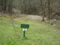
Trailhead
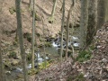
View along the hike

