Grassy Ridge: Difference between revisions
m (→Misc. Information: Removed Baatany Goat Project since no longer active) |
|||
| (29 intermediate revisions by 6 users not shown) | |||
| Line 1: | Line 1: | ||
<!-- The following few lines create the "Infobox" table template. Please scroll down to edit the main content of the article. --> | <!-- The following few lines create the "Infobox" table template. Please scroll down to edit the main content of the article. | ||
{{Infobox Trail | |||
| Image Name = | -->{{Infobox Trail | ||
| Image Name = GrassyRidge_View.jpg | |||
| City = Roan Mountain | | City = Roan Mountain | ||
| State = Tennessee | | State = Tennessee | ||
| Marking = White blaze | |||
| Trail Use = {{Hike}}{{Camping}} | | Trail Use = {{Hike}}{{Camping}} | ||
| Difficulty Rating = Easy | | Difficulty Rating = Easy | ||
| Hike Time = 4 | | Hike Time = 4 | ||
| Distance = | | Distance = 4 | ||
| Elevation Gain = 650 | | Elevation Gain = 650 | ||
| High Point = 6,160 | | High Point = 6,160 | ||
| Line 15: | Line 15: | ||
| Longitude = -82.110183 | | Longitude = -82.110183 | ||
| Medical = Elizabethton, TN | | Medical = Elizabethton, TN | ||
}}<!-- | |||
}} | |||
<!-- | |||
End Infobox template table | |||
-->{{Trail page needs | |||
| Hide needs = | |||
| KML = | |||
| Updated KML = Yes | |||
| Detail route description = Yes | |||
| Photos = | |||
| Winter photos = | |||
| Remove prefix = | |||
| Update infobox = Yes | |||
| Infobox data update = Yes | |||
| Trail pins = | |||
| Other = | |||
| Comment = Change KML to be spur off of AT | |||
| Date reviewed = 10/25/2015 | |||
}}<!-- | |||
Start of Main Page --> | |||
== Trail Overview == | == Trail Overview == | ||
<!-- Enter a overview of the trail. What attracts you to this trail, points of interest, types of flowers, lakes, and peaks that you see along the way. --> | <!-- Enter a overview of the trail. What attracts you to this trail, points of interest, types of flowers, lakes, and peaks that you see along the way. --> | ||
Spur trail | Spur trail off AT above Carver's Gap. Hike across balds by Catawba rhododendron (late June to September), pick huckleberries (August to mid-September), see the goats (July thru September), and reach the natural 360˚ view on the summit. | ||
== How to get there == | == How to get there == | ||
<!-- Please enter detailed instruction on how to find the trail head. --> | <!-- Please enter detailed instruction on how to find the trail head. --> | ||
From Kingsport, TN | |||
#Take I-26 south to Exit 24 for US-321/TN-67 toward Elizabethton. | |||
#Continue through Elizabethton and right at traffic light to stay on US-321 South. | |||
#At Hampton, stay on US19E as it veers right. | |||
#At Roan Mountain, turn right (south) onto TN143. | |||
#Travel 13 miles to the TN/NC border and park at Carver's Gap. | |||
(Alternatively at Steps 2-3, once just inside Elizabethton city limits, turn right on TN-362, then right again and follow Gap Creek Rd for 8 miles to US19E, thus bypassing around Elizabethton and Hampton.) | |||
== Route Description== | == Route Description== | ||
<!-- Detailed description of the route. Is there any side trails that are worth traveling? --> | <!-- Detailed description of the route. Is there any side trails that are worth traveling? --> | ||
From Carver's Gap, take AT northbound up and over the balds. (Stay on the trail path!) At roughly two miles along the AT, a junction sign will show the spur trail up to Grassy Ridge, which climbs up an established rut (which can become a creek in the rain). Reach the rock outcropping at the summit. Read the dedication plaque to Cornelious Rex Peake. Have lunch. And then return by reverse route. | |||
For family, hiking just to Round or Jane Bald will be sufficient - and avoids the rougher trail path heading up to Grassy Ridge. | |||
== Typical Conditions == | == Typical Conditions == | ||
<!-- Typical conditions throughout the year of what to expect on the trail. Rocky, muddy, sandy, flowers, lots of downed trees? --> | <!-- Typical conditions throughout the year of what to expect on the trail. Rocky, muddy, sandy, flowers, lots of downed trees? --> | ||
From the trailhead, follow path which has been specifically routed and hardened using gravel on geotextile. Stay on this route to avoid damage to the fragile landscape. Accessible year-around, thus can be snow covered trail in winter to summer rainshowers. High enough elevation to sometimes be "up in the clouds" as mist passes up and over the gap. The temperature up on the balds can be 10-15F lower than down in the valley, so bringing a light jacket is a good idea - even if you don't need it when you leave town. | |||
==Fees, Permits, etc. == | ==Fees, Permits, etc. == | ||
<!-- Please list any Fees, Permits, Regulations, etc. that may be required on this trail.--> | <!-- Please list any Fees, Permits, Regulations, etc. that may be required on this trail.--> | ||
No permits or fees. | |||
== After the Hike == | == After the Hike == | ||
<!-- Other things to check out while you're in the area. Restaurants, attractions, monuments, etc... --> | <!-- Other things to check out while you're in the area. Restaurants, attractions, monuments, etc... --> | ||
Grab a drink and/or a cone in Elizabethton on the way back. | |||
== Misc. Information == | == Misc. Information == | ||
<!-- Enter any additional information that doesn't fit an any other fields. Does this trail require any permits for overnight? parking? --> | <!-- Enter any additional information that doesn't fit an any other fields. Does this trail require any permits for overnight? parking? --> | ||
Grassy Ridge is one of the [http://www.carolinamountainclub.org/index.cfm/do/pages.view/id/190/page/SB6K-RoanMts South Beyond 6000] peaks. | |||
== Maps == | == Maps == | ||
<!-- You can place pictures, PDF's, links, or even create a Google map with your waypoints and place it here. --> | <!-- You can place pictures, PDF's, links, or even create a Google map with your waypoints and place it here. --> | ||
<display_map type="terrain" width="90%" height="600" gkml="https://tehcc.org/clubwiki/kml/Grassy_Ridge.kml"> | |||
36.10625,-82.110183~Parking at Carver's Gap~ ~MarkerA.png | |||
36.10682,-82.103683~Round Bald (5826')~ ~MarkerE.png | |||
36.10593,-82.093383~Jane Bald (5807')~ ~MarkerE.png | |||
36.10548,-82.085367~Spur trail to Grassy Ridge~ ~MarkerG.png | |||
36.1001,-82.080883~Grassy Ridge~ ~MarkerE.png | |||
</display_map> | |||
== Photos == | == Photos == | ||
| Line 62: | Line 88: | ||
<!-- Place any pictures from this trail below. Ideally we would have a picture of the trailhead to help people know when they found it --> | <!-- Place any pictures from this trail below. Ideally we would have a picture of the trailhead to help people know when they found it --> | ||
<!-- Add a picture by typing Image:imagename.extension --> | <!-- Add a picture by typing Image:imagename.extension --> | ||
Image: | Image:View_from_GrassyRidge.jpg|View back the way you came | ||
Image:Cornelious_Rex_Peake.jpg|Plaque dedicated to Cornelious Rex Peake | |||
Image:GrassyRidgePano2.jpg|Panorama of the southern end of Grassy Ridge | |||
<!-- Do not remove the end gallery code.--> | <!-- Do not remove the end gallery code.--> | ||
</gallery> | </gallery> | ||
<!-- Finally add the trail to any Categories it should belong to. Please keep the State category. To make a new category just type [[Category:mycategory]]. Keep in mind categories are case sensitive. Check here ClubWIKI:Categorization_Plan for our list of categories that we are using --> | <!-- Finally add the trail to any Categories it should belong to. Please keep the State category. To make a new category just type [[Category:mycategory]]. Keep in mind categories are case sensitive. Check here ClubWIKI:Categorization_Plan for our list of categories that we are using --> | ||
[[Category:Tennessee]] [[Category:Overlook]] [[Category:Easy]] [[Category:Hiking]] [[Category:Dog Friendly]] [[Category:Appalachian Trail]] | |||
Latest revision as of 17:29, 19 March 2023
| |||||||||||||||||||||||||||||||||||||

Trail Overview[edit]
Spur trail off AT above Carver's Gap. Hike across balds by Catawba rhododendron (late June to September), pick huckleberries (August to mid-September), see the goats (July thru September), and reach the natural 360˚ view on the summit.
How to get there[edit]
From Kingsport, TN
- Take I-26 south to Exit 24 for US-321/TN-67 toward Elizabethton.
- Continue through Elizabethton and right at traffic light to stay on US-321 South.
- At Hampton, stay on US19E as it veers right.
- At Roan Mountain, turn right (south) onto TN143.
- Travel 13 miles to the TN/NC border and park at Carver's Gap.
(Alternatively at Steps 2-3, once just inside Elizabethton city limits, turn right on TN-362, then right again and follow Gap Creek Rd for 8 miles to US19E, thus bypassing around Elizabethton and Hampton.)
Route Description[edit]
From Carver's Gap, take AT northbound up and over the balds. (Stay on the trail path!) At roughly two miles along the AT, a junction sign will show the spur trail up to Grassy Ridge, which climbs up an established rut (which can become a creek in the rain). Reach the rock outcropping at the summit. Read the dedication plaque to Cornelious Rex Peake. Have lunch. And then return by reverse route.
For family, hiking just to Round or Jane Bald will be sufficient - and avoids the rougher trail path heading up to Grassy Ridge.
Typical Conditions[edit]
From the trailhead, follow path which has been specifically routed and hardened using gravel on geotextile. Stay on this route to avoid damage to the fragile landscape. Accessible year-around, thus can be snow covered trail in winter to summer rainshowers. High enough elevation to sometimes be "up in the clouds" as mist passes up and over the gap. The temperature up on the balds can be 10-15F lower than down in the valley, so bringing a light jacket is a good idea - even if you don't need it when you leave town.
Fees, Permits, etc.[edit]
No permits or fees.
After the Hike[edit]
Grab a drink and/or a cone in Elizabethton on the way back.
Misc. Information[edit]
Grassy Ridge is one of the South Beyond 6000 peaks.
Maps[edit]
Photos[edit]
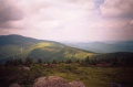
View back the way you came
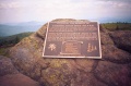
Plaque dedicated to Cornelious Rex Peake
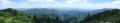
Panorama of the southern end of Grassy Ridge

