Mount Pisgah
| |||||||||||||||||||||||||||||||||||||

Trail Overview
Mount Pisgah (5,722 ft.) is a very famous, easily recognizable landmark around most of western North Carolina especially the downtown Asheville area. Its distinct feature is its large WLOS antenna at the top so it’s very easy to pick out from the surrounding mountains. Its summit has 360 degree views if you don’t mind the antenna blocking some of it. This is one of the most popular hikes on the Blue Ridge Parkway and is usually crowded.
On clear days you can see downtown Asheville and the Biltmore House. Also you get views of the Craggy Mountains and Black Mountains. Cold Mountain and the Great Smoky Mountains National Park are also visible.
How to get there
Google Maps Driving Directions
Route Description
Very rugged rocky trail. Gets steep once you arrive at the ridgeline until the top
| Miles | Snake Mountain | Elevation |
|---|---|---|
| 0.0 miles | Parking Area | 4,991 feet |
| 0.6 miles | Arrive at ridgeline | 5,124 feet |
| 1.5 miles | Summit | 5,722 feet |
Typical Conditions
- First half of hike alternates between smooth and rocky and is not very steep
- Second half of hike is steep and rocky with rock steps at times
- Very popular trail. You'll have company if you hike this.
Fees, Permits, etc.
After the Hike
Misc. Information
Maps
Photos
-
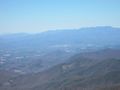 View Towards Asheville with the Craggy and Black Mountains looming over the city
 -
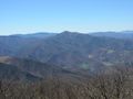 Cold Mountain from the summit of Mount Pisgah. The Balsam Mountains and Smoky Mountains behind it.
 -
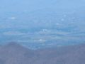 View of the Biltmore House from the summit of Mount Pisgah
 -
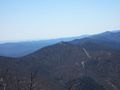 View towards the fire tower on Fryingpan Mountain
 -
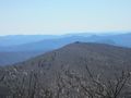 View towards Big Bald from the summit of Mount Pisgah
 -
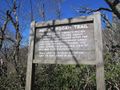 Informational sign at Mount Pisgah parking lot
 -
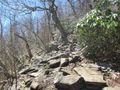 Typical rocky conditions on the summit trail
 -
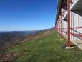
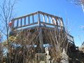 Wooden platform at the top of Mount Pisgah
 -
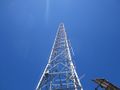 Huge WLOS antenna on the Mount Pisgah summit. It does partially obscure your views.
 -
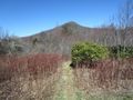 Mount Pisgah from a meadow below
 -
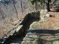 The remains of the Buck Spring Lodge. The lodge is the place George Vanderbilt of the Biltmore Estate would stay when he would go on hunting trips in his backyard (i.e. Pisgah National Forest).
 -
 The Pisgah Inn


