Morrell Trail
| Morrell Trail (log in to submit report) | |
|---|---|
| Highlight | Ascend the north slope of Holston Mountain on a well maintained trail. Sweeping views of Holston Valley, South Holston Lake and Bristol with Clinch Mountain in the distance. |
| Trail Number | FS #47 |
| Land Owner | Cherokee National Forest |
| Located | |
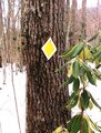
| Trail Marking | {{{Trail Marking}}} |
| Trail UseThings allowed to do on or near the trail |
|
| FeaturesThings to see on or near the trail |
|
| Difficulty Rating | Medium |
| Hiking TimeTime from car and back. Includes any time hiking to access this trail. | 3 hours0.188 Days <br />180 Min <br /> round trip |
| Distance: | 2.32.3 Mi <br />3.701 km <br /> trailStrict non-repeating trail length / 4.64.6 mi <br />7.403 km <br /> round tripTypical or shortest length from the car, hike the trail, and return to car |
| Trail Type | In-and-Out |
| Low / High Point | 23102,310 Feet <br />770 Yards <br />704.088 Meters <br /> / 40204,020 Feet <br />1,340 Yards <br />1,225.296 Meters <br /> |
| Elev. Gain/LossSee link for details of calculation. Gain/Loss is direction dependent. | 17101,710 Feet <br />521.208 Meters <br /> / (-150-150 Feet <br />-45.72 Meters <br />) – North-to-South |
| Trip ReportsFrom user "hiked it" submissions<br />Recent is within last 90 days | No hikes logged yet |
| NearbyWithin 5 mi<br />Click link to view list | 2 trails / 5.5 mi of trail |
| Parking | 36° 27' 54.07" N, 82° 7' 7.32" W Map |
| Trailhead | 36° 27' 54.07" N, 82° 7' 7.32" W Map |
|
| |
| Show In Google Maps | |
Download KML / Upload new version / KML File Page / Create Profile Chart / gpsvisualizer Map
Trail Overview
Morrell Trail ascends the north slope of Holston Mountain connecting Big Creek Road to the Holston Mountain Trail West at the top of Holston Mountain. The first mile or so has a gentle grade with level places to camp. The upper trail has multiple switchbacks with views of South Holston Lake and Holston Valley with Clinch Mountain in the distance. To extended the hike, take a right or left on Holston Mountain Trail and following the crest of the mountain for a ways.
How to get there
From Bristol, TN:
- Head east on State Street.
- Turn right onto Pennsylvania Av (hwy 421).
- Follow 421 for about 5 miles.
- Turn right onto HWY 44 (Hickory Tree Rd).
- In about 2 miles turn right at the four-way stop to stay on HWY 44.
- After 1.5 miles, take a left onto Morrell Creek Road.
- Go 3.5 miles and turn right onto Big Creek Road. Before getting to the Big Creek Rd turnoff, the pavement ends and the road can be rutted and muddy.
- After 0.5 miles find the trailhead on the left. The road can be rutted and muddy.
- Park on either side of the road.
Note: Parking for 4 cars. The parking space is just a wide place in the road. Lower side parking can be muddy with potential for getting stuck. Just a hundred yards or so up the road is more parking space.
Photos
-
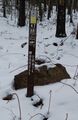 Lower Trailhead Sign
 -

-
 Upper Trailhead_Junction With Holston Mt Trail West
 -


