Kitchen Rock Trail
| Kitchen Rock Trail (log in to submit report) | |
|---|---|

| |
| Highlight | Kitchen Rock is a large sandstone outcropping with an eroded small cave opening at its base. |
| Trail Number | 209 |
| Park | Bark Camp Lake |
| Land Owner | Virginia Department of Forestry |
| Located | Dungannon, VirginiaLocation inherited from associated park |
| Trail Marking | Yellow |
| Trail UseThings allowed to do on or near the trail |
|
| FeaturesThings to see on or near the trail |
|
| Difficulty Rating | Medium |
| Hiking TimeTime from car and back. Includes any time hiking to access this trail. | 1 hr0.0625 Days <br />60 Min <br /> round trip |
| Distance: | 0.64 mi1.03 km <br /> trailStrict non-repeating trail length / 0.640.64 mi <br />1.03 km <br /> round tripTypical or shortest length from the car, hike the trail, and return to car |
| Trail Type | Loop |
| Low / High Point | 2765 ft921.667 Yards <br />842.772 Meters <br /> / 2956 ft985.333 Yards <br />900.989 Meters <br /> |
| Elev. Gain/LossSee link for details of calculation. Gain/Loss is direction dependent. | {{{Elevation Gain}}}"{{{Elevation Gain}}}" is not a number. / ({{{Elevation Loss}}}"{{{Elevation Loss}}}" is not a number.) – Clockwise |
| Trip ReportsFrom user "hiked it" submissions<br />Recent is within last 90 days | 1 logged hikes (0 recent) |
| NearbyWithin 5 mi<br />Click link to view list | 2 trails / 6.3 mi of trail |
| Parking | 36° 51' 59.98" N, 82° 31' 27.01" W Map |
| Trailhead | 36° 52' 3.83" N, 82° 31' 22.51" W Map |
|
| |
| Show In Google Maps | |
Download KML / Upload new version / KML File Page / GeoJson Page / Create Profile Chart / gpsvisualizer Map
Trail Overview
A loop trail leaving the uphill side of the main parking to climb a low ridge above Bark Camp Lake. Kitchen Rock is a large sandstone outcropping with a small cave opening at its base.
How To Get There
Refer to the park page for directions from Kingsport. Pass the turn for the campground to parking lot for the fishing piers.
Route Description
Starting from the parking lot, you can go clockwise or counterclockwise on the loop trail. This basic description is clockwise from the main parking lot.
| Miles CW | Miles CCW | Elevation (ft) | Description |
|---|---|---|---|
| 0.0 | 0.6 | 2763 | At main parking lot |
| 0.3 | 0.3 | 2953 | Reach highpoint |
| 0.5 | 0.1 | 2936 | At access road |
| 0.6 | 0.0 | 2763 | Back at parking lot |
Typical Conditions
Hard dirt trail with multiple switchbacks.
Fees, Permits, etc.
$3 day use fee - pay at information kiosk in main parking lot.
Dogs are also able to use this trail but must be kept on leash.
After the Hike
Miscellaneous Information
Gallery
-
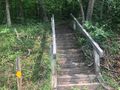
 Starting stairs on eastern side
 -
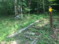
 Starting stairs on west side

