Chestnut Trail
| Chestnut Trail (log in to submit report) | |
|---|---|

| |
| Park | Bays Mountain Park |
| Land Owner | City of Kingsport |
| Located | Kingsport, TennesseeLocation inherited from associated park |
| Trail Marking | Signs |
| Trail UseThings allowed to do on or near the trail |
|
| FeaturesThings to see on or near the trail |
|
| Difficulty Rating | Medium |
| Hiking TimeTime from car and back. Includes any time hiking to access this trail. | 30 min0.5 Hours <br />0.0313 Days <br /> round trip |
| Distance: | 1.49 mi2.398 km <br /> trailStrict non-repeating trail length / 2.98 mi4.796 km <br /> round tripTypical or shortest length from the car, hike the trail, and return to car |
| Trail Type | Segment |
| Low / High Point | 1,931 ft643.667 Yards <br />588.569 Meters <br /> / 2,124 Ft708 Yards <br />647.395 Meters <br /> |
| Elev. Gain/LossSee link for details of calculation. Gain/Loss is direction dependent. | 190 Ft57.912 Meters <br /> / (97 Ft29.566 Meters <br />) – West-to-East |
| Trip ReportsFrom user "hiked it" submissions<br />Recent is within last 90 days | 1 logged hikes (0 recent) |
| NearbyWithin 5 mi<br />Click link to view list | 30 trails / 37.0 mi of trail |
| Parking | 36° 30' 31.75" N, 82° 36' 34.38" W Map |
| Trailhead | 36° 30' 26.06" N, 82° 36' 34.38" W Map |
|
| |
| Show In Google Maps | |
Download KML / Upload new version / KML File Page / GeoJson Page / Create Profile Chart / gpsvisualizer Map
Purple line is the Chestnut Trail. Yellow is Azalea Trail. Red line on the left (NW) is the Big Oak Trail. Red trace on the right (SE) is Bays Mountain Road.
Trail Overview
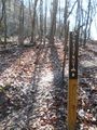
Located in Bays Mountain Park. Beginner single track mountain biking trail constructed by the Northeast Tennessee Mountain Bike Association. Good for an easy ride or hike through hardwood forest.
How to get there
From the main parking lot, head up Bays Mountain Road to the locked service gate near the maintenance parking area. To the west is the marked trail heading into the forest. Or take Lake Road around to Azalea and head uphill to the other end.
Route Description
Straight level (< 1% grade) 1.6 mile single track biking path through the forest. (Trailhead sign says 1.7 mi., but measured 1.6 mi. twice.)
This trail has connections to Lake Road, Azalea, and Big Oak Trail
For a 70 minute loop hike, take Chestnut Trail from the gate to Big Oak Trail, and back on Lake Road.
For a 5 mile loop hike/ride, start with the same route, but from Big Oak Trail take the Chinquapin Trail around to Lake Road.

Typical Conditions
Hard packed trail with groove down the middle from the mountain bikes. No designed passing zones, so be careful of riders coming both ways!
Photos
-
-
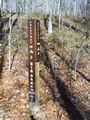 Intersection with Azalea and Big Oak
 -
 Trail Profile
