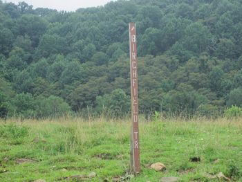
Birchfield Trail
| |||||||||||||||||||||||||||||||||||||||
Trail Overview[edit]
Located in the Hampton Creek Cove State Natural Area.
Alternative trail that runs parallel along with the Overmountain Victory National Historic Trail. Trail follows Left Prong creek on the way up and has one bridgeless creek crossing that might get your feet wet.
The trail bypasses the farm and most of the gates.
Route Description[edit]
First part of trail is in cow field before entering woods at a farm gate. The trail is blazed white vinyl and follows the Left Prong Creek.
| Miles | Notes |
|---|---|
| 0.0 | Trailhead on Overmountain Victory National Historic Trail |
| 0.2 | Farm Gate |
| 0.5 | Creek Crossing |
| 1.0 | Trailhead on Overmountain Victory National Historic Trail |
Typical Conditions[edit]
Trail is good condition and well blazed. Blazes nailed to trees. Not hard to follow. A little narrow in places.
Fees, Permits, etc.[edit]
No permit or fee. The nature area closes at dusk. The trail officially says no mountain bikes or horses.
Maps[edit]
Birchfield Trail is blue
Photos[edit]
-
Creek crossing on Birchfield Trail
-
Birchfield Trail North Junction
-
Birchfield Trail South Junction


