Search results
Jump to navigation
Jump to search
Page title matches

File:Hemlock trail profile.png |File name=Hemlock trail profile.png |Trail=Hemlock Trail(1,160 × 660 (23 KB)) - 15:40, 15 December 2019- {{Trail |Trail Marking=Signs2 KB (260 words) - 23:22, 15 December 2019

File:Holly trail profile.png |File name=Holly trail profile.png |Trail=Holly Trail(1,160 × 660 (22 KB)) - 17:00, 15 December 2019- {{Trail |Trail Marking=Signs5 KB (675 words) - 23:11, 14 December 2019

File:Pine trail profile.png |File name=Pine trail profile.png |Trail=Pine Trail(1,160 × 660 (22 KB)) - 20:05, 15 December 2019
File:Cliffside trail profile.png |File name=Cliffside trail profile.png |Trail=Cliffside Trail(1,160 × 660 (22 KB)) - 22:40, 14 December 2019- ...r trails. Park/Trail aware. Probably will make different ones for Park vs. Trail instead of one monolithic beast. * Trail name1 KB (177 words) - 13:41, 6 January 2021
- {{Trail |Banner Image=File:BMP Bays Ridge Trail sign.JPG4 KB (595 words) - 23:09, 23 November 2019
- {{Trail |Trail Marking=Blue6 KB (988 words) - 16:33, 19 September 2021
- Holston Mn Trail Hike May 27-28,2011 ...howed us where the blue blaze trail was that is the end of the Holston Mn. Trail. It's at the top of the hill on the left going SOBO from the shelter. After2 KB (494 words) - 14:30, 6 June 2011
- {{Trail |Banner Image=File:BMP Big Oak Trail.JPG3 KB (460 words) - 00:12, 11 December 2019

File:Chinquapin Trail Profile.png |File name=Chinquapin Trail Profile.png |Trail=Chinquapin Trail(1,160 × 660 (27 KB)) - 20:46, 14 December 2019- {{Trail |Trail Marking=None5 KB (719 words) - 16:06, 8 December 2019
- {{Trail |Banner Image=File:BMP Pretty Ridge Trail sty.JPG3 KB (537 words) - 15:22, 10 November 2019
- {{Trail |Banner Image=File:BMP Bear Run Trail.JPG3 KB (482 words) - 18:15, 24 November 2019
- {{Trail |Trail Marking=Signs2 KB (340 words) - 15:51, 10 November 2019
- -->{{Infobox Trail | Trail Use = {{Hike}}{{Dogs}}4 KB (641 words) - 12:12, 7 January 2023
- -->{{Infobox Trail | Trail Use = {{Hike}}{{Dogs}}4 KB (618 words) - 13:05, 19 May 2024
- -->{{Infobox Trail | Trail Use = {{Hike}}{{Dogs}}4 KB (632 words) - 12:12, 7 January 2023

File:Trail edit with form.png Editing a trail page with the form(1,646 × 373 (446 KB)) - 23:11, 12 December 2019


Page text matches
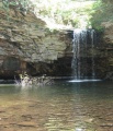
File:Upper Falls of Little Stony Creek.jpg |Trail=Little Stony Creek Falls(385 × 450 (55 KB)) - 11:08, 19 January 2020- -->{{Infobox Trail | Trail Use = {{Hike}} {{Biking}} {{Dogs}}5 KB (760 words) - 12:12, 7 January 2023
- -->{{Infobox Trail | Trail Use = {{Hike}}{{Dogs}}4 KB (686 words) - 17:37, 19 March 2023
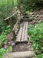
File:IMG 3502.jpg |Trail=Margarette Falls Short wooden bridge to cross muddy trail due to water trickling down the hill(480 × 640 (218 KB)) - 21:25, 21 May 2023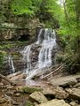
File:IMG 3505.jpg |Trail=Margarette Falls(480 × 640 (206 KB)) - 21:27, 21 May 2023- *[[Pinnacle Mountain Fire Tower]] - newly constructed trail to renovated fire tower *[[Carver's Gap to US19E|Carver's Gap]] to [[Grassy Ridge]] - spur trail off the AT to 360 degree overlook4 KB (690 words) - 17:06, 19 March 2023
- |Trail Condition=Clear ...rail. The rocky trail was covered in leaves but fairly easy to follow. The trail was marked using ribbons and some yellow paint. Ropes must be used to scale1 KB (202 words) - 12:34, 20 May 2021
- ...e temperature may drop more than you expect - and more wind on the exposed trail. A hiking stick or trekking poles can be of great use to protect against s23 members (0 subcategories, 0 files) - 07:21, 5 February 2012
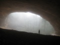
File:SandCave.JPG |Trail=Ewing Trail(1,200 × 900 (205 KB)) - 23:24, 27 November 2019- Subjective (up or down) to other factors as ongoing trail condition, water crossings, and hiking speed.527 bytes (77 words) - 06:05, 29 September 2011

File:Dnr camp.png Signifies that camping is allowed along, or at least near, the trail (see details for sites vs. dispersed) |Caption=Signifies that camping is allowed near the trail<br>'''Note:''' Check with proper authorities for their registration, locati(80 × 80 (815 bytes)) - 18:19, 21 November 2018- {{Infobox Trail | Trail Use = {{Hike}}{{Dogs}}{{Camping}}6 KB (880 words) - 12:12, 7 January 2023
- {{Trail |Trail Highlight=Hike with 13-14 water crossings to double drop waterfall4 KB (549 words) - 22:15, 18 September 2021

File:Gentry Creek Falls profile.png |Trail=Gentry Creek Falls |Caption=Trail Profile(1,160 × 660 (22 KB)) - 23:31, 10 May 2021- |Trail Condition=Clear |Trail Comment=A lot of water still on the back side of Little Hump. Everything e579 bytes (103 words) - 08:16, 30 April 2021
- |Trail Condition=Problems ...be off location. Not sure if a bunch of water came through floating it off trail. Enough boards and dry spots to get across without a wet foot.605 bytes (100 words) - 15:50, 27 April 2020
- ...on't understand your final sentence in the Trail Description. We found the trail to be fairly well marked and nearly every portion clear where to continue. [[Category:Trail]]2 KB (339 words) - 19:24, 21 October 2015
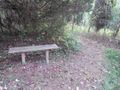
File:WPSP SW bench at 2nd loop split.jpg |Trail=Sinking Waters(1,280 × 960 (305 KB)) - 23:35, 18 November 2018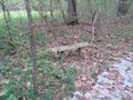
File:WPSP SW bench at paved portion.jpg |Trail=Sinking Waters(1,280 × 960 (226 KB)) - 23:35, 18 November 2018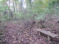
File:WPSP SW bench on North middle loop.jpg |Trail=Sinking Waters(1,280 × 960 (364 KB)) - 23:36, 18 November 2018


