Unused files
Jump to navigation
Jump to search
The following files exist but are not embedded in any page. Please note that other web sites may link to a file with a direct URL, and so may still be listed here despite being in active use.
Showing below up to 50 results in range #351 to #400.
View (previous 50 | next 50) (20 | 50 | 100 | 250 | 500)
 PCSP Ore Mine lower path.JPG 3,024 × 4,032; 4.27 MB
 PCSP Ore Mine intersection sign.JPG 4,032 × 3,024; 4.73 MB
 PCSP Ore Mine Trail - Bench.JPG 3,024 × 4,032; 4.88 MB
 PCSP Ore Mine Trail - View thru trees.JPG 3,024 × 4,032; 4.1 MB
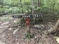 PCSP Lost Road Trail - trail junction sign.JPG 4,032 × 3,024; 5.83 MB
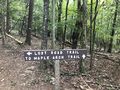 PCSP Lost Road Trail - another trail junction sign.JPG 4,032 × 3,024; 5.76 MB
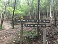 PCSP Lost Road Trail - first junction with Maple Arch Trail.JPG 4,032 × 3,024; 4.52 MB
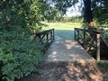 PCSP Road to Recycling Trail - bridge.JPG 4,032 × 3,024; 6.01 MB
 PCSP Road to Recycling Trail - last info sign remaining.JPG 3,024 × 4,032; 3.95 MB
 Old Shawnee Trail.kml ; 13 KB
- Raider's Run Trail.kml ; 6 KB
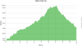
 Raider's run trail profile.png 1,160 × 660; 23 KB
- Molly's Knob Trail.kml ; 14 KB
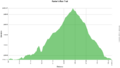
 Molly's knob trail profile.png 1,160 × 660; 24 KB
- Vista Trail.kml ; 5 KB
 Vista trail profile.png 1,160 × 660; 21 KB
- Lake Trail Loop.kml ; 25 KB
- CCC Trail.kml ; 9 KB
- Vista Trail-20200922131830.kml ; 46 KB
 Hungry Mother photo spot.jpg 4,032 × 3,024; 4.04 MB
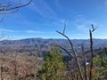
 High view of Hungry Mother Lake.jpg 4,032 × 3,024; 4.79 MB
- Norris Dam State Park.kml ; 50 KB
- Cumberland Mountain State Park.kml ; 585 KB
- Edgar Evins State Park.kml ; 403 KB
 Chimney Top2.jpg 2,016 × 1,512; 1.06 MB
 Big Bald Hike Lookout 1.jpg 2,016 × 1,512; 442 KB
 Big Bald Hike Lookout 2.jpg 2,016 × 1,512; 1.04 MB
- Gentry Creek Falls.kml ; 3 KB
- Kitchen Rock Trail.kml ; 9 KB
- Bark Camp Lakeshore Trail.kml ; 10 KB
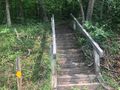 Kitchen Rock Trail western stairs.jpg 640 × 480; 180 KB
 Kitchen Rock Trail eastern stairs.jpg 640 × 480; 183 KB
- Laurel Run Trail.kml ; 6 KB
- Rock Creek Falls.kml ; 4 KB
- Wahoo.kml ; 12 KB
- Lone Oak Trail.kml ; 9 KB
- High Ridge Trail.kml ; 3 KB
- Cascade Trail.kml ; 11 KB
- Fork Knob Trail.kml ; 5 KB
- Fork Ridge Trail.kml ; 4 KB
- Hartsell Hollow Trail.kml ; 2 KB
- The Noggin Trail.kml ; 3 KB
- White Rock Trail.kml ; 14 KB
- Tower Ridge Trail.kml ; 5 KB
 1.jpg 640 × 480; 149 KB
 2.jpg 640 × 480; 106 KB


