Unused files
Jump to navigation
Jump to search
The following files exist but are not embedded in any page. Please note that other web sites may link to a file with a direct URL, and so may still be listed here despite being in active use.
Showing below up to 50 results in range #301 to #350.
View (previous 50 | next 50) (20 | 50 | 100 | 250 | 500)
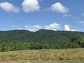 Kane Gap from distance.JPG 4,032 × 3,024; 3.02 MB
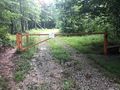
 Do not pass gate.JPG 4,032 × 3,024; 5.77 MB
 Coon Den Falls.kml ; 10 KB
- Roaring Branch Trail.kml ; 4 KB
- Phipps Bend Trail.kml ; 4 KB
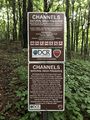
- Channels Trail.kml ; 29 KB
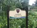 Channels State Forest Entrance Sign.JPG 4,032 × 3,024; 4.05 MB
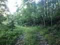
 Locked Gate.JPG 4,032 × 3,024; 4.7 MB
 Channel NAP boundary sign.JPG 3,024 × 4,032; 5.28 MB
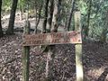
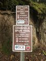 Spur trail sign.JPG 3,024 × 4,032; 4.09 MB
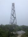 Firetower.JPG 3,024 × 4,032; 2.36 MB
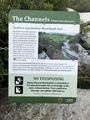 Channel NAP info sign.JPG 3,024 × 4,032; 4.16 MB
 Channels top side enveloped in clouds.JPG 4,032 × 3,024; 4.06 MB
 In The Channels.JPG 3,024 × 4,032; 4.43 MB
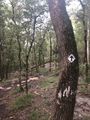
 Trail Markers.JPG 3,024 × 4,032; 5.68 MB
 Holston River.jpg 1,024 × 768; 160 KB
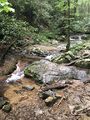 Stream view along trail.JPG 3,024 × 4,032; 5.29 MB
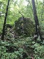 Iron furnace.JPG 3,024 × 4,032; 6.94 MB
- Cabin Creek Trail.kml ; 12 KB
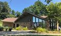 Welcome Center.jpg 609 × 356; 100 KB
 Hiking Trail Marker.jpg 480 × 640; 143 KB
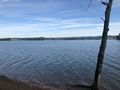
 Shore view from lake.jpg 640 × 480; 105 KB
 Trail intersection.jpg 640 × 480; 165 KB
- Ridge Crest Trail.kml ; 4 KB
- Point Lookout Trail.kml ; 12 KB
- Old Wagon Trail.kml ; 4 KB
- Road to Recycling Trail.kml ; 5 KB
- Ore Mine Trail.kml ; 7 KB
- Norris Blackburn Trail.kml ; 2 KB
- Seven Sinkholes Trail.kml ; 3 KB
 Smallman Area Overlook.JPG 4,032 × 3,024; 2.62 MB
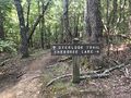
 PCSP Point Lookout Trail - Cherokee Lake1.JPG 4,032 × 3,024; 5.61 MB
 PCSP Point Lookout Trail - Cherokee Lake2.JPG 4,032 × 3,024; 2.49 MB
 PCSP Point Lookout Trail - 0.50 MI sign.JPG 4,032 × 3,024; 6.9 MB
 PCSP Point Lookout Trail - spur trail sign.JPG 4,032 × 3,024; 7.89 MB
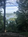 PCSP Point Lookout Trail - overlook.JPG 3,024 × 4,032; 4.49 MB
 PCSP Point Lookout Trail - bench.JPG 3,024 × 4,032; 7.08 MB
 PCSP Norris Blackburn Trail - intersection sign.JPG 4,032 × 3,024; 5.94 MB
 PCSP Norris Blackburn Trail - disc golf.JPG 3,024 × 4,032; 5.82 MB
 PCSP Norris Blackburn Trail - wildlife observatory.JPG 4,032 × 3,024; 6.43 MB
 PCSP Norris Blackburn Trail - hiking trail marker.JPG 3,024 × 4,032; 5.37 MB
 PCSP Seven Sinkholes Trail - Sinkhole 1.JPG 3,024 × 4,032; 7.02 MB
 PCSP Seven Sinkholes Trail - Another Sinkhole.JPG 3,024 × 4,032; 3.94 MB
 PCSP Maple Arch Trail - first beach.JPG 4,032 × 3,024; 2.69 MB
 PCSP Maple Arch Trail - slowly crossing the path.JPG 4,032 × 3,024; 5.7 MB
 PCSP Maple Arch Trail - last beach.JPG 4,032 × 3,024; 3.16 MB
- Maple Arch Trail.kml ; 18 KB
- Lost Road Trail.kml ; 6 KB
 PCSP Maple Arch Trail - another beach view.JPG 4,032 × 3,024; 3.16 MB


