Unused files
Jump to navigation
Jump to search
The following files exist but are not embedded in any page. Please note that other web sites may link to a file with a direct URL, and so may still be listed here despite being in active use.
Showing below up to 50 results in range #251 to #300.
View (previous 50 | next 50) (20 | 50 | 100 | 250 | 500)
 Rocky Fork State Park.kml ; 43 KB
- Hungry Mother State Park.kml ; 34 KB
- Warriors' Path State Park.kml ; 309 KB
- Fall Creek Falls State Park.kml ; 81 KB
- Frozen Head State Park.kml ; 16 KB
- Blackwater Falls State Park.kml ; 13 KB
- Forest Road.kml ; 30 KB
- Fred Behrend.kml ; 21 KB
- Peg Leg Mine.kml ; 4 KB
 WPSP Rock City - View of inlet.jpg 1,280 × 960; 440 KB
 WPSP Rock City - Fall Creek Rd Bridge.jpg 1,280 × 960; 259 KB
- Raven Rock.kml ; 13 KB
- Boneyard Connector.kml ; 1 KB
- Pawpaw Connector.kml ; 1 KB
- Pawpaw.kml ; 6 KB
- Whitetail Loop.kml ; 16 KB
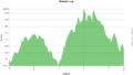 Whitetail loop trail profile.png 1,160 × 660; 24 KB
- Zipline.kml ; 4 KB
- Fawn Loop.kml ; 5 KB
- Riverside.kml ; 6 KB
- Tom Gray.kml ; 7 KB
- 2020-01-04 Gaia Darwin Hike.kml ; 10 KB
- Turkey Trot.kml ; 4 KB
- Big Butt Trail.kml ; 33 KB
- Devil's Bathtub.kml ; 81 KB
- Green Knob Tower Trail.kml ; 3 KB
- Little Stony Creek Falls.kml ; 14 KB
- Beartree Gap Trail.kml ; 7 KB
- White House Cliffs Trail.kml ; 6 KB
 Observation Tower Steps.jpeg 2,048 × 1,536; 1.83 MB
- Sill Branch.kml ; 6 KB
 Sill branch profile.png 1,160 × 660; 22 KB
- Squibb Creek Falls.kml ; 15 KB
 82532482 3020937654596526 8659480441918586880 n.jpg 720 × 960; 128 KB
 LRP Overlook.jpg 640 × 480; 81 KB
 LRP Overlook Trail.jpg 640 × 480; 191 KB
- Hawksbill Mountain.kml ; 3 KB
- Table Rock Summit Trail.kml ; 5 KB
 Daniel Boone Trail locked gate.JPG 4,032 × 3,024; 6.71 MB
 IMG 2089-2-.JPG 4,032 × 3,024; 6.71 MB
- Daniel Boone Trail.kml ; 6 KB
 City Water Tower.JPG 4,032 × 3,024; 5.87 MB


