|
|

|
|
|
| Trail Name
|
Fred Behrend
|
| Park
|
Roan Mountain State Park
|
| Nearest City
|
Roan Mountain
|
| State
|
Tennessee
|
| Trail Marking
|
Green
|
| Trail Use/Features
|
  
|
| Difficulty Rating
|
Medium
|
| Hiking Time
|
1 Hour0.0625 Days <br />60 Min <br />
|
Distance:
round-trip/trail only
|
2.27 Mi3.653 km <br /> / 2.27 Mi3.653 km <br />
|
| Trail Type
|
Loop
|
| Climb/Descent Elevation
|
1,005 Ft306.324 Meters <br /> / -1,005 Ft-306.324 Meters <br />
|
| High Point
|
3,241 Ft1,080.333 Yards <br />987.857 Meters <br />
|
| Parking
|
36° 9' 33.15" N, 82° 5' 58.61" W
|
| Trailhead
|
36° 9' 33.37" N, 82° 6' 1.22" W
|
| Nearest Medical
|
Elizabethton, TN
|
| Trip Reports
|
Click Here
|
|
|
Loading map... {"type":"ROADMAP","minzoom":false,"maxzoom":false,"types":["ROADMAP","SATELLITE","HYBRID","TERRAIN"],"mappingservice":"googlemaps3","width":"270px","height":"180px","centre":false,"title":"","label":"","icon":"","lines":[],"polygons":[],"circles":[],"rectangles":[],"copycoords":false,"static":false,"visitedicon":"","wmsoverlay":false,"zoom":8,"layers":[],"controls":["zoom"],"zoomstyle":"DEFAULT","typestyle":"DEFAULT","autoinfowindows":false,"resizable":false,"kmlrezoom":false,"poi":true,"cluster":false,"clustergridsize":60,"clustermaxzoom":20,"clusterzoomonclick":true,"clusteraveragecenter":true,"clusterminsize":2,"imageoverlays":[],"kml":[],"gkml":[],"searchmarkers":"","fullscreen":false,"scrollwheelzoom":false,"locations":[{"text":"","title":"","link":"","lat":36.15920799999999957208274281583726406097412109375,"lon":-82.099615000000000009094947017729282379150390625,"icon":""}]} |
|
| Show Large Map
|
|
Trail Overview
This is part of the Roan Mountain State Park trail system
How to get there
From Johnson City (I-26 Exit 24):
- Take TN67/US321 over to Elizabethton (about eight miles).
- Turn right/south at traffic light for TN37/US19E/US321 and travel for 17 miles.
- Turn right/south for TN143 for five miles to park visitors center.
- Trailheads are in several places around the park.
GPS address is 1015 Hwy 143 Roan Mountain, TN 37687.
Route Description
A loop trail around the campgrounds.
Accessible from this trail is Riverside Trail.
Typical Conditions
Being a TN state park, the dirt and gravel trails are kept in good condition. Some of the trail sections are steep, thus can be slippery after a rain.
Fees, Permits, etc.
Misc. Information
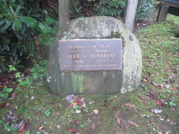
Formally known was the Bearwallow Trail until renamed in honor of naturalist Fred Behrend
After the Hike
After a hike, check out Bob's Dairyland back down in Roan Mountain.
Maps
Fred Behrend Trail is shown below in its blaze color of green.
Loading map...
{"type":"TERRAIN","minzoom":false,"maxzoom":false,"types":["ROADMAP","SATELLITE","HYBRID","TERRAIN"],"mappingservice":"googlemaps3","width":"auto","height":"550px","centre":{"text":"","title":"","link":"","lat":36.1634999999999990905052982270717620849609375,"lon":-82.09877000000000180079950951039791107177734375,"icon":""},"title":"","label":"","icon":"","lines":[],"polygons":[],"circles":[],"rectangles":[],"copycoords":false,"static":false,"visitedicon":"","wmsoverlay":false,"zoom":15,"layers":[],"controls":["pan","zoom","type","scale","streetview","rotate"],"zoomstyle":"DEFAULT","typestyle":"DEFAULT","autoinfowindows":false,"resizable":false,"kmlrezoom":false,"poi":true,"cluster":false,"clustergridsize":60,"clustermaxzoom":20,"clusterzoomonclick":true,"clusteraveragecenter":true,"clusterminsize":2,"imageoverlays":[],"kml":[],"gkml":["http://tehcc.org/clubwiki/kml/RMSP_Fred_Behrend_Trail.kml","http://tehcc.org/clubwiki/kml/RMSP_Riverside_Trail.kml"],"searchmarkers":"","fullscreen":false,"scrollwheelzoom":false,"locations":[]}
Photos
Large rock along the trail


