ClubWiki:Using GPS Devices
If you would like to either log your hikes, or contribute item locations and trail tracks, you'll need to record GPS tracks. I'll look into phones, but in the meantime I'll document what I use, two different Garmin devices.
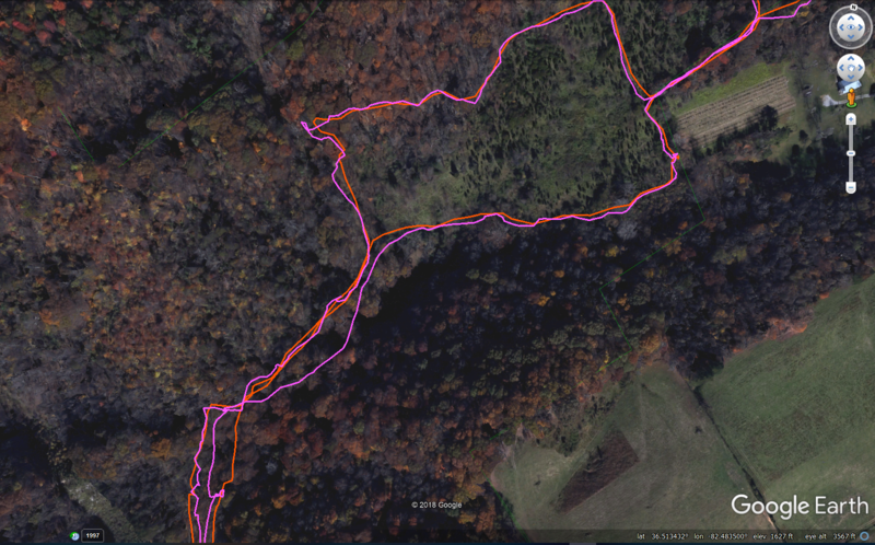
In a recent test, the eTrex was about twice as accurate as the Forerunner. I suspect both are more accurate than a phone would be.
These documents will describe any special settings, how to log waypoints/pins and create tracks/paths. Then when you get home, the best way to get them off of the device.
Below is a comparison of a Garmin eTrex 10 and a Forerunner 305 on a hike at Sinking Waters in Warriors' Path State Park. eTrex is orange and Forerunner is magenta/pink. The eTrex track was more consistent upon trail returns and known trail locations/shape. The eTrex was typically noting accuracy at 9ft while the Forerunner moved between 15-30ft. Typically always 2-3x of what the eTrex was currently reporting.
Here is a 3-way comparison of the eTrex 10 (magenta/pink), Forerunner 305 (orange), and using Gaia on an iPhone 10 (yellow). Initial conclusions are the two Garmin devices stayed mostly consistent with each other. Occasionally the iPhone would have far deviations from the other two (and known trail routing).
