Fred Behrend: Difference between revisions
m (add needs) |
(Wrong river! and fix directions) |
||
| Line 35: | Line 35: | ||
| Trail pins = | | Trail pins = | ||
| Other = | | Other = | ||
| Comment = | | Comment = Loos good, except possibly some light work on descriptive content | ||
| Date reviewed = 10/24/2015 | | Date reviewed = 10/24/2015 | ||
}}<!-- | }}<!-- | ||
| Line 42: | Line 42: | ||
== Trail Overview == | == Trail Overview == | ||
<!-- Enter a overview of the trail. What attracts you to this trail, points of interest, types of flowers, lakes, and peaks that you see along the way. --> | <!-- Enter a overview of the trail. What attracts you to this trail, points of interest, types of flowers, lakes, and peaks that you see along the way. --> | ||
This is part of the [[Roan Mountain State Park]] trail system. If you're staying at the campground, this is a good way to spend an hour or two as it begins and ends at the campground check-in station. It hikes through the woods past large boulders then returns along | This is part of the [[Roan Mountain State Park]] trail system. If you're staying at the campground, this is a good way to spend an hour or two as it begins and ends at the campground check-in station. It hikes through the woods past large boulders then returns along the Doe River. | ||
== How to get there == | == How to get there == | ||
<!-- Please enter detailed instruction on how to find the trail head. --> | <!-- Please enter detailed instruction on how to find the trail head. --> | ||
From | From the [[Roan Mountain State Park|visitor's center]]: | ||
# | #Continue south on TN143 | ||
# | #Past the pool and tennis courts, turn right into the campground area | ||
# | #Park at the shelter on your left before the campground station | ||
# | #Hike begins on the left just past the bridge on the campground road | ||
== Route Description== | == Route Description== | ||
Revision as of 12:06, 24 October 2015
| |||||||||||||||||||||||||||||||||||||||||||||
Trail Overview
This is part of the Roan Mountain State Park trail system. If you're staying at the campground, this is a good way to spend an hour or two as it begins and ends at the campground check-in station. It hikes through the woods past large boulders then returns along the Doe River.
How to get there
From the visitor's center:
- Continue south on TN143
- Past the pool and tennis courts, turn right into the campground area
- Park at the shelter on your left before the campground station
- Hike begins on the left just past the bridge on the campground road
Route Description
A loop trail around the campgrounds.
Accessible from this trail is Riverside Trail.
Following a clockwise hike
| Miles Out | Fred Behrend | Miles Back | Elevation (ft) |
|---|---|---|---|
| 0.0 | Trail head at bridge near campground station | 2.26 | 2,914 |
| 0.15 | Some unmarked trail shortcuts | 2.11 | 2,976 |
| 0.82 | Cross trail road marked to campground | 1.44 | 3,062 |
| 0.87 | Stream bridge crossing | 1.39 | 3,032 |
| 0.90 | Pass campground access connection | 1.36 | 3,034 |
| 1.20 | Pass large rock | 1.06 | 3,125 |
| 1.42 | Trail high point | 0.84 | 3,264 |
| 1.52 | Pass large rock | 0.74 | 3,139 |
| 1.87 | Connect with Lakeside Trail | 0.39 | 2,945 |
| 2.14 | Stream bridge | 0.12 | 2,923 |
| 2.22 | Hike through old playground | 0.04 | 2,920 |
| 2.26 | Returned to start | 0.00 | 2,914 |
Typical Conditions
Being a TN state park, the dirt and gravel trails are kept in good condition. Some of the trail sections are steep, thus can be slippery after a rain.
Fees, Permits, etc.
Misc. Information
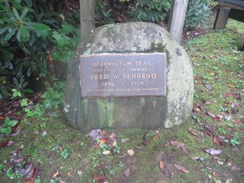
Formally known was the Bearwallow Trail until renamed in honor of naturalist Fred Behrend
After the Hike
After a hike, check out Bob's Dairyland back down in Roan Mountain.
Maps
Fred Behrend Trail is shown below in its blaze color of green.


