Fred Behrend: Difference between revisions
Jump to navigation
Jump to search
(→Misc. Information: add note about name change) |
(→Maps: add waypoints) |
||
| Line 60: | Line 60: | ||
<display_map center="36.1635,-82.098770" type="terrain" zoom="15" width="auto" height="550" gkml="http://tehcc.org/clubwiki/kml/RMSP_Fred_Behrend_Trail.kml, | <display_map center="36.1635,-82.098770" type="terrain" zoom="15" width="auto" height="550" gkml="http://tehcc.org/clubwiki/kml/RMSP_Fred_Behrend_Trail.kml, | ||
http://tehcc.org/clubwiki/kml/RMSP_Riverside_Trail.kml"> | http://tehcc.org/clubwiki/kml/RMSP_Riverside_Trail.kml"> | ||
36.157851,-82.100521~Trail head~[[Image:Roan Fred Behrend Trail Head sign.jpg|150px|Trail head sign]]~MarkerG.png | |||
36.157075,-82.105123~Campground access connection~ ~MarkerG.png | |||
36.157125,-82.105683~Stream crossing~[[Image:Roan Fred Behrend stream bridge.jpg|150px|Typical stream bridge]]~MarkerL.png | |||
36.157514,-82.105459~Campground access connection~ ~MarkerG.png | |||
36.160449,-82.105322~Large rock~ ~MarkerG.png | |||
36.160635,-82.105275~Campground access connection~Bathhouse #4~MarkerG.png | |||
36.16269,-82.103946~Large rock~[[Image:Roan Fred Behrend large rock.jpg|150px|Large rock along the trail]]~MarkerG.png | |||
36.163128,-82.100052~Connection to Riverside Trail~Continue with Doe River on your left or go off river depending on hike direction~MarkerG.png | |||
36.160275,-82.100914~Stream bridge~ ~MarkerL.png | |||
36.159321,-82.100804~Playground~ ~MarkerO.png | |||
</display_map> | </display_map> | ||
Revision as of 08:16, 26 September 2015
| |||||||||||||||||||||||||||||||||||||||||||||
Trail Overview
This is part of the Roan Mountain State Park trail system
How to get there
From Johnson City (I-26 Exit 24):
- Take TN67/US321 over to Elizabethton (about eight miles).
- Turn right/south at traffic light for TN37/US19E/US321 and travel for 17 miles.
- Turn right/south for TN143 for five miles to park visitors center.
- Trailheads are in several places around the park.
GPS address is 1015 Hwy 143 Roan Mountain, TN 37687.
Route Description
A loop trail around the campgrounds.
Accessible from this trail is Riverside Trail.
Typical Conditions
Being a TN state park, the dirt and gravel trails are kept in good condition. Some of the trail sections are steep, thus can be slippery after a rain.
Fees, Permits, etc.
Misc. Information
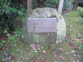
Formally known was the Bearwallow Trail until renamed in honor of naturalist Fred Behrend
After the Hike
After a hike, check out Bob's Dairyland back down in Roan Mountain.
Maps
Fred Behrend Trail is shown below in its blaze color of green.
Photos
-
Large rock along the trail
-
Typical stream bridge
-
Trail head sign


