Warriors' Path State Park: Difference between revisions
(→Misc. Information: add renovation blurb) |
m (fix banner reference) |
||
| Line 1: | Line 1: | ||
{{Park | {{Park | ||
|Banner Image=File:Warriors' Path State Park Banner.jpg | |||
|Park Type=State Park | |Park Type=State Park | ||
|Park Website=https://tnstateparks.com/parks/warriors-path | |Park Website=https://tnstateparks.com/parks/warriors-path | ||
Revision as of 16:43, 22 November 2019
| Warriors' Path State Park | |
|---|---|

| |
| Park Type | State Park |
| Located | Kingsport, Tennessee |
| External Links | Official Website |
| Entrance Fee | Unknown |
| ActivitiesThings to do at the park | |
| Park AmenitiesThings built to enjoy or use at the park | |
| FeaturesNatural things to see at the park | |
| Park Trails |
24 Trails / Total of 17.84 miles28.711 km <br /> |
| Lodging Types | |
| Camping Amenities |
|
| Park Area | 950 acres3.845 km² <br /> |
| Operated By | Tennessee Department of Environment and Conservation |
| Main Location | Map |
|
| |
| Show In Google Maps | |
Download KML / Upload new version / KML File Page
Park Overview
Warrior's Path State Park has 24 trails covering 17.84 miles good for quick after work jaunts with the kids and pets for a quick stroll.
How to get there
The park address is 490 Hemlock Road, Kingsport, Tennessee 37663
From downtown Kingsport, TN:
- Take Fort Henry Drive/TN-36 toward Colonial Heights.
- Turn left at stoplight by Food City onto Hemlock Road. (Warning: Red Light camera intersection this direction.)
- Follow Hemlock Road under railroad underpass. The park ranger station is just inside the main entrance.
From I-81:
- Take TN Exit 59 (Kingsport).
- Turn NW on Fort Henry Drive/TN-36.
- Turn right (north) onto Colonial Heights (by Zoomerz, Sunoco). (Warning: Red Light camera intersection in this direction. Come to a complete stop if the light is yellow or red before making turn.)
- Continue on Colonial Heights road as it makes a sharp left and then right over railroad tracks.
- Turn right (east) on Hemlock Road. The main park entrance can be seen.
Trailheads are in several different locations, so refer to the specific trail descriptions.
Park Trails
The park offers the following trails to explore:
| Park Trails | Distance | Difficulty | Marking | Usage | Highlight |
|---|---|---|---|---|---|
| Boneyard | 2.33 mi | Medium | Black Triangle |
|
|
| Boneyard Connector | 0.04 mi | Easy | None |
|
|
| Connector | 0.28 mi | Easy | None |
|
|
| Darwin's Connector | 0.10 mi | Easy | None |
|
|
| Darwin's Revenge | 2.06 mi | Medium | Black Diamond |
|
|
| Devil's Backbone | 1.20 mi | Medium | Red |
|
|
| Fall Creek Loop | 0.92 mi | Medium | Orange |
|
|
| Fawn Loop | 0.61 mi | Easy | Yellow |
|
|
| Holston Bluffs | 0.38 mi | Easy | White |
|
|
| Lake Hollow | 0.56 mi | Easy | None |
|
|
| Lake Road | 0.84 mi | Easy | None |
|
The main trail artery of the Mountain Bike System |
| Lakeshore | 0.31 mi | Easy | Black |
|
|
| Magic Carpet Ride | 0.20 mi | Medium | None |
|
|
| Overlook | 0.73 mi | Easy | None |
|
|
| Pawpaw | 0.56 mi | Medium | Blue |
|
Half mile loop that can be added to Lake Road or connect with Whitetail |
| Pawpaw Connector | 0.10 mi | Easy | None |
|
|
| Ridge Top | 0.48 mi | Hard | None |
|
|
| Riverbank | 0.24 mi | Easy | Blue |
|
|
| Rock City | 0.50 mi | Medium | Black |
|
|
| Sinking Waters | 1.75 mi | Easy | Green, Yellow, Blue |
|
Three connected loops and a stream that disappears into a sinkhole |
| Whitetail Alternate | 0.20 mi | Medium | None |
|
|
| Whitetail Loop | 2.31 mi | Medium | Blue Triangle |
|
One of the three main loops of the mountain bike trails |
| Woodland Ridge | 0.78 mi | Medium | None |
|
|
| Zipline | 0.35 mi | Easy | None |
|
Alternate to/from other trails rather than using Lake Road |
A couple mile loop around most of the park campground can be done on Lake Hollow, Connector, and Lakeshore trails.
Devil's Backbone and Fall Creek Loop trails also make a nice combination.
Riverbank Trail no longer connects across Fall Creek Road with Holston Bluffs Trail.
Park Lodging
Park offers 134 camping sites. All of which allows either tents or RV's. Sites fill up quickly on most summer weekends. It is ill advised to arrive without a reservation in the summer.
Campground
Campground has bath houses spread around the park, including showers. Two dump stations are available at the front and rear of the campground.
Other Park Amenities
- Pool
- Golf Course
- Playgrounds
- Amphitheater
- Picnic areas
- Pavilions
- Tennis courts
- Boat launches
- Marina with restaurant
- Soccer fields
- Disc golf
- Basketball court
- Horseback riding stables
Fees, Permits, etc.
The park has no day use, trail head, or entrance fees.
Camping fees range from $11-$20 per night depending on time of year and site amenities plus a $3 per reservation fee and taxes. Reservations can be made at their website.
Dining
Inside the marina is a snack bar offering select grill items, drinks, and other standard small store concessions.
Seasonal Events
- Winter Gardening Seminar
- Spring Nature Festival
- Dragonfly Day
- Summer in the Park
- Folklife Festival
- Environmental Education Workshop
- Adopt a Tree
- Christmas on the Lake
- Recreation and Nature Activities
Misc. Information
Formally a Tennessee Valley Authority (TVA) park.
The park name is "plural possessive." It is the path of (multiple) Warriors.
In 2019 a major renovation program was announced by the park as part of a $6 million program. Renovations include upgrading the water main, building a new marina with dock and covered slips, transforming the recreation hall on Duck Island into the park headquarters and visitors center, and modify the overflow campground to be better suited to modern large RV's. Work is expected to begin in 2020. No statement of completion time frame.
Gallery
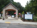
Darrel's Dream playground
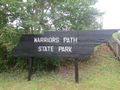
Soccer Fields Sign
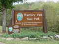
Warriors Drive Welcome Sign
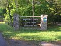
Hemlock Welcome Sign


