File:GPSBabel settings for eTrex.png
Jump to navigation
Jump to search
Size of this preview: 661 × 600 pixels. Other resolution: 678 × 615 pixels.
Original file (678 × 615 pixels, file size: 37 KB, MIME type: image/png)
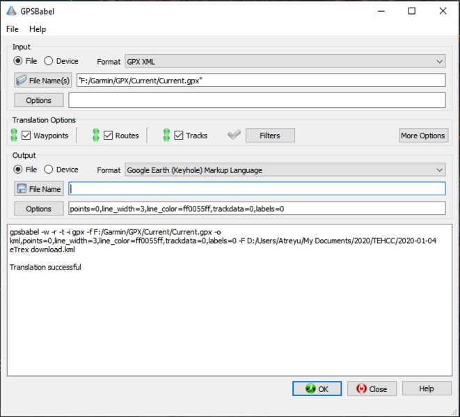
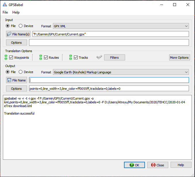
Summary[edit]
GPS settings I use for downloading eTrex tracks and waypoints using GPSBabel
File history
Click on a date/time to view the file as it appeared at that time.
| Date/Time | Thumbnail | Dimensions | User | Comment | |
|---|---|---|---|---|---|
| current | 12:20, 4 January 2020 | | 678 × 615 (37 KB) | Tim (talk | contribs) | GPS settings I use for downloading eTrex tracks and waypoints using GPSBabel |
You cannot overwrite this file.
File usage
The following page uses this file: