File:AT2016Hike-Laurel Fork Trail to 321.PNG
Jump to navigation
Jump to search
Size of this preview: 800 × 168 pixels. Other resolution: 1,522 × 319 pixels.
Original file (1,522 × 319 pixels, file size: 56 KB, MIME type: image/png)
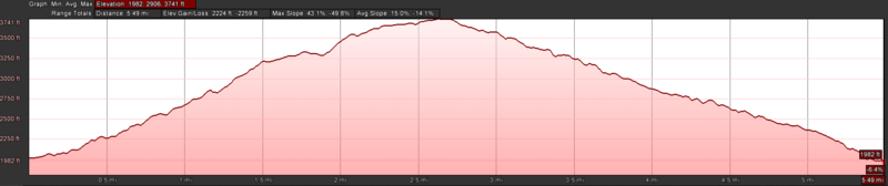
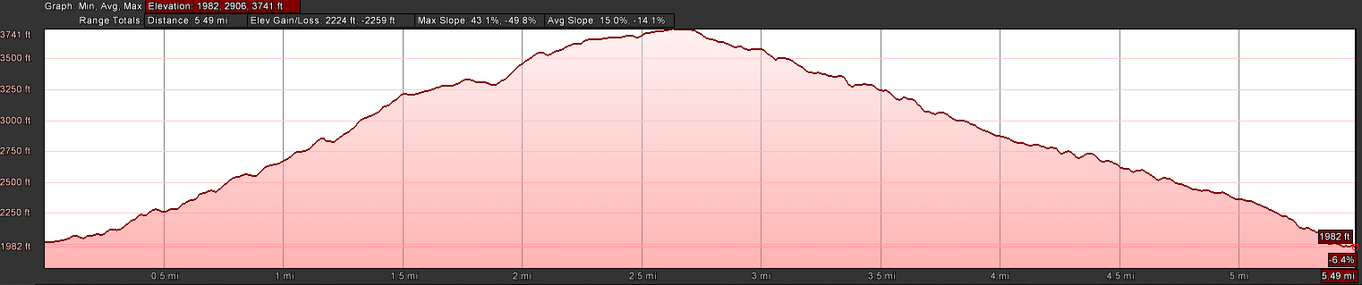
Profile of the Laurel Fork Trail on to Pond Mountain to Shook Branch Rd on US321 section of the A.T.
File history
Click on a date/time to view the file as it appeared at that time.
| Date/Time | Thumbnail | Dimensions | User | Comment | |
|---|---|---|---|---|---|
| current | 07:36, 29 January 2017 | 1,522 × 319 (56 KB) | Tim (talk | contribs) | Profile of the Laurel Fork Trail on to Pond Mountain to Shook Branch Rd on US321 section of the A.T. |
You cannot overwrite this file.
File usage
The following page uses this file: