Loading map...
{"format":"googlemaps3","type":"TERRAIN","minzoom":false,"maxzoom":false,"types":["SATELLITE","HYBRID","TERRAIN"],"limit":50,"offset":0,"link":"none","sort":[""],"order":[],"headers":"show","mainlabel":"","intro":"","outro":"","searchlabel":"... further results","default":"","import-annotation":false,"width":"auto","height":"600px","centre":false,"title":"","label":"","icon":"","lines":[],"polygons":[],"circles":[],"rectangles":[],"copycoords":false,"static":false,"visitedicon":"","wmsoverlay":false,"zoom":false,"layers":[],"controls":["pan","zoom","type","scale","streetview","rotate"],"zoomstyle":"DEFAULT","typestyle":"DEFAULT","autoinfowindows":false,"resizable":false,"kmlrezoom":true,"poi":true,"cluster":false,"clustergridsize":60,"clustermaxzoom":20,"clusterzoomonclick":true,"clusteraveragecenter":true,"clusterminsize":2,"imageoverlays":[],"kml":[],"gkml":["https://tehcc.org/clubwiki/images/Tom_Gray.kml"],"searchmarkers":"","fullscreen":false,"scrollwheelzoom":false,"showtitle":false,"hidenamespace":true,"template":"Map Balloon Template","userparam":"","activeicon":"","pagelabel":false,"ajaxcoordproperty":"","ajaxquery":"","locations":[{"text":"\u003Cp\u003E\u003Cb\u003E\u003Ca class=\"mw-selflink selflink\"\u003ETom Gray\u003C/a\u003E\u003C/b\u003E\u003Cbr /\u003E\u003C/p\u003E\u003Chr /\u003E\u003Cp\u003E0.47\u0026#160;Mi (0.75\u0026#160;km)\u003Cbr /\u003EDifficulty: Easy\u003Cbr /\u003EMarking: White\u003C/p\u003E","title":"Tom Gray","link":"","lat":36.15878000000000014324541552923619747161865234375,"lon":-82.1000499999999959754859446547925472259521484375,"icon":"/clubwiki/images/MarkerT.png"},{"text":"\u003Cp\u003E\u003Cb\u003ESign post #10\u003C/b\u003E\u003Cbr /\u003E\u003C/p\u003E\u003Chr /\u003E\u003Cp\u003E\u003Ca href=\"/wiki/File:Roan_Ted_Gray_Post_10.jpg\" class=\"image\" title=\"Sign post #10\"\u003E\u003Cimg alt=\"Sign post #10\" src=\"/clubwiki/images/thumb/Roan_Ted_Gray_Post_10.jpg/150px-Roan_Ted_Gray_Post_10.jpg\" decoding=\"async\" width=\"150\" height=\"113\" srcset=\"/clubwiki/images/thumb/Roan_Ted_Gray_Post_10.jpg/225px-Roan_Ted_Gray_Post_10.jpg 1.5x, /clubwiki/images/thumb/Roan_Ted_Gray_Post_10.jpg/300px-Roan_Ted_Gray_Post_10.jpg 2x\" data-file-width=\"1280\" data-file-height=\"960\" /\u003E\u003C/a\u003E\u003C/p\u003E","title":"Tom Gray","link":"","lat":36.15661800000000170030034496448934078216552734375,"lon":-82.09989699999999857027432881295680999755859375,"icon":"/clubwiki/images/MarkerG.png"},{"text":"\u003Cp\u003E\u003Cb\u003ESign post #7\u003C/b\u003E\u003Cbr /\u003E\u003C/p\u003E\u003Chr /\u003E\u003Cp\u003E\u003Ca href=\"/wiki/File:Roan_Ted_Gray_Post_7.jpg\" class=\"image\" title=\"Sign post #7\"\u003E\u003Cimg alt=\"Sign post #7\" src=\"/clubwiki/images/thumb/Roan_Ted_Gray_Post_7.jpg/150px-Roan_Ted_Gray_Post_7.jpg\" decoding=\"async\" width=\"150\" height=\"113\" srcset=\"/clubwiki/images/thumb/Roan_Ted_Gray_Post_7.jpg/225px-Roan_Ted_Gray_Post_7.jpg 1.5x, /clubwiki/images/thumb/Roan_Ted_Gray_Post_7.jpg/300px-Roan_Ted_Gray_Post_7.jpg 2x\" data-file-width=\"1280\" data-file-height=\"960\" /\u003E\u003C/a\u003E\u003C/p\u003E","title":"Tom Gray","link":"","lat":36.1562440000000009376890375278890132904052734375,"lon":-82.09998500000000376530806533992290496826171875,"icon":"/clubwiki/images/MarkerG.png"},{"text":"\u003Cp\u003E\u003Cb\u003ESign post #1\u003C/b\u003E\u003Cbr /\u003E\u003C/p\u003E\u003Chr /\u003E\u003Cp\u003E\u003Ca href=\"/wiki/File:Roan_Ted_Gray_Post_1.jpg\" class=\"image\" title=\"Sign post #1\"\u003E\u003Cimg alt=\"Sign post #1\" src=\"/clubwiki/images/thumb/Roan_Ted_Gray_Post_1.jpg/150px-Roan_Ted_Gray_Post_1.jpg\" decoding=\"async\" width=\"150\" height=\"200\" srcset=\"/clubwiki/images/thumb/Roan_Ted_Gray_Post_1.jpg/225px-Roan_Ted_Gray_Post_1.jpg 1.5x, /clubwiki/images/thumb/Roan_Ted_Gray_Post_1.jpg/300px-Roan_Ted_Gray_Post_1.jpg 2x\" data-file-width=\"960\" data-file-height=\"1280\" /\u003E\u003C/a\u003E\u003C/p\u003E","title":"Tom Gray","link":"","lat":36.1584610000000026275301934219896793365478515625,"lon":-82.1000480000000010250005288980901241302490234375,"icon":"/clubwiki/images/MarkerG.png"},{"text":"\u003Cp\u003E\u003Cb\u003ESign post #3\u003C/b\u003E\u003Cbr /\u003E\u003C/p\u003E\u003Chr /\u003E\u003Cp\u003E\u003Ca href=\"/wiki/File:Roan_Ted_Gray_Post_3.jpg\" class=\"image\" title=\"Sign post #3\"\u003E\u003Cimg alt=\"Sign post #3\" src=\"/clubwiki/images/thumb/Roan_Ted_Gray_Post_3.jpg/150px-Roan_Ted_Gray_Post_3.jpg\" decoding=\"async\" width=\"150\" height=\"113\" srcset=\"/clubwiki/images/thumb/Roan_Ted_Gray_Post_3.jpg/225px-Roan_Ted_Gray_Post_3.jpg 1.5x, /clubwiki/images/thumb/Roan_Ted_Gray_Post_3.jpg/300px-Roan_Ted_Gray_Post_3.jpg 2x\" data-file-width=\"1280\" data-file-height=\"960\" /\u003E\u003C/a\u003E\u003C/p\u003E","title":"Tom Gray","link":"","lat":36.1576390000000031932358979247510433197021484375,"lon":-82.1003170000000039863152778707444667816162109375,"icon":"/clubwiki/images/MarkerG.png"},{"text":"\u003Cp\u003E\u003Cb\u003ESign post #6\u003C/b\u003E\u003Cbr /\u003E\u003C/p\u003E\u003Chr /\u003E\u003Cp\u003E\u003Ca href=\"/wiki/File:Roan_Ted_Gray_Post_6.jpg\" class=\"image\" title=\"Sign post #6\"\u003E\u003Cimg alt=\"Sign post #6\" src=\"/clubwiki/images/thumb/Roan_Ted_Gray_Post_6.jpg/150px-Roan_Ted_Gray_Post_6.jpg\" decoding=\"async\" width=\"150\" height=\"200\" srcset=\"/clubwiki/images/thumb/Roan_Ted_Gray_Post_6.jpg/225px-Roan_Ted_Gray_Post_6.jpg 1.5x, /clubwiki/images/thumb/Roan_Ted_Gray_Post_6.jpg/300px-Roan_Ted_Gray_Post_6.jpg 2x\" data-file-width=\"960\" data-file-height=\"1280\" /\u003E\u003C/a\u003E\u003C/p\u003E","title":"Tom Gray","link":"","lat":36.1566839999999984911482897587120532989501953125,"lon":-82.100337999999993598976288922131061553955078125,"icon":"/clubwiki/images/MarkerG.png"},{"text":"\u003Cp\u003E\u003Cb\u003ESign post #2\u003C/b\u003E\u003Cbr /\u003E\u003C/p\u003E\u003Chr /\u003E\u003Cp\u003E\u003Ca href=\"/wiki/File:Roan_Ted_Gray_Post_2.jpg\" class=\"image\" title=\"Sign post #2\"\u003E\u003Cimg alt=\"Sign post #2\" src=\"/clubwiki/images/thumb/Roan_Ted_Gray_Post_2.jpg/150px-Roan_Ted_Gray_Post_2.jpg\" decoding=\"async\" width=\"150\" height=\"200\" srcset=\"/clubwiki/images/thumb/Roan_Ted_Gray_Post_2.jpg/225px-Roan_Ted_Gray_Post_2.jpg 1.5x, /clubwiki/images/thumb/Roan_Ted_Gray_Post_2.jpg/300px-Roan_Ted_Gray_Post_2.jpg 2x\" data-file-width=\"960\" data-file-height=\"1280\" /\u003E\u003C/a\u003E\u003C/p\u003E","title":"Tom Gray","link":"","lat":36.15777200000000135560185299254953861236572265625,"lon":-82.1002079999999949677658150903880596160888671875,"icon":"/clubwiki/images/MarkerG.png"},{"text":"\u003Cp\u003E\u003Cb\u003ESign post #8\u003C/b\u003E\u003Cbr /\u003E\u003C/p\u003E\u003Chr /\u003E\u003Cp\u003E\u003Ca href=\"/wiki/File:Roan_Ted_Gray_Post_8.jpg\" class=\"image\" title=\"Sign post #8\"\u003E\u003Cimg alt=\"Sign post #8\" src=\"/clubwiki/images/thumb/Roan_Ted_Gray_Post_8.jpg/150px-Roan_Ted_Gray_Post_8.jpg\" decoding=\"async\" width=\"150\" height=\"113\" srcset=\"/clubwiki/images/thumb/Roan_Ted_Gray_Post_8.jpg/225px-Roan_Ted_Gray_Post_8.jpg 1.5x, /clubwiki/images/thumb/Roan_Ted_Gray_Post_8.jpg/300px-Roan_Ted_Gray_Post_8.jpg 2x\" data-file-width=\"1280\" data-file-height=\"960\" /\u003E\u003C/a\u003E\u003C/p\u003E","title":"Tom Gray","link":"","lat":36.15589200000000147383616422303020954132080078125,"lon":-82.099998999999996840415406040847301483154296875,"icon":"/clubwiki/images/MarkerG.png"},{"text":"\u003Cp\u003E\u003Cb\u003ESign post #11\u003C/b\u003E\u003Cbr /\u003E\u003C/p\u003E\u003Chr /\u003E\u003Cp\u003E\u003Ca href=\"/wiki/File:Roan_Ted_Gray_Post_11.jpg\" class=\"image\" title=\"Sign post #11\"\u003E\u003Cimg alt=\"Sign post #11\" src=\"/clubwiki/images/thumb/Roan_Ted_Gray_Post_11.jpg/150px-Roan_Ted_Gray_Post_11.jpg\" decoding=\"async\" width=\"150\" height=\"113\" srcset=\"/clubwiki/images/thumb/Roan_Ted_Gray_Post_11.jpg/225px-Roan_Ted_Gray_Post_11.jpg 1.5x, /clubwiki/images/thumb/Roan_Ted_Gray_Post_11.jpg/300px-Roan_Ted_Gray_Post_11.jpg 2x\" data-file-width=\"1280\" data-file-height=\"960\" /\u003E\u003C/a\u003E\u003C/p\u003E","title":"Tom Gray","link":"","lat":36.15693900000000127192834042944014072418212890625,"lon":-82.0999609999999933052095002494752407073974609375,"icon":"/clubwiki/images/MarkerG.png"},{"text":"\u003Cp\u003E\u003Cb\u003ESign post #9\u003C/b\u003E\u003Cbr /\u003E\u003C/p\u003E\u003Chr /\u003E\u003Cp\u003E\u003Ca href=\"/wiki/File:Roan_Ted_Gray_Post_9.jpg\" class=\"image\" title=\"Sign post #9\"\u003E\u003Cimg alt=\"Sign post #9\" src=\"/clubwiki/images/thumb/Roan_Ted_Gray_Post_9.jpg/150px-Roan_Ted_Gray_Post_9.jpg\" decoding=\"async\" width=\"150\" height=\"113\" srcset=\"/clubwiki/images/thumb/Roan_Ted_Gray_Post_9.jpg/225px-Roan_Ted_Gray_Post_9.jpg 1.5x, /clubwiki/images/thumb/Roan_Ted_Gray_Post_9.jpg/300px-Roan_Ted_Gray_Post_9.jpg 2x\" data-file-width=\"1280\" data-file-height=\"960\" /\u003E\u003C/a\u003E\u003C/p\u003E","title":"Tom Gray","link":"","lat":36.1563579999999973324520397000014781951904296875,"lon":-82.0998749999999972715158946812152862548828125,"icon":"/clubwiki/images/MarkerG.png"},{"text":"\u003Cp\u003E\u003Cb\u003ESign post #4\u003C/b\u003E\u003Cbr /\u003E\u003C/p\u003E\u003Chr /\u003E\u003Cp\u003E\u003Ca href=\"/wiki/File:Roan_Ted_Gray_Post_4.jpg\" class=\"image\" title=\"Sign post #4\"\u003E\u003Cimg alt=\"Sign post #4\" src=\"/clubwiki/images/thumb/Roan_Ted_Gray_Post_4.jpg/150px-Roan_Ted_Gray_Post_4.jpg\" decoding=\"async\" width=\"150\" height=\"200\" srcset=\"/clubwiki/images/thumb/Roan_Ted_Gray_Post_4.jpg/225px-Roan_Ted_Gray_Post_4.jpg 1.5x, /clubwiki/images/thumb/Roan_Ted_Gray_Post_4.jpg/300px-Roan_Ted_Gray_Post_4.jpg 2x\" data-file-width=\"960\" data-file-height=\"1280\" /\u003E\u003C/a\u003E\u003C/p\u003E","title":"Tom Gray","link":"","lat":36.15740199999999759938873467035591602325439453125,"lon":-82.1003860000000003083187039010226726531982421875,"icon":"/clubwiki/images/MarkerG.png"},{"text":"\u003Cp\u003E\u003Cb\u003ESign post #5\u003C/b\u003E\u003Cbr /\u003E\u003C/p\u003E\u003Chr /\u003E\u003Cp\u003E\u003Ca href=\"/wiki/File:Roan_Ted_Gray_Post_5.jpg\" class=\"image\" title=\"Sign post #5\"\u003E\u003Cimg alt=\"Sign post #5\" src=\"/clubwiki/images/thumb/Roan_Ted_Gray_Post_5.jpg/150px-Roan_Ted_Gray_Post_5.jpg\" decoding=\"async\" width=\"150\" height=\"113\" srcset=\"/clubwiki/images/thumb/Roan_Ted_Gray_Post_5.jpg/225px-Roan_Ted_Gray_Post_5.jpg 1.5x, /clubwiki/images/thumb/Roan_Ted_Gray_Post_5.jpg/300px-Roan_Ted_Gray_Post_5.jpg 2x\" data-file-width=\"1280\" data-file-height=\"960\" /\u003E\u003C/a\u003E\u003C/p\u003E","title":"Tom Gray","link":"","lat":36.156869999999997844497556798160076141357421875,"lon":-82.1004410000000035552147892303764820098876953125,"icon":"/clubwiki/images/MarkerG.png"}]}
From the Visitor Center head south on 143 and turn right into the campground area. If not camping, park at the shelter. The trail begins to the left of the new playground and the rear of the clearing.
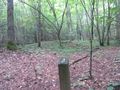
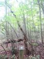
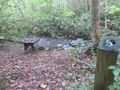
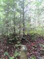
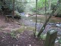
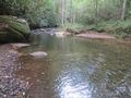
A short hike along the Doe River beginning from the campground registration.
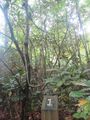
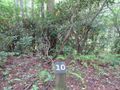
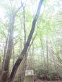
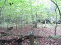
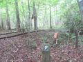
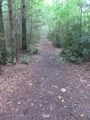
Being a TN state park, the dirt and gravel trails are kept in good condition. Some of the trail sections are steep, thus can be slippery after a rain.


