Road to Recycling Trail: Difference between revisions
(Creating trail page using form) |
(Adding elevation data from GE) |
||
| Line 4: | Line 4: | ||
|Trail Marking=Black arrow on silver diamond | |Trail Marking=Black arrow on silver diamond | ||
|Trail Use=Hiking | |Trail Use=Hiking | ||
|Trail Features=Rivers | |||
|Difficulty Rating=Easy | |Difficulty Rating=Easy | ||
|Hike Time=30 min | |Hike Time=30 min | ||
|Trail Distance=1.20 mi | |Trail Distance=1.20 mi | ||
|Round Trip Distance=1. | |Round Trip Distance=1.70 mi | ||
|Trail Type=Loop | |Trail Type=Loop | ||
|High Point=1200 ft | |||
|Low Point=1080 ft | |||
|Elevation Gain=287 | |||
|Elevation Loss=273 | |||
|Elevation Change Direction=Counter Clockwise | |||
|Parking location=36.21484, -83.40581 | |Parking location=36.21484, -83.40581 | ||
|Trailhead location=36.21227, -83.40309 | |Trailhead location=36.21227, -83.40309 | ||
| Line 29: | Line 35: | ||
! Mileage !! Feature !! Elevation | ! Mileage !! Feature !! Elevation | ||
|- | |- | ||
| (0. | | (0.25) || Spoone Rec. Area Parking Lot || 1085 | ||
|- | |- | ||
| 0. | | (0.20) || Panther Path Trail at park road || 1083 | ||
|- | |- | ||
| 0. | | (0.10) || Bench along Panther Creek || 1088 | ||
|- | |- | ||
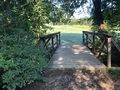
| | | 0.00 || Bridge over Panther Creek || 1095 | ||
|- | |- | ||
| (1. | | 0.xx || Unmarked spur trail to campground || 1143 | ||
|- | |||
| 1.20 || Back at bridge || 1095 | |||
|- | |||
| (1.70) || Back at parking lot || 1085 | |||
|} | |} | ||
Revision as of 19:22, 11 September 2020
| Road to Recycling Trail (log in to submit report) | |
|---|---|
| Highlight | Good for trail running |
| Park | Panther Creek State Park |
| Located | Morristown, TennesseeLocation inherited from associated park |
| Trail Marking | Black arrow on silver diamond |
| Trail UseThings allowed to do on or near the trail |
|
| FeaturesThings to see on or near the trail |
|
| Difficulty Rating | Easy |
| Hiking TimeTime from car and back. Includes any time hiking to access this trail. | 30 min0.5 Hours <br />0.0313 Days <br /> round trip |
| Distance: | 1.20 mi1.931 km <br /> trailStrict non-repeating trail length / 1.70 mi2.736 km <br /> round tripTypical or shortest length from the car, hike the trail, and return to car |
| Trail Type | Loop |
| Low / High Point | 1080 ft360 Yards <br />329.184 Meters <br /> / 1200 ft400 Yards <br />365.76 Meters <br /> |
| Elev. Gain/LossSee link for details of calculation. Gain/Loss is direction dependent. | 287287 Feet <br />87.478 Meters <br /> / (273273 Feet <br />83.21 Meters <br />) – Counter Clockwise |
| Trip ReportsFrom user "hiked it" submissions<br />Recent is within last 90 days | 1 logged hikes (0 recent) |
| NearbyWithin 5 mi<br />Click link to view list | 8 trails / 11.5 mi of trail |
| Parking | 36° 12' 53.42" N, 83° 24' 20.92" W Map |
| Trailhead | 36° 12' 44.17" N, 83° 24' 11.12" W Map |
|
| |
| Show In Google Maps | |
Download KML / Upload new version / KML File Page / Create Profile Chart / gpsvisualizer Map
Trail Overview
Non-descriptive path through scrub forest mostly used by trail runners.
How To Get There
Once at the state park, closest parking is the Spoone Recreation Area. Parking at playground/pool area will require a walk through an intermittently mown field.
Route Description
Will have to start with a short segment of the Panther Path Trail to reach the bridge crossing Panther Creek to access this loop trail. Clockwise or counterclockwise have similar experience.
| Mileage | Feature | Elevation |
|---|---|---|
| (0.25) | Spoone Rec. Area Parking Lot | 1085 |
| (0.20) | Panther Path Trail at park road | 1083 |
| (0.10) | Bench along Panther Creek | 1088 |
| 0.00 | Bridge over Panther Creek | 1095 |
| 0.xx | Unmarked spur trail to campground | 1143 |
| 1.20 | Back at bridge | 1095 |
| (1.70) | Back at parking lot | 1085 |
Typical Conditions
Forest road cut through scrub trees. Deep erosion in places as water not purposefully directed off the trail. White lines on the ground showing the high school cross-country route used in the park by combining several trail segments.
Miscellaneous Information
Reportedly a self-guided tour, but the trailhead kiosk did not have any information, which must be at the Welcome Center. Only saw some of the numbered posts from 2004.
Gallery
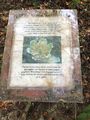
Last remaining info sign for self-guided tour

