|
|
| (3 intermediate revisions by the same user not shown) |
| Line 1: |
Line 1: |
| <!-- The following few lines create the "Infobox" table template. Please scroll down to edit the main content of the article.
| | {{Trail |
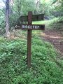
| | |Banner Image=File:WPSP Ridgetop Sign.JPG |
| | |Trail System=Warriors' Path State Park Mountain Bike Trails |
| | |Park=Warriors' Path State Park |
| | |Trail Marking=None |
| | |Trail Use=Hiking, Biking |
| | |Trail Features=Vistas |
| | |Difficulty Rating=Hard |
| | |Hike Time=30 min |
| | |Trail Distance=0.48 mi |
| | |Round Trip Distance=0.8 mi |
| | |Trail Type=Segment |
| | |High Point=1,581 Ft |
| | |Low Point=1,469 ft |
| | |Elevation Gain=0 Ft |
| | |Elevation Loss=108 Ft |
| | |Elevation Change Direction=Clockwise |
| | |Parking location=36.49213, -82.46857 |
| | |Trailhead location=36.49318, -82.46913 |
| | }} |
| | {{Trail Map|Other Trails=Magic Carpet Ride}} |
| | Ridge Top is in black and Magic Carpet Ride in dark purple (and together makes a profile of a [https://www.google.com/search?tbm=isch&as_q=sonic+the+hedgehog famous hedgehog]!). |
|
| |
|
| -->{{Infobox Trail
| | __TOC__ |
| | Image Name = WPSP_Mt_Bike_Trails_sign.jpg
| |
| | Park = Warriors Path State Park
| |
| | City = Kingsport
| |
| | State = Tennessee
| |
| | Marking = None
| |
| | Trail Use = {{Biking}} {{Dogs}} {{Hike}}
| |
| | Difficulty Rating = Hard
| |
| | Hike Time = 30 Min
| |
| | Round Trip Distance = 0.8 Mi
| |
| | Trail Distance = 0.51 Mi
| |
| | Trail Type = Segment
| |
| | Elevation Gain = 252 Ft
| |
| | Elevation Loss = -351 Ft
| |
| | High Point = 1,636 Ft
| |
| | Parking coords = 36.49213,-82.46857
| |
| | Trailhead coords = 36.493178,-82.469127
| |
| | Medical = Indian Path Hospital
| |
| }}<!--
| |
| | |
| End Infobox template table
| |
| | |
| -->{{Trail page needs
| |
| | Hide needs =
| |
| | KML =
| |
| | Updated KML =
| |
| | Detail route description = Yes
| |
| | Photos = Yes
| |
| | Winter photos =
| |
| | Remove prefix =
| |
| | Update infobox =
| |
| | Infobox data update =
| |
| | Trail pins = Yes
| |
| | Other =
| |
| | Comment = Determine min round trip length
| |
| | Date reviewed = 10/25/2015
| |
| }}<!--
| |
| | |
| Start of Main Page -->
| |
| == Trail Overview == | | == Trail Overview == |
| <!-- Enter a overview of the trail. What attracts you to this trail, points of interest, types of flowers, lakes, and peaks that you see along the way. --> | | <!-- Enter a overview of the trail. What attracts you to this trail, points of interest, types of flowers, lakes, and peaks that you see along the way. --> |
| Line 66: |
Line 49: |
| <!-- Please list any Fees, Permits, Regulations, etc. that may be required on this trail.--> | | <!-- Please list any Fees, Permits, Regulations, etc. that may be required on this trail.--> |
| No fee required. Dogs are allowed on or off leash. Do not drink any water without treatment! | | No fee required. Dogs are allowed on or off leash. Do not drink any water without treatment! |
|
| |
| == After the Hike ==
| |
| <!-- Other things to check out while you're in the area. Restaurants, attractions, monuments, etc... -->
| |
|
| |
| == Misc. Information ==
| |
| <!-- Enter any additional information that doesn't fit an any other fields. Does this trail require any permits for overnight? parking? -->
| |
|
| |
| == Maps ==
| |
| <!-- You can place pictures, PDF's, links, or even create a Google map with your waypoints and place it here. -->
| |
| Click the official trail map:
| |
| [[File:Warriors-MTB-Trails.pdf|SORBA TriCities Trail Map]]
| |
|
| |
| [http://tnstateparks.com/assets/pdf/additional-content/warriors-path_bike-trail-map.pdf State Park Map]
| |
|
| |
| Ridge Top is in black and Magic Carpet Ride in dark purple (and together makes a profile of a hedgehog!).
| |
| <display_map center="36.491510,-82.469220" type="terrain" zoom="16" width="auto" height="550" gkml="http://tehcc.org/clubwiki/kml/WPSP_Magic_Carpet_Ride.kml,
| |
| http://tehcc.org/clubwiki/kml/WPSP_Ridge_Top.kml">
| |
|
| |
| </display_map>
| |
|
| |
|
| == Photos == | | == Photos == |
| <gallery>
| | {{Park trail gallery|Trail={{PAGENAME}}}} |
| <!-- Place any pictures from this trail below. Ideally we would have a picture of the trailhead to help people know when they found it -->
| |
| <!-- Add a picture by typing Image:imagename.extension -->
| |
| | |
| <!-- Do not remove the end gallery code.-->
| |
| </gallery>
| |
| | |
| <!-- Finally add the trail to any Categories it should belong to. Please keep the State category. -->
| |
| [[Category:Tennessee]] [[Category:Warriors Path State Park]] [[Category:Kingsport]] [[Category:Biking]] [[Category:Dog Friendly]] [[Category:No Trail KML]] [[Category:Stub]]
| |
| Ridge Top (Warriors Path State Park)
(log in to submit report)
|

|
|
|
| Trail System
|
Warriors' Path State Park Mountain Bike Trails
|
| Park
|
Warriors' Path State Park
|
| Located
|
Kingsport, TennesseeLocation inherited from associated park
|
| Trail Marking
|
None
|
| Trail UseThings allowed to do on or near the trail
|
 
|
| FeaturesThings to see on or near the trail
|

|
| Difficulty Rating
|
Hard
|
| Hiking TimeTime from car and back. Includes any time hiking to access this trail.
|
30 min0.5 Hours <br />0.0313 Days <br /> round trip
|
| Distance:
|
0.48 mi0.772 km <br /> trailStrict non-repeating trail length / 0.8 mi1.287 km <br /> round tripTypical or shortest length from the car, hike the trail, and return to car
|
| Trail Type
|
Segment
|
| Low / High Point
|
1,469 ft489.667 Yards <br />447.751 Meters <br /> / 1,581 Ft527 Yards <br />481.889 Meters <br />
|
| Elev. Gain/LossSee link for details of calculation. Gain/Loss is direction dependent.
|
0 Ft0 Meters <br /> / (108 Ft32.918 Meters <br />) – Clockwise
|
| Trip ReportsFrom user "hiked it" submissions<br />Recent is within last 90 days
|
1 logged hikes (0 recent)
|
| NearbyWithin 5 mi<br />Click link to view list
|
25 trails / 20.2 mi of trail
|
| Parking
|
36° 29' 31.67" N, 82° 28' 6.85" W Map
|
| Trailhead
|
36° 29' 35.45" N, 82° 28' 8.87" W Map
|
Loading map... {"type":"ROADMAP","minzoom":false,"maxzoom":false,"types":["ROADMAP","SATELLITE","HYBRID","TERRAIN"],"mappingservice":"googlemaps3","width":"100%","height":"180px","centre":false,"title":"","label":"","icon":"","lines":[],"polygons":[],"circles":[],"rectangles":[],"copycoords":false,"static":false,"visitedicon":"","wmsoverlay":false,"zoom":8,"layers":[],"controls":[""],"zoomstyle":"DEFAULT","typestyle":"DEFAULT","autoinfowindows":false,"resizable":false,"kmlrezoom":false,"poi":true,"cluster":false,"clustergridsize":60,"clustermaxzoom":20,"clusterzoomonclick":true,"clusteraveragecenter":true,"clusterminsize":2,"imageoverlays":[],"kml":[],"gkml":[],"searchmarkers":"","fullscreen":false,"scrollwheelzoom":false,"locations":[{"text":"\u003Cb\u003E\u003Cdiv class=\"mw-parser-output\"\u003E\u003Cp\u003ERidge Top (Warriors Path State Park)\n\u003C/p\u003E\u003C/div\u003E\u003C/b\u003E\u003Cdiv class=\"mw-parser-output\"\u003E\u003Cp\u003EMain Parking Location\n\u003C/p\u003E\u003C/div\u003E","title":"Ridge Top (Warriors Path State Park)\n","link":"","lat":36.492130000000003064997144974768161773681640625,"lon":-82.4685699999999997089616954326629638671875,"icon":""}]} |
| Show In Google Maps
|
Loading map...
{"format":"googlemaps3","type":"TERRAIN","minzoom":false,"maxzoom":false,"types":["SATELLITE","HYBRID","TERRAIN"],"limit":50,"offset":0,"link":"none","sort":[""],"order":[],"headers":"show","mainlabel":"","intro":"","outro":"","searchlabel":"... further results","default":"","import-annotation":false,"width":"auto","height":"600px","centre":false,"title":"","label":"","icon":"","lines":[],"polygons":[],"circles":[],"rectangles":[],"copycoords":false,"static":false,"visitedicon":"","wmsoverlay":false,"zoom":false,"layers":[],"controls":["pan","zoom","type","scale","streetview","rotate"],"zoomstyle":"DEFAULT","typestyle":"DEFAULT","autoinfowindows":false,"resizable":false,"kmlrezoom":true,"poi":true,"cluster":false,"clustergridsize":60,"clustermaxzoom":20,"clusterzoomonclick":true,"clusteraveragecenter":true,"clusterminsize":2,"imageoverlays":[],"kml":[],"gkml":["https://tehcc.org/clubwiki/images/Magic_Carpet_Ride.kml","https://tehcc.org/clubwiki/images/Ridge_Top_(Warriors_Path_State_Park).kml"],"searchmarkers":"","fullscreen":false,"scrollwheelzoom":false,"showtitle":false,"hidenamespace":true,"template":"Map Balloon Template","userparam":"","activeicon":"","pagelabel":false,"ajaxcoordproperty":"","ajaxquery":"","locations":[{"text":"\u003Cp\u003E\u003Cb\u003E\u003Ca href=\"/wiki/Magic_Carpet_Ride\" title=\"Magic Carpet Ride\"\u003EMagic Carpet Ride\u003C/a\u003E\u003C/b\u003E\u003Cbr /\u003E\u003C/p\u003E\u003Chr /\u003E\u003Cp\u003E0.20\u0026#160;Mi (0.33\u0026#160;km)\u003Cbr /\u003EDifficulty: Medium\u003Cbr /\u003EMarking: None\u003C/p\u003E","title":"Magic Carpet Ride","link":"","lat":36.492130000000003064997144974768161773681640625,"lon":-82.4685699999999997089616954326629638671875,"icon":"/clubwiki/images/MarkerT.png"},{"text":"\u003Cp\u003E\u003Cb\u003E\u003Ca class=\"mw-selflink selflink\"\u003ERidge Top (Warriors Path State Park)\u003C/a\u003E\u003C/b\u003E\u003Cbr /\u003E\u003C/p\u003E\u003Chr /\u003E\u003Cp\u003E0.48\u0026#160;Mi (0.77\u0026#160;km)\u003Cbr /\u003EDifficulty: Hard\u003Cbr /\u003EMarking: None\u003C/p\u003E","title":"Ridge Top (Warriors Path State Park)","link":"","lat":36.49318000000000239424480241723358631134033203125,"lon":-82.46913000000000693034962750971317291259765625,"icon":"/clubwiki/images/MarkerT.png"}]}
Download KML / Upload new version / KML File Page / Create Profile Chart / gpsvisualizer Map
Ridge Top is in black and Magic Carpet Ride in dark purple (and together makes a profile of a famous hedgehog!).
Trail Overview[edit]
Located in Warriors Path State Park as part of their Mountain Bike Trail system. A short trail up the ridge that turns into Magic Carpet Ride (and really both should be all considered one trail).
How to get there[edit]
From main entrance of Warriors Path State Park:
- Go north on Fall Creek Road for 2.4 miles.
- Turn right (east) onto Old Mill Road for 0.8 miles.
- Turn right (south) onto Childress Ferry Road for just roughly 100 yards.
- Turn left (east) onto Buttermilk Road for 1.2 miles.
- Turn right (south) onto Freeman Road for 0.5 mile.
- Continue when road changes from asphalt to gravel.
Trailhead at gravel parking lot.
Route Description[edit]
This trail has connections to Magic Carpet Ride and Whitetail Alternate.
Typical Conditions[edit]
The mountain biking association SORBA Tri-Cities handles the trail maintenance, thus generally in good condition. While there are no blazes to guide you through the forest, the narrow single tracks are well established. Grab a trail map at the parking lot kiosk to help you decipher intersections; some which could use signs. Be aware for approaching bike riders who can come up quickly on your group. Step aside to let them safely pass.
Fees, Permits, etc.[edit]
No fee required. Dogs are allowed on or off leash. Do not drink any water without treatment!