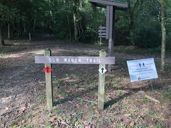
Old Wagon Trail
| Old Wagon Trail (log in to submit report) | |
|---|---|

| |
| Highlight | Good for beginners. |
| Park | Panther Creek State Park |
| Located | Morristown, TennesseeLocation inherited from associated park |
| Trail Marking | Black arrow on red diamond |
| Trail UseThings allowed to do on or near the trail | |
| FeaturesThings to see on or near the trail |
|
| Difficulty Rating | Easy |
| Hiking TimeTime from car and back. Includes any time hiking to access this trail. | 45 minutes0.75 Hours <br />0.0469 Days <br /> round trip |
| Distance: | 1.00 mi1.609 km <br /> trailStrict non-repeating trail length / 2.00 mi3.219 km <br /> round tripTypical or shortest length from the car, hike the trail, and return to car |
| Trail Type | Segment |
| High Point | {{{High Point}}}"{{{High Point}}}" is not a number. |
| Elev. Gain/LossSee link for details of calculation. Gain/Loss is direction dependent. | {{{Elevation Gain}}}"{{{Elevation Gain}}}" is not a number. / ({{{Elevation Loss}}}"{{{Elevation Loss}}}" is not a number.) – {{{Elevation Change Direction}}} |
| Trip ReportsFrom user "hiked it" submissions<br />Recent is within last 90 days | 1 logged hikes (0 recent) |
| NearbyWithin 5 mi<br />Click link to view list | 8 trails / 11.7 mi of trail |
| Parking | 36° 12' 53.42" N, 83° 24' 20.92" W Map |
| Trailhead | 36° 12' 50.69" N, 83° 24' 18.36" W Map |
|
| |
| Show In Google Maps | |
Trail Overview
Main promenade for the park as wide, flat path used by dog walkers, stroller pushers, bike riders, and more.
How To Get There
Once at the state park, parking for the two ends are at Spoone Recreation Area and Welcome Center. The latter will require a 0.2 mile connecting segment to begin.
Route Description
Likely, in-and-out for those staying in the campground and wanting a shorter walk. For other visitors, Old Wagon Trail will be part of a larger loop hike with other trails
| Mileage | Feature | Elevation |
|---|---|---|
| 0.00 | NE trailhead immediately crossing Horse Connector Trail | |
| 0.36 | Connecting segment to Norris Blackburn Trail | |
| 0.56 | Intersection with Deer Run Trail | |
| 0.71 | Intersection with Pine Cove Trail | |
| 1.00 | Gate for Welcome Center |
Typical Conditions
Flat and wide clay path which could be muddy and slick during/after a rain. One uncut blowdown across trail during visit. Social trails down to the stream/lake inlet. Trail appears to be part of the high school cross-country route as white directional arrows painted on the ground.
Miscellaneous Information
Reportedly good for wildlife spotting as many different bird and animal species in areas during early mornings.
Gallery