Max Patch: Difference between revisions

From TEHCC Wiki
Jump to navigation Jump to search
No edit summary
(→‎Photos: added categories to otherwise blank hike plan)
Line 64: Line 64:
</gallery>
</gallery>


<!-- Finally add the trail to any Categories it should belong to. Please keep the State category. To make a new category just type [[Category:mycategory]].  Keep in mind categories are case sensitive. Check here ClubWIKI:Categorization_Plan for our list of categories that we are using -->
<!-- Categories - Keep in mind the titles are case sensitive. Check here ClubWIKI:Categorization_Plan for our list of categories that we are using -->
[[Category:Tennessee]] [[Category:Hiking]] [[Category:Dog Friendly]] [[Category:Appalachian Trail]]

Revision as of 05:58, 16 April 2012


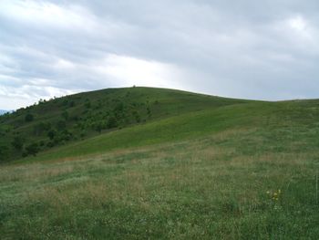
Max Patch.jpg
Trail Name Max Patch
Nearest City Madison County
State North Carolina
Trail Marking {{{Marking}}}
Trail Use/Features Dnr hiking.png
Difficulty Rating Easy
Hiking Time *"*" is not a number.
Distance, round-trip *"*" is not a number.
Climb/Descent Elevation *"*" is not a number. / {{{Elevation Loss}}}"{{{Elevation Loss}}}" is not a number.
High Point 4,629 ft1,543 Yards <br />1,410.919 Meters <br />
Nearest Medical *, NC
Trip Reports Click Here
Loading map...
Show Large Map


Trail Overview

How to get there

Route Description

Typical Conditions

Fees, Permits, etc.

After the Hike

Misc. Information

Maps

Photos