Lakeside Trail: Difference between revisions
Jump to navigation
Jump to search
No edit summary |
(Switched to trail page format) |
||
| Line 1: | Line 1: | ||
== Trail | <!-- The following few lines create the "Infobox" table template. Please scroll down to edit the main content of the article. --> | ||
Very popular hiking loop trail around the reservoir. It connects with many other park trails, thus a common starting point. Officially takes 90 minutes on maintained path with moderate climbs and drops. A few benches are scattered along the trail. | {{Infobox Trail | ||
| Image Name = Lakeside_Trail_-_Bays_Mountain_Dam.jpg | |||
| Trail No. = * | |||
| City = Kingsport | |||
| State = Tennessee | |||
| Trail Use = {{Hike}}{{Dogs}} | |||
| Season = * | |||
| Difficulty Rating = * | |||
| Hike Time = * | |||
| Distance = * | |||
| Elevation Gain = * | |||
| High Point = * | |||
| Latitude = 36.50803 | |||
| Longitude = -82.61255 | |||
| Medical = *, TN | |||
<!-- DON'T EDIT THE GOOGLEMAP TAG --> | |||
| googlemap = | |||
<googlemap lat="36.50803" lon="-82.61255" zoom="12" width="270" type="terrain" height="180" selector="no" controls="small"> | |||
36.50803,-82.61255,Lakeside Trail | |||
</googlemap> | |||
}} | |||
<!-- End Infobox template table--> | |||
<!-- Start of Main Page --> | |||
== Trail Overview == | |||
<!-- Enter a overview of the trail. What attracts you to this trail, points of interest, types of flowers, lakes, and peaks that you see along the way. --> | |||
Very popular hiking loop trail around the reservoir. It connects with many other park trails, thus a common starting point. Officially takes 90 minutes on maintained path with moderate climbs and drops. A few benches are scattered along the trail. Points of interest include floating bridge, beaver activity (dams, lodges, and down/gnawed trees), lillypad pond, and the wolves and other animal habitats. Note red dirt from maroon shale in places. | |||
== How to get there == | |||
<!-- Please enter detailed instruction on how to find the trail head. --> | |||
== Route Description== | |||
<!-- Detailed description of the route. Is there any side trails that are worth traveling? --> | |||
{| class="wikitable" border="1" | {| class="wikitable" border="1" | ||
|- | |- | ||
| Line 59: | Line 90: | ||
|} | |} | ||
== | == Typical Conditions == | ||
<!-- | <!-- Typical conditions throughout the year of what to expect on the trail. Rocky, muddy, sandy, flowers, lots of downed trees? --> | ||
==Fees, Permits, etc. == | |||
<!-- Please list any Fees, Permits, Regulations, etc. that may be required on this trail.--> | |||
== After the Hike == | |||
<!-- Other things to check out while you're in the area. Restaurants, attractions, monuments, etc... --> | |||
== Misc. Information == | |||
<!-- Enter any additional information that doesn't fit an any other fields. Does this trail require any permits for overnight? parking? --> | |||
== Maps == | |||
<!-- You can place pictures, PDF's, links, or even create a Google map with your waypoints and place it here. --> | |||
<googlemap lat="36.50803" lon="-82.61255" zoom="12" width="270" type="terrain" height="180" selector="no" controls="small"> | <googlemap lat="36.50803" lon="-82.61255" zoom="12" width="270" type="terrain" height="180" selector="no" controls="small"> | ||
36.50803,-82.61255,Lakeside Trailhead at Dam | 36.50803,-82.61255,Lakeside Trailhead at Dam | ||
</googlemap> | </googlemap> | ||
== Photos == | == Photos == | ||
<gallery> | <gallery> | ||
<!-- Place any pictures from this trail below. | <!-- Place any pictures from this trail below. Ideally we would have a picture of the trailhead to help people know when they found it --> | ||
<!-- Add a picture by typing Image:imagename.extension --> | |||
Image:Lakeside_Trailhead_from_Dam.jpg | Image:Lakeside_Trailhead_from_Dam.jpg | ||
Image:Lakeside_trail_-_evergreen_grove.jpg | Image:Lakeside_trail_-_evergreen_grove.jpg | ||
Image:Lakeside_Trail_-_former_avery_area.jpg | Image:Lakeside_Trail_-_former_avery_area.jpg | ||
Image:Lakeside_Trail_-_Bays_Mountain_Dam.jpg | Image:Lakeside_Trail_-_Bays_Mountain_Dam.jpg | ||
<!-- Do not remove the end gallery code.--> | <!-- Do not remove the end gallery code.--> | ||
</gallery> | </gallery> | ||
<!-- Finally add the trail to any Categories it should belong to. Please keep the State category. To make a new category just type [[Category:mycategory]]. Keep in mind categories are case sensitive. --> | |||
[[Category:Bays Mountain Park]] | [[Category:Bays Mountain Park]] | ||
Revision as of 15:59, 5 March 2011
| |||||||||||||||||||||||||||||||||||||

Trail Overview
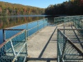
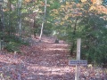
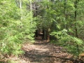
Very popular hiking loop trail around the reservoir. It connects with many other park trails, thus a common starting point. Officially takes 90 minutes on maintained path with moderate climbs and drops. A few benches are scattered along the trail. Points of interest include floating bridge, beaver activity (dams, lodges, and down/gnawed trees), lillypad pond, and the wolves and other animal habitats. Note red dirt from maroon shale in places.
How to get there
Route Description
| Miles | Lakeside Trail | Miles |
|---|---|---|
| 0.0 | Dam, end nearest Nature Center | 2.4 |
| 0.1 | Dam, far end | 2.3 |
| 0.2 | Pine Trail junction | 2.2 |
| 0.4 | Floating Bridge | 2.0 |
| 0.5 | Cherry Knobs Trail junction | 1.9 |
| 1.1 | Beaver Pond Bridge/ Sweet Gum Trail junction | 1.3 |
| 1.6 | Hemlock Tr./ (Firetower Trail) junction | 0.8 |
| 1.7 | Holly Trail/ Towhee Trail junction | 0.7 |
| 1.8 | Holly Trail junction | 0.6 |
| 2.1 | Fern Trail junction | 0.3 |
| 2.3 | Water Fowl Aviary/ Laurel Trail junction | 0.1 |
| 2.4 | Nature Center | 0.0 |
Typical Conditions
Fees, Permits, etc.
After the Hike
Misc. Information
Maps
<googlemap lat="36.50803" lon="-82.61255" zoom="12" width="270" type="terrain" height="180" selector="no" controls="small"> 36.50803,-82.61255,Lakeside Trailhead at Dam </googlemap>
Photos
- Lakeside Trail - former avery area.jpg