Lake Road (Warriors Path State Park): Difference between revisions
Jump to navigation
Jump to search
m (WikiSysop moved page Lake Valley Road to Lake Road without leaving a redirect: Updating name per park map) |
(tweaks after recent hike) |
||
| (9 intermediate revisions by 3 users not shown) | |||
| Line 1: | Line 1: | ||
{{Trail | |||
{{ | |Trail Highlight=The main trail artery of the Mountain Bike System | ||
|Trail System=Warriors' Path State Park Mountain Bike Trails | |||
|Park=Warriors' Path State Park | |||
|Trail Marking=None | |||
|Trail Use=Hiking, Biking | |||
|Trail Features=Vistas, Rivers | |||
|Difficulty Rating=Easy | |||
|Hike Time=30 min | |||
|Trail Distance=0.8396 mi | |||
|Round Trip Distance=1.6 mi | |||
|Trail Type=In-and-Out | |||
|High Point=1,503 Ft | |||
|Low Point=1,300 ft | |||
|Elevation Gain=40 Ft | |||
|Elevation Loss=206 Ft | |||
|Elevation Change Direction=South-to-North | |||
|Parking location=36.49227, -82.4684 | |||
|Trailhead location=36.49213, -82.46857 | |||
}} | }} | ||
{{Trail Map|Other Trails=Boneyard}} | |||
__TOC__ | |||
== Trail Overview == | == Trail Overview == | ||
<!-- Enter a overview of the trail. What attracts you to this trail, points of interest, types of flowers, lakes, and peaks that you see along the way. --> | <!-- Enter a overview of the trail. What attracts you to this trail, points of interest, types of flowers, lakes, and peaks that you see along the way. --> | ||
| Line 25: | Line 27: | ||
== How to get there == | == How to get there == | ||
Accessible at the [[Warriors' Path State Park Mountain Bike Trails]] | |||
Trailhead at gravel parking lot. | Trailhead at gravel parking lot. | ||
== Route Description== | == Route Description== | ||
[[File:WPSP lake road profile.png|thumb|right]] | |||
== Typical Conditions == | == Typical Conditions == | ||
<!-- Typical conditions throughout the year of what to expect on the trail. Rocky, muddy, sandy, flowers, lots of downed trees? --> | <!-- Typical conditions throughout the year of what to expect on the trail. Rocky, muddy, sandy, flowers, lots of downed trees? --> | ||
The mountain biking association [http://ntmba.org/ SORBA Tri-Cities] handles the trail maintenance, thus generally in good condition. While there are no blazes to guide you through the forest, the narrow single tracks are well established. Grab a trail map at the parking lot kiosk to help you decipher intersections; some which could use signs. Be aware for approaching bike riders who can come up quickly on your group. Step aside to let them safely pass. | The mountain biking association [http://ntmba.org/ SORBA Tri-Cities] handles the trail maintenance, thus generally in good condition. While there are no blazes to guide you through the forest, the narrow single tracks are well established. Grab a trail map at the parking lot kiosk to help you decipher intersections; some which could use signs. Be aware for approaching bike riders who can come up quickly on your group. Step aside to let them safely pass. | ||
== Photos == | == Photos == | ||
{{Park trail gallery|Trail={{PAGENAME}}}} | |||
Latest revision as of 14:53, 29 December 2019
| Lake Road (Warriors Path State Park) (log in to submit report) | |
|---|---|
| Highlight | The main trail artery of the Mountain Bike System |
| Trail System | Warriors' Path State Park Mountain Bike Trails |
| Park | Warriors' Path State Park |
| Located | Kingsport, TennesseeLocation inherited from associated park |
| Trail Marking | None |
| Trail UseThings allowed to do on or near the trail |
|
| FeaturesThings to see on or near the trail |
|
| Difficulty Rating | Easy |
| Hiking TimeTime from car and back. Includes any time hiking to access this trail. | 30 min0.5 Hours <br />0.0313 Days <br /> round trip |
| Distance: | 0.8396 mi1.351 km <br /> trailStrict non-repeating trail length / 1.6 mi2.575 km <br /> round tripTypical or shortest length from the car, hike the trail, and return to car |
| Trail Type | In-and-Out |
| Low / High Point | 1,300 ft433.333 Yards <br />396.24 Meters <br /> / 1,503 Ft501 Yards <br />458.114 Meters <br /> |
| Elev. Gain/LossSee link for details of calculation. Gain/Loss is direction dependent. | 40 Ft12.192 Meters <br /> / (206 Ft62.789 Meters <br />) – South-to-North |
| Trip ReportsFrom user "hiked it" submissions<br />Recent is within last 90 days | 2 logged hikes (0 recent) |
| NearbyWithin 5 mi<br />Click link to view list | 21 trails / 18.9 mi of trail |
| Parking | 36° 29' 32.17" N, 82° 28' 6.24" W Map |
| Trailhead | 36° 29' 31.67" N, 82° 28' 6.85" W Map |
|
| |
| Show In Google Maps | |
Download KML / Upload new version / KML File Page / Create Profile Chart / gpsvisualizer Map
Trail Overview[edit]
Located in Warriors Path State Park.
How to get there[edit]
Accessible at the Warriors' Path State Park Mountain Bike Trails Trailhead at gravel parking lot.
Route Description[edit]

Typical Conditions[edit]
The mountain biking association SORBA Tri-Cities handles the trail maintenance, thus generally in good condition. While there are no blazes to guide you through the forest, the narrow single tracks are well established. Grab a trail map at the parking lot kiosk to help you decipher intersections; some which could use signs. Be aware for approaching bike riders who can come up quickly on your group. Step aside to let them safely pass.
Photos[edit]
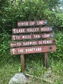
Signs at main trail split

Trail Profile

_Banner.jpg)