Jones Road: Difference between revisions
(Update IB to new format) |
(cleanup IB and update map) |
||
| Line 1: | Line 1: | ||
<!-- The following few lines create the "Infobox" table template. Please scroll down to edit the main content of the article. --> | <!-- The following few lines create the "Infobox" table template. Please scroll down to edit the main content of the article. --> | ||
{{Infobox Trail | {{Infobox Trail | ||
| Image Name = BMP Jones Road.JPG | |||
| Park = Bays Mountain Park | |||
| City = Kingsport | |||
| State = Tennessee | |||
| Marking = Junction Signs | |||
| Trail Use = {{Hike}} {{Biking}} {{Dogs}} | |||
| Difficulty Rating = Medium | |||
| Hike Time = 20 Min | |||
| Distance = 2,101 Ft | |||
| Elevation Gain = 374 Ft | |||
| Elevation Loss = -149 Ft | |||
| High Point = 2,090 Ft | |||
| Latitude = 36.49487 | |||
| Longitude = -82.60517 | |||
| Medical = Kingsport, TN | |||
}} | }} | ||
<!-- End Infobox template table--> | <!-- End Infobox template table--> | ||
| Line 59: | Line 61: | ||
== Maps == | == Maps == | ||
<!-- You can place pictures, PDF's, links, or even create a Google map with your waypoints and place it here. --> | <!-- You can place pictures, PDF's, links, or even create a Google map with your waypoints and place it here. --> | ||
< | <display_map center="36.49210,-82.63372" type="terrain" zoom="15" width="auto" height="550" gkml="http://tehcc.org/clubwiki/kml/BMP_Jones_Road.kml, | ||
http://tehcc.org/clubwiki/kml/BMP_Jones_Road.kml | http://tehcc.org/clubwiki/kml/BMP_Front_Hollow_Road.kml, | ||
http://tehcc.org/clubwiki/kml/BMP_Front_Hollow_Road.kml | http://tehcc.org/clubwiki/kml/BMP_Bays_Ridge_Road.kml"> | ||
http://tehcc.org/clubwiki/kml/BMP_Bays_Ridge_Road.kml | |||
36.49603,-82.63158~Junction with [[BMP Front Hollow Road|Front Hollow Road]] by "Big Oak"~[[Image:BMP Big Oak.JPG|100px]]~MarkerG.png | |||
36.49210,-82.63372~Junction with [[BMP Bays Ridge Road|Bays Ridge Road]]~ ~MarkerG.png | |||
</display_map> | |||
:::The following elevation profile travels from Front Hollow Road up to Bays Ridge Road. | :::The following elevation profile travels from Front Hollow Road up to Bays Ridge Road. | ||
Revision as of 21:35, 9 September 2015
| |||||||||||||||||||||||||||||||||||||||

Trail Overview
Located in Bays Mountain Park. Steep! eroded road between Front Hollow Road at the "Big Oak" and Bays Ridge Road. Not much to see along the route.
How to get there
The road is not directly accessible from the main parking lot. Cross the dam and take either Lake Road through Ledbetter Gap onto Front Hollow Road or Bays Ridge Road. No sign on Front Hollow Road, but one up on Bays Ridge Road near some graffiti.
Route Description
Short 0.3 mile, but very steep connecting road. There is a split in the middle which rejoins.
| Miles | Jones Road | Miles | Elevation (ft) |
|---|---|---|---|
| 0.0 | Trailhead at Front Hollow Road by the "Big Oak". No trail sign, but steepest path up from here. | 0.3 | 1770 |
| 0.3 | Trailhead at Bays Ridge Road | 0.0 | 2090 |
Typical Conditions
Severely washed out road on steep slopes, and natural gravel on top. Water will be flowing down thru the rut.
Misc. Information
Not shown on the park map, but Jones Road may continue down Bays Ridge towards Reservoir Road.
Maps
- The following elevation profile travels from Front Hollow Road up to Bays Ridge Road.
File:BMP Jones Road profile.JPG
Photos
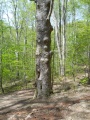
Big Oak at bottom of Jones Road
