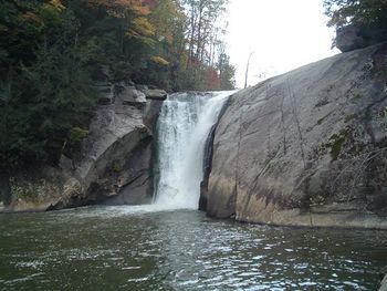
Elk River Big Falls: Difference between revisions
Jump to navigation
Jump to search
(add categories for stub and kml) |
m (add needs) |
||
| Line 1: | Line 1: | ||
<!-- The following few lines create the "Infobox" table template. Please scroll down to edit the main content of the article. --> | <!-- The following few lines create the "Infobox" table template. Please scroll down to edit the main content of the article. | ||
{{Infobox Trail | |||
-->{{Infobox Trail | |||
| Image Name = Elk_Park_Big_Falls1.JPG | | Image Name = Elk_Park_Big_Falls1.JPG | ||
| City = Elk Park | | City = Elk Park | ||
| Line 14: | Line 15: | ||
| Longitude = -81.9695 | | Longitude = -81.9695 | ||
| Medical = *, TN | | Medical = *, TN | ||
}} | }}<!-- | ||
<!-- End Infobox template table | |||
End Infobox template table | |||
<!-- | -->{{Trail page needs | ||
| Hide needs = | |||
| KML = Yes | |||
| Updated KML = | |||
| Detail route description = Yes | |||
| Photos = Yes | |||
| Winter photos = Yes | |||
| Remove prefix = | |||
| Update infobox = YEs | |||
| Infobox data update = Yes | |||
| Trail pins = Yes | |||
| Other = | |||
| Comment = Stubbiest stub, just a picture! | |||
| Date reviewed = 10/24/2015 | |||
}}<!-- | |||
Start of Main Page --> | |||
== Trail Overview == | == Trail Overview == | ||
<!-- Enter a overview of the trail. What attracts you to this trail, points of interest, types of flowers, lakes, and peaks that you see along the way. --> | <!-- Enter a overview of the trail. What attracts you to this trail, points of interest, types of flowers, lakes, and peaks that you see along the way. --> | ||
Revision as of 21:34, 24 October 2015
| |||||||||||||||||||||||||||||||||||||
Trail Overview
How to get there
Route Description
Typical Conditions
Fees, Permits, etc.
After the Hike
Misc. Information
Maps
Photos
- Placeholder.gif
