|
|
|
|
|
| Trail Name
|
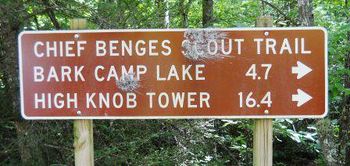
Chief Benge Scout Trail
|
| Nearest City
|
Norton
|
| State
|
Virginia
|
| Trail Marking
|
Yellow blaze
|
| Trail Use/Features
|
  
|
| Difficulty Rating
|
Hard
|
| Hiking Time
|
1010 Hours <br />0.625 Days <br />600 Min <br />
|
| Distance, round-trip
|
18.718.7 mi <br />30.095 km <br />
|
| Climb/Descent Elevation
|
1,3601,360 Feet <br />414.528 Meters <br /> / {{{Elevation Loss}}}"{{{Elevation Loss}}}" is not a number.
|
| High Point
|
3,4503,450 Feet <br />1,150 Yards <br />1,051.56 Meters <br />
|
| Nearest Medical
|
Norton, VA
|
| Trip Reports
|
Click Here
|
|
|
Loading map... {"type":"ROADMAP","minzoom":false,"maxzoom":false,"types":["ROADMAP","SATELLITE","HYBRID","TERRAIN"],"mappingservice":"googlemaps3","width":"270px","height":"180px","centre":false,"title":"","label":"","icon":"","lines":[],"polygons":[],"circles":[],"rectangles":[],"copycoords":false,"static":false,"visitedicon":"","wmsoverlay":false,"zoom":8,"layers":[],"controls":["zoom"],"zoomstyle":"DEFAULT","typestyle":"DEFAULT","autoinfowindows":false,"resizable":false,"kmlrezoom":false,"poi":true,"cluster":false,"clustergridsize":60,"clustermaxzoom":20,"clusterzoomonclick":true,"clusteraveragecenter":true,"clusterminsize":2,"imageoverlays":[],"kml":[],"gkml":[],"searchmarkers":"","fullscreen":false,"scrollwheelzoom":false,"locations":[{"text":"","title":"","link":"","lat":36.89352000000000231239027925767004489898681640625,"lon":-82.6284699999999929787009023129940032958984375,"icon":""}]} |
|
| Show Large Map
|
|
Trail Overview
Chief Benge Scout Trail (CBST) is a good overnight backpacking opportunity or hike a section. Things to see and enjoy vary from High Knob overlook, cold mountain lakes, following streams in deep gorges, and Little Stony plunge waterfall.
How to get there
There are several routes to the High Knob Trailhead from Gate City, VA. One is direct for 25 miles on backroads in the Jefferson National Forest; another, is 40 miles but less than ten minutes longer due to better highway road. Choice depends on what you are doing and how much time available.
Better road route to High Knob:
- Take US23 north for 33 miles around to Norton, VA.
- Turn right/east on Hoot Owl Hollow Road/Route 622 for 1.5 miles.
- Turn right/south on Alley Valley Road for just under three miles.
- Turn sharp left/NE on FS Road 238 for half mile.
- Turn right/SW for short road to the former site of the High Knob Observation Tower.
Backroad route to High Knob:
- Take VA71 east out of Gate City for couple of miles.
- Turn left/north on VA72 for 11 miles to Ft. Blackmore.
- Turn left/north on Big Stoney Creek Road for 3.6 miles.
- Veer right/north to take Alley Valley Road/FS 213 for half mile, then first left to stay on Alley Valley Road for another winding 7.5 miles.
- Veer right/NE on FS Road 238 for half mile.
- Turn right/SW for short road to the former site of the High Knob Observation Tower.
Little Stony Creek Falls trailhead:
- Take VA71 east of Gate City for couple of miles.
- Turn left/north on VA72 and proceed north (through Ft. Blackmore and Dungannon, then past USFS Hanging Rock Recreation Area) for about 29 miles. The last road section will be very curvy.
- Turn left onto VA664 and go 1.1 miles
- Turn left onto gravel FS Road 700 and go 1.4 miles
- At the road split take the left (FS Road 701) and go 1 mile to gravel parking area.
For a car drop at Hanging Rock Rec. Area, then starting at High Knob:
- Take VA71 east of Gate City for couple of miles.
- Turn left/north on VA72 and proceed 22 miles north (through Ft. Blackmore and Dungannon) to USFS Hanging Rock Recreation Area.
- Drop off shuttle vehicle.
- Continue north on VA72 another eight miles to Norton, VA.
- Turn west on Highway US58 for nine miles to Exit #1.
- Take exit south onto Alley Valley Road/FS 213 for four miles.
- Turn sharp left/NE on FS Road 238 for half mile.
- Turn right/SW for short road to the former site of the High Knob Observation Tower.
- You're now at High Knob to begin the trip.
Route Description
The Scott County Chamber of Commerce has an excellent write-up of CBST with trailhead access and general description. Below is a summary until others can contribute more details.
| Access Point
|
Distance (mi)
|
Elevation (ft)
|
| High Knob
|
0.0
|
|
| High Knob Lake
|
1.0
|
|
| Mountain Fork
|
3.9
|
|
| Edith Gap
|
|
|
| Bark Camp Lake
|
|
|
| Little Stony Falls
|
16.6
|
|
| Hanging Rock Rec. Area
|
19.2
|
|
Distances are from High Knob. The last section is an extension onto Little Stony Creek Falls trail.
Access at Mountain Fork is from FS Road 704 which is locked for winter from Sept 15 thru May 15.
The recommended backpacking route is to drop off a vehicle at Hanging Rock Rec. Area, then start at High Knob so overall heading downhill. At Bark Camp Lake which is roughly mid-way, the trail splits to go around both sides as Lakeshore Trail. Travel around the northern shore for campground with showers and bathrooms (open April into October), or proceed around southern shore for a backcountry spot. The following day continues downstream, then past falls on Little Stony Creek to the car shuttle.
Typical Conditions
The trail varies depending on what section. Can be steep. Multiple creek crossings. Some blowdowns reported to be still on the trail from 2009 and 2011 winter storms, so be prepared.
2/2/13 Update - The Forest Service has marked the trail between Little Stony Falls and Hanging Rock Rec. Area closed as it is obliterated by a land slide which has removed about 30 feet of the trail between the first and second bridges (as designated northbound). This closure is expected to be in place for many months.
Fees, Permits, etc.
Camping is at High Knob Lake and Bark Camp Lake, which have $10-12/site fees. Hanging Rock and High Knob Recreation Areas have $3 day use fees.
Misc. Information
Per the Forest Service website, "Local communities are assisting the Forest Service in constructing a new High Knob Observation Tower, expected to be completed in the spring of 2012. From this tower visitors will enjoy an unrestricted view of five states."
Maps
Loading map...
{"type":"TERRAIN","minzoom":false,"maxzoom":false,"types":["ROADMAP","SATELLITE","HYBRID","TERRAIN"],"mappingservice":"googlemaps3","width":"90%","height":"450px","centre":false,"title":"","label":"","icon":"","lines":[],"polygons":[],"circles":[],"rectangles":[],"copycoords":false,"static":false,"visitedicon":"","wmsoverlay":false,"zoom":false,"layers":[],"controls":["pan","zoom","type","scale","streetview","rotate"],"zoomstyle":"DEFAULT","typestyle":"DEFAULT","autoinfowindows":false,"resizable":false,"kmlrezoom":false,"poi":true,"cluster":false,"clustergridsize":60,"clustermaxzoom":20,"clusterzoomonclick":true,"clusteraveragecenter":true,"clusterminsize":2,"imageoverlays":[],"kml":[],"gkml":["http://tehcc.org/clubwiki/kml/Little_Stony_Creek_Falls.kml"],"searchmarkers":"","fullscreen":false,"scrollwheelzoom":false,"locations":[{"text":"\u003Cdiv class=\"mw-parser-output\"\u003E\u003Cp\u003EHigh Knob trailhead\n\u003C/p\u003E\u003C/div\u003E","title":"High Knob trailhead\n","link":"","lat":36.89352000000000231239027925767004489898681640625,"lon":-82.6284699999999929787009023129940032958984375,"icon":"/clubwiki/images/MarkerG.png"},{"text":"\u003Cb\u003E\u003Cdiv class=\"mw-parser-output\"\u003E\u003Cp\u003EHigh Knob Lake access point\n\u003C/p\u003E\u003C/div\u003E\u003C/b\u003E\u003Cdiv class=\"mw-parser-output\"\u003E\u003Cp\u003EPicnic area\n\u003C/p\u003E\u003C/div\u003E","title":"High Knob Lake access point\n","link":"","lat":36.89150000000000062527760746888816356658935546875,"lon":-82.619270000000000209183781407773494720458984375,"icon":"/clubwiki/images/MarkerG.png"},{"text":"\u003Cdiv class=\"mw-parser-output\"\u003E\u003Cp\u003EMountain Fork access point - locked in winter\n\u003C/p\u003E\u003C/div\u003E","title":"Mountain Fork access point - locked in winter\n","link":"","lat":36.8881200000000006866684998385608196258544921875,"lon":-82.5856299999999947658579912967979907989501953125,"icon":"/clubwiki/images/MarkerG.png"},{"text":"\u003Cdiv class=\"mw-parser-output\"\u003E\u003Cp\u003EEdith Gap access point\n\u003C/p\u003E\u003C/div\u003E","title":"Edith Gap access point\n","link":"","lat":36.88127999999999673264028388075530529022216796875,"lon":-82.553550000000001318767317570745944976806640625,"icon":"/clubwiki/images/MarkerG.png"},{"text":"\u003Cdiv class=\"mw-parser-output\"\u003E\u003Cp\u003EBark Camp Lake access point\n\u003C/p\u003E\u003C/div\u003E","title":"Bark Camp Lake access point\n","link":"","lat":36.8676999999999992496668710373342037200927734375,"lon":-82.5156999999999953843143885023891925811767578125,"icon":"/clubwiki/images/MarkerG.png"},{"text":"\u003Cb\u003E\u003Cdiv class=\"mw-parser-output\"\u003E\u003Cp\u003ELittle Stony Falls access point\n\u003C/p\u003E\u003C/div\u003E\u003C/b\u003E\u003Cdiv class=\"mw-parser-output\"\u003E\u003Cp\u003E\u003Ca href=\"/wiki/File:CBST_Trail_Sign.JPG\" class=\"image\"\u003E\u003Cimg alt=\"CBST Trail Sign.JPG\" src=\"/clubwiki/images/thumb/CBST_Trail_Sign.JPG/150px-CBST_Trail_Sign.JPG\" decoding=\"async\" width=\"150\" height=\"71\" srcset=\"/clubwiki/images/thumb/CBST_Trail_Sign.JPG/225px-CBST_Trail_Sign.JPG 1.5x, /clubwiki/images/thumb/CBST_Trail_Sign.JPG/300px-CBST_Trail_Sign.JPG 2x\" data-file-width=\"448\" data-file-height=\"212\" /\u003E\u003C/a\u003E\n\u003C/p\u003E\u003C/div\u003E","title":"Little Stony Falls access point\n","link":"","lat":36.869900000000001227817847393453121185302734375,"lon":-82.463200000000000500222085975110530853271484375,"icon":"/clubwiki/images/MarkerG.png"},{"text":"\u003Cb\u003E\u003Cdiv class=\"mw-parser-output\"\u003E\u003Cp\u003EHanging Rock Rec. Area trailhead\n\u003C/p\u003E\u003C/div\u003E\u003C/b\u003E\u003Cdiv class=\"mw-parser-output\"\u003E\u003Cp\u003E\u003Ca href=\"/wiki/File:Little_Stony_Creek_Falls_trailhead_sign.JPG\" class=\"image\"\u003E\u003Cimg alt=\"Little Stony Creek Falls trailhead sign.JPG\" src=\"/clubwiki/images/thumb/Little_Stony_Creek_Falls_trailhead_sign.JPG/150px-Little_Stony_Creek_Falls_trailhead_sign.JPG\" decoding=\"async\" width=\"150\" height=\"95\" srcset=\"/clubwiki/images/thumb/Little_Stony_Creek_Falls_trailhead_sign.JPG/225px-Little_Stony_Creek_Falls_trailhead_sign.JPG 1.5x, /clubwiki/images/thumb/Little_Stony_Creek_Falls_trailhead_sign.JPG/300px-Little_Stony_Creek_Falls_trailhead_sign.JPG 2x\" data-file-width=\"448\" data-file-height=\"284\" /\u003E\u003C/a\u003E\n\u003C/p\u003E\u003C/div\u003E","title":"Hanging Rock Rec. Area trailhead\n","link":"","lat":36.8609000000000008867573342286050319671630859375,"lon":-82.4462500000000062527760746888816356658935546875,"icon":"/clubwiki/images/MarkerG.png"},{"text":"\u003Cb\u003E\u003Cdiv class=\"mw-parser-output\"\u003E\u003Cp\u003ELittle Stony Upper Waterfall\n\u003C/p\u003E\u003C/div\u003E\u003C/b\u003E\u003Cdiv class=\"mw-parser-output\"\u003E\u003Cp\u003E\u003Ca href=\"/wiki/File:Upper_Falls_Little_Stony_Creek.JPG\" class=\"image\"\u003E\u003Cimg alt=\"Upper Falls Little Stony Creek.JPG\" src=\"/clubwiki/images/thumb/Upper_Falls_Little_Stony_Creek.JPG/150px-Upper_Falls_Little_Stony_Creek.JPG\" decoding=\"async\" width=\"150\" height=\"200\" srcset=\"/clubwiki/images/thumb/Upper_Falls_Little_Stony_Creek.JPG/225px-Upper_Falls_Little_Stony_Creek.JPG 1.5x, /clubwiki/images/thumb/Upper_Falls_Little_Stony_Creek.JPG/300px-Upper_Falls_Little_Stony_Creek.JPG 2x\" data-file-width=\"768\" data-file-height=\"1024\" /\u003E\u003C/a\u003E\n\u003C/p\u003E\u003C/div\u003E","title":"Little Stony Upper Waterfall\n","link":"","lat":36.87133000000000038198777474462985992431640625,"lon":-82.462029999999998608473106287419795989990234375,"icon":"/clubwiki/images/MarkerC.png"}]}
Photos
