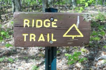
Bays Ridge Trail
| |||||||||||||||||||||||||||||||||||||
Trail Overview
Located in Bays Mountain Park. Follows the ridgeline past Bays Ridge Road until heading down to Front Hollow Road. Views of Hawkins and Greene County valleys.
How to get there
From the main parking lot, cross the dam and take the left onto Lake Road, then Bays Ridge Road. The trail will split off left before the road heads downhill.
Route Description
The path follows the base of the ridge. Meaders some to pass around deep muddy ruts and interects with the creek.
| Miles | Bays Ridge Trail | Miles |
|---|---|---|
| 0.0 | Trailhead at Bays Ridge Road | 2.6 |
| 0.8 | Junction with Jones Road at two splits. First leads out of park; second to the "Big Oak". | 1.8 |
| 2.1 | Far end of the ridge crest | 0.5 |
| 2.6 | Trailhead at Front Hollow Road | 0.0 |
Warning: The intersection at Jones Road is not marked. The direction to Front Hollow Road is be some grafitti. When heading back towards the Nature Center, the unmarked trail split is off the roadbed to the left continuing on the ridge crest.
Typical Conditions
Mostly an eroded dirt road, with large, muddy water-filled ruts. Unregulated ATV use has destroyed some of the road bed. Picked up a grocery bag of beer cans for recycling.
Misc. Information
The "fireworks" you hear are the firearms being used at the Cherokee Rod and Gun Club located at the base of the ridge. There is at least one warning sign stating to not head SW off the trail.
Maps
<googlemap version="0.9" lat="36.498" lon="-82.633" type="terrain" zoom="14" width="735" scale="yes" icons="http://tehcc.org/clubwiki/kml/marker{label}.png"> http://tehcc.org/clubwiki/kml/BMP_Front_Hollow_Road.kml http://tehcc.org/clubwiki/kml/BMP_Bays_Ridge_Road.kml http://tehcc.org/clubwiki/kml/BMP_Pretty_Ridge_Trail.kml http://tehcc.org/clubwiki/kml/BMP_Bays_Ridge_Trail.kml
(G)
Trailhead at Bays Ridge Road
(G)
Trailhead at Front Hollow Road
</googlemap>
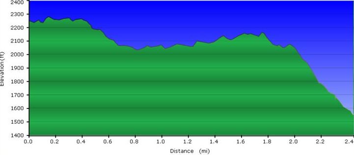
- The following elevation profile travels uphill from Front Hollow Road to Bays Ridge Road.
Photos
- BMP placeholder.JPG
Placeholder

