Riverside: Difference between revisions
(Add pictures) |
(→Maps: add waypoints) |
||
| Line 33: | Line 33: | ||
Beginning at a park shelter, this trail begins with either crossing the river for a short hike, or walking along the river until it meets [[Fred Behrend|Fred Behrend Trail]]. | Beginning at a park shelter, this trail begins with either crossing the river for a short hike, or walking along the river until it meets [[Fred Behrend|Fred Behrend Trail]]. | ||
Accessible from this trail [[Trail connects to::Fred Behrend|Fred Behrend Trail]]. | Accessible from this trail is the [[Trail connects to::Fred Behrend|Fred Behrend Trail]]. | ||
== Typical Conditions == | == Typical Conditions == | ||
| Line 45: | Line 45: | ||
<!-- You can place pictures, PDF's, links, or even create a Google map with your waypoints and place it here. --> | <!-- You can place pictures, PDF's, links, or even create a Google map with your waypoints and place it here. --> | ||
Riverside Trail is shown below in purple since maps don't allow the use of its blaze color white. | Riverside Trail is shown below in purple since maps don't allow the use of its blaze color white. | ||
<display_map center="36.166706,-82.098770" type="terrain" zoom=" | <display_map center="36.166706,-82.098770" type="terrain" zoom="16" width="auto" height="550" gkml="http://tehcc.org/clubwiki/kml/RMSP_Riverside_Trail.kml, | ||
http://tehcc.org/clubwiki/kml/RMSP_Fred_Behrend_Trail.kml"> | http://tehcc.org/clubwiki/kml/RMSP_Fred_Behrend_Trail.kml"> | ||
36.163128,-82.100052~Connection with Fred Behrend Trail~ ~MarkerT.png | |||
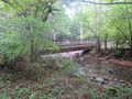
36.164150,-82.098783~Bridge to group campsites~[[Image:Roan Bridge over Doe River.jpg|150px|Bridge to group campsites]]~MarkerL.png | |||
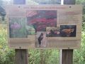
36.165727,-82.096531~Bridge to boardwalk~[[Image:Builders of Roan bridge.jpg|150px|Builders of the bridge]]~MarkerL.png | |||
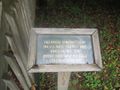
36.165566,-82.096234~Handicap accessible boardwalk~[[Image:Roan sign about the wetlands.jpg|150px|About the wetlands]]~MarkerG.png | |||
36.165300,-82.096353~Boardwalk ends~ ~MarkerG.png | |||
36.164304,-82.096686~Trail head~ ~MarkerG.png | |||
</display_map> | </display_map> | ||
| Line 55: | Line 61: | ||
Image:Builders of Roan bridge.jpg|Builders of the bridge | Image:Builders of Roan bridge.jpg|Builders of the bridge | ||
Image:Roan sign about the wetlands.jpg|About the wetlands | Image:Roan sign about the wetlands.jpg|About the wetlands | ||
Image:Roan Bridge over Doe River.jpg|Bridge to group campsites | |||
<!-- Do not remove the end gallery code.--> | <!-- Do not remove the end gallery code.--> | ||
</gallery> | </gallery> | ||
Revision as of 09:40, 27 September 2015
| |||||||||||||||||||||||||||||||||||||||||||||

Trail Overview
One of the flattest and easiest trail within the Roan Mountain State Park trail system. A portion of this trail is handicap friendly including an accessible bridge from the shelter to the boardwalk through a portion of wetlands. It can also be used to connect between the park cabins and group camping or the regular campground.
How to get there
Leaving south on 143, the most direct access is at the shelter before the cabins. This access is mid-way through the trail.
Route Description
Beginning at a park shelter, this trail begins with either crossing the river for a short hike, or walking along the river until it meets Fred Behrend Trail.
Accessible from this trail is the Fred Behrend Trail.
Typical Conditions
Being a TN state park, the dirt and gravel trails are kept in good condition. Some of the trail sections are steep, thus can be slippery after a rain.
Misc. Information
Maps
Riverside Trail is shown below in purple since maps don't allow the use of its blaze color white.
Photos
Builders of the bridge
About the wetlands
Bridge to group campsites

